Location
Latitude: |
36-37-50.7090N (36.630753) |
Longitude: |
080-01-06.0180W (-80.018338) |
Elevation: |
940.9 feet MSL (287 m MSL) |
Magnetic Variation: |
8.7 W (as of April 2024 from WMM2020 model) |
Time Zone: |
UTC -5.0 (Standard Time) UTC -4.0 (Daylight Savings Time) |
From City: |
08 N.M. SW of Martinsville, Virginia |
Found On: |
Cincinnati Chart |
FAA Region: |
AEA |
Contacts
Manager: |
Publicly owned: |
| JASON DAVIS 525 AIRPORT ROAD MARTINSVILLE, VA 24112 276-957-2291 |
BLUE RIDGE ARPT AUTH 525 AIRPORT ROAD MARTINSVILLE, VA 24112 276-957-2291 |
Operations
Airport Status: |
Operational |
Facility Use: |
Public |
Type: |
Airport |
Control tower: |
No |
Attendance (Months/Days/Hours): |
Months/Days/Hours ALL/ALL/0800-1700 |
Boundary ARTCC: |
ZDC (Washington) |
Responsible ARTCC: |
ZTL (Atlanta) |
Lighting Schedule: |
SEE RMK |
Segmented Circle Indicator: |
Yes |
Traffic Pattern Altitude (MSL): |
1941 feet (592 m) |
NOTAMs Facility: |
MTV |
NOTAM-D Service: |
Yes |
International Airport of Entry: |
No |
Customs Landing Rights: |
No |
Military Landing Rights: |
Yes |
Civil/Military Joint Use: |
No |
Based Aircraft
| Single Engine: | 16 |
| Multi Engine: | 3 |
| Jet Engine: | 1 |
Annual Operations (as of 09/30/2017)
| Total Operations: | 23500 | |
| Air Taxi: | 699 | 3.0% |
| GA Local: | 15421 | 65.6% |
| GA Itinerant: | 7163 | 30.5% |
| Military Aircraft: | 217 | 0.9% |
Communications
| CTAF: | 122.700 |
| Unicom: | 122.700 |
| Approach: | GREENSBORO 124.35 124.35 124.35 |
| Departure: | GREENSBORO 124.35 124.35 124.35 |
| AWOS-3: | 118.45 (276-957-3784) |
Fixed Based Operators (FBOs) & Fuel
(Click on a business for detail)
Please help us keep this information up to date. This is a FREE SERVICE just like everything else on Airport Guide! If you see that a business needs to be added, modified, or deleted please fill out our Update Form.
To add, modify, or delete a business click here.
Please help us keep this information up to date. This is a FREE SERVICE just like everything else on Airport Guide! If you see that a business needs to be added, modified, or deleted please fill out our Update Form.
Area Code: 540 |
| Business Name | Frequency | Phone | Fuel Grade |
|---|
Flight Service Stations
| Primary | Alternate | |
| FSS on Field: | N | |
| FSS Name (ID): | Leesburg(DCA) | |
| Frequency: | ||
| Toll Free Phone: | 1-800-WX-BRIEF |
Instrument Procedures / Charts
FAA Terminal Procedures valid from 0901Z 03/21/24 to 0901Z 04/18/24.
There are various types of charts available for an airport. They are listed in the Page Type column. Here is a legend for those types:
APD - Airport Diagram
DP - Departure Procedure Charts
HOT - Hot Spots
IAP - Instrument Approach Procedure Charts
MIN - Minimums
STAR - Standard Terminal Arrival Charts
| Page Type | Page Name | Volume | Action Since Last Cycle |
|---|---|---|---|
| IAP | LOC RWY 31 | NE-3 | Changed |
| IAP | RNAV (GPS) RWY 13 | NE-3 | |
| IAP | RNAV (GPS) RWY 31 | NE-3 | Changed |
| MIN | ALTERNATE MINIMUMS | NE-3 | |
| MIN | TAKEOFF MINIMUMS | NE-3 |
Terminal Procedures are only available for airports in several countries with more being added all the time. If you are looking for a specific country's charts, please send an email to support(at)airportguide.com stating the country name. This will be used to prioritize the implementation.
Navigation Aids (Navaids) near KMTV
| Dist (NM) | ID | Morse Code | Name | Type | Freq | True Hdg | Mag Hdg |
|---|---|---|---|---|---|---|---|
| 5.4 | UV | . . _ . . . _ | Bales | NDB | 396 | 116 | 125 |
| 15.3 | OQA | _ _ _ _ _ . _ . _ | Rockingham County | FAN MARKER | 143 | 152 | |
| 19.4 | SIF | . . . . . . . _ . | Slammer | NDB | 423 | 140 | 149 |
| 29.3 | AZW | . _ _ _ . . . _ _ | Mount Airy | NDB | 223 | 239 | 248 |
| 33.0 | DAN | _ . . . _ _ . | Danville | VOR | 113.10 | 96 | 105 |
| 34.3 | IN | . . _ . | Reeno | NDB | 317 | 192 | 201 |
| 35.0 | VIT | . . . _ . . _ | Vinton | NDB | 277 | 10 | 19 |
| 35.2 | GSO | _ _ . . . . _ _ _ | Greensboro | VORTAC | 116.20 | 176 | 185 |
| 39.2 | ZEF | _ _ . . . . . _ . | Zephyr | NDB | 326 | 240 | 248 |
| 39.3 | TEC | _ . _ . _ . | Tech | NDB | 368 | 332 | 341 |
| 39.5 | HLX | . . . . . _ . . _ . . _ | Hillsville | NDB | 269 | 281 | 289 |
| 41.6 | ODR | _ _ _ _ . . . _ . | Woodrum | VOR | 114.90 | 2 | 11 |
| 42.8 | ROA | . _ . _ _ _ . _ | Roanoke | VOR-DME | 109.40 | 356 | 365 |
| 43.2 | PSK | . _ _ . . . . _ . _ | Pulaski | VORTAC | 116.80 | 309 | 318 |
| 44.4 | HB | . . . . _ . . . | Alamm | NDB | 361 | 151 | 160 |
| 48.4 | SBV | . . . _ . . . . . . _ | South Boston | VORTAC | 110.40 | 86 | 95 |
| 51.8 | HUR | . . . . . . _ . _ . | Person | NDB | 220 | 117 | 126 |
| 52.9 | LIB | . _ . . . . _ . . . | Liberty | VORTAC | 113.00 | 158 | 167 |
| 53.0 | LYH | . _ . . _ . _ _ . . . . | Lynchburg | VOR-DME | 109.20 | 44 | 53 |
| 53.1 | LY | . _ . . _ . _ _ | Bojar | NDB | 385 | 44 | 53 |
Nearby Airports with Fuel
Notices to Airmen (NOTAMS)
Remarks
| A110-1 | DEER ON AND INVOF ARPT. |
| A110-3 | FOR CD CTC GREENSBORO APCH AT 743-222-6129. |
| A110-4 | COLD TEMPERATURE AIRPORT. ALTITUDE CORRECTION REQUIRED AT OR BELOW -17C. |
| A16 | MANAGER CELL: 276-358-0749. |
| A43-13 | UNUSBL BYD 9 DEG RIGHT OF CNTRLN. |
| A81-APT | ACTVT REIL RWY 13 & 31; ODALS RWY 31; PAPI RWY 13 & 31; MIRL RWY 13/31 - CTAF. |
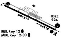
Runways
Runway Summary
| Runways: | 13/31 |
| Longest Runway: | 13/31 is 5002 ft (1525 m) long |
| Runways with an Instrument Approach: | 31 |
KMTV Airport Runway Details
| Runway 13/31 | 5002 ft x 100 ft (1525 m x 30 m) | |
| Runway Length Source: | 3RD PARTY SURVEY as of 10/25/2019 | |
| Surface: | Asphalt - Good condition - Saw-cut or plastic grooved | |
| Runway Edge Lights: | Medium Intensity | |
Runway Weight Bearing Capacity (in thousands of pounds) |
||
| Single Wheel Landing Gear: | 30.0 | |
| Dual Wheel Landing Gear: | 60.0 | |
Runway 13 |
Runway 31 |
|
Elevation: |
940.9 | 911.9 |
Latitude: |
36-38-02.3943N | 36-37-39.0227N |
Longitude: |
080-01-33.0609W | 080-00-38.9767W |
|
Runway True Alignment: |
118 | 298 |
ILS Type: |
LOC/DME | |
Glide Path Angle: |
3.0 degrees | 3.0 degrees |
Traffic Pattern: |
Left | Left |
Runway Markings Type: |
Nonprecision Instrument | Nonprecision Instrument |
Runway Markings Condition: |
Good | Good |
Object at End: |
TREE | TREE |
Object Height: |
97 | 25 |
Distance from End: |
3494 | 1104 |
Object Centerline Offset: |
639 ft. left of centerline | 297 ft. right of centerline |
Visual Glide Slope Indicators: |
4-Light PAPI On Left Side Of Runway | 4-Light PAPI On Left Side Of Runway |
Approach Light System: |
Omnidirectional Approach Lighting System | |
REIL: |
Yes | Yes |
Threshold Crossing Height: |
40 | 47 |
Services
Airframe Repair: |
Major |
Powerplant Repair: |
Major |
Bulk Oxygen: |
None |
Fuel Available: |
100LL, Jet A-1+ |
Landing Fees: |
No |
Parking: |
Tiedowns available |
Maps & Diagrams
KMTV Sectional
Flight Planning
at skyvector.com
at skyvector.com