
Location
Latitude: |
35-48-39.9280N (35.811091) |
Longitude: |
083-59-38.6420W (-83.994067) |
Elevation: |
986.4 feet MSL (301 m MSL) |
Magnetic Variation: |
6 W (as of April 2024 from WMM2020 model) |
Time Zone: |
UTC -5.0 (Standard Time) UTC -4.0 (Daylight Savings Time) |
From City: |
10 N.M. S of Knoxville, Tennessee |
Found On: |
Atlanta Chart |
FAA Region: |
ASO |
Contacts
Manager: |
Publicly owned: |
| PATRICK WILSON P.O. BOX 15600 KNOXVILLE, TN 37901 865-342-3088 |
METRO KNOXVILLE ARPT AUTH MC GHEE TYSON AIRPORT, 2055 ALCOA HWY ALCOA, TN 37701 865-342-3000 |
Operations
Airport Status: |
Operational |
Facility Use: |
Public |
Type: |
Airport |
Activation Date: |
01/1970 |
Control tower: |
Yes |
Attendance (Months/Days/Hours): |
Months/Days/Hours ALL/ALL/ALL |
Boundary ARTCC: |
ZTL (Atlanta) |
Responsible ARTCC: |
ZTL (Atlanta) |
Lighting Schedule: |
SS-SR |
Segmented Circle Indicator: |
Yes |
Traffic Pattern Altitude (MSL): |
1986 feet (605 m) |
NOTAMs Facility: |
TYS |
NOTAM-D Service: |
Yes |
International Airport of Entry: |
No |
Customs Landing Rights: |
Yes |
Military Landing Rights: |
Yes |
Civil/Military Joint Use: |
No |
Aircraft Rescue and Firefighting: |
Class I ARFF Index: C Air Carrier Service: Scheduled Certification Date: 05/1973 |
Based Aircraft
| Single Engine: | 84 |
| Multi Engine: | 26 |
| Jet Engine: | 50 |
| GA Helicopters: | 4 |
| Military Aircraft: | 22 |
Annual Operations (as of 04/01/2023)
| Total Operations: | 124702 | |
| Commercial: | 27138 | 21.8% |
| Air Taxi: | 17528 | 14.1% |
| GA Local: | 17945 | 14.4% |
| GA Itinerant: | 48448 | 38.9% |
| Military Aircraft: | 13643 | 10.9% |
Communications
| Unicom: | 122.950 |
| Tower: | KNOXVILLE 121.2 257.8 Hrs: 24 |
| Clearance Del.: | 121.65 |
| Ground: | 121.9 348.6 |
| Approach: | KNOXVILLE 118.0 ;051-229 123.9 ;230-050 353.6 ;230-050 360.8 ;051-229 Hrs: 24 125.525 |
| Departure: | KNOXVILLE 118.0 ;051-229 123.9 ;230-050 353.6 ;230-050 360.8 ;051-229 Hrs: 24 125.525 |
| ATIS: | 128.35 Hrs: 24 |
| ASOS: | (865-981-4053) |
| CLASS C: | 118.0 ;051-229 |
| ANG OPS: | 143.8 |
| CLASS C: | 360.8 ;051-229 |
| ARNG OPS: | 149.8 |
| ARNG OPS: | 373.9 |
| EMERG: | 121.5 |
| EMERG: | 243.0 |
| ARNG OPS: | 49.95 |
| ANG OPS: | 303.25 ;SODA CAN CON |
| CLASS C: | 123.9 ;230-050 |
| CLASS C: | 353.6 ;230-050 |
Fixed Based Operators (FBOs) & Fuel
(Click on a business for detail)
Please help us keep this information up to date. This is a FREE SERVICE just like everything else on Airport Guide! If you see that a business needs to be added, modified, or deleted please fill out our Update Form.
To add, modify, or delete a business click here.
Please help us keep this information up to date. This is a FREE SERVICE just like everything else on Airport Guide! If you see that a business needs to be added, modified, or deleted please fill out our Update Form.
Area Code: 865 |
| Business Name | Frequency | Phone | Fuel Grade |
|---|---|---|---|
| Avionics America, Inc.
Update FBO info |
970-9999, -3622 | ||
| Cherokee Aviation
Update FBO info |
Unicom 122.95 | 970-9000 | 100LL, Jet A |
| VIP Charter
Update FBO info |
Unicom 122.875 | 970-9329 | |
| Volunteer Aviation of Knoxville
Update FBO info |
970-3090 |
Flight Service Stations
| Primary | Alternate | |
| FSS on Field: | N | |
| FSS Name (ID): | Nashville(BNA) | |
| Frequency: | ||
| Toll Free Phone: | 1-800-WX-BRIEF |
Instrument Procedures / Charts
FAA Terminal Procedures valid from 0901Z 03/21/24 to 0901Z 04/18/24.
There are various types of charts available for an airport. They are listed in the Page Type column. Here is a legend for those types:
APD - Airport Diagram
DP - Departure Procedure Charts
HOT - Hot Spots
IAP - Instrument Approach Procedure Charts
MIN - Minimums
STAR - Standard Terminal Arrival Charts
| Page Type | Page Name | Volume | Action Since Last Cycle |
|---|---|---|---|
| APD | AIRPORT DIAGRAM | SE-1 | |
| DP | KNOXVILLE SEVEN | SE-1 | Changed |
| HOT | HOT SPOT | SE-1 | |
| IAP | HI-ILS OR LOC RWY 05L | SE-1 | Changed |
| IAP | HI-ILS OR LOC RWY 23L | SE-1 | Changed |
| IAP | HI-ILS OR LOC RWY 23R | SE-1 | Changed |
| IAP | HI-VOR OR TACAN RWY 05L | SE-1 | Changed |
| IAP | HI-VOR OR TACAN RWY 23R | SE-1 | Changed |
| IAP | ILS OR LOC RWY 05L | SE-1 | |
| IAP | ILS OR LOC RWY 23L | SE-1 | |
| IAP | ILS OR LOC RWY 23R | SE-1 | |
| IAP | ILS RWY 23R (CAT II) | SE-1 | |
| IAP | ILS RWY 23R (SA CAT I) | SE-1 | |
| IAP | RNAV (GPS) RWY 05L | SE-1 | |
| IAP | RNAV (GPS) RWY 05R | SE-1 | |
| IAP | RNAV (GPS) RWY 23L | SE-1 | |
| IAP | RNAV (GPS) RWY 23R | SE-1 | |
| IAP | VOR RWY 23L | SE-1 | |
| IAP | VOR RWY 23R | SE-1 | |
| MIN | ALTERNATE MINIMUMS | SE-1 | |
| MIN | RADAR MINIMUMS | SE-1 | |
| MIN | TAKEOFF MINIMUMS | SE-1 |
Terminal Procedures are only available for airports in several countries with more being added all the time. If you are looking for a specific country's charts, please send an email to support(at)airportguide.com stating the country name. This will be used to prioritize the implementation.
Navigation Aids (Navaids) near TYS
| Dist (NM) | ID | Morse Code | Name | Type | Freq | True Hdg | Mag Hdg |
|---|---|---|---|---|---|---|---|
| 0.3 | TYS | _ _ . _ _ . . . | Knoxville | VOT | 112.00 | 344 | 350 |
| 7.4 | VXV | . . . _ _ . . _ . . . _ | Volunteer | VORTAC | 116.40 | 40 | 46 |
| 24.8 | MNV | _ _ _ . . . . _ | Madisonville | NDB | 361 | 230 | 236 |
| 30.9 | JXT | . _ _ _ _ . . _ _ | Jefferson | NDB | 346 | 54 | 60 |
| 37.3 | MMI | _ _ _ _ . . | Mc Minn County | NDB | 242 | 228 | 234 |
| 45.8 | SOT | . . . _ _ _ _ | Snowbird | VORTAC | 108.80 | 91 | 97 |
| 47.9 | HCH | . . . . _ . _ . . . . . | Hinch Mountain | VOR-DME | 117.60 | 268 | 274 |
| 49.5 | BPO | _ . . . . _ _ . _ _ _ | Piney Grove | NDB | 403 | 332 | 338 |
| 49.8 | DTE | _ . . _ . | Mark Anton | NDB | 394 | 246 | 252 |
| 52.2 | HRS | . . . . . _ . . . . | Harris | VORTAC | 109.80 | 175 | 181 |
| 57.0 | DYQ | _ . . _ . _ _ _ _ . _ | Dulaney | NDB | 263 | 69 | 75 |
| 59.5 | HDI | . . . . _ . . . . | Hardwick | NDB | 369 | 228 | 234 |
| 66.2 | RVN | . _ . . . . _ _ . | Rogersville | NDB | 329 | 53 | 59 |
| 68.7 | CQN | _ . _ . _ _ . _ _ . | Daisy | NDB | 341 | 236 | 242 |
| 70.6 | IM | . . _ _ | Keans | NDB | 357 | 103 | 109 |
| 73.3 | LVT | . _ . . . . . _ _ | Livingston | VOR-DME | 114.35 | 309 | 315 |
| 73.5 | LOZ | . _ . . _ _ _ _ _ . . | London | VOR-DME | 116.55 | 355 | 361 |
| 75.1 | ODF | _ _ _ _ . . . . _ . | Foothills | VOR-DME | 113.40 | 152 | 158 |
| 76.3 | GQO | _ _ . _ _ . _ _ _ _ | Choo Choo | DME | 115.8 | 228 | 234 |
| 76.8 | UWI | . . _ . _ _ . . | Whitfield | NDB | 400 | 217 | 223 |
Nearby Airports with Fuel
Notices to Airmen (NOTAMS)
Remarks
| A110-10 | WIDE BODY USE CTN TURNING ONTO TWY A FM RAMP 4, 5 & 6. |
| A110-13 | CTN: PTN OF TWY A NEAR RWY 05R APCH END NOT VSB FM TWR. |
| A110-15 | ANG OPS CTC SODA CTL 303.025. |
| A110-16 | ANG: COMD POST H24 - D266-4371/ C865-336-4371. AMGR DOES NOT ISSUE OR STORE COMSEC FOR TSNT. TMPRY STOR OF CLASSIFIED MATERIALS UP TO TOP SECRET AT COMD POST. |
| A110-17 | ANG: PPR 24 HR PPR; LTD TO OFFL BUS ONLY - AMGMT D266-4404/4419/ C865-336-4404/4419. |
| A110-18 | CTN: HOLD SHORT LINE FOR RWY 23L SLIGHTLY N OF TWY A-8. |
| A110-2 | ANG BASE OPS 0730-1700 MON-FRI; PPR - D266-4601/4605. |
| A110-20 | ANG: ARNG RAMP NOT SUITABLE FOR AMC ACFT EXC C-21. |
| A110-21 | CSTMS/AG/IMG: MIL CUSTOMS 72 HR PPR. |
| A110-23 | RSCD NOT MNTD 1630-0800 DLY, WKEND & HOL. |
| A110-24 | RWY 5L/23R & 5R/23L WT BRG CPTY FOR 2S LNDG GEAR IS 175. |
| A110-4 | BIRDS ON & INVOF OF ARPT; INCRD OCT-APR. |
| A110-6 | CIVIL PPR TO USE TWYS G1, G2, G3 & G SOUTH OF TWY G4 - ANG 865-336-4371. |
| A110-7 | RWY 23L & 23R DEP MNTN RWY HDG UNTIL PASSING RESIDENTIAL AREA S OF EXTDD CNTRLN UNLESS INSTRD BY ATC. |
| A70-FUEL-10 | 0LL MIL CONTR FUEL VBL. |
Runways
Runway Summary
| Runways: | 05L/23R 05R/23L |
| Longest Runway: | 05L/23R is 10000 ft (3048 m) long |
| Runways with an Instrument Approach: | 05L, 23R, 23L |
TYS Airport Runway Details
| Runway 05L/23R | 10000 ft x 150 ft (3048 m x 46 m) | |
| Runway Length Source: | 3RD PARTY SURVEY as of 09/01/2021 | |
| Surface: | Concrete - Good condition - Saw-cut or plastic grooved | |
| Runway Pavement Class: | 105/R/B/W/T | |
| Runway Edge Lights: | High Intensity | |
Runway Weight Bearing Capacity (in thousands of pounds) |
||
| Single Wheel Landing Gear: | 120.0 | |
| Dual Wheel Landing Gear: | 250.0 | |
| Dual Tandem Wheel Landing Gear: | 550.0 | |
| Dual Dual Tandem Wheel Landing Gear: | 1120.0 | |
Runway 05L |
Runway 23R |
|
Elevation: |
925.9 | 986.4 |
Latitude: |
35-48-12.1472N | 35-49-22.2918N |
Longitude: |
084-00-23.8825W | 083-58-58.3019W |
|
Runway True Alignment: |
045 | 225 |
ILS Type: |
ILS | ILS |
Glide Path Angle: |
3.0 degrees | 3.0 degrees |
Traffic Pattern: |
Left | Right |
Runway Markings Type: |
Precision Instrument | Precision Instrument |
Runway Markings Condition: |
Good | Good |
Visual Glide Slope Indicators: |
4-Light PAPI On Left Side Of Runway | 4-Light PAPI On Left Side Of Runway |
Runway Visual Range (RVR): |
Touchdown, Midfield, Rollout | Touchdown, Midfield, Rollout |
Approach Light System: |
1,400 Foot Medium Intensity Approach Lighting System With Runway Alignment Indicator Lights | Standard 2,400 Foot High Intensity Approach Lighting System With Sequenced Flashers, Cat. II or III Config. |
REIL: |
No | |
Touchdown Lights: |
No | Yes |
Centerline Lights: |
Yes | Yes |
Threshold Crossing Height: |
55 | 56 |
Threshold Elevation: |
929.8 | 984.3 |
Displaced Threshold: |
490 | 505 |
Threshold Latitude: |
35-48-15.5878N | 35-49-18.7512N |
Threshold Longitude: |
084-00-19.6845W | 083-59-02.6235W |
Declared Distances |
||
Take Off Run Avbl. (TORA): |
10000 | 10000 |
Take Off Distance Avbl. (TODA): |
10000 | 10000 |
Actual Stop Dist. Avbl. (ASDA): |
10000 | 10000 |
Landing Dist. Avbl. (LDA): |
9508 | 9495 |
| Runway 05R/23L | 9000 ft x 150 ft (2743 m x 46 m) | |
| Runway Length Source: | 3RD PARTY SURVEY as of 09/01/2021 | |
| Surface: | Concrete - Good condition - Saw-cut or plastic grooved | |
| Runway Pavement Class: | 70 /F/B/X/T | |
| Runway Edge Lights: | High Intensity | |
Runway Weight Bearing Capacity (in thousands of pounds) |
||
| Single Wheel Landing Gear: | 75.0 | |
| Dual Wheel Landing Gear: | 250.0 | |
| Dual Tandem Wheel Landing Gear: | 489.0 | |
| Dual Dual Tandem Wheel Landing Gear: | 1106.0 | |
Runway 05R |
Runway 23L |
|
Elevation: |
938.3 | 962.3 |
Latitude: |
35-48-00.2529N | 35-49-03.3921N |
Longitude: |
084-00-14.4117W | 083-58-57.4063W |
|
Runway True Alignment: |
045 | 225 |
ILS Type: |
ILS/DME | |
Glide Path Angle: |
3.0 degrees | 3.0 degrees |
Traffic Pattern: |
Right | Left |
Runway Markings Type: |
Precision Instrument | Precision Instrument |
Runway Markings Condition: |
Good | Good |
Visual Glide Slope Indicators: |
4-Light PAPI On Left Side Of Runway | 4-Light PAPI On Left Side Of Runway |
Runway Visual Range (RVR): |
Rollout | Touchdown |
REIL: |
Yes | Yes |
Touchdown Lights: |
Yes | No |
Centerline Lights: |
Yes | Yes |
Threshold Crossing Height: |
50 | 50 |
Threshold Elevation: |
962.2 | |
Displaced Threshold: |
397 | |
Threshold Latitude: |
35-49-00.5884N | |
Threshold Longitude: |
083-59-00.8322W | |
Declared Distances |
||
Take Off Run Avbl. (TORA): |
9000 | 9000 |
Take Off Distance Avbl. (TODA): |
9000 | 9000 |
Actual Stop Dist. Avbl. (ASDA): |
8600 | 9000 |
Landing Dist. Avbl. (LDA): |
8600 | 8600 |
Services
Airframe Repair: |
Minor |
Powerplant Repair: |
Minor |
Bottled Oxygen: |
High Pressure |
Bulk Oxygen: |
None |
Fuel Available: |
100LL, Jet A |
Landing Fees: |
No |
Parking: |
Hangars and tiedowns available |
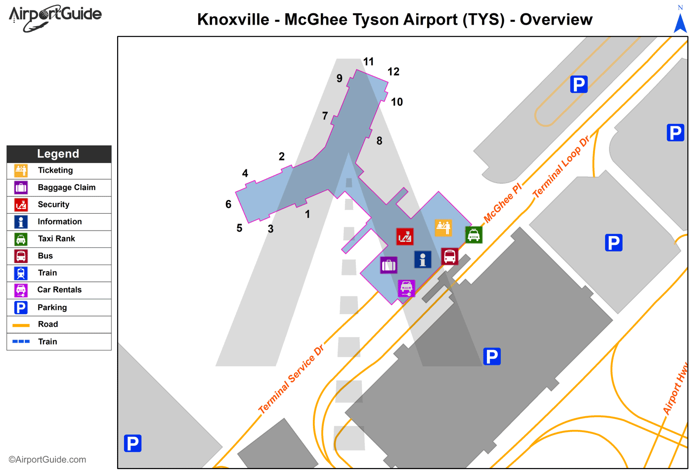
Maps & Diagrams
TYS Sectional
Flight Planning
at skyvector.com
at skyvector.com
 Diagram")