Location
Latitude: |
36-22-33.4000N (36.375944) |
Longitude: |
097-47-21.9000W (-97.789417) |
Elevation: |
1167.2 feet MSL (356 m MSL) |
Magnetic Variation: |
3.3 E (as of April 2024 from WMM2020 model) |
Time Zone: |
UTC -6.0 (Standard Time) UTC -5.0 (Daylight Savings Time) |
From City: |
04 N.M. SE of Enid, Oklahoma |
Found On: |
Wichita Chart |
FAA Region: |
ASW |
Contacts
Manager: |
Publicly owned: |
| KESTON COOK 1026 SOUTH 66TH STREET ENID, OK 73701 580-616-7386 |
CITY OF ENID PO BOX 1768 ENID, OK 73702 580-234-0400 |
Operations
Airport Status: |
Operational |
Facility Use: |
Public |
Type: |
Airport |
Activation Date: |
11/1938 |
Control tower: |
Yes |
Attendance (Months/Days/Hours): |
Months/Days/Hours ALL/ALL/0600-2130 |
Boundary ARTCC: |
ZKC (Kansas City) |
Responsible ARTCC: |
ZKC (Kansas City) |
Lighting Schedule: |
SEE RMK |
Segmented Circle Indicator: |
Yes |
Traffic Pattern Altitude (MSL): |
2167 feet (661 m) |
NOTAMs Facility: |
WDG |
NOTAM-D Service: |
Yes |
International Airport of Entry: |
No |
Customs Landing Rights: |
No |
Military Landing Rights: |
Yes |
Civil/Military Joint Use: |
No |
Based Aircraft
| Single Engine: | 70 |
| Multi Engine: | 6 |
| Jet Engine: | 3 |
| Ultralights: | 1 |
Annual Operations (as of 04/24/2019)
| Total Operations: | 35000 | |
| Air Taxi: | 678 | 1.9% |
| GA Local: | 3697 | 10.6% |
| GA Itinerant: | 7363 | 21.0% |
| Military Aircraft: | 23262 | 66.5% |
Communications
| CTAF: | 118.900 |
| Tower: | WOODRING 118.9 257.95 Hrs: 0630-2100 |
| Ground: | 121.925 |
| Approach: | VANCE 121.3 121.3 KANSAS CITY ARTCC |
| Departure: | VANCE 121.3 121.3 KANSAS CITY ARTCC |
| AWOS-3PT: | 123.725 (580-237-1475) |
| EMERG: | 121.5 |
- APCH/DEP CTL SVC PRVDD BY KANSAS CITY ARTCC (ZKC) ON FREQS 127.8/319.1 (PONCA CITY RCAG) WHEN VANCE APCH CTL (END) CLSD.
Fixed Based Operators (FBOs) & Fuel
(Click on a business for detail)
Please help us keep this information up to date. This is a FREE SERVICE just like everything else on Airport Guide! If you see that a business needs to be added, modified, or deleted please fill out our Update Form.
To add, modify, or delete a business click here.
Please help us keep this information up to date. This is a FREE SERVICE just like everything else on Airport Guide! If you see that a business needs to be added, modified, or deleted please fill out our Update Form.
Area Code: 580 |
| Business Name | Frequency | Phone | Fuel Grade |
|---|---|---|---|
| Enid Woodring Municipal Airport
Update FBO info |
Unicom 122.95 | 800-259-5476, 234-5476 | 100LL, Jet A |
| Northwest Aero
Update FBO info |
233-4531 |
Flight Service Stations
| Primary | Alternate | |
| FSS on Field: | N | |
| FSS Name (ID): | Mc Alester(MLC) | |
| Frequency: | ||
| Toll Free Phone: | 1-800-WX-BRIEF |
Instrument Procedures / Charts
FAA Terminal Procedures valid from 0901Z 03/21/24 to 0901Z 04/18/24.
There are various types of charts available for an airport. They are listed in the Page Type column. Here is a legend for those types:
APD - Airport Diagram
DP - Departure Procedure Charts
HOT - Hot Spots
IAP - Instrument Approach Procedure Charts
MIN - Minimums
STAR - Standard Terminal Arrival Charts
| Page Type | Page Name | Volume | Action Since Last Cycle |
|---|---|---|---|
| APD | AIRPORT DIAGRAM | SC-1 | |
| IAP | ILS OR LOC RWY 35 | SC-1 | |
| IAP | RNAV (GPS) RWY 17 | SC-1 | |
| IAP | RNAV (GPS) RWY 35 | SC-1 | |
| IAP | VOR RWY 17 | SC-1 | |
| IAP | VOR RWY 35 | SC-1 | |
| MIN | ALTERNATE MINIMUMS | SC-1 | |
| MIN | TAKEOFF MINIMUMS | SC-1 |
Terminal Procedures are only available for airports in several countries with more being added all the time. If you are looking for a specific country's charts, please send an email to support(at)airportguide.com stating the country name. This will be used to prioritize the implementation.
Navigation Aids (Navaids) near WDG
| Dist (NM) | ID | Morse Code | Name | Type | Freq | True Hdg | Mag Hdg |
|---|---|---|---|---|---|---|---|
| 0.1 | ODG | _ _ _ _ . . _ _ . | Woodring | VOR-DME | 109.00 | 153 | 150 |
| 6.1 | EI | . . . | Garfy | NDB | 341 | 180 | 177 |
| 6.5 | END | . _ . _ . . | Vance | VORTAC | 115.40 | 253 | 250 |
| 35.0 | SW | . . . . _ _ | Gabeh | NDB | 255 | 103 | 100 |
| 35.4 | SWO | . . . . _ _ _ _ _ | Stillwater | VOR-DME | 108.40 | 104 | 101 |
| 35.8 | IFI | . . . . _ . . . | Kingfisher | TACAN | 114.70 | 196 | 193 |
| 37.6 | PER | . _ _ . . . _ . | Pioneer | VORTAC | 113.20 | 53 | 50 |
| 42.7 | PN | . _ _ . _ . | Ponca | NDB | 515 | 50 | 47 |
| 50.4 | ANY | . _ _ . _ . _ _ | Anthony | TACAN | 112.90 | 338 | 335 |
| 51.1 | PWA | . _ _ . . _ _ . _ | Wiley Post | VOR-DME | 113.40 | 172 | 169 |
| 55.0 | OK | _ _ _ _ . _ | Tuloo | NDB | 406 | 170 | 167 |
| 56.1 | SO | . . . _ _ _ | Sawcy | NDB | 353 | 39 | 36 |
| 57.2 | CUH | _ . _ . . . _ . . . . | Cushing | NDB | 242 | 120 | 117 |
| 59.8 | TIK | _ . . _ . _ | Tinker | TACAN | 115.80 | 160 | 157 |
| 60.0 | EGT | . _ _ . _ | Wellington | NDB | 414 | 18 | 15 |
| 61.0 | OKC | _ _ _ _ . _ _ . _ . | Oklahoma Will Rgs W | VOT | 112.15 | 171 | 168 |
| 61.2 | CQB | _ . _ . _ _ . _ _ . . . | Tilghman | NDB | 396 | 129 | 126 |
| 61.7 | IRW | . . . _ . . _ _ | Will Rogers | VORTAC | 114.10 | 171 | 168 |
| 65.6 | RG | . _ . _ _ . | Gally | NDB | 350 | 171 | 168 |
| 68.1 | MDF | _ _ _ . . . . _ . | Mooreland | NDB | 284 | 276 | 272 |
Nearby Airports with Fuel
Notices to Airmen (NOTAMS)
Remarks
| A110-2 | MIL JET TRNG DRG DALGT HRS INVOF ARPT. |
| A110-3 | NOISE SENSITIVE AREA 3/4NM NW. ALL ACFT DEP RWY 35 CLIMB 500FT AGL PRIOR TO TURNING CROSSWIND TO WEST. |
| A110-4 | FOR CD CTC VANCE APCH C580-213-6765. WHEN VANCE APCH CLSD, CTC KANSAS CITY ARTCC 913-254-8508. |
| A33-13/31 | RWY 13/31 MOD TO SEVERE CRACKING, RAVELING, PONDING, & GRASS GROWING THROUGH CRACKS. |
| A70-FUEL-10 | 0LL FUEL AVBL 24 HRS. SELF SVC AVGAS AVBL. FOR JET A FUEL AFT HRS CALL(580) 231-0189. |
| A81-APT | WHEN ATCT CLSD ACTVT MALSR RWY 35; REIL RWY 17; MIRL RWY 17/35 & 13/31 - CTAF. PAPI RWY 17 & 35 OPER CONSLY. |
Runways
Runway Summary
| Runways: | 13/31 17/35 |
| Longest Runway: | 17/35 is 8613 ft (2625 m) long |
| Runways with an Instrument Approach: | 35 |
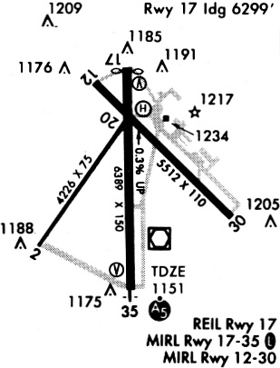
WDG Airport Runway Details
| Runway 13/31 | 3150 ft x 108 ft (960 m x 33 m) | |
| Runway Length Source: | 3RD PARTY SURVEY as of 01/29/2016 | |
| Surface: | Asphalt - Poor condition - No special surface treatment | |
| Runway Edge Lights: | Medium Intensity | |
Runway Weight Bearing Capacity (in thousands of pounds) |
||
| Single Wheel Landing Gear: | 16.0 | |
Runway 13 |
Runway 31 |
|
Elevation: |
1158.7 | 1157.4 |
Latitude: |
36-22-53.9309N | 36-22-31.9066N |
Longitude: |
097-47-19.2104W | 097-46-51.9746W |
|
Runway True Alignment: |
135 | 315 |
Glide Path Angle: |
0.0 degrees | 0.0 degrees |
Traffic Pattern: |
Left | Right |
Runway Markings Type: |
Basic | Basic |
Runway Markings Condition: |
Good | Good |
Threshold Elevation: |
1157.8 | |
Displaced Threshold: |
112 | |
Threshold Latitude: |
36-22-53.1507N | |
Threshold Longitude: |
097-47-18.2448W |
| Runway 17/35 | 8613 ft x 100 ft (2625 m x 30 m) | |
| Runway Length Source: | 3RD PARTY SURVEY as of 01/29/2016 | |
| Surface: | Asphalt - Poor condition - Saw-cut or plastic grooved | |
| Runway Pavement Class: | 21 /R/C/W/T | |
| Runway Edge Lights: | Medium Intensity | |
Runway Weight Bearing Capacity (in thousands of pounds) |
||
| Single Wheel Landing Gear: | 60.0 | |
| Dual Wheel Landing Gear: | 73.0 | |
| Dual Tandem Wheel Landing Gear: | 131.0 | |
Runway 17 |
Runway 35 |
|
Elevation: |
1167.2 | 1137.3 |
Latitude: |
36-23-12.5558N | 36-21-47.3851N |
Longitude: |
097-47-27.8731W | 097-47-27.9122W |
|
Runway True Alignment: |
180 | 000 |
ILS Type: |
ILS | |
Glide Path Angle: |
3.0 degrees | 3.0 degrees |
Traffic Pattern: |
Left | Right |
Runway Markings Type: |
Precision Instrument | Precision Instrument |
Runway Markings Condition: |
Good | Good |
Object at End: |
ROAD | |
Object Height: |
20 | |
Distance from End: |
284 | |
Visual Glide Slope Indicators: |
4-Light PAPI On Left Side Of Runway | 4-Light PAPI On Left Side Of Runway |
Approach Light System: |
1,400 Foot Medium Intensity Approach Lighting System With Runway Alignment Indicator Lights | |
REIL: |
Yes | |
Threshold Crossing Height: |
52 | 49 |
Threshold Elevation: |
1164.6 | |
Displaced Threshold: |
611 | |
Threshold Latitude: |
36-23-06.5113N | |
Threshold Longitude: |
097-47-27.8806W |
Services
Airframe Repair: |
None |
Powerplant Repair: |
None |
Bottled Oxygen: |
None |
Bulk Oxygen: |
None |
Fuel Available: |
100LL |
Landing Fees: |
No |
Parking: |
Tiedowns available |
Maps & Diagrams
WDG Sectional
Flight Planning
at skyvector.com
at skyvector.com