Location
Latitude: |
43-33-36.9440N (43.560262) |
Longitude: |
089-28-58.4810W (-89.482911) |
Elevation: |
824.8 feet MSL (251 m MSL) |
Magnetic Variation: |
2.9 W (as of April 2024 from WMM2020 model) |
Time Zone: |
UTC -6.0 (Standard Time) UTC -5.0 (Daylight Savings Time) |
From City: |
02 N.M. NW of Portage, Wisconsin |
Found On: |
Chicago Chart |
FAA Region: |
AGL |
Contacts
Manager: |
Publicly owned: |
| PAUL PHELPS 1011 SILVER LAKE DRIVE, BOX 319 PORTAGE, WI 53901 608-692-9337 |
CITY OF PORTAGE 115 PLEASANT PORTAGE, WI 53901 608-742-2176 |
Operations
Airport Status: |
Operational |
Facility Use: |
Public |
Type: |
Airport |
Activation Date: |
10/1941 |
Control tower: |
No |
Attendance (Months/Days/Hours): |
Months/Days/Hours ALL/MON-FRI/0900-1500 |
Boundary ARTCC: |
ZAU (Chicago) |
Responsible ARTCC: |
ZAU (Chicago) |
Segmented Circle Indicator: |
Yes |
Traffic Pattern Altitude (MSL): |
1825 feet (556 m) |
NOTAMs Facility: |
GRB |
NOTAM-D Service: |
Yes |
International Airport of Entry: |
No |
Customs Landing Rights: |
No |
Military Landing Rights: |
Yes |
Civil/Military Joint Use: |
No |
Based Aircraft
| Single Engine: | 21 |
Annual Operations (as of 06/07/2023)
| Total Operations: | 4750 | |
| Air Taxi: | 50 | 1.1% |
| GA Local: | 2000 | 42.1% |
| GA Itinerant: | 2500 | 52.6% |
| Military Aircraft: | 200 | 4.2% |
Communications
| CTAF: | 122.700 |
| Unicom: | 122.700 |
| Approach: | MADISON CHICAGO ARTCC 120.1 120.1 120.1 120.1 |
| Departure: | MADISON CHICAGO ARTCC 120.1 120.1 120.1 120.1 |
- APCH/DEP SVC PRVDD BY CHICAGO ARTCC ON FREQS 133.3/257.925 (LONE ROCK RCAG) WHEN MADISON APCH CTL CLSD.
Fixed Based Operators (FBOs) & Fuel
(Click on a business for detail)
Please help us keep this information up to date. This is a FREE SERVICE just like everything else on Airport Guide! If you see that a business needs to be added, modified, or deleted please fill out our Update Form.
To add, modify, or delete a business click here.
Please help us keep this information up to date. This is a FREE SERVICE just like everything else on Airport Guide! If you see that a business needs to be added, modified, or deleted please fill out our Update Form.
Area Code: 608 |
| Business Name | Frequency | Phone | Fuel Grade |
|---|---|---|---|
| Services Unlimited
Update FBO info |
742-6609 | 100LL, Mogas |
Flight Service Stations
| Primary | Alternate | |
| FSS on Field: | N | |
| FSS Name (ID): | Green Bay(GRB) | |
| Frequency: | ||
| Toll Free Phone: | 1-800-WX-BRIEF |
Instrument Procedures / Charts
FAA Terminal Procedures valid from 0901Z 03/21/24 to 0901Z 04/18/24.
There are various types of charts available for an airport. They are listed in the Page Type column. Here is a legend for those types:
APD - Airport Diagram
DP - Departure Procedure Charts
HOT - Hot Spots
IAP - Instrument Approach Procedure Charts
MIN - Minimums
STAR - Standard Terminal Arrival Charts
| Page Type | Page Name | Volume | Action Since Last Cycle |
|---|---|---|---|
| IAP | RNAV (GPS) RWY 18 | EC-3 | |
| MIN | TAKEOFF MINIMUMS | EC-3 |
Terminal Procedures are only available for airports in several countries with more being added all the time. If you are looking for a specific country's charts, please send an email to support(at)airportguide.com stating the country name. This will be used to prioritize the implementation.
Navigation Aids (Navaids) near C47
| Dist (NM) | ID | Morse Code | Name | Type | Freq | True Hdg | Mag Hdg |
|---|---|---|---|---|---|---|---|
| 12.2 | DLL | _ . . . _ . . . _ . . | Dells | VORTAC | 117.00 | 267 | 270 |
| 25.7 | MSN | _ _ . . . _ . | Madison | VORTAC | 108.60 | 165 | 168 |
| 30.4 | MS | _ _ . . . | Monah | NDB | 400 | 168 | 171 |
| 32.5 | LNR | . _ . . _ . . _ . | Lone Rock | DME | 116.05 | 240 | 243 |
| 34.9 | UNU | . . _ _ . . . _ | Juneau | NDB | 344 | 102 | 105 |
| 37.4 | HBW | . . . . _ . . . . _ _ | Kickapoo | NDB | 251 | 279 | 282 |
| 40.4 | RYV | . _ . _ . _ _ . . . _ | Rock River | NDB | 371 | 124 | 127 |
| 40.7 | VOK | . . . _ _ _ _ _ . _ | Volk | TACAN | 110.40 | 304 | 307 |
| 44.3 | OS | _ _ _ . . . | Pober | NDB | 395 | 64 | 67 |
| 45.5 | EK | . _ . _ | Nepco | NDB | 326 | 337 | 340 |
| 47.7 | OSH | _ _ _ . . . . . . . | Oshkosh | VORTAC | 116.75 | 56 | 59 |
| 50.6 | PCZ | . _ _ . _ . _ . _ _ . . | Waupaca | NDB | 382 | 23 | 26 |
| 50.6 | ISW | . . . . . . _ _ | Wisconsin Rapids | NDB | 215 | 342 | 345 |
| 51.8 | MRJ | _ _ . _ . . _ _ _ | Mineral Point | NDB | 365 | 219 | 222 |
| 53.1 | AT | . _ _ | Gamie | NDB | 230 | 46 | 49 |
| 55.1 | CMY | _ . _ . _ _ _ . _ _ | Mccoy | NDB | 412 | 294 | 297 |
| 58.7 | BAE | _ . . . . _ . | Badger | VOR-DME | 116.40 | 116 | 119 |
| 59.0 | STE | . . . _ . | Stevens Point | VORTAC | 110.60 | 358 | 361 |
| 59.7 | BJB | _ . . . . _ _ _ _ . . . | West Bend | VOR | 109.80 | 97 | 100 |
| 59.9 | JVL | . _ _ _ . . . _ . _ . . | Janesville | NDB | 375 | 161 | 164 |
Nearby Airports with Fuel
Notices to Airmen (NOTAMS)
Remarks
| A110-2 | DEER ON & INVOF OF ARPT. |
| A110-3 | RWY 36 LRG HNGRS & TREE 200 FT W OF MAY CAUSE WIND SHEAR WITH STRONG NW WINDS. |
| A110-4 | POWERLINE 110 FT AGL 1580 FT FM DSPLCD THLD RY 36. |
| A110-5 | FOR CD CTC MADISON APP/DEP CON AT 608-249-8240. WHEN MADISON APCH CLSD, FOR CD CTC CHICAGO ARTCC AT 630-906-8921. |
| A16 | ADDNL PHONE 608-745-9050. |
| A30-04/22 | RWY NOT PLOWED DURG WINTER, CFM COND WITH AMGR. |
| A40-18/36 | MIRL NSTD. RWY 18 FIRST 100 FT NOT LGTD; RWY 36 FIRST 193 FT NOT LGTD. |
| A57-04 | CTLG OBSTN EXCEEDS A 45 DEG SLP. |
| A57-18 | APCH RATIO 20:1 TO DSPLCD THR. |
| A57-36 | APCH RATIO 10:1 TO DSPLCD THR; 63 FT TREES 587 FT FM DSPLCD THR, 220 L AND 105 FT PLINE 1576 FT FM DSPLCD THR, 70 FT L. |
| A58-04 | 30 FT TREES 40 FT FM RWY END; 100 FT L. |
| A58-18 | 2 FT RD AT RWY END; 170 FT RIGHT. |
| A58-22 | 6 FT TRRN AT THR; 90 FT L. |
| A58-36 | 14 FT RD 42 FT FM RWY END; 28 FT POLE 30 FT FM RWY END, 125 FT L. |
| A70-FUEL-10 | 0LL FUEL AVBL 24 HRS WITH CREDIT CARD. |
| A75 | CONFIRM AVBL WITH AMGR. |
| E111 | EXISTED PRIOR TO 1959. |
Runways
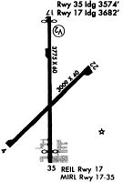
Runway Summary
| Runways: | 04/22 18/36 |
| Longest Runway: | 18/36 is 3770 ft (1149 m) long |
| Runways with an Instrument Approach: |
C47 Airport Runway Details
| Runway 04/22 | 2668 ft x 40 ft (813 m x 12 m) | |
| Runway Length Source: | 3RD PARTY SURVEY as of 10/10/2020 | |
| Surface: | Asphalt - Fair condition - Aggregate friction seal coat | |
Runway 04 |
Runway 22 |
|
Elevation: |
824.7 | 815.8 |
Latitude: |
43-33-25.5162N | 43-33-44.7711N |
Longitude: |
089-29-09.9877W | 089-28-45.2540W |
|
Runway True Alignment: |
043 | 223 |
Glide Path Angle: |
0.0 degrees | 0.0 degrees |
Traffic Pattern: |
Left | Left |
Runway Markings Type: |
Basic | Basic |
Runway Markings Condition: |
Good | Good |
Object at End: |
ROAD | TREES |
Object Height: |
15 | 58 |
Distance from End: |
200 | 814 |
Object Centerline Offset: |
80 ft. right of centerline | 164 ft. left of centerline |
REIL: |
No | No |
Touchdown Lights: |
No | No |
Centerline Lights: |
No | No |
Threshold Elevation: |
824.1 | |
Displaced Threshold: |
109 | |
Threshold Latitude: |
43-33-26.3063N | |
Threshold Longitude: |
089-29-08.9730W |
| Runway 18/36 | 3770 ft x 60 ft (1149 m x 18 m) | |
| Runway Length Source: | 3RD PARTY SURVEY as of 10/10/2020 | |
| Surface: | Asphalt - Fair condition - No special surface treatment | |
| Runway Edge Lights: | Non-standard lighting system Intensity | |
Runway 18 |
Runway 36 |
|
Elevation: |
811.3 | 821.9 |
Latitude: |
43-33-56.8228N | 43-33-19.6145N |
Longitude: |
089-29-00.0598W | 089-28-58.1189W |
|
Runway True Alignment: |
178 | 358 |
Glide Path Angle: |
3.8 degrees | 0.0 degrees |
Traffic Pattern: |
Left | Left |
Runway Markings Type: |
Nonprecision Instrument | Nonprecision Instrument |
Runway Markings Condition: |
Good | Good |
Object at End: |
ROAD | TREES |
Object Height: |
2 | 63 |
Distance from End: |
200 | 325 |
Object Centerline Offset: |
80 ft. right of centerline | 164 ft. left of centerline |
Visual Glide Slope Indicators: |
2-Light PAPI On Left Side Of Runway | |
REIL: |
Yes | No |
Touchdown Lights: |
No | No |
Centerline Lights: |
No | No |
Threshold Crossing Height: |
40 | |
Threshold Elevation: |
811.0 | 820.6 |
Displaced Threshold: |
98 | 262 |
Threshold Latitude: |
43-33-55.8508N | 43-33-22.2005N |
Threshold Longitude: |
089-29-00.0087W | 089-28-58.2535W |
Services
Airframe Repair: |
Major |
Powerplant Repair: |
Major |
Bottled Oxygen: |
None |
Bulk Oxygen: |
None |
Fuel Available: |
100LL |
Landing Fees: |
No |
Parking: |
Hangars and tiedowns available |
Maps & Diagrams
C47 Sectional
Flight Planning
at skyvector.com
at skyvector.com