Location
Latitude: |
41-22-38.7000N (41.377417) |
Longitude: |
087-40-47.1000W (-87.67975) |
Elevation: |
790.2 feet MSL (241 m MSL) |
Magnetic Variation: |
4 W (as of April 2024 from WMM2020 model) |
Time Zone: |
UTC -6.0 (Standard Time) UTC -5.0 (Daylight Savings Time) |
From City: |
03 N.M. SE of Monee, Illinois |
Found On: |
Chicago Chart |
FAA Region: |
AGL |
Contacts
Manager: |
Publicly owned: |
| MARK THOMPSON 28261 SOUTH KEDZIE AVE MONEE, IL 60449 (708) 534-8282 |
IL DEPT OF TRANSPORTATION 1 LANGHORNE BOND DR. SPRINGFIELD, IL 62702 708-534-8282 |
Operations
Airport Status: |
Operational |
Facility Use: |
Public |
Type: |
Airport |
Activation Date: |
09/1953 |
Control tower: |
No |
Attendance (Months/Days/Hours): |
Months/Days/Hours ALL/ALL/0800-1700 |
Boundary ARTCC: |
ZAU (Chicago) |
Responsible ARTCC: |
ZAU (Chicago) |
Lighting Schedule: |
SS-SR |
Segmented Circle Indicator: |
No |
Traffic Pattern Altitude (MSL): |
1790 feet (546 m) |
NOTAMs Facility: |
IKK |
NOTAM-D Service: |
Yes |
International Airport of Entry: |
No |
Customs Landing Rights: |
No |
Military Landing Rights: |
No |
Civil/Military Joint Use: |
No |
Based Aircraft
| Single Engine: | 81 |
| Multi Engine: | 4 |
| Jet Engine: | 1 |
| Gliders: | 2 |
Annual Operations (as of 07/31/2018)
| Total Operations: | 13300 | |
| Air Taxi: | 100 | 0.8% |
| GA Local: | 3300 | 24.8% |
| GA Itinerant: | 9900 | 74.4% |
Communications
| CTAF: | 123.000 |
| Unicom: | 123.000 |
| AWOS-AV: | 119.125 (708-534-5256) |
- APCH/DEP SVC PRVDD BY CHICAGO ARTCC (ZAU) ON FREQS 132.5/284.7 (KANKAKEE RCAG).
Fixed Based Operators (FBOs) & Fuel
(Click on a business for detail)
Please help us keep this information up to date. This is a FREE SERVICE just like everything else on Airport Guide! If you see that a business needs to be added, modified, or deleted please fill out our Update Form.
To add, modify, or delete a business click here.
Please help us keep this information up to date. This is a FREE SERVICE just like everything else on Airport Guide! If you see that a business needs to be added, modified, or deleted please fill out our Update Form.
Area Code: 708 |
| Business Name | Frequency | Phone | Fuel Grade |
|---|---|---|---|
| Sanger Airport
Update FBO info |
Unicom 123.0 | 534-8282 | 100LL |
Flight Service Stations
| Primary | Alternate | |
| FSS on Field: | N | |
| FSS Name (ID): | Kankakee(IKK) | |
| Frequency: | ||
| Toll Free Phone: | 1-800-WX-BRIEF |
Instrument Procedures / Charts
FAA Terminal Procedures valid from 0901Z 03/21/24 to 0901Z 04/18/24.
There are various types of charts available for an airport. They are listed in the Page Type column. Here is a legend for those types:
APD - Airport Diagram
DP - Departure Procedure Charts
HOT - Hot Spots
IAP - Instrument Approach Procedure Charts
MIN - Minimums
STAR - Standard Terminal Arrival Charts
| Page Type | Page Name | Volume | Action Since Last Cycle |
|---|---|---|---|
| IAP | RNAV (GPS) RWY 09 | EC-3 | |
| IAP | RNAV (GPS) RWY 27 | EC-3 | |
| MIN | TAKEOFF MINIMUMS | EC-3 |
Terminal Procedures are only available for airports in several countries with more being added all the time. If you are looking for a specific country's charts, please send an email to support(at)airportguide.com stating the country name. This will be used to prioritize the implementation.
Navigation Aids (Navaids) near C56
| Dist (NM) | ID | Morse Code | Name | Type | Freq | True Hdg | Mag Hdg |
|---|---|---|---|---|---|---|---|
| 8.2 | EON | . _ _ _ _ . | Peotone | VORTAC | 113.20 | 217 | 221 |
| 9.3 | CGT | _ . _ . _ _ . _ | Chicago Heights | VORTAC | 114.20 | 31 | 35 |
| 19.7 | IKK | . . _ . _ _ . _ | Kankakee | DME | 111.6 | 202 | 206 |
| 21.7 | HK | . . . . _ . _ | Ermin | NDB | 332 | 341 | 345 |
| 21.8 | MX | _ _ _ . . _ | Kedzi | NDB | 248 | 358 | 362 |
| 23.8 | IK | . . _ . _ | Lukow | NDB | 272 | 205 | 209 |
| 24.7 | MDW | _ _ _ . . . _ _ | Chicago Midway | VOT | 111.00 | 352 | 356 |
| 30.5 | JOT | . _ _ _ _ _ _ _ | Joliet | VOR-DME | 112.30 | 289 | 293 |
| 36.4 | VP | . . . _ . _ _ . | Sedly | NDB | 212 | 82 | 86 |
| 38.0 | ORD | _ _ _ . _ . _ . . | Chicago O'hare | VOR-DME | 113.90 | 344 | 348 |
| 38.3 | GCO | _ _ . _ . _ . _ _ _ | Chicago | DME | 108.25 | 344 | 348 |
| 38.7 | ME | _ _ . | Deana | NDB | 350 | 336 | 340 |
| 41.5 | IUL | . . . . _ . _ . . | La Porte | NDB | 356 | 79 | 83 |
| 43.0 | DPA | _ . . . _ _ . . _ | Dupage | VOR-DME | 108.40 | 315 | 319 |
| 46.5 | OXI | _ _ _ _ . . _ . . | Knox | DME | 115.6 | 93 | 97 |
| 51.4 | RWN | . _ . . _ _ _ . | Winamac/Dcmsnd | NDB | 335 | 108 | 112 |
| 52.1 | OBK | _ _ _ _ . . . _ . _ | Northbrook | VOR-DME | 113.00 | 346 | 350 |
| 52.5 | RBS | . _ . _ . . . . . . | Roberts | VOR-DME | 116.80 | 204 | 208 |
| 52.9 | OIX | _ _ _ . . _ . . _ | Ottawa | NDB | 266 | 269 | 273 |
| 56.5 | BVT | _ . . . . . . _ _ | Boiler | VORTAC | 115.10 | 150 | 154 |
Nearby Airports with Fuel
Notices to Airmen (NOTAMS)
Remarks
| A110-1 | BIRDS AND ANIMALS ON AND INVOF OF ARPT. |
| A110-2 | FOR CD CTC CHICAGO ARTCC AT 630-906-8921. |
| A15 | EMAIL ADDRESS: MTHOMPSON@BULTFIELD.COM (ALL LOWER CASE) |
| A17 | 708-534-8282 |
| A30A-27 | CALM WND RWY. |
| A58-09 | RWY 27 12 FT ROAD 141 FT FM RWY END ON CL. |
| A58-27 | RWY 09 8 FT ROAD 156 FT RWY END CL. |
| A70-FUEL-10 | 0LL 100LL FUEL AVBL H24 W/CREDIT CARD. |
| A70-FUEL-A | JET A AVBL AFT HR WITH PRIOR ARRANGEMENT. |
| E111 | EXISTED PRIOR TO 1959. |
Runways
Runway Summary
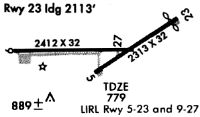
| Runways: | 09/27 |
| Longest Runway: | 09/27 is 5001 ft (1524 m) long |
| Runways with an Instrument Approach: |
C56 Airport Runway Details
| Runway 09/27 | 5001 ft x 75 ft (1524 m x 23 m) | |
| Runway Length Source: | 3RD PARTY SURVEY as of 09/06/2008 | |
| Surface: | Concrete - Excellent condition - No special surface treatment | |
| Runway Edge Lights: | Low Intensity | |
Runway Weight Bearing Capacity (in thousands of pounds) |
||
| Single Wheel Landing Gear: | 60.0 | |
Runway 09 |
Runway 27 |
|
Elevation: |
790.0 | 772.4 |
Latitude: |
41-22-38.5910N | 41-22-38.8600N |
Longitude: |
087-41-19.8753W | 087-40-14.2779W |
|
Runway True Alignment: |
090 | 270 |
Glide Path Angle: |
0.0 degrees | 0.0 degrees |
Traffic Pattern: |
Left | Left |
Runway Markings Type: |
Nonprecision Instrument | Nonprecision Instrument |
Runway Markings Condition: |
Fair | Fair |
REIL: |
No | No |
Touchdown Lights: |
No | No |
Centerline Lights: |
No | No |
Threshold Elevation: |
771.5 | |
Displaced Threshold: |
151 | |
Threshold Latitude: |
41-22-38.8535N | |
Threshold Longitude: |
087-40-16.2608W |
Services
Bottled Oxygen: |
None |
Bulk Oxygen: |
None |
Fuel Available: |
100LL, Mogas |
Landing Fees: |
No |
Parking: |
Tiedowns available |
Maps & Diagrams
C56 Sectional
Flight Planning
at skyvector.com
at skyvector.com