Location
Latitude: |
26-44-06.6150N (26.735171) |
Longitude: |
081-03-03.8160W (-81.05106) |
Elevation: |
20.2 feet MSL (6 m MSL) |
Magnetic Variation: |
6.8 W (as of April 2024 from WMM2020 model) |
Time Zone: |
UTC -5.0 (Standard Time) UTC -4.0 (Daylight Savings Time) |
From City: |
05 N.M. W of Clewiston, Florida |
Found On: |
Miami Chart |
FAA Region: |
ASO |
Contacts
Manager: |
Publicly owned: |
| RICK MCELROY 1090 AIRGLADES BLVD, SUITE 200 CLEWISTON, FL 33440 614-499-4437 |
HENDRY COUNTY P.O. BOX 1607, 99 EAST COWBOY WAY LABELLE, FL 33975-1607 863-675-5252 |
Operations
Airport Status: |
Operational |
Facility Use: |
Public |
Type: |
Airport |
Activation Date: |
03/1942 |
Control tower: |
No |
Attendance (Months/Days/Hours): |
Months/Days/Hours ALL/MON-FRI/0800-1700 |
Boundary ARTCC: |
ZMA (Miami) |
Responsible ARTCC: |
ZMA (Miami) |
Lighting Schedule: |
SEE RMK |
Segmented Circle Indicator: |
Yes, Lighted |
Traffic Pattern Altitude (MSL): |
1020 feet (311 m) |
NOTAMs Facility: |
MIA |
NOTAM-D Service: |
Yes |
International Airport of Entry: |
No |
Customs Landing Rights: |
No |
Military Landing Rights: |
Yes |
Civil/Military Joint Use: |
No |
Based Aircraft
| Single Engine: | 30 |
| Multi Engine: | 5 |
| GA Helicopters: | 2 |
Annual Operations (as of 10/09/2018)
| Total Operations: | 11527 | |
| GA Local: | 6900 | 59.9% |
| GA Itinerant: | 4599 | 39.9% |
| Military Aircraft: | 28 | 0.2% |
Communications
| CTAF: | 123.050 |
| Unicom: | 123.050 |
| AWOS-3PT: | 124.175 (863-983-7020) |
- APCH/DEP SVC PRVDD BY MIAMA ARTCC ON FREQS 132.45/307.1 (PAHOKEE RCAG).
Fixed Based Operators (FBOs) & Fuel
(Click on a business for detail)
Please help us keep this information up to date. This is a FREE SERVICE just like everything else on Airport Guide! If you see that a business needs to be added, modified, or deleted please fill out our Update Form.
To add, modify, or delete a business click here.
Please help us keep this information up to date. This is a FREE SERVICE just like everything else on Airport Guide! If you see that a business needs to be added, modified, or deleted please fill out our Update Form.
Area Code: 863 |
| Business Name | Frequency | Phone | Fuel Grade |
|---|---|---|---|
| Air Adventures of Clewiston, Inc.
Update FBO info |
Unicom 123.05 | 983-6151 | 100LL |
Flight Service Stations
| Primary | Alternate | |
| FSS on Field: | N | |
| FSS Name (ID): | Miami(MIA) | |
| Frequency: | ||
| Toll Free Phone: | 1-800-WX-BRIEF |
Instrument Procedures / Charts
FAA Terminal Procedures valid from 0901Z 03/21/24 to 0901Z 04/18/24.
There are various types of charts available for an airport. They are listed in the Page Type column. Here is a legend for those types:
APD - Airport Diagram
DP - Departure Procedure Charts
HOT - Hot Spots
IAP - Instrument Approach Procedure Charts
MIN - Minimums
STAR - Standard Terminal Arrival Charts
| Page Type | Page Name | Volume | Action Since Last Cycle |
|---|---|---|---|
| IAP | RNAV (GPS) RWY 13 | SE-3 | |
| IAP | RNAV (GPS) RWY 31 | SE-3 | |
| MIN | ALTERNATE MINIMUMS | SE-3 | |
| MIN | TAKEOFF MINIMUMS | SE-3 |
Terminal Procedures are only available for airports in several countries with more being added all the time. If you are looking for a specific country's charts, please send an email to support(at)airportguide.com stating the country name. This will be used to prioritize the implementation.
Navigation Aids (Navaids) near 2IS
| Dist (NM) | ID | Morse Code | Name | Type | Freq | True Hdg | Mag Hdg |
|---|---|---|---|---|---|---|---|
| 19.1 | LBV | . _ . . _ . . . . . . _ | La Belle | VORTAC | 110.40 | 287 | 294 |
| 19.5 | PHK | . _ _ . . . . . _ . _ | Pahokee | VOR-DME | 115.40 | 81 | 88 |
| 39.7 | UTX | . . _ _ _ . . _ | United | NDB | 405 | 74 | 81 |
| 40.8 | RSW | . _ . . . . . _ _ | Lee County | VORTAC | 114.15 | 252 | 259 |
| 50.0 | FM | . . _ . _ _ | Caloo | NDB | 341 | 254 | 261 |
| 50.9 | PBI | . _ _ . _ . . . . . | Palm Beach | VOT | 109.00 | 93 | 100 |
| 51.5 | PGD | . _ _ . _ _ . _ . . | Punta Gorda | VOR | 110.20 | 282 | 289 |
| 51.8 | PBI | . _ _ . _ . . . . . | Palm Beach | VORTAC | 115.70 | 93 | 100 |
| 52.2 | FX | . . _ . _ . . _ | Praiz | NDB | 221 | 129 | 136 |
| 52.4 | CYY | _ . _ . _ . _ _ _ . _ _ | Cypress | VOR-DME | 108.60 | 228 | 235 |
| 52.4 | TN | _ _ . | Monry | NDB | 227 | 177 | 184 |
| 57.8 | FPR | . . _ . . _ _ . . _ . | Fort Pierce | NDB | 275 | 38 | 45 |
| 61.9 | FLL | . . _ . . _ . . . _ . . | Fort Lauderdale | VOR-DME | 114.40 | 129 | 136 |
| 64.0 | TRV | _ . _ . . . . _ | Treasure | VORTAC | 117.30 | 27 | 34 |
| 67.6 | DHP | _ . . . . . . . _ _ . | Dolphin | VORTAC | 113.90 | 145 | 152 |
| 70.1 | MIA | _ _ . . . _ | Miami Intl | VOT | 112.00 | 143 | 150 |
| 71.9 | TM | _ _ _ | Qeezy | NDB | 266 | 155 | 162 |
| 76.2 | VKZ | . . . _ _ . _ _ _ . . | Virginia Key | VOR-DME | 117.10 | 140 | 147 |
| 76.4 | VNC | . . . _ _ . _ . _ . | Venice | NDB | 206 | 285 | 291 |
| 83.0 | HST | . . . . . . . _ | Homestead | TACAN | 108.20 | 154 | 161 |
Nearby Airports with Fuel
Notices to Airmen (NOTAMS)
Remarks
| A11 | JENNIFER DAVIS 863-675-5220. |
| A110-1 | FOR CD CTC MIAMI ARTCC AT 305-716-1731. |
| A14 | 863-983-6151 |
| A70-FUEL-10 | 0LL SELF SVC. |
| A70-FUEL-A | SELF SVC. |
| A81-APT | ACTVT MIRL RWY 13/31 - CTAF. |
| E111 | VFR ONLY. |
Runways
Runway Summary
| Runways: | 13/31 |
| Longest Runway: | 13/31 is 5902 ft (1799 m) long |
| Runways with an Instrument Approach: |
2IS Airport Runway Details
| Runway 13/31 | 5902 ft x 75 ft (1799 m x 23 m) | |
| Runway Length Source: | 3RD PARTY SURVEY as of 07/22/2019 | |
| Surface: | Asphalt - Good condition - No special surface treatment | |
| Runway Pavement Class: | 28 /F/A/X/T | |
| Runway Edge Lights: | Medium Intensity | |
Runway Weight Bearing Capacity (in thousands of pounds) |
||
| Single Wheel Landing Gear: | 79.0 | |
| Dual Wheel Landing Gear: | 116.0 | |
Runway 13 |
Runway 31 |
|
Elevation: |
19.4 | 19.3 |
Latitude: |
26-44-27.1684N | 26-43-46.0607N |
Longitude: |
081-03-26.9526W | 081-02-40.6813W |
|
Runway True Alignment: |
135 | 315 |
Glide Path Angle: |
0.0 degrees | 0.0 degrees |
Traffic Pattern: |
Right | Left |
Runway Markings Type: |
Nonprecision Instrument | Nonprecision Instrument |
Runway Markings Condition: |
Fair | Fair |
Object at End: |
TREE | |
Object Height: |
41 | |
Distance from End: |
1855 | |
Object Centerline Offset: |
185 ft. right of centerline |
Services
Airframe Repair: |
Major |
Powerplant Repair: |
Major |
Bottled Oxygen: |
None |
Bulk Oxygen: |
None |
Fuel Available: |
100LL, Jet A |
Landing Fees: |
No |
Parking: |
Hangars and tiedowns available |
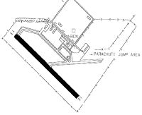
Maps & Diagrams
2IS Sectional
Flight Planning
at skyvector.com
at skyvector.com