Location
Latitude: |
41-24-04.4000N (41.401222) |
Longitude: |
092-56-45.1000W (-92.945861) |
Elevation: |
884.8 feet MSL (270 m MSL) |
Magnetic Variation: |
0.1 W (as of May 2024 from WMM2020 model) |
Time Zone: |
UTC -6.0 (Standard Time) UTC -5.0 (Daylight Savings Time) |
From City: |
01 N.M. W of Pella, Iowa |
Found On: |
Chicago Chart |
FAA Region: |
ACE |
Contacts
Manager: |
Publicly owned: |
| SHANE VANDEVOORT 501 WEST 15TH STREET PELLA, IA 50219 641-628-9393 |
CITY OF PELLA 717 MAIN PELLA, IA 50219 641-628-4173 |
Operations
Airport Status: |
Operational |
Facility Use: |
Public |
Type: |
Airport |
Activation Date: |
01/1968 |
Control tower: |
No |
Attendance (Months/Days/Hours): |
Months/Days/Hours ALL/MON-SAT/0700-DUSK |
Boundary ARTCC: |
ZAU (Chicago) |
Responsible ARTCC: |
ZMP (Minneapolis) |
Lighting Schedule: |
SEE RMK |
Segmented Circle Indicator: |
No |
Traffic Pattern Altitude (MSL): |
1885 feet (575 m) |
NOTAMs Facility: |
PEA |
NOTAM-D Service: |
Yes |
Military Landing Rights: |
No |
Civil/Military Joint Use: |
No |
Based Aircraft
| Single Engine: | 25 |
| Multi Engine: | 2 |
| Jet Engine: | 3 |
Annual Operations (as of 05/23/2022)
| Total Operations: | 12250 | |
| GA Local: | 8983 | 73.3% |
| GA Itinerant: | 3267 | 26.7% |
Communications
| CTAF: | 122.800 |
| Unicom: | 122.800 |
| Approach: | DES MOINES 123.9 123.9 |
| Departure: | DES MOINES 123.9 123.9 |
| AWOS-3: | 118.875 (641-628-3459) |
Fixed Based Operators (FBOs) & Fuel
(Click on a business for detail)
Please help us keep this information up to date. This is a FREE SERVICE just like everything else on Airport Guide! If you see that a business needs to be added, modified, or deleted please fill out our Update Form.
To add, modify, or delete a business click here.
Please help us keep this information up to date. This is a FREE SERVICE just like everything else on Airport Guide! If you see that a business needs to be added, modified, or deleted please fill out our Update Form.
Area Code: 641 |
| Business Name | Frequency | Phone | Fuel Grade |
|---|---|---|---|
| Classic Aviation, Inc.
Update FBO info |
628-9393 | 100LL, Jet A |
Flight Service Stations
| Primary | Alternate | |
| FSS on Field: | N | |
| FSS Name (ID): | Fort Dodge(FOD) | |
| Frequency: | ||
| Toll Free Phone: | 1-800-WX-BRIEF |
Instrument Procedures / Charts
FAA Terminal Procedures valid from 0901Z 03/21/24 to 0901Z 04/18/24.
There are various types of charts available for an airport. They are listed in the Page Type column. Here is a legend for those types:
APD - Airport Diagram
DP - Departure Procedure Charts
HOT - Hot Spots
IAP - Instrument Approach Procedure Charts
MIN - Minimums
STAR - Standard Terminal Arrival Charts
| Page Type | Page Name | Volume | Action Since Last Cycle |
|---|---|---|---|
| IAP | NDB RWY 34 | NC-3 | |
| IAP | RNAV (GPS) RWY 16 | NC-3 | |
| IAP | RNAV (GPS) RWY 34 | NC-3 | |
| MIN | ALTERNATE MINIMUMS | NC-3 | |
| MIN | TAKEOFF MINIMUMS | NC-3 |
Terminal Procedures are only available for airports in several countries with more being added all the time. If you are looking for a specific country's charts, please send an email to support(at)airportguide.com stating the country name. This will be used to prioritize the implementation.
Navigation Aids (Navaids) near KPEA
| Dist (NM) | ID | Morse Code | Name | Type | Freq | True Hdg | Mag Hdg |
|---|---|---|---|---|---|---|---|
| 0.2 | PEA | . _ _ . . . _ | Pella | NDB | 257 | 16 | 16 |
| 23.2 | OOA | _ _ _ _ _ _ . _ | Oskaloosa | NDB | 414 | 116 | 116 |
| 24.1 | TNU | _ _ . . . _ | Newton | VOR-DME | 112.50 | 342 | 342 |
| 31.7 | DSM | _ . . . . . _ _ | Des Moines | VORTAC | 117.50 | 274 | 274 |
| 33.0 | DSM | _ . . . . . _ _ | Des Moines | VOT | 109.20 | 284 | 284 |
| 35.8 | OTM | _ _ _ _ _ _ | Ottumwa | VOR-DME | 111.60 | 128 | 128 |
| 42.6 | JWJ | . _ _ _ . _ _ . _ _ _ | Elmwood | DME | 109.4 | 2 | 2 |
| 43.9 | EE | . . | Merle | NDB | 362 | 313 | 313 |
| 45.8 | BEX | _ . . . . _ . . _ | Bloomfield | NDB | 269 | 149 | 149 |
| 49.2 | FFL | . . _ . . . _ . . _ . . | Fairfield | NDB | 332 | 118 | 118 |
| 57.8 | AWG | . _ . _ _ _ _ . | Washington | NDB | 219 | 96 | 97 |
| 59.6 | CID | _ . _ . . . _ . . | Cedar Rapids | VOR-DME | 114.10 | 60 | 61 |
| 60.3 | IOW | . . _ _ _ . _ _ | Iowa City | VOR-DME | 116.20 | 82 | 83 |
| 66.9 | LMN | . _ . . _ _ _ . | Lamoni | VOR-DME | 116.70 | 224 | 224 |
| 68.7 | UNE | . . _ _ . . | Union County | NDB | 379 | 247 | 247 |
| 70.1 | MPZ | _ _ . _ _ . _ _ . . | Mount Pleasant | NDB | 212 | 112 | 113 |
| 72.6 | EFW | . . . _ . . _ _ | Jefferson | NDB | 391 | 300 | 300 |
| 73.5 | ALO | . _ . _ . . _ _ _ | Waterloo | VOR-DME | 112.20 | 19 | 19 |
| 74.8 | EBS | . _ . . . . . . | Webster City | NDB | 323 | 326 | 326 |
| 77.2 | IIB | . . . . _ . . . | Wapsie | NDB | 206 | 34 | 35 |
Nearby Airports with Fuel
Notices to Airmen (NOTAMS)
Remarks
| A110-2 | FOR CD CTC DES MOINES ATCT AT 515-974-8016. |
| A15 | EMAIL ADDRESS: SHANE@FLYCLASSICAVIATION.COM (ALL LOWER CASE) |
| A16 | CELL PHONE 641-780-0244 |
| A17 | AFTER HRS CALL 641-780-0244. |
| A57-16 | RWY 16 APCH SLP TO DTHR 22:1. |
| A57-34 | RWY 34 APCH SLP TO DTHR 21:1. |
| A81-APT | MIRL RWY 16/34 PRESET LOW INTST; TO INCREASE INTST AND ACTVT PAPI RWY 16 & 34; REIL RWYS 16 & 34 - CTAF. |
| E111 | PRVDD EACH APCH IS MAINTD FOR MIN 20:1 GLIDE SLOPE AND TRSNL SFC MAINTD FOR 7:1 SLOPE. |
| E147 | ONLY APPLIES TO NON-TURBINE ACFT. |
Runways
Runway Summary
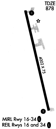
| Runways: | 16/34 |
| Longest Runway: | 16/34 is 5403 ft (1647 m) long |
| Runways with an Instrument Approach: |
KPEA Airport Runway Details
| Runway 16/34 | 5403 ft x 75 ft (1647 m x 23 m) | |
| Runway Length Source: | 3RD PARTY SURVEY as of 06/11/2007 | |
| Surface: | Concrete - Fair condition - No special surface treatment | |
| Runway Pavement Class: | 8 /R/D/W/T | |
| Runway Edge Lights: | Medium Intensity | |
Runway Weight Bearing Capacity (in thousands of pounds) |
||
| Single Wheel Landing Gear: | 30.0 | |
| Dual Wheel Landing Gear: | 40.0 | |
Runway 16 |
Runway 34 |
|
Elevation: |
884.8 | 869.6 |
Latitude: |
41-24-30.4388N | 41-23-38.3405N |
Longitude: |
092-56-52.7945W | 092-56-37.4071W |
|
Runway True Alignment: |
167 | 347 |
Glide Path Angle: |
3.3 degrees | 3.0 degrees |
Traffic Pattern: |
Left | Left |
Runway Markings Type: |
Nonprecision Instrument | Nonprecision Instrument |
Runway Markings Condition: |
Fair | Fair |
Object at End: |
TREE | TREES |
Object Height: |
32 | 31 |
Distance from End: |
527 | 474 |
Object Centerline Offset: |
191 ft. left of centerline | 188 ft. left of centerline |
Visual Glide Slope Indicators: |
2-Light PAPI On Left Side Of Runway | 2-Light PAPI On Left Side Of Runway |
REIL: |
Yes | Yes |
Threshold Crossing Height: |
26 | 46 |
Threshold Elevation: |
884.6 | 870.2 |
Displaced Threshold: |
200 | 201 |
Threshold Latitude: |
41-24-28.5117N | 41-23-40.2829N |
Threshold Longitude: |
092-56-52.2242W | 092-56-37.9825W |
Declared Distances |
||
Take Off Run Avbl. (TORA): |
5400 | 5400 |
Take Off Distance Avbl. (TODA): |
5400 | 5400 |
Actual Stop Dist. Avbl. (ASDA): |
5200 | 5200 |
Landing Dist. Avbl. (LDA): |
5000 | 5000 |
Services
Airframe Repair: |
Major |
Powerplant Repair: |
Major |
Bottled Oxygen: |
None |
Bulk Oxygen: |
None |
Fuel Available: |
100LL, Jet A |
Landing Fees: |
No |
Parking: |
Hangars and tiedowns available |
Maps & Diagrams
KPEA Sectional
Flight Planning
at skyvector.com
at skyvector.com