Location
Latitude: |
29-37-08.1000N (29.618917) |
Longitude: |
082-30-31.6000W (-82.508778) |
Elevation: |
90.0 feet MSL (27 m MSL) |
Magnetic Variation: |
6.2 W (as of May 2024 from WMM2020 model) |
Time Zone: |
UTC -5.0 (Standard Time) UTC -4.0 (Daylight Savings Time) |
From City: |
05 N.M. N of Archer, Florida |
Found On: |
Jacksonville Chart |
FAA Region: |
ASO |
Contacts
Manager: |
Privately owned: |
| WALKER MORAN 3124 SOUTHWEST 154TH ST ARCHER, FL 32618 305-744-8078 |
FLYING TEN, INC. 3124 SOUTHWEST 154TH ST ARCHER, FL 32618 352-495-2559 |
Operations
Airport Status: |
Operational |
Facility Use: |
Public |
Type: |
Airport |
Activation Date: |
02/1968 |
Control tower: |
No |
Attendance (Months/Days/Hours): |
Months/Days/Hours ALL/MON-SAT/0800-1700 |
Boundary ARTCC: |
ZJX (Jacksonville) |
Responsible ARTCC: |
ZJX (Jacksonville) |
Lighting Schedule: |
SEE RMK |
Segmented Circle Indicator: |
No |
Traffic Pattern Altitude (MSL): |
1090 feet (332 m) |
NOTAMs Facility: |
GNV |
NOTAM-D Service: |
Yes |
Based Aircraft
| Single Engine: | 10 |
| Ultralights: | 1 |
Annual Operations (as of 04/05/2018)
| Total Operations: | 30000 | |
| GA Local: | 20000 | 66.7% |
| GA Itinerant: | 10000 | 33.3% |
Communications
| CTAF: | 122.900 |
Fixed Based Operators (FBOs) & Fuel
(Click on a business for detail)
Please help us keep this information up to date. This is a FREE SERVICE just like everything else on Airport Guide! If you see that a business needs to be added, modified, or deleted please fill out our Update Form.
To add, modify, or delete a business click here.
Please help us keep this information up to date. This is a FREE SERVICE just like everything else on Airport Guide! If you see that a business needs to be added, modified, or deleted please fill out our Update Form.
Area Code: 352 |
| Business Name | Frequency | Phone | Fuel Grade |
|---|---|---|---|
| Kitty Hawke Aviation
Update FBO info |
Unicom 122.9 | 495-2559, 495-1190 | 100LL |
Flight Service Stations
| Primary | Alternate | |
| FSS on Field: | N | |
| FSS Name (ID): | Gainesville(GNV) | |
| Frequency: | ||
| Toll Free Phone: | 1-800-WX-BRIEF |
Instrument Procedures / Charts
Terminal Procedures are only available for airports in several countries with more being added all the time. If you are looking for a specific country's charts, please send an email to support(at)airportguide.com stating the country name. This will be used to prioritize the implementation.
Navigation Aids (Navaids) near 0J8
| Dist (NM) | ID | Morse Code | Name | Type | Freq | True Hdg | Mag Hdg |
|---|---|---|---|---|---|---|---|
| 13.1 | GNV | _ _ . _ . . . . _ | Gators | VORTAC | 116.20 | 70 | 76 |
| 17.8 | GN | _ _ . _ . | Wynds | NDB | 269 | 80 | 86 |
| 28.2 | CTY | _ . _ . _ _ . _ _ | Cross City | VORTAC | 112.00 | 267 | 273 |
| 30.3 | OCF | _ _ _ _ . _ . . . _ . | Ocala | VORTAC | 113.70 | 150 | 156 |
| 34.2 | LCQ | . _ . . _ . _ . _ _ . _ | Lake City | NDB | 204 | 353 | 359 |
| 36.4 | IAK | . . . _ _ . _ | Palatka | NDB | 243 | 86 | 92 |
| 48.0 | VQQ | . . . _ _ _ . _ _ _ . _ | Cecil | VOR | 117.90 | 41 | 47 |
| 49.0 | RYD | . _ . _ . _ _ _ . . | Reynolds | NDB | 338 | 64 | 71 |
| 53.2 | TAY | _ . _ _ . _ _ | Taylor | VORTAC | 112.90 | 357 | 363 |
| 57.0 | NIP | _ . . . . _ _ . | Jacksonville | TACAN | 108.20 | 49 | 56 |
| 60.5 | LEE | . _ . . . . | Leesburg | NDB | 335 | 142 | 148 |
| 62.7 | JA | . _ _ _ . _ | Dinns | NDB | 344 | 35 | 42 |
| 64.6 | SGJ | . . . _ _ . . _ _ _ | St Augustine | VOR-DME | 109.40 | 71 | 78 |
| 67.2 | EYA | . _ . _ _ . _ | Eastport | NDB | 357 | 43 | 50 |
| 67.5 | JAX | . _ _ _ . _ _ . . _ | Jacksonville Intl | VOT | 111.00 | 38 | 45 |
| 67.5 | CRG | _ . _ . . _ . _ _ . | Craig | VORTAC | 114.50 | 49 | 56 |
| 72.5 | DED | _ . . . _ . . | Deland/Dcmsnd | NDB | 201 | 116 | 123 |
| 72.9 | NRB | _ . . _ . _ . . . | Mayport | TACAN | 111.40 | 50 | 57 |
| 75.4 | OMN | _ _ _ _ _ _ . | Ormond Beach | VORTAC | 112.60 | 104 | 111 |
| 80.3 | OTK | _ _ _ _ _ . _ | Valdosta | VOR-DME | 114.80 | 330 | 336 |
Nearby Airports with Fuel
Notices to Airmen (NOTAMS)
Remarks
| A110-1 | ACFT MAINTENANCE AND TRANSPONDER AND ALTIMETER CERTIFICATION AVBL. |
| A110-2 | FOR CD CTC JACKSONVILLE APCH AT 904-741-0284. |
| A110-3 | UNLGTD TREES & FENCE 100 FT WEST & EAST OF RWY 18/36 CNTLN INSIDE PRI SFC. |
| A110-4 | WINDSOCK AND THRS UNLGTD. |
| A40-18/36 | RWY 18/36 NSTD LIRL SPACING. LGTS VERY LOW INTST. RWY 18/36 MKD WITH PAVERS & LGTS. |
| A57-36 | RWY 36 20:1 APCH TO THE DSPLCD THLD DUE TO 38 FT TREE; 400 FT FROM RWY END; 75 LEFT OF RWY CNTRLN. |
| A58-18 | TREES 100 FT RIGHT & LEFT INSIDE PRI SFC. |
| A58-36 | FENCE 100 FT LEFT INSIDE PRI SFC. |
| A81-APT | ACTVT LIRL RWY 18/36 - CTAF. |
| E111 | VFR OPNS ONLY. |
Runways
Runway Summary
| Runways: | 18/36 |
| Longest Runway: | 18/36 is 3200 ft (975 m) long |
| Runways with an Instrument Approach: |
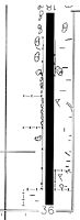
0J8 Airport Runway Details
| Runway 18/36 | 3200 ft x 170 ft (975 m x 52 m) | |
| Surface: | Turf - Fair condition - No special surface treatment | |
| Runway Edge Lights: | Non-standard lighting system Intensity | |
Runway 18 |
Runway 36 |
|
Elevation: |
90.0 | 85.0 |
Latitude: |
29-37-23.9389N | 29-36-52.2560N |
Longitude: |
082-30-31.8171W | 082-30-31.3724W |
|
Runway True Alignment: |
179 | 359 |
Glide Path Angle: |
0.0 degrees | 0.0 degrees |
Traffic Pattern: |
Left | Left |
Runway Markings Type: |
Nonstandard (other than numbers only) | Nonstandard (other than numbers only) |
Runway Markings Condition: |
Fair | Fair |
Object at End: |
TREES | FENCE |
Object Height: |
47 | 5 |
Object Marked/Lighted?: |
Marked | |
Distance from End: |
2095 | 4 |
Object Centerline Offset: |
60 ft. right of centerline | 0 ft. left and right of centerline |
Services
Airframe Repair: |
Major |
Powerplant Repair: |
Major |
Bottled Oxygen: |
None |
Bulk Oxygen: |
None |
Landing Fees: |
Yes |
Parking: |
Hangars and tiedowns available |
Maps & Diagrams
0J8 Sectional
Flight Planning
at skyvector.com
at skyvector.com