
Location
Latitude: |
28-06-09.9000N (28.10275) |
Longitude: |
080-38-42.9000W (-80.64525) |
Elevation: |
33.3 feet MSL (10 m MSL) |
Magnetic Variation: |
7.2 W (as of April 2024 from WMM2020 model) |
Time Zone: |
UTC -5.0 (Standard Time) UTC -4.0 (Daylight Savings Time) |
From City: |
02 N.M. NW of Melbourne, Florida |
Found On: |
Jacksonville Chart |
FAA Region: |
ASO |
Contacts
Manager: |
Publicly owned: |
| GREG DONOVAN 1 AIRPORT TERMINAL PKWY, SUITE 220 MELBOURNE, FL 32901 321-723-6227 |
CITY OF MELBOURNE 1 AIR TERMINAL PKWY/SUITE 220 MELBOURNE, FL 32901 321-723-6227 |
Operations
Airport Status: |
Operational |
Facility Use: |
Public |
Type: |
Airport |
Activation Date: |
04/1940 |
Control tower: |
Yes |
Attendance (Months/Days/Hours): |
Months/Days/Hours ALL/ALL/ALL |
Boundary ARTCC: |
ZMA (Miami) |
Responsible ARTCC: |
ZJX (Jacksonville) |
Lighting Schedule: |
SEE RMK |
Segmented Circle Indicator: |
Yes |
Traffic Pattern Altitude (MSL): |
1033 feet (315 m) |
NOTAMs Facility: |
MLB |
NOTAM-D Service: |
Yes |
International Airport of Entry: |
No |
Customs Landing Rights: |
No |
Military Landing Rights: |
Yes |
Civil/Military Joint Use: |
No |
Aircraft Rescue and Firefighting: |
Class I ARFF Index: C Air Carrier Service: Scheduled Certification Date: 05/1973 |
Based Aircraft
| Single Engine: | 186 |
| Multi Engine: | 42 |
| Jet Engine: | 26 |
| GA Helicopters: | 9 |
| Military Aircraft: | 1 |
Annual Operations (as of 12/31/2020)
| Total Operations: | 103660 | |
| Commercial: | 4210 | 4.1% |
| Air Taxi: | 2581 | 2.5% |
| GA Local: | 27685 | 26.7% |
| GA Itinerant: | 68586 | 66.2% |
| Military Aircraft: | 598 | 0.6% |
Communications
| CTAF: | 118.200 |
| Unicom: | 122.950 |
| Tower: | MELBOURNE 118.2 257.8 124.05 Hrs: 0600-2400 |
| Clearance Del.: | 121.9 |
| Ground: | 121.9 |
| Approach: | ORLANDO |
| Departure: | ORLANDO |
| ATIS: | 132.55 Hrs: 24 |
| ASOS: | 132.55 (321-951-7575) |
| VFR ADZY: | 118.2 |
Fixed Based Operators (FBOs) & Fuel
(Click on a business for detail)
Please help us keep this information up to date. This is a FREE SERVICE just like everything else on Airport Guide! If you see that a business needs to be added, modified, or deleted please fill out our Update Form.
To add, modify, or delete a business click here.
Please help us keep this information up to date. This is a FREE SERVICE just like everything else on Airport Guide! If you see that a business needs to be added, modified, or deleted please fill out our Update Form.
Area Code: 321 |
| Business Name | Frequency | Phone | Fuel Grade |
|---|---|---|---|
| Corporate Detailing Service LLC
Website Update FBO info |
1-772-532-8708 | ||
| F. I. T. Aviation, Inc.
Update FBO info |
Unicom 122.95 | 674-6501 | 100LL, Jet A |
| Southeast Aerospace
Website Update FBO info |
255-9877 |
Flight Service Stations
| Primary | Alternate | |
| FSS on Field: | N | |
| FSS Name (ID): | Saint Petersburg(PIE) | |
| Frequency: | ||
| Toll Free Phone: | 1-800-WX-BRIEF |
Instrument Procedures / Charts
FAA Terminal Procedures valid from 0901Z 03/21/24 to 0901Z 04/18/24.
There are various types of charts available for an airport. They are listed in the Page Type column. Here is a legend for those types:
APD - Airport Diagram
DP - Departure Procedure Charts
HOT - Hot Spots
IAP - Instrument Approach Procedure Charts
MIN - Minimums
STAR - Standard Terminal Arrival Charts
| Page Type | Page Name | Volume | Action Since Last Cycle |
|---|---|---|---|
| APD | AIRPORT DIAGRAM | SE-3 | Changed |
| DP | MELBOURNE SEVEN | SE-3 | Changed |
| IAP | ILS OR LOC RWY 09R | SE-3 | Changed |
| IAP | LOC BC RWY 27L | SE-3 | Changed |
| IAP | RNAV (GPS) RWY 09L | SE-3 | Changed |
| IAP | RNAV (GPS) RWY 09R | SE-3 | Changed |
| IAP | RNAV (GPS) RWY 27L | SE-3 | Changed |
| IAP | RNAV (GPS) RWY 27R | SE-3 | Changed |
| IAP | VOR RWY 09R | SE-3 | Changed |
| IAP | VOR RWY 27L | SE-3 | Changed |
| MIN | ALTERNATE MINIMUMS | SE-3 | |
| MIN | TAKEOFF MINIMUMS | SE-3 | |
| STAR | BITHO SEVEN | SE-3 | Changed |
| STAR | JOKRS THREE (RNAV) | SE-3 | |
| STAR | JOKRS THREE (RNAV)[DELIMITER] CONT.1 | SE-3 | |
| STAR | PRICY THREE (RNAV) | SE-3 | |
| STAR | PRICY THREE (RNAV)[DELIMITER] CONT.1 | SE-3 | |
| STAR | PRICY THREE (RNAV)[DELIMITER] CONT.2 | SE-3 |
Terminal Procedures are only available for airports in several countries with more being added all the time. If you are looking for a specific country's charts, please send an email to support(at)airportguide.com stating the country name. This will be used to prioritize the implementation.
Navigation Aids (Navaids) near MLB
| Dist (NM) | ID | Morse Code | Name | Type | Freq | True Hdg | Mag Hdg |
|---|---|---|---|---|---|---|---|
| 0.5 | MLB | _ _ . _ . . _ . . . | Melbourne | VOR-DME | 115.85 | 73 | 80 |
| 2.9 | SQT | . . . _ _ . _ _ | Satellite | NDB | 257 | 266 | 273 |
| 8.3 | COF | _ . _ . _ _ _ . . _ . | Patrick | TACAN | 115.00 | 12 | 19 |
| 25.8 | TVV | _ . . . _ . . . _ | Space Center Executive | NDB | 237 | 342 | 349 |
| 26.8 | TRV | _ . _ . . . . _ | Treasure | VORTAC | 117.30 | 162 | 169 |
| 39.7 | FPR | . . _ . . _ _ . . _ . | Fort Pierce | NDB | 275 | 158 | 165 |
| 45.0 | ORL | _ _ _ . _ . . _ . . | Orlando | VORTAC | 112.20 | 306 | 313 |
| 48.2 | OR | _ _ _ . _ . | Herny | NDB | 221 | 300 | 307 |
| 51.7 | SFB | . . . . . _ . _ . . . | Sanford | NDB | 408 | 322 | 329 |
| 59.2 | EVB | . . . . _ _ . . . | New Smyrna Beach | NDB | 417 | 344 | 351 |
| 66.7 | DED | _ . . . _ . . | Deland/Dcmsnd | NDB | 201 | 330 | 337 |
| 68.2 | DAB | _ . . . _ _ . . . | Daytona Beach | VOT | 111.00 | 341 | 348 |
| 72.8 | LAL | . _ . . . _ . _ . . | Lakeland | VORTAC | 116.00 | 264 | 271 |
| 73.5 | UTX | . . _ _ _ . . _ | United | NDB | 405 | 166 | 173 |
| 74.8 | LEE | . _ . . . . | Leesburg | NDB | 335 | 305 | 312 |
| 76.1 | OMN | _ _ _ _ _ _ . | Ormond Beach | VORTAC | 112.60 | 341 | 348 |
| 79.2 | PHK | . _ _ . . . . . _ . _ | Pahokee | VOR-DME | 115.40 | 181 | 188 |
| 80.3 | RHZ | . _ . . . . . _ _ . . | Zephyrhills | NDB | 253 | 275 | 282 |
| 86.2 | LBV | . _ . . _ . . . . . . _ | La Belle | VORTAC | 110.40 | 207 | 214 |
| 89.7 | PBI | . _ _ . _ . . . . . | Palm Beach | VOT | 109.00 | 161 | 168 |
Nearby Airports with Fuel
Notices to Airmen (NOTAMS)
Remarks
| A110-2 | TGL NA AFT 2100 OR 2 HR AFT SS; WHICHEVER IS LATER. |
| A110-3 | RSTRD: MIL AIRCREW USE OF NORTHROP/GRUMMAN RAMP PPR - GRUMMAN OPS DSN 854-5245 EXTN 5522, C407-5522; PRIOR TO ARR - GRUMMAN OPS 123.2. |
| A110-4 | UNCONTROLLED AREA TWY V WEST OF RWY 5; TWY C NORTH OF TWY K; TWY S NORTH OF S1; TWY H & G. |
| A110-5 | SFC COND NOT RPRTD 2300-0600. |
| A110-6 | BIRD ACT ON & INVOF ARPT. |
| A110-7 | CAUTION: RWY 9L/27R HLDG PSN SIGN ON TWY Q NOT STD; SIGN IS LCTD FWD OF RWY HLDG PSN MARKING. |
| A26 | INDEX D AVBL UPON REQ. |
| A30-05/23 | RWY 5/23 NOT AVBL FOR SKED ACR OPNS WITH MORE THAN 9 PAX SEATS OR UNSKED ACR AT LEAST 31 PAX SEATS. |
| A31-09R/27L | 400 FT BLAST PAD BOTH RWY ENDS. |
| A47-09R | RVR UNAVBL 0000-0600. |
| A47-27L | RVR UNAVBL 0000-0600. |
| A57-09L | RWY 09L APCH SLP 34:1 TO AER. |
| A58-09L | TREES 20 FT TALL, 200 FT BFR AER, 404 RIGHT OF CNTRLN. |
| A81-APT | WHEN ATCT CLSD ACTVT MALSR RWY 9R; REIL RWY 27L; PAPI RWY 9R & 27L; MIRL 5/23 & 9L/27R; HIRL RWY 9R/27L - CTAF. |
| E80 | US CUSTOMS USER FEE ARPT. |
Runways
Runway Summary
| Runways: | 05/23 09L/27R 09R/27L |
| Longest Runway: | 09R/27L is 10181 ft (3103 m) long |
| Runways with an Instrument Approach: | 09R |
MLB Airport Runway Details
| Runway 05/23 | 3001 ft x 75 ft (915 m x 23 m) | |
| Runway Length Source: | 3RD PARTY SURVEY as of 04/24/2015 | |
| Surface: | Asphalt - Excellent condition - No special surface treatment | |
| Runway Pavement Class: | 9 /F/A/Y/T | |
| Runway Edge Lights: | Medium Intensity | |
Runway Weight Bearing Capacity (in thousands of pounds) |
||
| Single Wheel Landing Gear: | 26.0 | |
Runway 05 |
Runway 23 |
|
Elevation: |
25.1 | 21.5 |
Latitude: |
28-05-45.2534N | 28-06-07.3026N |
Longitude: |
080-38-14.6115W | 080-37-52.1437W |
|
Runway True Alignment: |
042 | 222 |
Glide Path Angle: |
3.0 degrees | 3.0 degrees |
Traffic Pattern: |
Left | Left |
Runway Markings Type: |
Basic | Basic |
Runway Markings Condition: |
Good | Good |
Object at End: |
TREES | HANGAR |
Object Height: |
41 | 45 |
Object Marked/Lighted?: |
Lighted | |
Distance from End: |
1240 | 1370 |
Object Centerline Offset: |
135 ft. right of centerline | 65 ft. right of centerline |
Visual Glide Slope Indicators: |
2-Light PAPI On Left Side Of Runway | 2-Light PAPI On Left Side Of Runway |
Threshold Crossing Height: |
21 | 21 |
Declared Distances |
||
Take Off Run Avbl. (TORA): |
3000 | 3000 |
Take Off Distance Avbl. (TODA): |
3000 | 3000 |
Actual Stop Dist. Avbl. (ASDA): |
3000 | 3000 |
Landing Dist. Avbl. (LDA): |
3000 | 3000 |
| Runway 09L/27R | 6000 ft x 150 ft (1829 m x 46 m) | |
| Runway Length Source: | 3RD PARTY SURVEY as of 04/24/2015 | |
| Surface: | Asphalt - Excellent condition - Saw-cut or plastic grooved | |
| Runway Pavement Class: | 31 /F/B/X/T | |
| Runway Edge Lights: | Medium Intensity | |
Runway Weight Bearing Capacity (in thousands of pounds) |
||
| Single Wheel Landing Gear: | 60.0 | |
| Dual Wheel Landing Gear: | 60.0 | |
Runway 09L |
Runway 27R |
|
Elevation: |
30.5 | 26.0 |
Latitude: |
28-06-19.4586N | 28-06-22.6919N |
Longitude: |
080-39-35.4930W | 080-38-28.5984W |
|
Runway True Alignment: |
087 | 267 |
Glide Path Angle: |
3.0 degrees | 3.0 degrees |
Runway Markings Type: |
Nonprecision Instrument | Nonprecision Instrument |
Runway Markings Condition: |
Good | Good |
Object at End: |
TREES | BLDG |
Object Height: |
26 | 46 |
Distance from End: |
550 | 1880 |
Object Centerline Offset: |
135 ft. right of centerline | 65 ft. right of centerline |
Visual Glide Slope Indicators: |
4-Light PAPI On Left Side Of Runway | 4-Light PAPI On Left Side Of Runway |
Threshold Crossing Height: |
39 | 40 |
Declared Distances |
||
Take Off Run Avbl. (TORA): |
6000 | 6000 |
Take Off Distance Avbl. (TODA): |
6000 | 6000 |
Actual Stop Dist. Avbl. (ASDA): |
6000 | 6000 |
Landing Dist. Avbl. (LDA): |
6000 | 6000 |
| Runway 09R/27L | 10181 ft x 150 ft (3103 m x 46 m) | |
| Runway Length Source: | 3RD PARTY SURVEY as of 04/24/2015 | |
| Surface: | Asphalt - Excellent condition - Saw-cut or plastic grooved | |
| Runway Pavement Class: | 74 /F/A/X/T | |
| Runway Edge Lights: | High Intensity | |
Runway Weight Bearing Capacity (in thousands of pounds) |
||
| Single Wheel Landing Gear: | 100.0 | |
| Dual Wheel Landing Gear: | 165.0 | |
| Dual Tandem Wheel Landing Gear: | 300.0 | |
Runway 09R |
Runway 27L |
|
Elevation: |
32.0 | 21.4 |
Latitude: |
28-06-04.6130N | 28-06-10.0891N |
Longitude: |
080-39-40.0931W | 080-37-46.5834W |
|
Runway True Alignment: |
087 | 267 |
ILS Type: |
ILS | |
Glide Path Angle: |
3.0 degrees | 3.0 degrees |
Runway Markings Type: |
Precision Instrument | Precision Instrument |
Runway Markings Condition: |
Good | Good |
Object at End: |
TREES | |
Object Height: |
36 | |
Distance from End: |
1640 | |
Object Centerline Offset: |
135 ft. right of centerline | 65 ft. right of centerline |
Visual Glide Slope Indicators: |
4-Light PAPI On Left Side Of Runway | 4-Light PAPI On Left Side Of Runway |
Runway Visual Range (RVR): |
Touchdown | Rollout |
Approach Light System: |
1,400 Foot Medium Intensity Approach Lighting System With Runway Alignment Indicator Lights | |
REIL: |
Yes | |
Touchdown Lights: |
Yes | |
Centerline Lights: |
Yes | Yes |
Threshold Crossing Height: |
83 | 54 |
Threshold Elevation: |
22.2 | |
Displaced Threshold: |
699 | |
Threshold Latitude: |
28-06-09.7135N | |
Threshold Longitude: |
080-37-54.3796W | |
Declared Distances |
||
Take Off Run Avbl. (TORA): |
10181 | 10181 |
Take Off Distance Avbl. (TODA): |
10181 | 10181 |
Actual Stop Dist. Avbl. (ASDA): |
10181 | 10181 |
Landing Dist. Avbl. (LDA): |
10181 | 9482 |
Services
Airframe Repair: |
Major |
Powerplant Repair: |
Major |
Bottled Oxygen: |
None |
Bulk Oxygen: |
None |
Fuel Available: |
100LL, Jet A, MOGAS |
Landing Fees: |
No |
Parking: |
Hangars and tiedowns available |
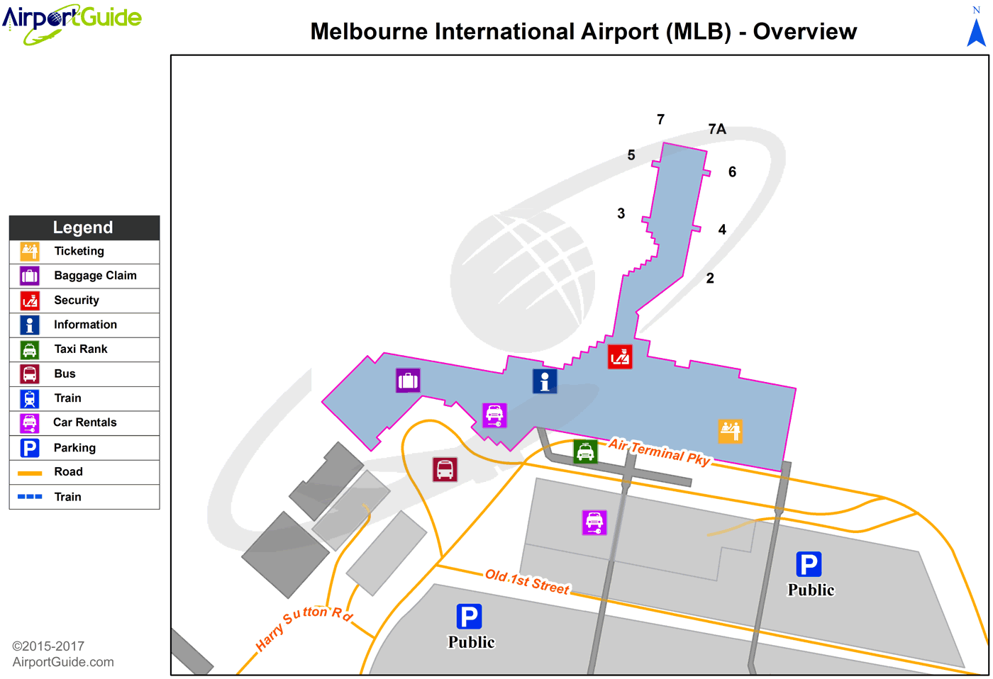
Maps & Diagrams
MLB Sectional
Flight Planning
at skyvector.com
at skyvector.com
 Diagram")