Location
Latitude: |
35-25-00.0980N (35.416694) |
Longitude: |
080-09-02.8480W (-80.150791) |
Elevation: |
609.0 feet MSL (186 m MSL) |
Magnetic Variation: |
8.4 W (as of April 2024 from WMM2020 model) |
Time Zone: |
UTC -5.0 (Standard Time) UTC -4.0 (Daylight Savings Time) |
From City: |
04 N.M. NE of Albemarle, North Carolina |
Found On: |
Charlotte Chart |
FAA Region: |
ASO |
Contacts
Manager: |
Publicly owned: |
| KEN SWARINGEN 43222 LOWDER AVIATION PARKWAY NEW LONDON, NC 28127 704-982-9013 |
STANLY COUNTY 43222 LOWDER AVIATION PARKWAY NEW LONDON, NC 28127 704-982-9013 |
Operations
Airport Status: |
Operational |
Facility Use: |
Public |
Type: |
Airport |
Activation Date: |
01/1979 |
Control tower: |
Yes |
Attendance (Months/Days/Hours): |
Months/Days/Hours ALL/ALL/0800-1800 |
Boundary ARTCC: |
ZTL (Atlanta) |
Responsible ARTCC: |
ZTL (Atlanta) |
Lighting Schedule: |
SEE RMK |
Segmented Circle Indicator: |
Yes |
Traffic Pattern Altitude (MSL): |
1609 feet (490 m) |
NOTAMs Facility: |
VUJ |
NOTAM-D Service: |
Yes |
Military Landing Rights: |
Yes |
Based Aircraft
| Single Engine: | 38 |
| Multi Engine: | 7 |
Annual Operations (as of 05/29/2023)
| Total Operations: | 28068 | |
| GA Local: | 15862 | 56.5% |
| GA Itinerant: | 1631 | 5.8% |
| Military Aircraft: | 10575 | 37.7% |
Communications
| CTAF: | 126.275 |
| Tower: | STANLY COUNTY 126.275 291.9 Hrs: 1300-2230Z++ OR BY NOTAM. |
| Clearance Del.: | 121.75 254.375 |
| Ground: | 121.75 254.375 |
| Approach: | CHARLOTTE |
| Departure: | CHARLOTTE |
| AWOS-3: | 128.175 (704-986-2097) |
- TWR SVCS PRVDD BY AIR GUARD.
Fixed Based Operators (FBOs) & Fuel
(Click on a business for detail)
Please help us keep this information up to date. This is a FREE SERVICE just like everything else on Airport Guide! If you see that a business needs to be added, modified, or deleted please fill out our Update Form.
To add, modify, or delete a business click here.
Please help us keep this information up to date. This is a FREE SERVICE just like everything else on Airport Guide! If you see that a business needs to be added, modified, or deleted please fill out our Update Form.
Area Code: 704 |
| Business Name | Frequency | Phone | Fuel Grade |
|---|---|---|---|
| Dallas Airmotive
Website Update FBO info |
983-7991 | ||
| Inglewood Aviation, Inc.
Update FBO info |
Unicom 123.0 | 983-1915, -1917 | |
| Stanly County
Update FBO info |
Unicom 123.0 | 982-9013 | 100LL, Jet A |
Flight Service Stations
| Primary | Alternate | |
| FSS on Field: | N | |
| FSS Name (ID): | Raleigh(RDU) | |
| Frequency: | ||
| Toll Free Phone: | 1-800-WX-BRIEF |
Instrument Procedures / Charts
FAA Terminal Procedures valid from 0901Z 03/21/24 to 0901Z 04/18/24.
There are various types of charts available for an airport. They are listed in the Page Type column. Here is a legend for those types:
APD - Airport Diagram
DP - Departure Procedure Charts
HOT - Hot Spots
IAP - Instrument Approach Procedure Charts
MIN - Minimums
STAR - Standard Terminal Arrival Charts
| Page Type | Page Name | Volume | Action Since Last Cycle |
|---|---|---|---|
| APD | AIRPORT DIAGRAM | SE-2 | |
| DP | BARMY FIVE (RNAV) | SE-2 | Changed |
| DP | BEAVY SIX (RNAV) | SE-2 | Changed |
| DP | BOBZY FIVE (RNAV) | SE-2 | Changed |
| DP | ESTRR FIVE (RNAV) | SE-2 | Changed |
| DP | ICONS FIVE (RNAV) | SE-2 | Changed |
| DP | JOJJO FIVE (RNAV) | SE-2 | Changed |
| DP | KERMIT FOUR | SE-2 | Changed |
| DP | KERMIT FOUR[DELIMITER] CONT.1 | SE-2 | Changed |
| DP | KILNS FIVE (RNAV) | SE-2 | Changed |
| DP | KNIGHTS THREE | SE-2 | Changed |
| DP | KNIGHTS THREE[DELIMITER] CONT.1 | SE-2 | Changed |
| DP | KRITR SIX (RNAV) | SE-2 | Changed |
| DP | KWEEN FIVE (RNAV) | SE-2 | Changed |
| DP | LILLS THREE (RNAV) | SE-2 | Changed |
| DP | WEAZL FIVE (RNAV) | SE-2 | Changed |
| IAP | ILS OR LOC RWY 22L | SE-2 | |
| IAP | NDB RWY 22L | SE-2 | |
| IAP | RNAV (GPS) RWY 04R | SE-2 | |
| IAP | RNAV (GPS) RWY 22L | SE-2 | |
| MIN | ALTERNATE MINIMUMS | SE-2 | |
| MIN | RADAR MINIMUMS | SE-2 | |
| MIN | TAKEOFF MINIMUMS | SE-2 | |
| STAR | JOOLS ONE (RNAV) | SE-2 | |
| STAR | KABEE THREE (RNAV) | SE-2 | |
| STAR | NASCR FOUR | SE-2 | Changed |
Terminal Procedures are only available for airports in several countries with more being added all the time. If you are looking for a specific country's charts, please send an email to support(at)airportguide.com stating the country name. This will be used to prioritize the implementation.
Navigation Aids (Navaids) near KVUJ
| Dist (NM) | ID | Morse Code | Name | Type | Freq | True Hdg | Mag Hdg |
|---|---|---|---|---|---|---|---|
| 5.5 | VU | . . . _ . . _ | Aller | NDB | 346 | 37 | 45 |
| 25.2 | RU | . _ . . . _ | Rovdy | NDB | 275 | 319 | 327 |
| 30.1 | SDZ | . . . _ . . _ _ . . | Sandhills | VORTAC | 111.80 | 113 | 122 |
| 35.4 | LIB | . _ . . . . _ . . . | Liberty | VORTAC | 113.00 | 47 | 56 |
| 38.7 | GSO | _ _ . . . . _ _ _ | Greensboro | VORTAC | 116.20 | 12 | 21 |
| 38.9 | TWL | _ . _ _ . _ . . | Wesley | NDB | 204 | 224 | 232 |
| 39.3 | IN | . . _ . | Reeno | NDB | 317 | 358 | 366 |
| 40.1 | HFF | . . . . . . _ . . . _ . | Mackall | NDB | 278 | 125 | 134 |
| 41.1 | CLT | _ . _ . . _ . . _ | Charlotte | VOT | 112.00 | 253 | 261 |
| 41.3 | PYG | . _ _ . _ . _ _ _ _ . | Pageland | NDB | 270 | 192 | 200 |
| 41.5 | CLT | _ . _ . . _ . . _ | Charlotte | VOR-DME | 115.00 | 251 | 259 |
| 42.8 | CQW | _ . _ . _ _ . _ . _ _ | Cheraw | NDB | 409 | 160 | 168 |
| 43.5 | HB | . . . . _ . . . | Alamm | NDB | 361 | 39 | 48 |
| 45.4 | EEJ | . . . _ _ _ | Lee County/Dcmsnd | NDB | 428 | 93 | 102 |
| 46.3 | IZN | . . _ _ . . _ . | Lincolnton | NDB | 432 | 279 | 287 |
| 46.4 | CTF | _ . _ . _ . . _ . | Chesterfield | VOR-DME | 114.55 | 187 | 195 |
| 49.6 | TT | _ _ | Leeco | NDB | 406 | 84 | 93 |
| 51.1 | GHJ | _ _ . . . . . . _ _ _ | Stonia | NDB | 260 | 254 | 262 |
| 52.0 | BES | _ . . . . . . . | Bennettsville | NDB | 230 | 156 | 165 |
| 53.7 | ME | _ _ . | Maxtn | NDB | 257 | 139 | 148 |
Nearby Airports with Fuel
Notices to Airmen (NOTAMS)
Remarks
| A110-1 | 959 FT MSL LGTD TWR 1.5NW. |
| A110-12 | MISC: REGIONAL TRAINING SITE (RTS) SUPPORT COORD THRU 145 AW/CE DSN 231-4229. |
| A110-13 | ANG: PPR ONLY IF RON ON ANG RAMP AND FBO RAMP, 145 AW BASOPS DSN 704-422-2551. |
| A110-14 | HEAVY PARACHUTE JUMPING NORTH END OF RWY 22L/R. |
| A110-15 | FOR CD WHEN ATCT IS CLSD CTC CHARLOTTE APCH AT 704-359-0241. |
| A110-16 | FBO OPERATIONAL HRS 0800-1800. |
| A110-17 | MILITARY FUEL - A+ (C704-982-9013, 1300-0000Z++, OT C704-984-3542 OR C704-961-8964) (NC-100LL). FUEL AVBL FROM FBO 1400-2200Z++, OTHER TIMES PPR, C704-982-9013. |
| A110-8 | RSTD: ANG RAMP RSTD TO MIL USE ONLY WITH PPR. CTC 235ATCS/ATM DSN 484-2552, C704-422-2551 OR C704-763-4633 AFTER DUTY HOURS. |
| A110-9 | CAUTION: BE ALERT FOR HIGH SPEED LOW LEVEL MIL ACFT IN VCNTY. FRQ NGT MIL OPR. FREQ ASSAULT OPS TO RWY 22R. DEER AND BIRD HAZARD. |
| A58-04L | 10 FT HILL 0-200 FT FROM THR 200 FT LEFT OF CNTRLN. |
| A70-FUEL-10 | 0LL 100LL AVBL SELF SVC H24 WITH CREDIT CARD. |
| A81-APT | ACTVT REIL RWY 04R & 22L; HIRL RWY 04R/22L, MIRL RWY 04L/22R - CTAF. PAPI RWY 04R & 22L ON DRG TWR OPN, OTHER TIMES - CTAF. |
| E147 | TPA: HEL 500 FT (1200 FT MSL), SMALL FW 1000 FT (1700 MSL), LRG/HVY 1500 FT (2200 FT MSL), OVHD 1500 FT (2200 FT MSL) OR AS ASGND BY TWR. |
Runways
Runway Summary
| Runways: | 04L/22R 04R/22L |
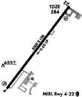
| Longest Runway: | 04R/22L is 5499 ft (1676 m) long |
| Runways with an Instrument Approach: | 22L |
KVUJ Airport Runway Details
| Runway 04L/22R | 3501 ft x 75 ft (1067 m x 23 m) | |
| Runway Length Source: | 3RD PARTY SURVEY as of 06/06/2018 | |
| Surface: | Asphalt - Excellent condition - No special surface treatment | |
| Runway Edge Lights: | Medium Intensity | |
Runway Weight Bearing Capacity (in thousands of pounds) |
||
| Dual Wheel Landing Gear: | 130.0 | |
Runway 04L |
Runway 22R |
|
Elevation: |
592.3 | 580.9 |
Latitude: |
35-24-54.0397N | 35-25-21.6179N |
Longitude: |
080-09-14.9467W | 080-08-49.3834W |
|
Runway True Alignment: |
037 | 217 |
Glide Path Angle: |
0.0 degrees | 0.0 degrees |
Runway Markings Type: |
Basic | Basic |
Runway Markings Condition: |
Good | Good |
Object at End: |
FENCE | TREES |
Object Height: |
23 | 32 |
Distance from End: |
411 | 793 |
Object Centerline Offset: |
301 ft. left of centerline | 270 ft. right of centerline |
| Runway 04R/22L | 5499 ft x 100 ft (1676 m x 30 m) | |
| Runway Length Source: | 3RD PARTY SURVEY as of 06/06/2018 | |
| Surface: | Asphalt - Excellent condition - Saw-cut or plastic grooved | |
| Runway Edge Lights: | High Intensity | |
Runway Weight Bearing Capacity (in thousands of pounds) |
||
| Dual Wheel Landing Gear: | 130.0 | |
Runway 04R |
Runway 22L |
|
Elevation: |
608.9 | 577.3 |
Latitude: |
35-24-33.5140N | 35-25-16.8384N |
Longitude: |
080-09-23.3618W | 080-08-43.1999W |
|
Runway True Alignment: |
037 | 217 |
ILS Type: |
ILS | |
Glide Path Angle: |
3.0 degrees | 3.0 degrees |
Traffic Pattern: |
Left | Left |
Runway Markings Type: |
Precision Instrument | Precision Instrument |
Runway Markings Condition: |
Good | Good |
Object at End: |
TREES | TREES |
Object Height: |
32 | 137 |
Distance from End: |
375 | 4194 |
Object Centerline Offset: |
301 ft. left of centerline | 270 ft. right of centerline |
Visual Glide Slope Indicators: |
2-Light PAPI On Left Side Of Runway | 2-Light PAPI On Left Side Of Runway |
REIL: |
Yes | Yes |
Threshold Crossing Height: |
30 | 40 |
Services
Bottled Oxygen: |
None |
Bulk Oxygen: |
None |
Fuel Available: |
100LL |
Landing Fees: |
No |
Parking: |
Tiedowns available |
Maps & Diagrams
KVUJ Sectional
Flight Planning
at skyvector.com
at skyvector.com