Location
Latitude: |
40-10-03.7000N (40.167694) |
Longitude: |
084-55-45.8000W (-84.929389) |
Elevation: |
1122.8 feet MSL (342 m MSL) |
Magnetic Variation: |
5.9 W (as of April 2024 from WMM2020 model) |
Time Zone: |
UTC -5.0 (Standard Time) UTC -4.0 (Daylight Savings Time) |
From City: |
03 N.M. E of Winchester, Indiana |
Found On: |
Detroit Chart |
FAA Region: |
AGL |
Contacts
Manager: |
Publicly owned: |
| ERIC LIVINGSTON 2937 E STATE RD 32 WINCHESTER, IN 47394 765-584-3611 |
RANDOLPH CO BOAC 2937 E STATE RD32 WINCHESTER, IN 47394 765-584-3611 |
Operations
Airport Status: |
Operational |
Facility Use: |
Public |
Type: |
Airport |
Activation Date: |
06/1948 |
Control tower: |
No |
Attendance (Months/Days/Hours): |
Months/Days/Hours ALL/MON-SAT/0800-1700 |
Boundary ARTCC: |
ZID (Indianapolis) |
Responsible ARTCC: |
ZID (Indianapolis) |
Lighting Schedule: |
SEE RMK |
Segmented Circle Indicator: |
No |
Traffic Pattern Altitude (MSL): |
2123 feet (647 m) |
NOTAMs Facility: |
HUF |
NOTAM-D Service: |
Yes |
International Airport of Entry: |
No |
Customs Landing Rights: |
No |
Military Landing Rights: |
No |
Civil/Military Joint Use: |
No |
Based Aircraft
| Single Engine: | 11 |
| Multi Engine: | 1 |
Annual Operations (as of 12/31/2019)
| Total Operations: | 2078 | |
| Air Taxi: | 62 | 3.0% |
| GA Local: | 977 | 47.0% |
| GA Itinerant: | 1039 | 50.0% |
Communications
| CTAF: | 123.000 |
| Unicom: | 123.000 |
| Approach: | COLUMBUS 118.425 118.425 118.425 118.425 |
| Departure: | COLUMBUS 118.425 118.425 118.425 118.425 |
Fixed Based Operators (FBOs) & Fuel
(Click on a business for detail)
Please help us keep this information up to date. This is a FREE SERVICE just like everything else on Airport Guide! If you see that a business needs to be added, modified, or deleted please fill out our Update Form.
To add, modify, or delete a business click here.
Please help us keep this information up to date. This is a FREE SERVICE just like everything else on Airport Guide! If you see that a business needs to be added, modified, or deleted please fill out our Update Form.
Area Code: 317 |
| Business Name | Frequency | Phone | Fuel Grade |
|---|---|---|---|
| Livingston Aviation
Update FBO info |
Unicom 123.0 | 584-3611 | 100LL, Jet A, Mogas |
Flight Service Stations
| Primary | Alternate | |
| FSS on Field: | N | |
| FSS Name (ID): | Terre Haute(HUF) | |
| Frequency: | ||
| Toll Free Phone: | 1-800-WX-BRIEF |
Instrument Procedures / Charts
FAA Terminal Procedures valid from 0901Z 03/21/24 to 0901Z 04/18/24.
There are various types of charts available for an airport. They are listed in the Page Type column. Here is a legend for those types:
APD - Airport Diagram
DP - Departure Procedure Charts
HOT - Hot Spots
IAP - Instrument Approach Procedure Charts
MIN - Minimums
STAR - Standard Terminal Arrival Charts
| Page Type | Page Name | Volume | Action Since Last Cycle |
|---|---|---|---|
| IAP | RNAV (GPS) RWY 08 | EC-2 | |
| IAP | RNAV (GPS) RWY 26 | EC-2 | |
| IAP | VOR-A | EC-2 | |
| MIN | TAKEOFF MINIMUMS | EC-2 |
Terminal Procedures are only available for airports in several countries with more being added all the time. If you are looking for a specific country's charts, please send an email to support(at)airportguide.com stating the country name. This will be used to prioritize the implementation.
Navigation Aids (Navaids) near I22
| Dist (NM) | ID | Morse Code | Name | Type | Freq | True Hdg | Mag Hdg |
|---|---|---|---|---|---|---|---|
| 18.0 | JN | . _ _ _ _ . | Balll | NDB | 365 | 272 | 278 |
| 21.7 | MIE | _ _ . . . | Muncie | VOR-DME | 114.40 | 281 | 287 |
| 24.9 | UWL | . . _ . _ _ . _ . . | New Castle | NDB | 385 | 226 | 232 |
| 25.1 | RID | . _ . . . _ . . | Richmond | DME | 110.6 | 170 | 176 |
| 25.2 | SQ | . . . _ _ . _ | Pnthr | NDB | 227 | 201 | 207 |
| 25.2 | CQA | _ . _ . _ _ . _ . _ | Lakefield | NDB | 205 | 41 | 47 |
| 26.1 | DQN | _ . . _ _ . _ _ . | Dayton | VOR-DME | 114.50 | 110 | 116 |
| 27.3 | AI | . _ . . | Video | NDB | 394 | 257 | 263 |
| 33.4 | AT | . _ _ | Bruny | NDB | 315 | 124 | 130 |
| 36.6 | DAY | _ . . . _ _ . _ _ | Dayton J M Cox-Day | VOT | 111.00 | 116 | 122 |
| 39.5 | MZZ | _ _ _ _ . . _ _ . . | Marion | VOR-DME | 108.60 | 299 | 305 |
| 40.2 | OXD | _ _ _ _ . . _ _ . . | Oxford | NDB | 282 | 170 | 176 |
| 41.2 | ROD | . _ . _ _ _ _ . . | Rosewood | VORTAC | 117.50 | 79 | 85 |
| 44.1 | VFU | . . . _ . . _ . . . _ | Stanley | NDB | 411 | 18 | 24 |
| 45.0 | MW | _ _ . _ _ | Onida | NDB | 223 | 141 | 147 |
| 45.3 | FFO | . . _ . . . _ . _ _ _ | Patterson | TACAN | 109.20 | 117 | 123 |
| 45.9 | HKF | . . . . _ . _ . . _ . | Hook Field | NDB | 239 | 150 | 156 |
| 47.9 | HHG | . . . . . . . . _ _ . | Huntington | NDB | 417 | 329 | 335 |
| 50.1 | FWA | . . _ . . _ _ . _ | Fort Wayne Baer | VOT | 111.00 | 346 | 352 |
| 50.1 | FWA | . . _ . . _ _ . _ | Fort Wayne | VORTAC | 117.80 | 346 | 352 |
Nearby Airports with Fuel
Notices to Airmen (NOTAMS)
Remarks
| A110-1 | COLUMBUS APCH CD (614) 338-8537. |
| A17 | ARPT CLSD THANKSGIVING & CHRISTMAS DAY. |
| A81-APT | ACTVT MIRL RY 08/26; REIL RY 08/26; PAPI RY 08/26 - CTAF. |
| E111 | EXISTED PRIOR TO 1959. |
Runways
Runway Summary
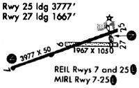
| Runways: | 08/26 |
| Longest Runway: | 08/26 is 4300 ft (1311 m) long |
| Runways with an Instrument Approach: |
I22 Airport Runway Details
| Runway 08/26 | 4300 ft x 75 ft (1311 m x 23 m) | |
| Runway Length Source: | 3RD PARTY SURVEY as of 08/20/2012 | |
| Surface: | Asphalt - Excellent condition - Saw-cut or plastic grooved | |
| Runway Pavement Class: | 21 /F/A/X/T | |
| Runway Edge Lights: | Medium Intensity | |
Runway Weight Bearing Capacity (in thousands of pounds) |
||
| Single Wheel Landing Gear: | 64.0 | |
| Dual Wheel Landing Gear: | 90.0 | |
| Dual Tandem Wheel Landing Gear: | 176.0 | |
Runway 08 |
Runway 26 |
|
Elevation: |
1115.9 | 1122.8 |
Latitude: |
40-09-59.0040N | 40-10-08.3616N |
Longitude: |
084-56-12.7655W | 084-55-18.7354W |
|
Runway True Alignment: |
077 | 257 |
Glide Path Angle: |
3.0 degrees | 3.0 degrees |
Traffic Pattern: |
Left | Left |
Runway Markings Type: |
Nonprecision Instrument | Nonprecision Instrument |
Runway Markings Condition: |
Good | Good |
Object at End: |
CROPS | ROAD |
Object Height: |
17 | 13 |
Distance from End: |
780 | 650 |
Object Centerline Offset: |
210 ft. right of centerline | 0 ft. left and right of centerline |
Visual Glide Slope Indicators: |
2-Light PAPI On Left Side Of Runway | 2-Light PAPI On Left Side Of Runway |
REIL: |
Yes | Yes |
Touchdown Lights: |
No | No |
Centerline Lights: |
No | No |
Threshold Crossing Height: |
25 | 25 |
Services
Airframe Repair: |
Major |
Powerplant Repair: |
Major |
Bottled Oxygen: |
Low Pressure |
Bulk Oxygen: |
None |
Fuel Available: |
100LL, Jet A+ |
Landing Fees: |
No |
Parking: |
Hangars and tiedowns available |
Maps & Diagrams
I22 Sectional
Flight Planning
at skyvector.com
at skyvector.com