Location
Latitude: |
31-52-09.5893N (31.86933) |
Longitude: |
095-13-02.6597W (-95.217405) |
Elevation: |
677.6 feet MSL (207 m MSL) |
Magnetic Variation: |
1.7 E (as of April 2024 from WMM2020 model) |
Time Zone: |
UTC -6.0 (Standard Time) UTC -5.0 (Daylight Savings Time) |
From City: |
06 N.M. SE of Jacksonville, Texas |
Found On: |
Houston Chart |
FAA Region: |
ASW |
Contacts
Manager: |
Publicly owned: |
| CLINT GOFF 420 CR 1618 RUSK, TX 75785 903-586-8219 |
CHEROKEE COUNTY 135 S. MAIN 3RD FLOOR RUSK, TX 75785 (903) 683-2324 |
Operations
Airport Status: |
Operational |
Facility Use: |
Public |
Type: |
Airport |
Activation Date: |
06/1964 |
Control tower: |
No |
Attendance (Months/Days/Hours): |
Months/Days/Hours ALL/MON-SAT/0800-1700 |
Boundary ARTCC: |
ZFW (Fort Worth) |
Responsible ARTCC: |
ZFW (Fort Worth) |
Lighting Schedule: |
SEE RMK |
Segmented Circle Indicator: |
Yes |
Traffic Pattern Altitude (MSL): |
1678 feet (511 m) |
NOTAMs Facility: |
JSO |
NOTAM-D Service: |
Yes |
International Airport of Entry: |
No |
Customs Landing Rights: |
No |
Military Landing Rights: |
Yes |
Civil/Military Joint Use: |
No |
Based Aircraft
| Single Engine: | 44 |
| Multi Engine: | 10 |
| Jet Engine: | 1 |
Annual Operations (as of 10/07/2022)
| Total Operations: | 20050 | |
| GA Local: | 15000 | 74.8% |
| GA Itinerant: | 5000 | 24.9% |
| Military Aircraft: | 50 | 0.2% |
Communications
| CTAF: | 122.700 |
| Unicom: | 122.700 |
| Approach: | LONGVIEW 128.75 128.75 FORT WORTH ARTCC |
| Departure: | LONGVIEW 128.75 128.75 FORT WORTH ARTCC |
| AWOS-3: | 119.075 (903-586-0124) |
- APCH/DEP CTL SVC PRVDD BY FORT WORTH ARTCC (ZFW) ON FREQS 135.25/265.1 (FRANKSTON RCAG) WHEN LONGVIEW APCH CTL (GGG) CLSD.
Fixed Based Operators (FBOs) & Fuel
(Click on a business for detail)
Please help us keep this information up to date. This is a FREE SERVICE just like everything else on Airport Guide! If you see that a business needs to be added, modified, or deleted please fill out our Update Form.
To add, modify, or delete a business click here.
Please help us keep this information up to date. This is a FREE SERVICE just like everything else on Airport Guide! If you see that a business needs to be added, modified, or deleted please fill out our Update Form.
Area Code: 903 |
| Business Name | Frequency | Phone | Fuel Grade |
|---|---|---|---|
| Air Center East Texas
Update FBO info |
Unicom 122.7 | 586-8219 | 100LL, Jet A |
| RidgeAire
Update FBO info |
Unicom 122.7 | 586-1521 |
Flight Service Stations
| Primary | Alternate | |
| FSS on Field: | N | |
| FSS Name (ID): | Fort Worth(FTW) | |
| Frequency: | ||
| Toll Free Phone: | 1-800-WX-BRIEF |
Instrument Procedures / Charts
FAA Terminal Procedures valid from 0901Z 03/21/24 to 0901Z 04/18/24.
There are various types of charts available for an airport. They are listed in the Page Type column. Here is a legend for those types:
APD - Airport Diagram
DP - Departure Procedure Charts
HOT - Hot Spots
IAP - Instrument Approach Procedure Charts
MIN - Minimums
STAR - Standard Terminal Arrival Charts
| Page Type | Page Name | Volume | Action Since Last Cycle |
|---|---|---|---|
| IAP | RNAV (GPS) RWY 14 | SC-5 | |
| IAP | RNAV (GPS) RWY 32 | SC-5 | |
| IAP | VOR RWY 14 | SC-5 | |
| MIN | ALTERNATE MINIMUMS | SC-5 | |
| MIN | TAKEOFF MINIMUMS | SC-5 |
Terminal Procedures are only available for airports in several countries with more being added all the time. If you are looking for a specific country's charts, please send an email to support(at)airportguide.com stating the country name. This will be used to prioritize the implementation.
Navigation Aids (Navaids) near JKV
| Dist (NM) | ID | Morse Code | Name | Type | Freq | True Hdg | Mag Hdg |
|---|---|---|---|---|---|---|---|
| 0.1 | JSO | . _ _ _ . . . _ _ _ | Cherokee County | NDB | 263 | 61 | 59 |
| 20.2 | FZT | . . _ . _ _ . . _ | Frankston | VOR-DME | 111.40 | 307 | 305 |
| 25.2 | PSN | . _ _ . . . . _ . | Palestine | NDB | 375 | 257 | 255 |
| 26.3 | HNO | . . . . _ . _ _ _ | Henderson | NDB | 371 | 43 | 41 |
| 29.3 | GXD | _ _ . _ . . _ _ . . | Nacogdoches | NDB | 391 | 116 | 114 |
| 30.7 | TYR | _ _ . _ _ . _ . | Tyler | VOR-DME | 114.20 | 342 | 340 |
| 34.3 | OC | _ _ _ _ . _ . | Nados | NDB | 253 | 132 | 130 |
| 35.2 | TY | _ _ . _ _ | Indoo | NDB | 320 | 338 | 336 |
| 35.7 | AHX | . _ . . . . _ . . _ | Athens | NDB | 269 | 299 | 297 |
| 39.4 | CSZ | _ . _ . . . . _ _ . . | Crossroads | NDB | 215 | 287 | 285 |
| 40.5 | GGG | _ _ . _ _ . _ _ . | Gregg County | VORTAC | 112.90 | 35 | 33 |
| 41.1 | GG | _ _ . _ _ . | Veels | NDB | 410 | 31 | 29 |
| 43.3 | ABG | . _ _ . . . _ _ . | Ambassador | NDB | 404 | 6 | 4 |
| 43.9 | LF | . _ . . . . _ . | Flufy | NDB | 350 | 152 | 150 |
| 49.5 | LFK | . _ . . . . _ . _ . _ | Lufkin | VORTAC | 112.10 | 148 | 146 |
| 49.9 | PYF | . _ _ . _ . _ _ . . _ . | Pyramid | NDB | 418 | 269 | 267 |
| 50.4 | RPF | . _ . . _ _ . . . _ . | Carthage | NDB | 332 | 68 | 67 |
| 54.3 | CZJ | _ . _ . _ _ . . . _ _ _ | Amason | NDB | 341 | 92 | 91 |
| 54.3 | CQY | _ . _ . _ _ . _ _ . _ _ | Cedar Creek | VORTAC | 114.80 | 290 | 288 |
| 58.9 | LOA | . _ . . _ _ _ . _ | Leona | VORTAC | 110.80 | 220 | 218 |
Nearby Airports with Fuel
Notices to Airmen (NOTAMS)
Remarks
| A110-1 | FOR CD CTC FORT WORTH ARTCC AT 817-858-7584. |
| A70-FUEL-10 | 0LL FUEL 24 HRS SELF-SERVE. |
| A81-APT | DUSK-DAWN, MIRL RWY 14/32 PRESET LOW INTST; TO INCR INTST AND TO ACTVT REIL RWY 14 - CTAF. |
Runways
Runway Summary
| Runways: | 14/32 |
| Longest Runway: | 14/32 is 5006 ft (1526 m) long |
| Runways with an Instrument Approach: |
JKV Airport Runway Details
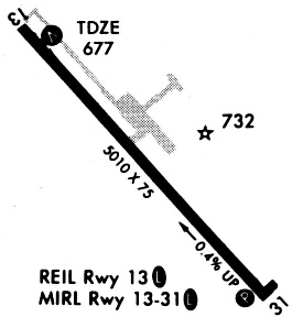
| Runway 14/32 | 5006 ft x 75 ft (1526 m x 23 m) | |
| Runway Length Source: | 3RD PARTY SURVEY as of 09/26/2008 | |
| Surface: | Asphalt - Good condition - No special surface treatment | |
| Runway Edge Lights: | Medium Intensity | |
Runway Weight Bearing Capacity (in thousands of pounds) |
||
| Single Wheel Landing Gear: | 30.0 | |
Runway 14 |
Runway 32 |
|
Elevation: |
677.6 | 657.7 |
Latitude: |
31-52-28.5791N | 31-51-50.5994N |
Longitude: |
095-13-21.2922W | 095-12-44.0271W |
|
Runway True Alignment: |
140 | 320 |
Glide Path Angle: |
3.0 degrees | 3.0 degrees |
Traffic Pattern: |
Left | Left |
Runway Markings Type: |
Nonprecision Instrument | Nonprecision Instrument |
Runway Markings Condition: |
Good | Good |
Object at End: |
TREE | |
Visual Glide Slope Indicators: |
4-Light PAPI On Left Side Of Runway | 4-Light PAPI On Left Side Of Runway |
REIL: |
Yes | |
Threshold Crossing Height: |
30 | 28 |
Services
Airframe Repair: |
Major |
Powerplant Repair: |
Major |
Fuel Available: |
100LL |
Maps & Diagrams
JKV Sectional
Flight Planning
at skyvector.com
at skyvector.com