Location
Latitude: |
40-54-47.3100N (40.913142) |
Longitude: |
076-43-58.8800W (-76.733022) |
Elevation: |
430.0 feet MSL (131 m MSL) |
Magnetic Variation: |
11.3 W (as of April 2024 from WMM2020 model) |
Time Zone: |
UTC -5.0 (Standard Time) UTC -4.0 (Daylight Savings Time) |
From City: |
03 N.M. NE of Sunbury, Pennsylvania |
Found On: |
New York Chart |
FAA Region: |
AEA |
Contacts
Manager: |
Privately owned: |
| SHANE R HAYHURST PO BX 416 SUNBURY, PA 17801 570-743-3229 |
SHANE R HAYHURST PO BOX 416 SUNBURY, PA 17801 (570) 850-2671 |
Operations
Airport Status: |
Operational |
Facility Use: |
Public |
Type: |
Seaplane Base |
Activation Date: |
07/1996 |
Control tower: |
No |
Attendance (Months/Days/Hours): |
Months/Days/Hours JUN-AUG/IREG/DALGT |
Boundary ARTCC: |
ZNY (New York) |
Responsible ARTCC: |
ZNY (New York) |
Segmented Circle Indicator: |
No |
Traffic Pattern Altitude (MSL): |
1430 feet (436 m) |
NOTAMs Facility: |
IPT |
NOTAM-D Service: |
Yes |
Based Aircraft
| Single Engine: | 2 |
Annual Operations (as of 10/18/2023)
| Total Operations: | 20 | |
| GA Local: | 20 | 100.0% |
Communications
| CTAF: | 122.900 |
Fixed Based Operators (FBOs) & Fuel
(Click on a business for detail)
Please help us keep this information up to date. This is a FREE SERVICE just like everything else on Airport Guide! If you see that a business needs to be added, modified, or deleted please fill out our Update Form.
To add, modify, or delete a business click here.
Please help us keep this information up to date. This is a FREE SERVICE just like everything else on Airport Guide! If you see that a business needs to be added, modified, or deleted please fill out our Update Form.
Area Code: 570 |
| Business Name | Frequency | Phone | Fuel Grade |
|---|
Flight Service Stations
| Primary | Alternate | |
| FSS on Field: | N | |
| FSS Name (ID): | Williamsport(IPT) | |
| Frequency: | ||
| Toll Free Phone: | 1-800-WX-BRIEF |
Instrument Procedures / Charts
Terminal Procedures are only available for airports in several countries with more being added all the time. If you are looking for a specific country's charts, please send an email to support(at)airportguide.com stating the country name. This will be used to prioritize the implementation.
Navigation Aids (Navaids) near H11
| Dist (NM) | ID | Morse Code | Name | Type | Freq | True Hdg | Mag Hdg |
|---|---|---|---|---|---|---|---|
| 7.3 | MIP | _ _ . . . _ _ . | Milton | VORTAC | 109.20 | 24 | 35 |
| 10.0 | SEG | . . . . _ _ . | Selinsgrove | VOR-DME | 110.40 | 223 | 234 |
| 21.9 | PIX | . _ _ . . . _ . . _ | Picture Rocks | NDB | 344 | 2 | 13 |
| 22.4 | RAV | . _ . . _ . . . _ | Ravine | VORTAC | 114.60 | 164 | 175 |
| 25.6 | FQM | . . _ . _ _ . _ _ _ | Williamsport | VOR-DME | 114.40 | 355 | 366 |
| 27.8 | HZL | . . . . _ _ . . . _ . . | Hazleton | VOR | 109.40 | 82 | 93 |
| 29.8 | BZJ | _ . . . _ _ . . . _ _ _ | Bellgrove | NDB | 328 | 163 | 174 |
| 39.7 | HAR | . . . . . _ . _ . | Harrisburg | VORTAC | 112.50 | 202 | 213 |
| 40.7 | MD | _ _ _ . . | Enola | NDB | 204 | 190 | 201 |
| 43.0 | MDT | _ _ _ . . _ | Harrisburg | VOT | 110.00 | 181 | 192 |
| 45.7 | UN | . . _ _ . | Penue | NDB | 388 | 270 | 281 |
| 45.8 | CX | _ . _ . _ . . _ | Latle | NDB | 219 | 195 | 206 |
| 51.7 | LRP | . _ . . . _ . . _ _ . | Lancaster | VOR-DME | 117.30 | 156 | 167 |
| 51.7 | ETX | . _ _ . . _ | East Texas | VOR-DME | 110.20 | 112 | 124 |
| 51.9 | LVZ | . _ . . . . . _ _ _ . . | Wilkes-Barre | VORTAC | 111.60 | 65 | 77 |
| 56.2 | SFK | . . . . . _ . _ . _ | Stonyfork | VOR-DME | 108.60 | 326 | 337 |
| 57.1 | PSB | . _ _ . . . . _ . . . | Philipsburg | VORTAC | 115.50 | 270 | 281 |
| 59.1 | FJC | . . _ . . _ _ _ _ . _ . | Allentown | VORTAC | 117.50 | 100 | 112 |
| 60.0 | EUD | . . . _ _ . . | York | NDB | 254 | 186 | 197 |
| 65.8 | LHY | . _ . . . . . . _ . _ _ | Lake Henry | VORTAC | 110.80 | 58 | 70 |
Nearby Airports with Fuel
Notices to Airmen (NOTAMS)
Remarks
| A110-2 | EXTREME CAUTION MAINTAINED TO INSURE MUTUAL SAFETY OF BOATERS & FLIGHT OPNS; COORDINATION BE MADE WITH SUNBURY ARPT ON CTAF 122.9 TO ASSURE ADEQUATE SEPARATION OF OPNS; AND LARGEST CLASS OF ACFT RECOMMENDED IS SINGLE ENGINE. |
| A110-3 | PPR 48 HRS PRIOR TO ARRIVAL DUE TO CHANGING CONDITIONS AND ATTENDANCE: 570-850-2671 OR 570-743-3229. |
| A110-4 | FOR CD CTC HARRISBURG APCH AT 800-932-0712. |
| A13 | AFT HRS 570-850-2671. |
| A30-07W/25W | 850 FT MSL RIDGE LINE PARALLEL TO RWY S SIDE. |
| E111 | PRVDD SPB USED FOR DALGT OPNS ONLY; COORDINATION OF PROPOSED LANDING AREA WITH THOSE AGENCIES WHO HAVECONTROL OR JURISDICTION OVER THE WATERWAYS; |
Runways
Runway Summary
| Runways: | 07W/25W |
| Longest Runway: | 07W/25W is 5000 ft (1524 m) long |
| Runways with an Instrument Approach: |
H11 Airport Runway Details
| Waterway 07W/25W | 5000 ft x 250 ft (1524 m x 76 m) | |
| Surface: | Water - No special surface treatment | |
Waterway 07W |
Runway 25W |
|
Glide Path Angle: |
0.0 degrees | 0.0 degrees |
Traffic Pattern: |
Right |
Services
Airframe Repair: |
Minor |
Powerplant Repair: |
Minor |
Fuel Available: |
100LL |
Landing Fees: |
No |
Parking: |
Hangars and tiedowns available |
Maps & Diagrams
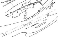
H11 Sectional
Flight Planning
at skyvector.com
at skyvector.com