Location
Latitude: |
37-27-00.2000N (37.450056) |
Longitude: |
094-43-52.4000W (-94.731222) |
Elevation: |
946.2 feet MSL (288 m MSL) |
Magnetic Variation: |
1.3 E (as of April 2024 from WMM2020 model) |
Time Zone: |
UTC -6.0 (Standard Time) UTC -5.0 (Daylight Savings Time) |
From City: |
03 N.M. NW of Pittsburg, Kansas |
Found On: |
Kansas City Chart |
FAA Region: |
ACE |
Contacts
Manager: |
Publicly owned: |
| BILL PYLE 3510 ARPT DR PITTSBURG, KS 66762 620-231-5760 |
CITY OF PITTSBURG 201 W 4TH ST PITTSBURG, KS 66762 620-231-4100 |
Operations
Airport Status: |
Operational |
Facility Use: |
Public |
Type: |
Airport |
Activation Date: |
04/1940 |
Control tower: |
No |
Attendance (Months/Days/Hours): |
Months/Days/Hours ALL/MON-FRI/0700-1700 |
Boundary ARTCC: |
ZKC (Kansas City) |
Responsible ARTCC: |
ZKC (Kansas City) |
Lighting Schedule: |
SEE RMK |
Segmented Circle Indicator: |
No |
Traffic Pattern Altitude (MSL): |
1946 feet (593 m) |
NOTAMs Facility: |
ICT |
NOTAM-D Service: |
Yes |
International Airport of Entry: |
No |
Customs Landing Rights: |
No |
Military Landing Rights: |
Yes |
Civil/Military Joint Use: |
No |
Based Aircraft
| Single Engine: | 20 |
| Multi Engine: | 4 |
| Jet Engine: | 4 |
| GA Helicopters: | 1 |
Annual Operations (as of 08/20/2019)
| Total Operations: | 23700 | |
| GA Local: | 15000 | 63.3% |
| GA Itinerant: | 8600 | 36.3% |
| Military Aircraft: | 100 | 0.4% |
Communications
| CTAF: | 123.000 |
| Unicom: | 123.000 |
| AWOS-3PT: | 118.775 (620-230-5654) |
- APCH/DEP CTL SVC PRVDD BY KANSAS CITY ARTCC (ZKC) ON FREQS 128.6/282.325 (EDNA RCAG).
Fixed Based Operators (FBOs) & Fuel
(Click on a business for detail)
Please help us keep this information up to date. This is a FREE SERVICE just like everything else on Airport Guide! If you see that a business needs to be added, modified, or deleted please fill out our Update Form.
To add, modify, or delete a business click here.
Please help us keep this information up to date. This is a FREE SERVICE just like everything else on Airport Guide! If you see that a business needs to be added, modified, or deleted please fill out our Update Form.
Area Code: 620 |
| Business Name | Frequency | Phone | Fuel Grade |
|---|---|---|---|
| Atkinson Municipal
Update FBO info |
Unicom 123.0 | 231-5760 | 100LL, Jet A |
| Mac's Aircraft Repair
Update FBO info |
Unicom 123.8 | 232-9102 | 100LL |
Flight Service Stations
| Primary | Alternate | |
| FSS on Field: | N | |
| FSS Name (ID): | Wichita(ICT) | |
| Frequency: | ||
| Toll Free Phone: | 1-800-WX-BRIEF |
Instrument Procedures / Charts
FAA Terminal Procedures valid from 0901Z 03/21/24 to 0901Z 04/18/24.
There are various types of charts available for an airport. They are listed in the Page Type column. Here is a legend for those types:
APD - Airport Diagram
DP - Departure Procedure Charts
HOT - Hot Spots
IAP - Instrument Approach Procedure Charts
MIN - Minimums
STAR - Standard Terminal Arrival Charts
| Page Type | Page Name | Volume | Action Since Last Cycle |
|---|---|---|---|
| IAP | RNAV (GPS) RWY 04 | NC-2 | |
| IAP | RNAV (GPS) RWY 17 | NC-2 | |
| IAP | RNAV (GPS) RWY 22 | NC-2 | |
| IAP | RNAV (GPS) RWY 35 | NC-2 | |
| MIN | ALTERNATE MINIMUMS | NC-2 | |
| MIN | TAKEOFF MINIMUMS | NC-2 |
Terminal Procedures are only available for airports in several countries with more being added all the time. If you are looking for a specific country's charts, please send an email to support(at)airportguide.com stating the country name. This will be used to prioritize the implementation.
Navigation Aids (Navaids) near PTS
| Dist (NM) | ID | Morse Code | Name | Type | Freq | True Hdg | Mag Hdg |
|---|---|---|---|---|---|---|---|
| 0.5 | PTS | . _ _ . _ . . . | Pittsburg | NDB | 365 | 154 | 153 |
| 17.0 | JL | . _ _ _ . _ . . | Lunns | NDB | 344 | 150 | 149 |
| 20.2 | LLU | . _ . . . _ . . . . _ | Spring River | NDB | 356 | 83 | 82 |
| 20.9 | FSK | . . _ . . . . _ . _ | Fort Scott | NDB | 379 | 355 | 354 |
| 28.6 | OSW | _ _ _ . . . . _ _ | Oswego | DME | 117.6 | 232 | 231 |
| 38.4 | MSB | _ _ . . . _ . . . | Monarch | NDB | 410 | 302 | 300 |
| 39.1 | EOS | . _ _ _ . . . | Neosho | DME | 117.3 | 158 | 157 |
| 42.4 | CNU | _ . _ . _ . . . _ | Chanute | VOR-DME | 109.20 | 284 | 282 |
| 45.5 | CFV | _ . _ . . . _ . . . . _ | Coffeyville | NDB | 212 | 242 | 240 |
| 50.6 | BUM | _ . . . . . _ _ _ | Butler | VORTAC | 115.90 | 13 | 12 |
| 66.8 | SGF | . . . _ _ . . . _ . | Springfield | VORTAC | 116.90 | 94 | 93 |
| 67.3 | RO | . _ . _ _ _ | Rogrs | NDB | 263 | 151 | 150 |
| 69.3 | UKL | . . _ _ . _ . _ . . | Boyd | NDB | 245 | 317 | 315 |
| 71.5 | BV | _ . . . . . . _ | Dewie | NDB | 201 | 239 | 237 |
| 71.8 | BVO | _ . . . . . . _ _ _ _ | Bartlesville | VOR-DME | 117.90 | 239 | 237 |
| 73.7 | GLY | _ _ . . _ . . _ . _ _ | Golden Valley | NDB | 388 | 41 | 40 |
| 76.5 | SLG | . . . . _ . . _ _ . | Siloam Springs | NDB | 284 | 171 | 170 |
| 77.9 | RZC | . _ . _ _ . . _ . _ . | Razorback | VORTAC | 116.40 | 157 | 156 |
| 78.2 | PK | . _ _ . _ . _ | Herbb | NDB | 420 | 359 | 358 |
| 83.4 | OJC | _ _ _ . _ _ _ _ . _ . | Johnson County | VOR-DME | 113.00 | 359 | 358 |
Nearby Airports with Fuel
Notices to Airmen (NOTAMS)
Remarks
| A110-2 | BIRDS ON & INVOF ARPT. |
| A110-3 | GCO AVBL ON FREQ 121.725 THRU KANSAS CITY CENTER & FLT SVCS. |
| A110-4 | FOR CD IF UNA TO CTC ON FSS FREQ, CTC KANSAS CITY ARTCC AT 913-254-8508. |
| A81-APT | DUSK-DAWN. ACTVT MIRL RYS 04/22 & 17/35; PAPI & REIL RYS 17, 35, 04 & 22 - CTAF. |
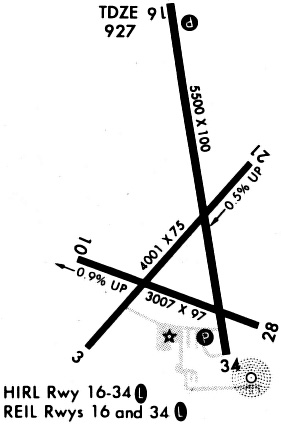
Runways
Runway Summary
| Runways: | 04/22 17/35 |
| Longest Runway: | 17/35 is 6100 ft (1859 m) long |
| Runways with an Instrument Approach: |
PTS Airport Runway Details
| Runway 04/22 | 4000 ft x 75 ft (1219 m x 23 m) | |
| Runway Length Source: | 3RD PARTY SURVEY as of 03/18/2016 | |
| Surface: | Asphalt - Good condition - No special surface treatment | |
| Runway Pavement Class: | 9 /F/D/X/T | |
| Runway Edge Lights: | Medium Intensity | |
Runway Weight Bearing Capacity (in thousands of pounds) |
||
| Single Wheel Landing Gear: | 24.0 | |
Runway 04 |
Runway 22 |
|
Elevation: |
946.2 | 922.3 |
Latitude: |
37-26-35.2507N | 37-27-05.6067N |
Longitude: |
094-44-10.7893W | 094-43-39.0079W |
|
Runway True Alignment: |
040 | 220 |
Glide Path Angle: |
3.0 degrees | 3.8 degrees |
Traffic Pattern: |
Left | Left |
Runway Markings Type: |
Nonprecision Instrument | Nonprecision Instrument |
Runway Markings Condition: |
Good | Good |
Object at End: |
TREES | TREES |
Object Height: |
44 | 56 |
Distance from End: |
450 | 579 |
Object Centerline Offset: |
148 ft. left of centerline | 190 ft. right of centerline |
Visual Glide Slope Indicators: |
4-Light PAPI On Left Side Of Runway | 4-Light PAPI On Left Side Of Runway |
REIL: |
Yes | Yes |
Threshold Crossing Height: |
37 | 55 |
| Runway 17/35 | 6100 ft x 100 ft (1859 m x 30 m) | |
| Runway Length Source: | 3RD PARTY SURVEY as of 03/18/2016 | |
| Surface: | Asphalt - Good condition - No special surface treatment | |
| Runway Pavement Class: | 17 /F/D/X/T | |
| Runway Edge Lights: | Medium Intensity | |
Runway Weight Bearing Capacity (in thousands of pounds) |
||
| Single Wheel Landing Gear: | 44.0 | |
| Dual Wheel Landing Gear: | 58.0 | |
Runway 17 |
Runway 35 |
|
Elevation: |
936.3 | 926.5 |
Latitude: |
37-27-36.2127N | 37-26-36.8470N |
Longitude: |
094-43-57.3830W | 094-43-44.0450W |
|
Runway True Alignment: |
170 | 350 |
Glide Path Angle: |
3.0 degrees | 3.0 degrees |
Traffic Pattern: |
Left | Left |
Runway Markings Type: |
Nonprecision Instrument | Nonprecision Instrument |
Runway Markings Condition: |
Good | Good |
Object at End: |
TREES | TREES |
Object Height: |
70 | 50 |
Distance from End: |
2369 | 1726 |
Object Centerline Offset: |
148 ft. left of centerline | 190 ft. right of centerline |
Visual Glide Slope Indicators: |
4-Light PAPI On Left Side Of Runway | 4-Light PAPI On Left Side Of Runway |
REIL: |
Yes | Yes |
Threshold Crossing Height: |
43 | 20 |
Services
Airframe Repair: |
Major |
Powerplant Repair: |
Major |
Bottled Oxygen: |
None |
Bulk Oxygen: |
None |
Fuel Available: |
100LL, Jet A |
Parking: |
Hangars and tiedowns available |
Maps & Diagrams
PTS Sectional
Flight Planning
at skyvector.com
at skyvector.com