Location
Latitude: |
31-12-45.1605N (31.212544) |
Longitude: |
083-13-30.9236W (-83.225256) |
Elevation: |
240.1 feet MSL (73 m MSL) |
Magnetic Variation: |
6 W (as of April 2024 from WMM2020 model) |
Time Zone: |
UTC -5.0 (Standard Time) UTC -4.0 (Daylight Savings Time) |
From City: |
01 N.M. E of Nashville, Georgia |
Found On: |
Jacksonville Chart |
FAA Region: |
ASO |
Contacts
Manager: |
Publicly owned: |
| MARY ALICE MCGEE P.O. BOX 217, ROOM 198 NASHVILLE, GA 31639 229-686-5421 |
BERRIEN COUNTY 201 N DAVIS ST, ROOM 198 NASHVILLE, GA 31639 229-686-5421 |
Operations
Airport Status: |
Operational |
Facility Use: |
Public |
Type: |
Airport |
Control tower: |
No |
Attendance (Months/Days/Hours): |
Months/Days/Hours UNATTENDED |
Boundary ARTCC: |
ZJX (Jacksonville) |
Responsible ARTCC: |
ZJX (Jacksonville) |
Lighting Schedule: |
SEE RMK |
Segmented Circle Indicator: |
Yes |
Traffic Pattern Altitude (MSL): |
1240 feet (378 m) |
NOTAMs Facility: |
MCN |
NOTAM-D Service: |
Yes |
International Airport of Entry: |
No |
Customs Landing Rights: |
No |
Military Landing Rights: |
Yes |
Civil/Military Joint Use: |
No |
Based Aircraft
| Single Engine: | 8 |
| Jet Engine: | 2 |
Annual Operations (as of 12/31/2023)
| Total Operations: | 4000 | |
| GA Local: | 3000 | 75.0% |
| GA Itinerant: | 1000 | 25.0% |
Communications
| CTAF: | 122.700 |
| Unicom: | 122.700 |
| Approach: | VALDOSTA 126.6 ;EAST OF VAD 360-VAD 180 126.6 ;EAST OF VAD 360-VAD 180 126.6 ;EAST OF VAD 360-VAD 180 JAX ARTCC |
| Departure: | VALDOSTA 126.6 ;EAST OF VAD 360-VAD 180 126.6 ;EAST OF VAD 360-VAD 180 126.6 ;EAST OF VAD 360-VAD 180 JAX ARTCC |
- APCH/DEP SVC PRVDD BY JACKSONVILLE ARTCC ON FREQS 133.7/323.3(VALDOSTA RCAG) WHEN VALDOSTA APCH CTL CLSD.
Fixed Based Operators (FBOs) & Fuel
(Click on a business for detail)
Please help us keep this information up to date. This is a FREE SERVICE just like everything else on Airport Guide! If you see that a business needs to be added, modified, or deleted please fill out our Update Form.
To add, modify, or delete a business click here.
Please help us keep this information up to date. This is a FREE SERVICE just like everything else on Airport Guide! If you see that a business needs to be added, modified, or deleted please fill out our Update Form.
Area Code: 912 |
| Business Name | Frequency | Phone | Fuel Grade |
|---|---|---|---|
| Harnage Aviation
Update FBO info |
Unicom 122.7 | 686-6483 | 100LL, Jet A |
Flight Service Stations
| Primary | Alternate | |
| FSS on Field: | N | |
| FSS Name (ID): | Macon(MCN) | |
| Frequency: | ||
| Toll Free Phone: | 1-800-WX-BRIEF |
Instrument Procedures / Charts
FAA Terminal Procedures valid from 0901Z 03/21/24 to 0901Z 04/18/24.
There are various types of charts available for an airport. They are listed in the Page Type column. Here is a legend for those types:
APD - Airport Diagram
DP - Departure Procedure Charts
HOT - Hot Spots
IAP - Instrument Approach Procedure Charts
MIN - Minimums
STAR - Standard Terminal Arrival Charts
| Page Type | Page Name | Volume | Action Since Last Cycle |
|---|---|---|---|
| IAP | RNAV (GPS) RWY 10 | SE-4 | |
| IAP | RNAV (GPS) RWY 28 | SE-4 | |
| MIN | TAKEOFF MINIMUMS | SE-4 |
Terminal Procedures are only available for airports in several countries with more being added all the time. If you are looking for a specific country's charts, please send an email to support(at)airportguide.com stating the country name. This will be used to prioritize the implementation.
Navigation Aids (Navaids) near 4J2
| Dist (NM) | ID | Morse Code | Name | Type | Freq | True Hdg | Mag Hdg |
|---|---|---|---|---|---|---|---|
| 14.4 | TM | _ _ _ | Tifto | NDB | 409 | 308 | 314 |
| 15.2 | VAD | . . . _ . _ _ . . | Moody | TACAN | 113.30 | 173 | 179 |
| 18.7 | IFM | . . . . _ . _ _ | Tift Myers | VOR | 112.50 | 313 | 319 |
| 19.3 | OWC | _ _ _ . _ _ _ . _ . | Coffee County | NDB | 390 | 53 | 59 |
| 24.3 | SUR | . . . . . _ . _ . | Fitzgerald | NDB | 362 | 352 | 358 |
| 25.1 | HOE | . . . . _ _ _ . | Homerville | NDB | 209 | 111 | 117 |
| 26.1 | OTK | _ _ _ _ _ . _ | Valdosta | VOR-DME | 114.80 | 186 | 192 |
| 30.7 | MGR | _ _ _ _ . . _ . | Moultrie | DME | 108.8 | 255 | 261 |
| 34.5 | AYS | . _ _ . _ _ . . . | Waycross | VORTAC | 110.20 | 84 | 90 |
| 34.5 | GTP | _ _ . _ . _ _ . | Paton | NDB | 245 | 243 | 249 |
| 41.6 | AMG | . _ _ _ _ _ . | Alma | VORTAC | 115.10 | 61 | 67 |
| 43.0 | AY | . _ _ . _ _ | Wiket | NDB | 219 | 80 | 86 |
| 49.0 | GEF | _ _ . . . . _ . | Greenville | VORTAC | 113.65 | 216 | 222 |
| 49.8 | AZE | . _ _ _ . . . | Hazlehurst | NDB | 414 | 36 | 42 |
| 51.8 | CYR | _ . _ . _ . _ _ . _ . | Caidy | NDB | 338 | 248 | 254 |
| 51.9 | CXU | _ . _ . _ . . _ . . _ | Camilla | NDB | 369 | 270 | 276 |
| 52.2 | BHC | _ . . . . . . . _ . _ . | Baxley | NDB | 376 | 54 | 60 |
| 54.8 | TAY | _ . _ _ . _ _ | Taylor | VORTAC | 112.90 | 140 | 146 |
| 55.3 | EZM | . _ _ . . _ _ | Eastman | NDB | 366 | 3 | 9 |
| 55.8 | AB | . _ _ . . . | Putny | NDB | 227 | 285 | 291 |
Nearby Airports with Fuel
Notices to Airmen (NOTAMS)
Remarks
| A110-2 | FOR CD CTC JACKSONVILLE ARTCC AT 904-845-1592. |
| A57-10 | CONTROLLING OBSTRUCTION EXCEEDS A 45 DEGREE SLOPE |
| A81-APT | MIRL 10/28 PRESET LOW INTST DUSK-DAWN; TO INCREASE INTST AND ACTVT REIL RWY 10 & 28; PAPI RWY 10 & 28 - CTAF |
| E111 | AIRSPACE APVL VFR OPERNS ONLY. |
Runways
Runway Summary
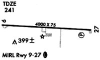
| Runways: | 10/28 |
| Longest Runway: | 10/28 is 5002 ft (1525 m) long |
| Runways with an Instrument Approach: |
4J2 Airport Runway Details
| Runway 10/28 | 5002 ft x 75 ft (1525 m x 23 m) | |
| Runway Length Source: | 3RD PARTY SURVEY as of 01/13/2015 | |
| Surface: | Asphalt - Good condition - No special surface treatment | |
| Runway Edge Lights: | Medium Intensity | |
Runway Weight Bearing Capacity (in thousands of pounds) |
||
| Single Wheel Landing Gear: | 23.0 | |
Runway 10 |
Runway 28 |
|
Elevation: |
238.2 | 232.9 |
Latitude: |
31-12-46.5494N | 31-12-43.7716N |
Longitude: |
083-13-59.6787W | 083-13-02.1684W |
|
Runway True Alignment: |
093 | 273 |
Glide Path Angle: |
3.6 degrees | 4.0 degrees |
Traffic Pattern: |
Left | Left |
Runway Markings Type: |
Nonprecision Instrument | Nonprecision Instrument |
Runway Markings Condition: |
Good | Good |
Object at End: |
TREES | TREES |
Object Height: |
28 | 87 |
Distance from End: |
582 | 2375 |
Object Centerline Offset: |
306 ft. left of centerline | 552 ft. right of centerline |
Visual Glide Slope Indicators: |
2-Light PAPI On Left Side Of Runway | 2-Light PAPI On Left Side Of Runway |
REIL: |
Yes | Yes |
Threshold Crossing Height: |
48 | 49 |
Services
Airframe Repair: |
None |
Powerplant Repair: |
None |
Bottled Oxygen: |
None |
Bulk Oxygen: |
None |
Fuel Available: |
100LL |
Landing Fees: |
No |
Parking: |
Tiedowns available |
Maps & Diagrams
4J2 Sectional
Flight Planning
at skyvector.com
at skyvector.com