
Location
Latitude: |
43-18-07.5636N (43.302101) |
Longitude: |
008-22-38.136W (-8.37726) |
Elevation: |
326 feet MSL (99 m MSL) |
Magnetic Variation: |
1.2 W (as of April 2024 from WMM2020 model) |
Time Zone: |
UTC +1.0 (Standard Time) UTC +2.0 (Daylight Savings Time) |
Contacts
Manager: |
: |
Operations
Airport Status: |
Operational |
Facility Use: |
Public |
Type: |
Airport |
Traffic Pattern Altitude (MSL): |
1326 feet (404 m) |
Based Aircraft
Annual Operations (as of )
Communications
| A Coruña TWR: | 118.3 |
| GND: | 121.7 |
| SANTIAGO APP: | 120.2 |
Fixed Based Operators (FBOs) & Fuel
(Click on a business for detail)
Please help us keep this information up to date. This is a FREE SERVICE just like everything else on Airport Guide! If you see that a business needs to be added, modified, or deleted please fill out our Update Form.
To add, modify, or delete a business click here.
Please help us keep this information up to date. This is a FREE SERVICE just like everything else on Airport Guide! If you see that a business needs to be added, modified, or deleted please fill out our Update Form.
| Business Name | Frequency | Phone | Fuel Grade |
|---|
Flight Service Stations
| Primary | Alternate | |
| FSS on Field: | ||
| FSS Name (ID): | ||
| Frequency: | ||
| Toll Free Phone: |
Instrument Procedures / Charts
Terminal Procedures are only available for airports in several countries with more being added all the time. If you are looking for a specific country's charts, please send an email to support(at)airportguide.com stating the country name. This will be used to prioritize the implementation.
Navigation Aids (Navaids) near LCG
| Dist (NM) | ID | Morse Code | Name | Type | Freq | True Hdg | Mag Hdg |
|---|---|---|---|---|---|---|---|
| 4.4 | COA | La Coruna | NDB | 401 | 29 | 30 | |
| 6.4 | LRA | La Coruna | VOR-DME | 115.10 | 28 | 29 | |
| 22.6 | STG | Santiago | VOR-DME | 116.40 | 185 | 186 | |
| 23.8 | SNO | Santiago | NDB | 417 | 185 | 186 | |
| 59.7 | VGO | Vigo | VOR-DME | 113.60 | 189 | 190 | |
| 59.9 | VI | Vigo | NDB | 345 | 189 | 190 | |
| 68.0 | VON | Vigo | NDB | 433 | 189 | 190 |
Nearby Airports with Fuel
| Dist (NM) | Name (Airport IDs) | True Hdg | Mag Hdg | Fuel Grade |
|---|---|---|---|---|
| 65.2 | Vigo Airport (VGO LEVX) |
189 | 190 | 100LL, Jet A |
Notices to Airmen (NOTAMS)
Remarks
No remarks for this landing facility
Runways
Runway Summary
| Runways: | 03/21 |
| Longest Runway: | 03/21 is 7178 ft (2188 m) long |
| Runways with an Instrument Approach: |
LCG Airport Runway Details
| Runway 03/21 | 7178 ft x 148 ft (2188 m x 45 m) | |
| Runway Edge Lights: | Yes Intensity | |
Runway 03 |
Runway 21 |
|
Elevation: |
327 | 286 |
Latitude: |
43.29169845581 | 43.30858612060 |
Longitude: |
-8.385761260986 | -8.371899604797 |
|
Runway True Alignment: |
31 | 211 |
Glide Path Angle: |
0.0 degrees | 0.0 degrees |
REIL: |
Yes | Yes |
Threshold Elevation: |
327 | 286 |
Services
Fuel Available: |
100LL, Jet A |
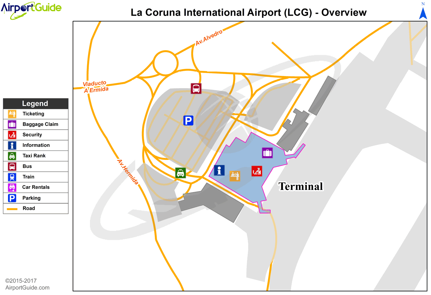
Maps & Diagrams
LCG Sectional
Flight Planning
at skyvector.com
at skyvector.com
