


Location
Latitude: |
38-22-06.6281N (38.368508) |
Longitude: |
082-33-37.2968W (-82.56036) |
Elevation: |
828.3 feet MSL (252 m MSL) |
Magnetic Variation: |
7.3 W (as of April 2024 from WMM2020 model) |
Time Zone: |
UTC -5.0 (Standard Time) UTC -4.0 (Daylight Savings Time) |
From City: |
03 N.M. S of Huntington, West Virginia |
Found On: |
Cincinnati Chart |
FAA Region: |
AEA |
Contacts
Manager: |
Publicly owned: |
| BRENT BROWN 1449 AIRPORT ROAD HUNTINGTON, WV 25704 304-453-6165 |
TRI-STATE AIRPORT AUTH. 1449 AIRPORT ROAD HUNTINGTON, WV 25704 304-453-6165 |
Operations
Airport Status: |
Operational |
Facility Use: |
Public |
Type: |
Airport |
Activation Date: |
12/1952 |
Control tower: |
Yes |
Attendance (Months/Days/Hours): |
Months/Days/Hours ALL/ALL/ALL |
Boundary ARTCC: |
ZID (Indianapolis) |
Responsible ARTCC: |
ZID (Indianapolis) |
Segmented Circle Indicator: |
No |
Traffic Pattern Altitude (MSL): |
1828 feet (557 m) |
NOTAMs Facility: |
HTS |
NOTAM-D Service: |
Yes |
International Airport of Entry: |
No |
Customs Landing Rights: |
Yes |
Military Landing Rights: |
Yes |
Civil/Military Joint Use: |
No |
Aircraft Rescue and Firefighting: |
Class I ARFF Index: B Air Carrier Service: Scheduled Certification Date: 05/1973 |
Based Aircraft
| Single Engine: | 26 |
| Multi Engine: | 6 |
| Jet Engine: | 2 |
| Ultralights: | 2 |
Annual Operations (as of 12/31/2022)
| Total Operations: | 11114 | |
| Commercial: | 1810 | 16.3% |
| Air Taxi: | 2725 | 24.5% |
| GA Local: | 639 | 5.7% |
| GA Itinerant: | 5354 | 48.2% |
| Military Aircraft: | 586 | 5.3% |
Communications
| Unicom: | 122.950 |
| Tower: | HUNTINGTON 118.5 270.1 Hrs: 24 |
| Clearance Del.: | 118.05 |
| Ground: | 121.9 |
| Approach: | HUNTINGTON 119.75 ;SOUTH 128.4 ;NORTH 270.1 Hrs: 24 |
| Departure: | HUNTINGTON 119.75 ;SOUTH 128.4 ;NORTH 270.1 Hrs: 24 |
| ATIS: | 125.2 Hrs: 24 |
| ASOS: | (304-453-3408) |
| EMERG: | 243.0 |
| TRSA: | 119.75 ;SOUTH |
| TRSA: | 270.1 |
| EMERG: | 121.5 |
| TRSA: | 128.4 ;NORTH |
Fixed Based Operators (FBOs) & Fuel
(Click on a business for detail)
Please help us keep this information up to date. This is a FREE SERVICE just like everything else on Airport Guide! If you see that a business needs to be added, modified, or deleted please fill out our Update Form.
To add, modify, or delete a business click here.
Please help us keep this information up to date. This is a FREE SERVICE just like everything else on Airport Guide! If you see that a business needs to be added, modified, or deleted please fill out our Update Form.
Area Code: 304 |
| Business Name | Frequency | Phone | Fuel Grade |
|---|
Flight Service Stations
| Primary | Alternate | |
| FSS on Field: | N | |
| FSS Name (ID): | Elkins(EKN) | |
| Frequency: | ||
| Toll Free Phone: | 1-800-WX-BRIEF |
Instrument Procedures / Charts
FAA Terminal Procedures valid from 0901Z 03/21/24 to 0901Z 04/18/24.
There are various types of charts available for an airport. They are listed in the Page Type column. Here is a legend for those types:
APD - Airport Diagram
DP - Departure Procedure Charts
HOT - Hot Spots
IAP - Instrument Approach Procedure Charts
MIN - Minimums
STAR - Standard Terminal Arrival Charts
| Page Type | Page Name | Volume | Action Since Last Cycle |
|---|---|---|---|
| APD | AIRPORT DIAGRAM | NE-4 | |
| HOT | HOT SPOT | NE-4 | |
| IAP | ILS OR LOC RWY 12 | NE-4 | |
| IAP | ILS OR LOC RWY 30 | NE-4 | |
| IAP | RNAV (GPS) RWY 12 | NE-4 | |
| IAP | RNAV (GPS) RWY 30 | NE-4 | |
| MIN | ALTERNATE MINIMUMS | NE-4 | |
| MIN | RADAR MINIMUMS | NE-4 | |
| MIN | TAKEOFF MINIMUMS | NE-4 |
Terminal Procedures are only available for airports in several countries with more being added all the time. If you are looking for a specific country's charts, please send an email to support(at)airportguide.com stating the country name. This will be used to prioritize the implementation.
Navigation Aids (Navaids) near HTS
| Dist (NM) | ID | Morse Code | Name | Type | Freq | True Hdg | Mag Hdg |
|---|---|---|---|---|---|---|---|
| 20.7 | ECB | . _ . _ . _ . . . | Newcombe | DME | 110.4 | 232 | 239 |
| 25.7 | YRK | _ . _ _ . _ . _ . _ | York | VORTAC | 112.80 | 310 | 317 |
| 34.1 | HNN | . . . . _ . _ . | Henderson | DME | 115.9 | 47 | 55 |
| 37.2 | HVQ | . . . . . . . _ _ _ . _ | Charleston | VOR-DME | 117.40 | 91 | 99 |
| 45.5 | CRW | _ . _ . . _ . . _ _ | Charleston | VOT | 108.80 | 89 | 97 |
| 46.7 | GTC | _ _ . _ _ . _ . | Guyandot | NDB | 293 | 138 | 145 |
| 48.9 | PZO | . _ _ . _ _ . . _ _ _ | Peebles | NDB | 329 | 312 | 319 |
| 51.0 | EOP | . _ _ _ . _ _ . | Waverly | NDB | 385 | 340 | 347 |
| 52.5 | XW | _ . . _ . _ _ | Flmng | NDB | 400 | 283 | 290 |
| 54.2 | UNI | . . _ _ . . . | Athens | FAN MARKER | 18 | 26 | |
| 55.4 | AMT | . _ _ _ _ | West Union | NDB | 359 | 302 | 309 |
| 57.1 | UGS | . . _ _ _ . . . . | University | NDB | 250 | 20 | 28 |
| 67.2 | HOC | . . . . _ _ _ _ . _ . | Hillsboro | NDB | 278 | 317 | 324 |
| 67.4 | AZQ | . _ _ _ . . _ _ . _ | Hazard | DME | 111.2 | 209 | 216 |
| 67.8 | RZT | . _ . _ _ . . _ | Ross County | NDB | 236 | 341 | 348 |
| 69.5 | IOB | . . _ _ _ _ . . . | Mount Sterling | NDB | 210 | 254 | 261 |
| 72.2 | XUB | _ . . _ . . _ _ . . . | Yellow Bud | VOR | 112.50 | 344 | 351 |
| 73.1 | PK | . _ _ . _ . _ | Versi | NDB | 388 | 43 | 51 |
| 76.5 | BKW | _ . . . _ . _ . _ _ | Beckley | VOR-DME | 117.70 | 117 | 125 |
| 78.5 | XYC | _ . . _ _ . _ _ _ . _ . | Seco | NDB | 393 | 242 | 249 |
Nearby Airports with Fuel
Notices to Airmen (NOTAMS)
Remarks
| A110-1 | PILOTS REPORT POSSIBILITY OF MISTAKING FUEL BURNING STACK LCTD APRXLY 2 MI W RY 12 FOR APCH LGTG SFL. |
| A110-2 | RY 12 OBSTN TWR LCTD 5100 FT W 600 FT N END RY. |
| A110-5 | BIRDS & DEER ON & INVOF ARPT. |
| A24 | FEE FOR ACFT UNLESS FUEL PURCHASED. |
| A43-30 | RY 30 P4L UNUSBL BYD 7 DEGS LEFT OF CNTRLN. |
| E111 | EXISTED PRIOR TO 1959. |
Runways
Runway Summary
| Runways: | 12/30 |
| Longest Runway: | 12/30 is 7017 ft (2139 m) long |
| Runways with an Instrument Approach: | 12, 30 |
HTS Airport Runway Details
| Runway 12/30 | 7017 ft x 150 ft (2139 m x 46 m) | |
| Runway Length Source: | 3RD PARTY SURVEY as of 12/01/2010 | |
| Surface: | Asphalt - Good condition - Saw-cut or plastic grooved | |
| Runway Pavement Class: | 81 /F/C/X/T | |
| Runway Edge Lights: | High Intensity | |
Runway Weight Bearing Capacity (in thousands of pounds) |
||
| Single Wheel Landing Gear: | 110.0 | |
| Dual Wheel Landing Gear: | 140.0 | |
| Dual Tandem Wheel Landing Gear: | 230.0 | |
Runway 12 |
Runway 30 |
|
Elevation: |
827.9 | 828.1 |
Latitude: |
38-22-19.8217N | 38-21-53.4124N |
Longitude: |
082-34-18.0066W | 082-32-56.5367W |
|
Runway True Alignment: |
112 | 292 |
ILS Type: |
ILS/DME | ILS/DME |
Glide Path Angle: |
3.0 degrees | 3.0 degrees |
Traffic Pattern: |
Left | Left |
Runway Markings Type: |
Precision Instrument | Precision Instrument |
Runway Markings Condition: |
Good | Good |
Object at End: |
TREES | |
Object Height: |
36 | |
Distance from End: |
950 | |
Object Centerline Offset: |
400 ft. left of centerline | |
Visual Glide Slope Indicators: |
4-Light PAPI On Left Side Of Runway | 4-Light PAPI On Left Side Of Runway |
Runway Visual Range (RVR): |
Touchdown | Rollout |
Approach Light System: |
1,400 Foot Medium Intensity Approach Lighting System With Runway Alignment Indicator Lights | |
REIL: |
No | Yes |
Touchdown Lights: |
No | No |
Threshold Crossing Height: |
56 | 49 |
Threshold Elevation: |
828.3 | |
Displaced Threshold: |
501 | |
Threshold Latitude: |
38-21-55.2987N | |
Threshold Longitude: |
082-33-02.3534W | |
Declared Distances |
||
Take Off Run Avbl. (TORA): |
7017 | 7017 |
Take Off Distance Avbl. (TODA): |
7017 | 7017 |
Actual Stop Dist. Avbl. (ASDA): |
6516 | 7017 |
Landing Dist. Avbl. (LDA): |
6516 | 6516 |
Services
Airframe Repair: |
Major |
Powerplant Repair: |
Major |
Bottled Oxygen: |
None |
Bulk Oxygen: |
High Pressure / Low Pressure |
Fuel Available: |
Jet A |
Landing Fees: |
Yes |
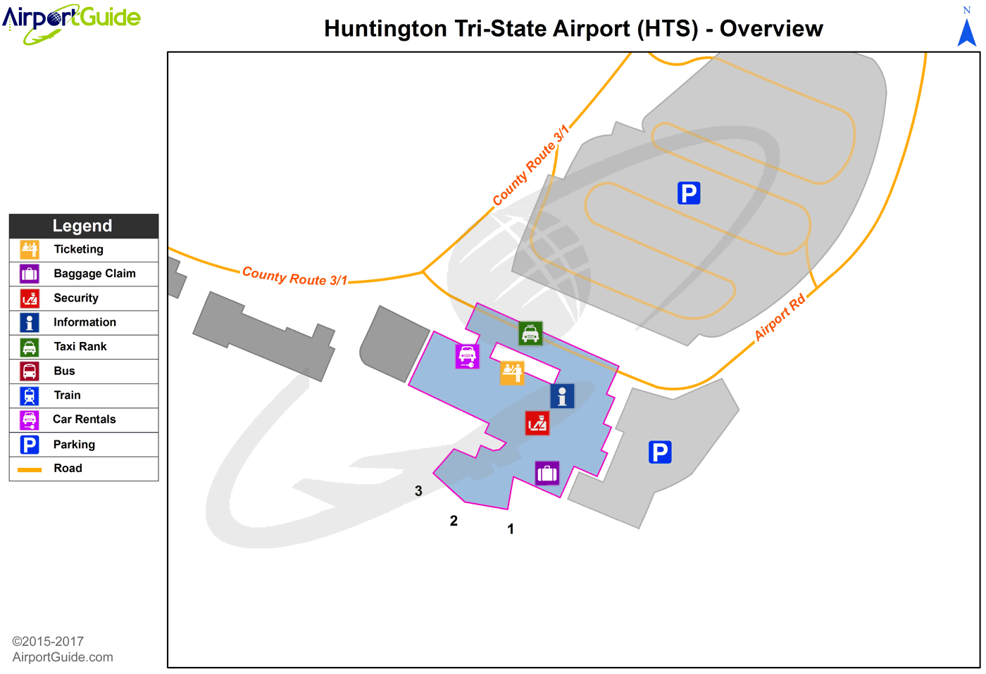
Maps & Diagrams
HTS Sectional
Flight Planning
at skyvector.com
at skyvector.com
 Diagram")