Location
Latitude: |
32-57-18.0092N (32.955003) |
Longitude: |
084-15-50.7103W (-84.264086) |
Elevation: |
797.7 feet MSL (243 m MSL) |
Magnetic Variation: |
5.5 W (as of April 2024 from WMM2020 model) |
Time Zone: |
UTC -5.0 (Standard Time) UTC -4.0 (Daylight Savings Time) |
From City: |
05 N.M. NE of Thomaston, Georgia |
Found On: |
Atlanta Chart |
FAA Region: |
ASO |
Contacts
Manager: |
Publicly owned: |
| MITCH ELLERBEE 2347 DEL RAY ROAD THOMASTON, GA 30286 706-647-4500 |
THOMASTON UPSON CO. ARPT AUTH 2347 DERAY RD THOMASTON, GA 30286 706-647-4500 |
Operations
Airport Status: |
Operational |
Facility Use: |
Public |
Type: |
Airport |
Activation Date: |
07/1994 |
Control tower: |
No |
Attendance (Months/Days/Hours): |
Months/Days/Hours ALL/ALL/0800-1800 |
Boundary ARTCC: |
ZTL (Atlanta) |
Responsible ARTCC: |
ZTL (Atlanta) |
Lighting Schedule: |
SEE RMK |
Segmented Circle Indicator: |
Yes |
Traffic Pattern Altitude (MSL): |
1798 feet (548 m) |
NOTAMs Facility: |
OPN |
NOTAM-D Service: |
Yes |
Based Aircraft
| Single Engine: | 89 |
| Multi Engine: | 17 |
| Jet Engine: | 1 |
Annual Operations (as of 12/31/2021)
| Total Operations: | 18900 | |
| GA Local: | 11000 | 58.2% |
| GA Itinerant: | 7900 | 41.8% |
Communications
| CTAF: | 122.800 |
| Unicom: | 122.800 |
| Approach: | ATLANTA 124.2 124.2 124.2 ATLANTA ARTCC |
| Departure: | ATLANTA 124.2 124.2 124.2 ATLANTA ARTCC |
| AWOS-3: | 133.975 (706-646-4123) |
- ATLANTA LARGE TRACON PROVIDES APCH/DEP SVC 0615-2300 ON FREQ 124.2; ATLANTA ARTCC PROVIDES APCH/DEP SVC 2300-0615 ON FREQS 134.5/360.75 (MACON RCAG).
Fixed Based Operators (FBOs) & Fuel
(Click on a business for detail)
Please help us keep this information up to date. This is a FREE SERVICE just like everything else on Airport Guide! If you see that a business needs to be added, modified, or deleted please fill out our Update Form.
To add, modify, or delete a business click here.
Please help us keep this information up to date. This is a FREE SERVICE just like everything else on Airport Guide! If you see that a business needs to be added, modified, or deleted please fill out our Update Form.
Area Code: 706 |
| Business Name | Frequency | Phone | Fuel Grade |
|---|---|---|---|
| Thomaston-Upson County
Update FBO info |
Unicom 122,8 | 647-4500, 647-8378 | 100LL, Jet A |
Flight Service Stations
| Primary | Alternate | |
| FSS on Field: | N | |
| FSS Name (ID): | Macon(MCN) | |
| Frequency: | ||
| Toll Free Phone: | 1-800-WX-BRIEF |
Instrument Procedures / Charts
FAA Terminal Procedures valid from 0901Z 03/21/24 to 0901Z 04/18/24.
There are various types of charts available for an airport. They are listed in the Page Type column. Here is a legend for those types:
APD - Airport Diagram
DP - Departure Procedure Charts
HOT - Hot Spots
IAP - Instrument Approach Procedure Charts
MIN - Minimums
STAR - Standard Terminal Arrival Charts
| Page Type | Page Name | Volume | Action Since Last Cycle |
|---|---|---|---|
| IAP | ILS OR LOC RWY 30 | SE-4 | |
| IAP | NDB RWY 30 | SE-4 | |
| IAP | RNAV (GPS) RWY 12 | SE-4 | |
| IAP | RNAV (GPS) RWY 30 | SE-4 | |
| MIN | ALTERNATE MINIMUMS | SE-4 | |
| MIN | TAKEOFF MINIMUMS | SE-4 |
Terminal Procedures are only available for airports in several countries with more being added all the time. If you are looking for a specific country's charts, please send an email to support(at)airportguide.com stating the country name. This will be used to prioritize the implementation.
Navigation Aids (Navaids) near KOPN
| Dist (NM) | ID | Morse Code | Name | Type | Freq | True Hdg | Mag Hdg |
|---|---|---|---|---|---|---|---|
| 4.4 | OP | _ _ _ . _ _ . | Yates | NDB | 339 | 118 | 124 |
| 23.6 | FFC | . . _ . . . _ . _ . _ . | Pecat | NDB | 316 | 331 | 336 |
| 28.9 | EQQ | . _ _ . _ _ _ . _ | Coweta County | NDB | 234 | 308 | 313 |
| 31.4 | PIM | . _ _ . . . _ _ | Pine Mountain | NDB | 272 | 257 | 262 |
| 34.9 | MCN | _ _ _ . _ . _ . | Macon | DME | 114.2 | 116 | 122 |
| 37.6 | IZS | . . _ _ . . . . . | Montezuma | NDB | 426 | 159 | 165 |
| 38.8 | WRB | . _ _ . _ . _ . . . | Robins | TACAN | 135.30 | 118 | 124 |
| 39.0 | BEP | _ . . . . . _ _ . | Bay Creek | NDB | 350 | 139 | 145 |
| 41.3 | ATL | . _ _ . _ . . | Atlanta | DME | 116.9 | 348 | 354 |
| 41.4 | GSU | _ _ . . . . . . _ | Atlanta | DME | 116.9 | 349 | 355 |
| 41.5 | BR | _ . . . . _ . | Redan | NDB | 266 | 356 | 362 |
| 42.9 | ATL | . _ _ . _ . . | Atlanta Muni | VOT | 111.00 | 349 | 355 |
| 43.1 | CSG | _ . _ . . . . _ _ . | Columbus | TACAN | 117.10 | 242 | 247 |
| 47.1 | VOF | . . . _ _ _ _ . . _ . | Alcovy | NDB | 370 | 30 | 36 |
| 47.5 | LKG | . _ . . _ . _ _ _ . | Lindbergh | NDB | 242 | 170 | 176 |
| 47.7 | LGC | . _ . . _ _ . _ . _ . | Lagrange | VORTAC | 115.60 | 277 | 282 |
| 49.5 | CS | _ . _ . . . . | Fenix | NDB | 355 | 232 | 237 |
| 52.0 | FT | . . _ . _ | Flanc | NDB | 344 | 338 | 343 |
| 52.5 | LSF | . _ . . . . . . . _ . | Lawson | VOR-DME | 111.40 | 224 | 229 |
| 54.1 | JNM | . _ _ _ _ . _ _ | Monroe | NDB | 392 | 29 | 35 |
Nearby Airports with Fuel
Notices to Airmen (NOTAMS)
Remarks
| A110-1 | FOR CD CTC ATLANTA APCH AT 678-364-6132, WHEN APCH CLSD CTC ATLANTA ARTCC AT 770-210-7692. |
| A17 | FOR AFT HRS SVC CALL 706-741-0562. |
| A57-12 | 34:1 APCH TO DSPLCD THLD. |
| A57-30 | 50:1 APCH TO DSPLCD THLD. |
| A58-12 | 6 FT FENCE AND ROAD 198 FT LEFT 200 FT FROM RY END. |
| A81-APT | ACTVT MALSR RY 30 AND PAPI RYS 12 & 30 - CTAF. MIRL RY 12/30 PRESET MED INTST DUSK-0000; AFTER 0000 ACTVT - CTAF. |
| E111 | PRVDD VFR |
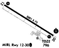
Runways
Runway Summary
| Runways: | 12/30 |
| Longest Runway: | 12/30 is 6350 ft (1935 m) long |
| Runways with an Instrument Approach: | 30 |
KOPN Airport Runway Details
| Runway 12/30 | 6350 ft x 100 ft (1935 m x 30 m) | |
| Runway Length Source: | 3RD PARTY SURVEY as of 11/17/2008 | |
| Surface: | Asphalt - Good condition - No special surface treatment | |
| Runway Edge Lights: | Medium Intensity | |
Runway Weight Bearing Capacity (in thousands of pounds) |
||
| Single Wheel Landing Gear: | 20.0 | |
| Dual Wheel Landing Gear: | 50.0 | |
Runway 12 |
Runway 30 |
|
Elevation: |
786.8 | 797.5 |
Latitude: |
32-57-32.6350N | 32-57-03.3834N |
Longitude: |
084-16-23.6830W | 084-15-17.7376W |
|
Runway True Alignment: |
118 | 298 |
ILS Type: |
ILS/DME | |
Glide Path Angle: |
3.5 degrees | 3.0 degrees |
Runway Markings Type: |
Precision Instrument | Precision Instrument |
Runway Markings Condition: |
Good | Good |
Object at End: |
ROAD | RR |
Object Height: |
15 | 16 |
Distance from End: |
201 | 360 |
Object Centerline Offset: |
250 ft. left of centerline | 0 ft. left and right of centerline |
Visual Glide Slope Indicators: |
2-Light PAPI On Left Side Of Runway | 2-Light PAPI On Left Side Of Runway |
Approach Light System: |
1,400 Foot Medium Intensity Approach Lighting System With Runway Alignment Indicator Lights | |
Threshold Crossing Height: |
32 | 27 |
Threshold Elevation: |
786.2 | 795.8 |
Displaced Threshold: |
648 | 699 |
Threshold Latitude: |
32-57-29.6521N | 32-57-06.6049N |
Threshold Longitude: |
084-16-16.9522W | 084-15-25.0024W |
Declared Distances |
||
Take Off Run Avbl. (TORA): |
6350 | 6350 |
Take Off Distance Avbl. (TODA): |
6350 | 6350 |
Actual Stop Dist. Avbl. (ASDA): |
6173 | 5662 |
Landing Dist. Avbl. (LDA): |
5525 | 4962 |
Services
Airframe Repair: |
Minor |
Powerplant Repair: |
Minor |
Bottled Oxygen: |
None |
Bulk Oxygen: |
None |
Fuel Available: |
100LL |
Landing Fees: |
No |
Parking: |
Tiedowns available |
Maps & Diagrams
KOPN Sectional
Flight Planning
at skyvector.com
at skyvector.com