
Location
Latitude: |
13-04-28.56N (13.0746) |
Longitude: |
059-29-33W (-59.4925) |
Elevation: |
169 feet MSL (52 m MSL) |
Magnetic Variation: |
15.9 W (as of April 2024 from WMM2020 model) |
Time Zone: |
UTC -4.0 (Standard Time) UTC -4.0 (Daylight Savings Time) |
Contacts
Manager: |
: |
Operations
Airport Status: |
Operational |
Facility Use: |
Public |
Type: |
Airport |
Traffic Pattern Altitude (MSL): |
1169 feet (356 m) |
Based Aircraft
Annual Operations (as of )
Communications
| ADAMS TWR: | 118.7 |
| ADAMS GND: | 121.9 |
| ADAMS APP: | 129.35 |
| ADAMS DEP: | 128.85 |
| ATIS: | 132.725 |
| ADAMS ARR: | 128.85 |
Fixed Based Operators (FBOs) & Fuel
(Click on a business for detail)
Please help us keep this information up to date. This is a FREE SERVICE just like everything else on Airport Guide! If you see that a business needs to be added, modified, or deleted please fill out our Update Form.
To add, modify, or delete a business click here.
Please help us keep this information up to date. This is a FREE SERVICE just like everything else on Airport Guide! If you see that a business needs to be added, modified, or deleted please fill out our Update Form.
| Business Name | Frequency | Phone | Fuel Grade |
|---|
Flight Service Stations
| Primary | Alternate | |
| FSS on Field: | ||
| FSS Name (ID): | ||
| Frequency: | ||
| Toll Free Phone: |
Instrument Procedures / Charts
Terminal Procedures are only available for airports in several countries with more being added all the time. If you are looking for a specific country's charts, please send an email to support(at)airportguide.com stating the country name. This will be used to prioritize the implementation.
Navigation Aids (Navaids) near BGI
| Dist (NM) | ID | Morse Code | Name | Type | Freq | True Hdg | Mag Hdg |
|---|---|---|---|---|---|---|---|
| 0.2 | BGI | Adams | NDB | 345 | 149 | 165 | |
| 0.5 | BGI | _ . . . _ _ . . . | Adams | VOR-DME | 112.70 | 87 | 103 |
| 95.1 | BNE | Hewanorra | NDB | 305 | 294 | 310 | |
| 95.2 | BNE | Hewanorra | VOR-DME | 112.40 | 294 | 310 |
Nearby Airports with Fuel
| Dist (NM) | Name (Airport IDs) | True Hdg | Mag Hdg | Fuel Grade |
|---|
Notices to Airmen (NOTAMS)
Remarks
No remarks for this landing facility
Runways
Runway Summary
| Runways: | 09/27 |
| Longest Runway: | 09/27 is 11000 ft (3353 m) long |
| Runways with an Instrument Approach: |
BGI Airport Runway Details
| Runway 09/27 | 11000 ft x 150 ft (3353 m x 46 m) | |
| Runway Edge Lights: | Yes Intensity | |
Runway 09 |
Runway 27 |
|
Elevation: |
169 | 160 |
Latitude: |
13.07089996337 | 13.07830047607 |
Longitude: |
-59.50749969482 | -59.47740173339 |
|
Runway True Alignment: |
75.9 | 255.9 |
Glide Path Angle: |
0.0 degrees | 0.0 degrees |
REIL: |
Yes | Yes |
Threshold Elevation: |
169 | 160 |
Services
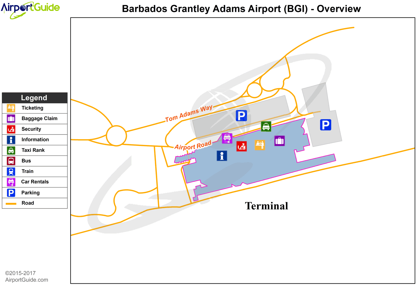
Maps & Diagrams
BGI Sectional
Flight Planning
at skyvector.com
at skyvector.com
