Location
Latitude: |
41-41-40.0000N (41.694444) |
Longitude: |
082-47-47.6000W (-82.796556) |
Elevation: |
582.0 feet MSL (177 m MSL) |
Magnetic Variation: |
7.6 W (as of April 2024 from WMM2020 model) |
Time Zone: |
UTC -5.0 (Standard Time) UTC -4.0 (Daylight Savings Time) |
From City: |
01 N.M. NE of Middle Bass Island, Ohio |
Found On: |
Detroit Chart |
FAA Region: |
AGL |
Contacts
Manager: |
Privately owned: |
| W B CLEVELAND III 10510 LAFAYETTE DR NW CANAL FULTON, OH 44614-8757 216-870-6513 |
EAST POINT ASSOCIATES INC 10510 LAFAYETTE DR NW CANAL FULTON, OH 44614-8757 216-870-6513 |
Operations
Airport Status: |
Operational |
Facility Use: |
Public |
Type: |
Airport |
Activation Date: |
05/1948 |
Control tower: |
No |
Attendance (Months/Days/Hours): |
Months/Days/Hours MAY-OCT/ALL/IREG |
Boundary ARTCC: |
ZOB (Cleveland) |
Responsible ARTCC: |
ZOB (Cleveland) |
Segmented Circle Indicator: |
No |
Traffic Pattern Altitude (MSL): |
1582 feet (482 m) |
NOTAMs Facility: |
CLE |
NOTAM-D Service: |
Yes |
Military Landing Rights: |
No |
Civil/Military Joint Use: |
No |
Based Aircraft
Annual Operations (as of 08/27/2021)
| Total Operations: | 720 | |
| Air Taxi: | 100 | 13.9% |
| GA Local: | 600 | 83.3% |
| GA Itinerant: | 20 | 2.8% |
Communications
| CTAF: | 122.900 |
Fixed Based Operators (FBOs) & Fuel
(Click on a business for detail)
Please help us keep this information up to date. This is a FREE SERVICE just like everything else on Airport Guide! If you see that a business needs to be added, modified, or deleted please fill out our Update Form.
To add, modify, or delete a business click here.
Please help us keep this information up to date. This is a FREE SERVICE just like everything else on Airport Guide! If you see that a business needs to be added, modified, or deleted please fill out our Update Form.
Area Code: 216 |
| Business Name | Frequency | Phone | Fuel Grade |
|---|
Flight Service Stations
| Primary | Alternate | |
| FSS on Field: | N | |
| FSS Name (ID): | Cleveland(CLE) | |
| Frequency: | ||
| Toll Free Phone: | 1-800-WX-BRIEF |
Instrument Procedures / Charts
Terminal Procedures are only available for airports in several countries with more being added all the time. If you are looking for a specific country's charts, please send an email to support(at)airportguide.com stating the country name. This will be used to prioritize the implementation.
Navigation Aids (Navaids) near 3W9
| Dist (NM) | ID | Morse Code | Name | Type | Freq | True Hdg | Mag Hdg |
|---|---|---|---|---|---|---|---|
| 11.0 | PCW | . _ _ . _ . _ . . _ _ | Port Clinton | NDB | 423 | 197 | 205 |
| 16.8 | SKY | . . . _ . _ _ . _ _ | Sandusky | VOR-DME | 109.20 | 157 | 165 |
| 29.1 | RYS | . _ . _ . _ _ . . . | Grosse Ile | NDB | 419 | 326 | 334 |
| 33.3 | YQG | _ . _ _ _ _ . _ _ _ . | Windsor | VOR-DME | 113.80 | 357 | 365 |
| 34.8 | ZQG | Laurel | NDB | 398 | 341 | 349 | |
| 34.9 | DJB | _ . . . _ _ _ _ . . . | Dryer | VOR-DME | 113.60 | 125 | 133 |
| 36.4 | CRL | _ . _ . . _ . . _ . . | Carleton | VOR-DME | 115.70 | 305 | 312 |
| 36.4 | JZJ | . _ _ _ _ _ . . . _ _ _ | Alaina | NDB | 223 | 330 | 338 |
| 37.2 | QG | Windsor | NDB | 353 | 355 | 363 | |
| 40.2 | DXO | _ . . _ . . _ _ _ _ | Detroit | VOR-DME | 113.40 | 320 | 327 |
| 40.3 | VQ | . . . _ _ _ . _ | Cargl | NDB | 230 | 350 | 358 |
| 40.5 | VWV | . . . _ . _ _ . . . _ | Waterville | VOR-DME | 113.10 | 249 | 256 |
| 40.6 | FZI | . . _ . _ _ . . . . | Fostoria | NDB | 379 | 221 | 228 |
| 40.6 | TII | _ . . . . | Tiffin | NDB | 269 | 207 | 214 |
| 40.8 | DTW | _ . . _ . _ _ | Detroit Met Wayne | VOT | 109.80 | 322 | 329 |
| 43.7 | DET | _ . . . _ | Detroit City | VOT | 111.60 | 347 | 355 |
| 45.4 | TOL | _ _ _ _ . _ . . | Toledo | TACAN | 112.50 | 262 | 269 |
| 45.6 | CLE | _ . _ . . _ . . . | Cleveland | VOT | 110.40 | 110 | 118 |
| 45.8 | YIP | _ . _ _ . . . _ _ . | Willow Run | VOT | 108.85 | 315 | 322 |
| 49.0 | 4L | Chatham | NDB | 236 | 40 | 48 |
Nearby Airports with Fuel
Notices to Airmen (NOTAMS)
Remarks
| A110*G | THIS AIRPORT HAS BEEN SURVEYED BY THE NATIONAL GEODETIC SURVEY. |
| A110-2 | NMRS TREES & BLDGS IN CLOSE PROXIMITY TO RWY. |
| A110-3 | EXP SGFNT WS & TURB ON APCH & DEP WHEN WIND EXCEEDS 10 KT. |
| A110-4 | FOR CD CTC CLEVELAND APCH AT 216-352-2323. |
| A110-5 | FOR WIND INDCR USE SEGMENTED CRC AT 3T7 ARPT. |
| A110-6 | OCNL DEER, BIRDS, & OTR WILDLIFE ON & INVOF ARPT. |
| A33-09/27 | SOFT & WET IN SPRING. |
| A75 | PRIOR CDN RQRD, ROPES & TEMPO TIEDOWNS NOT PRVDD. |
| E111 | VFR ONLY. |
Runways
Runway Summary
| Runways: | 09/27 |
| Longest Runway: | 09/27 is 2085 ft (636 m) long |
| Runways with an Instrument Approach: |
3W9 Airport Runway Details
| Runway 09/27 | 2085 ft x 67 ft (636 m x 20 m) | |
| Surface: | Turf - Fair condition - No special surface treatment | |
Runway 09 |
Runway 27 |
|
Elevation: |
578.0 | 579.6 |
Latitude: |
41-41-39.2225N | 41-41-40.7945N |
Longitude: |
082-48-01.3034W | 082-47-33.8881W |
|
Runway True Alignment: |
086 | 266 |
Glide Path Angle: |
0.0 degrees | 0.0 degrees |
Traffic Pattern: |
Left | Right |
Object at End: |
BERM | ROAD |
Object Height: |
2 | 10 |
Distance from End: |
0 | 10 |
Object Centerline Offset: |
60 ft. left of centerline | 90 ft. left of centerline |
Services
Fuel Available: |
100LL |
Landing Fees: |
No |
Parking: |
Tiedowns available |
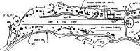
Maps & Diagrams
3W9 Sectional
Flight Planning
at skyvector.com
at skyvector.com