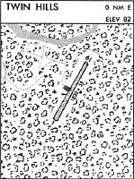
Location
Latitude: |
59-04-28.2900N (59.074525) |
Longitude: |
160-16-30.1500W (-160.275042) |
Elevation: |
82.0 feet MSL (25 m MSL) |
Magnetic Variation: |
10.5 E (as of April 2024 from WMM2020 model) |
Time Zone: |
UTC -9.0 (Standard Time) UTC -8.0 (Daylight Savings Time) |
From City: |
00 N.M. E of Twin Hills, Alaska |
Found On: |
Kodiak Chart |
FAA Region: |
AAL |
Contacts
Manager: |
Publicly owned: |
| JON TAYLOR BOX 250 DILLINGHAM, AK 99576 907-842-5511 |
ALASKA DOT&PF CENTRAL REGION PO BOX 196900 ANCHORAGE, AK 99519-6900 907-269-0749 |
Operations
Airport Status: |
Operational |
Facility Use: |
Public |
Type: |
Airport |
Activation Date: |
05/1974 |
Control tower: |
No |
Attendance (Months/Days/Hours): |
Months/Days/Hours Unattended |
Boundary ARTCC: |
ZAN (Anchorage) |
Responsible ARTCC: |
ZAN (Anchorage) |
Lighting Schedule: |
SEE RMK |
Segmented Circle Indicator: |
Yes |
Traffic Pattern Altitude (MSL): |
1082 feet (330 m) |
NOTAMs Facility: |
ENA |
NOTAM-D Service: |
Yes |
International Airport of Entry: |
No |
Customs Landing Rights: |
No |
Military Landing Rights: |
Yes |
Civil/Military Joint Use: |
No |
Based Aircraft
Annual Operations (as of 12/31/2022)
| Total Operations: | 600 | |
| Air Taxi: | 600 | 100.0% |
Communications
| CTAF: | 122.500 |
Fixed Based Operators (FBOs) & Fuel
(Click on a business for detail)
Please help us keep this information up to date. This is a FREE SERVICE just like everything else on Airport Guide! If you see that a business needs to be added, modified, or deleted please fill out our Update Form.
To add, modify, or delete a business click here.
Please help us keep this information up to date. This is a FREE SERVICE just like everything else on Airport Guide! If you see that a business needs to be added, modified, or deleted please fill out our Update Form.
Area Code: 907 |
| Business Name | Frequency | Phone | Fuel Grade |
|---|
Flight Service Stations
| Primary | Alternate | |
| FSS on Field: | N | |
| FSS Name (ID): | Kenai(ENA) | |
| Frequency: | ||
| Toll Free Phone: | 1-866-864-1737 |
Instrument Procedures / Charts
Terminal Procedures are only available for airports in several countries with more being added all the time. If you are looking for a specific country's charts, please send an email to support(at)airportguide.com stating the country name. This will be used to prioritize the implementation.
Navigation Aids (Navaids) near TWA
| Dist (NM) | ID | Morse Code | Name | Type | Freq | True Hdg | Mag Hdg |
|---|---|---|---|---|---|---|---|
| 3.2 | TOG | _ _ _ _ _ _ . | Togiak | NDB-DME | 393 | 258 | 248 |
| 53.4 | DLG | _ . . . _ . . _ _ . | Dillingham | VOR-DME | 116.40 | 94 | 83 |
| 53.5 | BTS | _ . . . _ . . . | Wood River | NDB | 429 | 94 | 83 |
| 61.2 | EHM | . . . . . _ _ | Cape Newenham | NDB-DME | 385 | 246 | 236 |
Nearby Airports with Fuel
| Dist (NM) | Name (Airport IDs) | True Hdg | Mag Hdg | Fuel Grade |
|---|---|---|---|---|
| 52.2 | Aleknagik Seaplane Base (Z33) |
76 | 65 | 100LL, MOGAS |
| 52.4 | Aleknagik /New Airport (WKK 5A8) |
75 | 64 | 100LL, Jet A, Mogas |
| 54.6 | Dillingham Airport (DLG PADL DLG) |
91 | 80 | 100LL, Jet A |
| 63.0 | Quinhagak Airport (KWN PAQH AQH) |
311 | 301 | 100LL |
Notices to Airmen (NOTAMS)
Remarks
| A110-1 | BLUFF AT NORTH END MAY CAUSE SOME TURBULENCE WHEN LNDG TO THE SOUTH. |
| A110-2 | RY COND NOT MNTRD; RCMD VISUAL INSPECTION PRIOR TO USE. |
| A30-18/36 | SLOPES 2% UPHILL TO N END. |
| A81-APT | ACTVT MIRL RY 18/36 - CTAF. |
| A81-BCN | ACTVT ROTG BCN - CTAF. |
Runways
Runway Summary
| Runways: | 18/36 |
| Longest Runway: | 18/36 is 3000 ft (914 m) long |
| Runways with an Instrument Approach: |
TWA Airport Runway Details
| Runway 18/36 | 3000 ft x 60 ft (914 m x 18 m) | |
| Surface: | Gravel - Good condition - No special surface treatment | |
| Runway Edge Lights: | Medium Intensity | |
Runway 18 |
Runway 36 |
|
Elevation: |
82.0 | 44.2 |
Latitude: |
59-04-42.5200N | 59-04-14.0600N |
Longitude: |
160-16-22.4300W | 160-16-37.8600W |
|
Runway True Alignment: |
196 | 016 |
Glide Path Angle: |
0.0 degrees | 0.0 degrees |
Traffic Pattern: |
Right | Left |
Object at End: |
BRUSH | |
Object Height: |
5 | |
Distance from End: |
0 | |
Object Centerline Offset: |
80 ft. left of centerline |
Services
Fuel Available: |
100LL |
Landing Fees: |
Yes |
Parking: |
Tiedowns available |
Maps & Diagrams
TWA Sectional
Flight Planning
at skyvector.com
at skyvector.com