Location
Latitude: |
30-44-06.7000N (30.735194) |
Longitude: |
101-12-07.9000W (-101.202194) |
Elevation: |
2376.9 feet MSL (724 m MSL) |
Magnetic Variation: |
5 E (as of April 2024 from WMM2020 model) |
Time Zone: |
UTC -6.0 (Standard Time) UTC -5.0 (Daylight Savings Time) |
From City: |
01 N.M. N of Ozona, Texas |
Found On: |
San Antonio Chart |
FAA Region: |
ASW |
Contacts
Manager: |
Publicly owned: |
| CHARLES MCCLEARY BOX 426 OZONA, TX 76943 325-392-2030 |
CROCKETT COUNTY PO BOX 1857 COUNTY COURTHOUSE OZONA, TX 76943 325-392-2965 |
Operations
Airport Status: |
Operational |
Facility Use: |
Public |
Type: |
Airport |
Activation Date: |
12/1950 |
Control tower: |
No |
Attendance (Months/Days/Hours): |
Months/Days/Hours ALL/MON-FRI/0800-1700 |
Boundary ARTCC: |
ZHU (Houston) |
Responsible ARTCC: |
ZHU (Houston) |
Lighting Schedule: |
SEE RMK |
Segmented Circle Indicator: |
Yes |
Traffic Pattern Altitude (MSL): |
3377 feet (1029 m) |
NOTAMs Facility: |
SJT |
NOTAM-D Service: |
Yes |
International Airport of Entry: |
No |
Customs Landing Rights: |
No |
Military Landing Rights: |
No |
Civil/Military Joint Use: |
No |
Based Aircraft
| Single Engine: | 13 |
| Multi Engine: | 1 |
| GA Helicopters: | 1 |
Annual Operations (as of 11/30/2017)
| Total Operations: | 3675 | |
| GA Local: | 2400 | 65.3% |
| GA Itinerant: | 1200 | 32.7% |
| Military Aircraft: | 75 | 2.0% |
Communications
| CTAF: | 122.800 |
| Unicom: | 122.800 |
| AWOS-3PT: | 118.425 (325-392-2051) |
- APCH/DEP CTL SVC PRVDD BY HOUSTON ARTCC ON FREQS 125.75/346.4 (ROCK SPRINGS RCAG).
Fixed Based Operators (FBOs) & Fuel
(Click on a business for detail)
Please help us keep this information up to date. This is a FREE SERVICE just like everything else on Airport Guide! If you see that a business needs to be added, modified, or deleted please fill out our Update Form.
To add, modify, or delete a business click here.
Please help us keep this information up to date. This is a FREE SERVICE just like everything else on Airport Guide! If you see that a business needs to be added, modified, or deleted please fill out our Update Form.
Area Code: 915 |
| Business Name | Frequency | Phone | Fuel Grade |
|---|---|---|---|
| Ozona Municipal/Ozona Jet Fuel Co.
Update FBO info |
Unicom 122.8 | 392-2030, -2789 | 100LL, Jet A |
Flight Service Stations
| Primary | Alternate | |
| FSS on Field: | N | |
| FSS Name (ID): | San Angelo(SJT) | |
| Frequency: | ||
| Toll Free Phone: | 1-800-WX-BRIEF |
Instrument Procedures / Charts
FAA Terminal Procedures valid from 0901Z 03/21/24 to 0901Z 04/18/24.
There are various types of charts available for an airport. They are listed in the Page Type column. Here is a legend for those types:
APD - Airport Diagram
DP - Departure Procedure Charts
HOT - Hot Spots
IAP - Instrument Approach Procedure Charts
MIN - Minimums
STAR - Standard Terminal Arrival Charts
| Page Type | Page Name | Volume | Action Since Last Cycle |
|---|---|---|---|
| IAP | RNAV (GPS) RWY 16 | SC-3 | |
| MIN | TAKEOFF MINIMUMS | SC-3 |
Terminal Procedures are only available for airports in several countries with more being added all the time. If you are looking for a specific country's charts, please send an email to support(at)airportguide.com stating the country name. This will be used to prioritize the implementation.
Navigation Aids (Navaids) near OZA
| Dist (NM) | ID | Morse Code | Name | Type | Freq | True Hdg | Mag Hdg |
|---|---|---|---|---|---|---|---|
| 30.1 | SOA | . . . _ _ _ . _ | Sonora | NDB | 371 | 107 | 102 |
| 45.9 | SJ | . . . . _ _ _ | Woole | NDB | 356 | 44 | 39 |
| 54.3 | SJT | . . . . _ _ _ _ | San Angelo | VORTAC | 115.10 | 44 | 39 |
| 63.6 | RSG | . _ . . . . _ _ . | Rocksprings | VORTAC | 114.55 | 132 | 127 |
| 71.9 | JCT | . _ _ _ _ . _ . _ | Junction | VORTAC | 116.00 | 96 | 91 |
| 78.3 | DR | _ . . . _ . | Kotti | NDB | 335 | 171 | 166 |
| 84.8 | UBC | . . _ _ . . . _ . _ . | Ballinger | NDB | 239 | 47 | 42 |
| 85.4 | DLF | _ . . . _ . . . . _ . | Laughlin | VORTAC | 114.40 | 164 | 159 |
| 88.6 | MAF | _ _ . _ . . _ . | Midland | VOT | 108.20 | 324 | 319 |
| 91.7 | MAF | _ _ . _ . . _ . | Midland | VORTAC | 114.80 | 326 | 321 |
| 92.3 | FST | . . _ . . . . _ | Fort Stockton | VORTAC | 116.90 | 278 | 273 |
| 94.7 | MA | _ _ . _ | Farly | NDB | 326 | 322 | 317 |
| 96.4 | BRX | _ . . . . _ . _ . . _ | La Fonda Ranch | NDB | 269 | 161 | 156 |
Nearby Airports with Fuel
| Dist (NM) | Name (Airport IDs) | True Hdg | Mag Hdg | Fuel Grade |
|---|---|---|---|---|
| 29.9 | Sonora Municipal Airport (KSOA SOA) |
107 | 102 | 100LL, Jet A |
| 31.4 | Eldorado Airport (27R) |
75 | 70 | 100LL |
| 52.1 | San Angelo Regional/Mathis Field Airport (SJT KSJT SJT) |
43 | 38 | 100LL, Jet A |
| 66.7 | Terrell County Airport (6R6) |
231 | 226 | 100LL |
| 75.5 | Kimble County Airport (JCT KJCT JCT) |
99 | 95 | 100LL, Jet A+ |
| 80.7 | Skywest Inc Airport (7T7) |
326 | 321 | 100LL, MOGAS |
| 82.9 | Del Rio International Airport (DRT KDRT DRT) |
170 | 165 | 100LL, Jet A |
| 84.4 | Bruce Field Airport (E30) |
47 | 43 | 100LL |
| 88.7 | Midland International Air And Space Port Airport (MAF KMAF MAF) |
324 | 318 | 100LL, Jet A, Jet A-1 |
| 88.8 | Fort Stockton-Pecos County Airport (FST KFST FST) |
277 | 271 | 100LL, Jet A+ |
| 90.1 | Big Spring Mc Mahon-Wrinkle Airport (KBPG BPG) |
349 | 344 | 100LL, Jet A |
| 90.7 | Midland Airpark Airport (MDD KMDD MDD) |
329 | 323 | 100LL, Jet A |
| 93.6 | Odessa-Schlemeyer Field Airport (KODO ODO) |
319 | 313 | 100LL, Jet A |
Notices to Airmen (NOTAMS)
Remarks
| A110-1 | FOR CD CTC HOUSTON ARTCC AT 281-230-5622. |
| A15 | ARPT PHYS ADDRESS 319 CR 308. |
| A70-FUEL-10 | 0LL FOR AFT HRS FUEL CALL 325-226-2628. |
| A81-APT | RWY 16/34 MIRL PRESET LOW INTST; TO INCR INTST ACTV - CTAF. |
Runways
Runway Summary
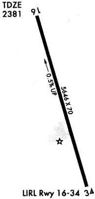
| Runways: | 16/34 |
| Longest Runway: | 16/34 is 6003 ft (1830 m) long |
| Runways with an Instrument Approach: |
OZA Airport Runway Details
| Runway 16/34 | 6003 ft x 75 ft (1830 m x 23 m) | |
| Runway Length Source: | 3RD PARTY SURVEY as of 08/11/2011 | |
| Surface: | Asphalt - Good condition - No special surface treatment | |
| Runway Edge Lights: | Medium Intensity | |
Runway Weight Bearing Capacity (in thousands of pounds) |
||
| Single Wheel Landing Gear: | 30.0 | |
Runway 16 |
Runway 34 |
|
Elevation: |
2376.8 | 2355.3 |
Latitude: |
30-44-35.7401N | 30-43-37.6888N |
Longitude: |
101-12-15.1528W | 101-12-00.5673W |
|
Runway True Alignment: |
168 | 348 |
Glide Path Angle: |
3.0 degrees | 3.0 degrees |
Traffic Pattern: |
Left | Left |
Runway Markings Type: |
Nonprecision Instrument | Nonprecision Instrument |
Runway Markings Condition: |
Good | Good |
Object at End: |
TREES | POLE |
Object Height: |
18 | 50 |
Distance from End: |
770 | 1200 |
Object Centerline Offset: |
185 ft. right of centerline | 45 ft. right of centerline |
Visual Glide Slope Indicators: |
4-Light PAPI On Left Side Of Runway | 4-Light PAPI On Left Side Of Runway |
Threshold Crossing Height: |
39 | 35 |
Services
Airframe Repair: |
Major |
Powerplant Repair: |
Major |
Bottled Oxygen: |
Low Pressure |
Fuel Available: |
100LL, Jet A |
Landing Fees: |
No |
Parking: |
Hangars and tiedowns available |
Maps & Diagrams
OZA Sectional
Flight Planning
at skyvector.com
at skyvector.com