Location
Latitude: |
30-37-36.4100N (30.626781) |
Longitude: |
088-04-05.1270W (-88.068091) |
Elevation: |
26.2 feet MSL (8 m MSL) |
Magnetic Variation: |
2.8 W (as of April 2024 from WMM2020 model) |
Time Zone: |
UTC -6.0 (Standard Time) UTC -5.0 (Daylight Savings Time) |
From City: |
03 N.M. S of Mobile, Alabama |
Found On: |
New Orleans Chart |
FAA Region: |
ASO |
Contacts
Manager: |
Publicly owned: |
| CHRIS CURRY P O BOX 88004 MOBILE, AL 36608 251-639-4680 |
MOBILE AIRPORT AUTHORITY 1891-9TH ST/BROOKLEY COMPLEX MOBILE, AL 36615 251-438-7334 |
Operations
Airport Status: |
Operational |
Facility Use: |
Public |
Type: |
Airport |
Activation Date: |
04/1940 |
Control tower: |
Yes |
Attendance (Months/Days/Hours): |
Months/Days/Hours ALL/ALL/0700-2300 |
Boundary ARTCC: |
ZHU (Houston) |
Responsible ARTCC: |
ZHU (Houston) |
Lighting Schedule: |
SEE RMK |
Segmented Circle Indicator: |
Yes |
Traffic Pattern Altitude (MSL): |
1026 feet (313 m) |
NOTAMs Facility: |
BFM |
NOTAM-D Service: |
Yes |
International Airport of Entry: |
No |
Customs Landing Rights: |
Yes |
Military Landing Rights: |
Yes |
Civil/Military Joint Use: |
No |
Aircraft Rescue and Firefighting: |
Class I ARFF Index: A Air Carrier Service: Scheduled Certification Date: 01/1980 |
Based Aircraft
| Single Engine: | 16 |
| Multi Engine: | 2 |
| Jet Engine: | 6 |
| GA Helicopters: | 1 |
Annual Operations (as of 10/31/2023)
| Total Operations: | 24726 | |
| Commercial: | 1802 | 7.3% |
| Air Taxi: | 2253 | 9.1% |
| GA Local: | 7514 | 30.4% |
| Military Aircraft: | 13157 | 53.2% |
Communications
| CTAF: | 118.800 |
| Unicom: | 122.950 |
| Tower: | INTERNATIONAL 118.8 251.1 Hrs: 0700-1900 SUN; 0700-2200 MON; 0330-2200 TUE THRU FRI; 0400-1900 SAT. |
| Ground: | 121.7 239.3 |
| Approach: | MOBILE 118.5 118.5 HOUSTON ARTCC |
| Departure: | MOBILE 118.5 118.5 HOUSTON ARTCC |
| ATIS: | 135.575 Hrs: 24 |
| ASOS: | (251-431-6762) |
| EMERG: | 121.5 |
| NG OPS: | 125.525 |
| NG OPS: | 49.85FM |
- APCH/DEP SVC PRVDD BY HOUSTON ARTCC (ZHU) ON FREQS 127.65/285.475 (MOBILE RCAG) WHEN APCH CTL CLSD.
- SAWRS 0800-1900.
Fixed Based Operators (FBOs) & Fuel
(Click on a business for detail)
Please help us keep this information up to date. This is a FREE SERVICE just like everything else on Airport Guide! If you see that a business needs to be added, modified, or deleted please fill out our Update Form.
To add, modify, or delete a business click here.
Please help us keep this information up to date. This is a FREE SERVICE just like everything else on Airport Guide! If you see that a business needs to be added, modified, or deleted please fill out our Update Form.
Area Code: 334 |
| Business Name | Frequency | Phone | Fuel Grade |
|---|---|---|---|
| Downtown Air Center
Update FBO info |
Unicom 122.95 | 433-2800 | 100LL, Jet A |
| Signature Flight Support
Update FBO info |
Unicom: 122.95 | +1 251 433 2800 | |
| South Alabama General Aviation
Update FBO info |
Unicom 122.95 | 432-7766 | 100LL, Jet A |
| Southern Avionics & Communication
Update FBO info |
433-9980 |
Flight Service Stations
| Primary | Alternate | |
| FSS on Field: | N | |
| FSS Name (ID): | Anniston(ANB) | |
| Frequency: | ||
| Toll Free Phone: | 1-800-WX-BRIEF |
Instrument Procedures / Charts
FAA Terminal Procedures valid from 0901Z 03/21/24 to 0901Z 04/18/24.
There are various types of charts available for an airport. They are listed in the Page Type column. Here is a legend for those types:
APD - Airport Diagram
DP - Departure Procedure Charts
HOT - Hot Spots
IAP - Instrument Approach Procedure Charts
MIN - Minimums
STAR - Standard Terminal Arrival Charts
| Page Type | Page Name | Volume | Action Since Last Cycle |
|---|---|---|---|
| APD | AIRPORT DIAGRAM | SE-4 | |
| IAP | ILS OR LOC RWY 32 | SE-4 | |
| IAP | RNAV (GPS) RWY 14 | SE-4 | |
| IAP | RNAV (GPS) RWY 18 | SE-4 | |
| IAP | RNAV (GPS) RWY 32 | SE-4 | |
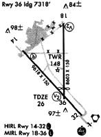
| IAP | RNAV (GPS) RWY 36 | SE-4 | |
| IAP | VOR RWY 14 | SE-4 | |
| IAP | VOR RWY 18 | SE-4 | |
| IAP | VOR RWY 32 | SE-4 | |
| MIN | ALTERNATE MINIMUMS | SE-4 | |
| MIN | TAKEOFF MINIMUMS | SE-4 |
Terminal Procedures are only available for airports in several countries with more being added all the time. If you are looking for a specific country's charts, please send an email to support(at)airportguide.com stating the country name. This will be used to prioritize the implementation.
Navigation Aids (Navaids) near BFM
| Dist (NM) | ID | Morse Code | Name | Type | Freq | True Hdg | Mag Hdg |
|---|---|---|---|---|---|---|---|
| 1.1 | BFM | _ . . . . . _ . _ _ | Brookley | VORTAC | 116.35 | 142 | 145 |
| 14.5 | MOB | _ _ _ _ _ _ . . . | Wisle | NDB | 248 | 303 | 306 |
| 16.2 | SJI | . . . . _ _ _ . . | Semmes | VORTAC | 115.30 | 291 | 294 |
| 19.3 | ESU | . . . . . . _ | Summerdale | NDB | 204 | 113 | 116 |
| 35.5 | GCV | _ _ . _ . _ . . . . _ | Greene County | VORTAC | 115.70 | 322 | 325 |
| 39.0 | NUN | _ . . . _ _ . | Saufley | VOR | 112.25 | 103 | 106 |
| 42.1 | NPA | _ . . _ _ . . _ | Pensacola | TACAN | 117.20 | 112 | 115 |
| 46.4 | BIX | _ . . . . . _ . . _ | Keesler | TACAN | 111.80 | 253 | 256 |
| 47.4 | PKZ | . _ _ . _ . _ _ _ . . | Pickens | NDB | 326 | 103 | 106 |
| 53.8 | GPT | _ _ . . _ _ . _ | Gulfport | VORTAC | 109.00 | 256 | 258 |
| 54.5 | NSE | _ . . . . . | Whiting | TACAN | 112.30 | 83 | 86 |
| 57.2 | GP | _ _ . . _ _ . | Bayou | NDB | 360 | 261 | 263 |
| 58.4 | NGS | _ . _ _ . . . . | Santa Rosa | TACAN | 133.60 | 90 | 93 |
| 62.0 | MVC | _ _ . . . _ _ . _ . | Monroeville | VORTAC | 116.80 | 36 | 39 |
| 72.2 | HRT | . . . . . _ . _ | Hurlburt | TACAN | 110.80 | 99 | 102 |
| 72.5 | HS | . . . . . . . | Hanco | NDB | 221 | 261 | 263 |
| 72.6 | CEW | _ . _ . . . _ _ | Crestview | VORTAC | 115.90 | 80 | 83 |
| 80.1 | CE | _ . _ . . | Kobra | NDB | 201 | 79 | 82 |
| 80.4 | DWG | _ . . . _ _ _ _ . | Warrington | TACAN | 134.50 | 95 | 98 |
| 80.7 | LBY | . _ . . _ . . . _ . _ _ | Eaton | VORTAC | 110.60 | 306 | 308 |
Nearby Airports with Fuel
Notices to Airmen (NOTAMS)
Remarks
| A110-1 | CONDS NOT MNT WHEN ATCT CLSD. |
| A110-2 | HOT CARGO SPACE ASGND TO TWY A BTN RWY 18/36 AND A6 |
| A110-3 | FOR CD WHEN ATCT CLSD CTC MOBILE APCH AT 251-662-6236. WHEN APCH CLSD CTC HOUSTON ARTCC AT 281-230-5622. |
| A110-4 | ARPT MNTNS ARFF INDEX A. INDEX B AVBL UPON REQ. |
| A16 | FAX PHONE 251-694-7667. |
| A46-14 | RWY 14/32 CNTRLN LGTS AVBL DURG ATCT OPER HRS ONLY. |
| A46A-32 | TDZ LGTS AVBL DURG ACTC OPER HRS ONLY. |
| A81-APT | DUSK-DAWN. WHEN ATCT CLSD ACTVT MALSR RWY 32 - CTAF. HIRL RWY 14/32 PRESET ON STEP 3 OR HYR BASED ON WX. |
| E111 | PRIOR TO FAA ACT. |
Runways
Runway Summary
| Runways: | 14/32 18/36 |
| Longest Runway: | 14/32 is 9618 ft (2932 m) long |
| Runways with an Instrument Approach: | 32 |
BFM Airport Runway Details
| Runway 14/32 | 9618 ft x 150 ft (2932 m x 46 m) | |
| Runway Length Source: | 3RD PARTY SURVEY as of 06/05/2019 | |
| Surface: | Asphalt/Concrete - Good condition - Saw-cut or plastic grooved | |
| Runway Pavement Class: | 72 /F/B/X/T | |
| Runway Edge Lights: | High Intensity | |
Runway Weight Bearing Capacity (in thousands of pounds) |
||
| Single Wheel Landing Gear: | 75.0 | |
| Dual Wheel Landing Gear: | 185.0 | |
| Dual Tandem Wheel Landing Gear: | 325.0 | |
Runway 14 |
Runway 32 |
|
Elevation: |
26.2 | 18.6 |
Latitude: |
30-37-59.0821N | 30-36-47.5137N |
Longitude: |
088-04-47.7842W | 088-03-35.2083W |
|
Runway True Alignment: |
139 | 319 |
ILS Type: |
ILS/DME | |
Glide Path Angle: |
3.0 degrees | 3.0 degrees |
Traffic Pattern: |
Right | Left |
Runway Markings Type: |
Precision Instrument | Precision Instrument |
Runway Markings Condition: |
Good | Good |
Object at End: |
TREE | |
Object Height: |
39 | |
Distance from End: |
1535 | |
Object Centerline Offset: |
500 ft. right of centerline | |
Visual Glide Slope Indicators: |
4-Light PAPI On Left Side Of Runway | 4-Light PAPI On Left Side Of Runway |
Runway Visual Range (RVR): |
Rollout | Touchdown |
Approach Light System: |
1,400 Foot Medium Intensity Approach Lighting System With Runway Alignment Indicator Lights | |
REIL: |
Yes | |
Touchdown Lights: |
Yes | |
Centerline Lights: |
Yes | Yes |
Threshold Crossing Height: |
68 | 71 |
| Runway 18/36 | 7800 ft x 150 ft (2377 m x 46 m) | |
| Runway Length Source: | 3RD PARTY SURVEY as of 06/05/2019 | |
| Surface: | Asphalt/Concrete - Good condition - No special surface treatment | |
| Runway Pavement Class: | 34 /R/B/X/T | |
| Runway Edge Lights: | Medium Intensity | |
Runway Weight Bearing Capacity (in thousands of pounds) |
||
| Single Wheel Landing Gear: | 76.0 | |
| Dual Wheel Landing Gear: | 150.0 | |
| Dual Tandem Wheel Landing Gear: | 320.0 | |
Runway 18 |
Runway 36 |
|
Elevation: |
25.4 | 25.0 |
Latitude: |
30-38-31.1769N | 30-37-13.9737N |
Longitude: |
088-03-57.3006W | 088-03-57.2556W |
|
Runway True Alignment: |
180 | 360 |
Glide Path Angle: |
3.0 degrees | 3.0 degrees |
Traffic Pattern: |
Left | Right |
Runway Markings Type: |
Nonprecision Instrument | Nonprecision Instrument |
Runway Markings Condition: |
Good | Good |
Object at End: |
POLE | TREES |
Object Height: |
33 | 55 |
Distance from End: |
1200 | 1300 |
Object Centerline Offset: |
500 ft. right of centerline | |
Visual Glide Slope Indicators: |
4-Light PAPI On Left Side Of Runway | 4-Light PAPI On Left Side Of Runway |
Threshold Crossing Height: |
64 | 62 |
Services
Airframe Repair: |
Major |
Powerplant Repair: |
Major |
Bottled Oxygen: |
None |
Bulk Oxygen: |
None |
Fuel Available: |
100LL |
Parking: |
Tiedowns available |
Maps & Diagrams
BFM Sectional
Flight Planning
at skyvector.com
at skyvector.com