Location
Latitude: |
33-21-16.1800N (33.354494) |
Longitude: |
097-26-20.6100W (-97.439058) |
Elevation: |
890.0 feet MSL (271 m MSL) |
Magnetic Variation: |
3.1 E (as of April 2024 from WMM2020 model) |
Time Zone: |
UTC -6.0 (Standard Time) UTC -5.0 (Daylight Savings Time) |
From City: |
04 N.M. W of Slidell, Texas |
Found On: |
Dallas-Ft Worth Chart |
FAA Region: |
ASW |
Contacts
Manager: |
Privately owned: |
| RON CAIN PO BOX 123 SLIDELL, TX 76267 214-914-4809 |
RONALD CAIN PO BOX 123, 6771 FM 51 SLIDELL, TX 76267 214-914-4809 |
Operations
Airport Status: |
Operational |
Facility Use: |
Public |
Type: |
Airport |
Activation Date: |
02/2010 |
Control tower: |
No |
Attendance (Months/Days/Hours): |
Months/Days/Hours ALL/ALL/ALL |
Boundary ARTCC: |
ZFW (Fort Worth) |
Responsible ARTCC: |
ZFW (Fort Worth) |
Traffic Pattern Altitude (MSL): |
1890 feet (576 m) |
NOTAMs Facility: |
FTW |
NOTAM-D Service: |
Yes |
Based Aircraft
| Single Engine: | 6 |
Annual Operations (as of 09/20/2022)
| Total Operations: | 750 | |
| GA Local: | 650 | 86.7% |
| GA Itinerant: | 100 | 13.3% |
Communications
| CTAF: | 122.900 |
Fixed Based Operators (FBOs) & Fuel
(Click on a business for detail)
Please help us keep this information up to date. This is a FREE SERVICE just like everything else on Airport Guide! If you see that a business needs to be added, modified, or deleted please fill out our Update Form.
To add, modify, or delete a business click here.
Please help us keep this information up to date. This is a FREE SERVICE just like everything else on Airport Guide! If you see that a business needs to be added, modified, or deleted please fill out our Update Form.
| Business Name | Frequency | Phone | Fuel Grade |
|---|
Flight Service Stations
| Primary | Alternate | |
| FSS on Field: | ||
| FSS Name (ID): | Fort Worth(FTW) | |
| Frequency: | ||
| Toll Free Phone: | 1-800-WX-BRIEF |
Instrument Procedures / Charts
Terminal Procedures are only available for airports in several countries with more being added all the time. If you are looking for a specific country's charts, please send an email to support(at)airportguide.com stating the country name. This will be used to prioritize the implementation.
Navigation Aids (Navaids) near T28
| Dist (NM) | ID | Morse Code | Name | Type | Freq | True Hdg | Mag Hdg |
|---|---|---|---|---|---|---|---|
| 12.9 | DT | _ . . _ | Pinck | NDB | 257 | 109 | 106 |
| 22.0 | UKW | . . _ _ . _ . _ _ | Bowie | VORTAC | 117.15 | 299 | 296 |
| 22.5 | GMZ | _ _ . _ _ _ _ . . | Grindstone Mountain | NDB | 356 | 312 | 309 |
| 27.9 | FT | . . _ . _ | Mufin | NDB | 365 | 173 | 170 |
| 30.8 | FUZ | . . _ . . . _ _ _ . . | Ranger | VORTAC | 115.70 | 154 | 151 |
| 32.3 | FTW | . . _ . _ . _ _ | Fort Worth | VOT | 108.20 | 173 | 170 |
| 35.0 | NFW | _ . . . _ . . _ _ | Nas Jrb Fort Worth | TACAN | 108.70 | 180 | 177 |
| 35.3 | TTT | _ _ _ | Maverick | VOR-DME | 113.10 | 145 | 142 |
| 38.7 | CVE | _ . _ . . . . _ . | Cowboy | VOR-DME | 116.20 | 135 | 132 |
| 42.2 | DAL | _ . . . _ . _ . . | Dallas | VOT | 113.30 | 135 | 132 |
| 43.0 | VLY | . . . _ . _ . . _ . _ _ | Melisa | NDB | 421 | 97 | 94 |
| 47.0 | MQP | _ _ _ _ . _ . _ _ . | Millsap | VORTAC | 117.70 | 216 | 213 |
| 47.8 | DNI | _ . . _ . . . | Denison | NDB | 341 | 53 | 50 |
| 53.2 | ADM | . _ _ . . _ _ | Ardmore | VORTAC | 116.70 | 14 | 11 |
| 54.3 | GHX | _ _ . . . . . _ . . _ | Graham | NDB | 371 | 258 | 255 |
| 56.2 | PQF | . _ _ . _ _ . _ . . _ . | Mesquite | NDB | 248 | 125 | 122 |
| 58.4 | SKB | . . . _ . _ _ . . . | Scotland | NDB | 344 | 296 | 293 |
| 58.4 | AI | . _ . . | Addmo | NDB | 400 | 25 | 22 |
| 60.7 | ICF | . . _ . _ . . . _ . | Madison | NDB | 296 | 303 | 300 |
| 61.3 | BYP | _ . . . _ . _ _ . _ _ . | Bonham | VORTAC | 114.60 | 79 | 76 |
Nearby Airports with Fuel
Notices to Airmen (NOTAMS)
Remarks
| A110-1 | RECOMMEND STOL ACFT OPNS ONLY. |
| A110-2 | DEER ON AND INVOF ARPT. |
| A110-3 | FOR CD CTC REGIONAL APCH AT 972-615-2799. |
| A31-18/36 | 8-10 FT RISING TERRAIN EAST OF RWY. ROLLING TERRAIN, RWY ENDS NOT VISIBLE FROM EACH END. |
| A33-18/36 | RWY ROUGH, SOME PORTIONS GRAVEL; CALL PRIOR TO USE FOR RWY COND. |
| E111 | PRVDD LETTER OF AGREEMENT WITH BISHOP ARPT (76T) AND DECATUR MUNI (LUD) TO PRVD COMPATIBLE TRAFFIC PAT OPNS. |
Runways
Runway Summary
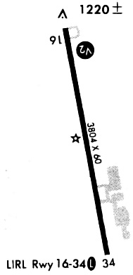
| Runways: | 18/36 |
| Longest Runway: | 18/36 is 1200 ft (366 m) long |
| Runways with an Instrument Approach: |
T28 Airport Runway Details
| Runway 18/36 | 1200 ft x 50 ft (366 m x 15 m) | |
| Runway Length Source: | OWNER as of 01/07/2010 | |
| Surface: | Turf - Fair condition - No special surface treatment | |
Runway 18 |
Runway 36 |
|
Glide Path Angle: |
0.0 degrees | 0.0 degrees |
Traffic Pattern: |
Right | |
Object at End: |
FENCE | BRUSH |
Object Height: |
4 | 16 |
Distance from End: |
0 | 0 |
Object Centerline Offset: |
30 ft. right of centerline | 30 ft. left and right of centerline |
Services
Bulk Oxygen: |
None |
Fuel Available: |
100LL, Jet A |
Landing Fees: |
No |
Parking: |
Tiedowns available |
Maps & Diagrams
T28 Sectional
Flight Planning
at skyvector.com
at skyvector.com