
Location
Latitude: |
34-53-44.4160N (34.895671) |
Longitude: |
082-13-07.8940W (-82.218859) |
Elevation: |
963.6 feet MSL (294 m MSL) |
Magnetic Variation: |
7.1 W (as of April 2024 from WMM2020 model) |
Time Zone: |
UTC -5.0 (Standard Time) UTC -4.0 (Daylight Savings Time) |
From City: |
03 N.M. S of Greer, South Carolina |
Found On: |
Atlanta Chart |
FAA Region: |
ASO |
Contacts
Manager: |
Publicly owned: |
| DAVID EDWARDS, JR. 2000 GSP DRIVE, SUITE 1 GREER, SC 29651-9202 (864) 848-6272 |
GREENVILLE-SPARTANBURG ACMSN 2000 GSP DRIVE, SUITE 1 GREER, SC 29651-9202 864-877-7426 |
Operations
Airport Status: |
Operational |
Facility Use: |
Public |
Type: |
Airport |
Activation Date: |
11/1962 |
Control tower: |
Yes |
Attendance (Months/Days/Hours): |
Months/Days/Hours ALL/ALL/ALL |
Boundary ARTCC: |
ZTL (Atlanta) |
Responsible ARTCC: |
ZTL (Atlanta) |
Lighting Schedule: |
SEE RMK |
Segmented Circle Indicator: |
Yes |
Traffic Pattern Altitude (MSL): |
1964 feet (599 m) |
NOTAMs Facility: |
GSP |
NOTAM-D Service: |
Yes |
International Airport of Entry: |
No |
Customs Landing Rights: |
Yes |
Military Landing Rights: |
Yes |
Civil/Military Joint Use: |
No |
Aircraft Rescue and Firefighting: |
Class I ARFF Index: C Air Carrier Service: Scheduled Certification Date: 05/1973 |
Based Aircraft
| Single Engine: | 4 |
| Multi Engine: | 9 |
| Jet Engine: | 19 |
| GA Helicopters: | 1 |
Annual Operations (as of 10/31/2023)
| Total Operations: | 52755 | |
| Commercial: | 28836 | 54.7% |
| Air Taxi: | 6099 | 11.6% |
| GA Local: | 2225 | 4.2% |
| GA Itinerant: | 10792 | 20.5% |
| Military Aircraft: | 4803 | 9.1% |
Communications
| CTAF: | 120.100 |
| Unicom: | 122.950 |
| Tower: | GREER 120.1 251.15 Hrs: 0600-2345 |
| Clearance Del.: | 121.9 |
| Ground: | 121.9 |
| Approach: | GREER 118.8 ;WEST 119.4 ;EAST 270.275 ;WEST 350.2 ;EAST Hrs: 0600-2345 ATLANTA ARTCC 120.6 120.6 Hrs: 2345-0600 |
| Departure: | GREER 118.8 ;WEST 119.4 ;EAST 270.275 ;WEST 350.2 ;EAST Hrs: 0600-2345 ATLANTA ARTCC 120.6 120.6 Hrs: 2345-0600 |
| ATIS: | 134.25 Hrs: 24 |
| ASOS: | 134.25 (864-879-0614) |
| BWALL DP: | 119.4 |
| BIMMR DP: | 350.2 |
| CLASS C: | 118.8 ;WEST |
| MCHLN STAR: | 119.4 |
| BWALL DP: | 350.2 |
| JUNNR STAR: | 118.8 ;WEST |
| CLASS C: | 270.275 ;WEST |
| MCHLN STAR: | 350.2 |
| RCTOR STAR: | 118.8 |
| JUNNR STAR: | 270.275 ;WEST |
| WORXS STAR: | 118.8 |
| RCTOR STAR: | 270.275 |
| EMERG: | 121.5 |
| WORXS STAR: | 270.275 |
| CLASS C: | 119.4 ;EAST |
| JUNNR STAR: | 119.4 ;EAST |
| CLASS C: | 350.2 ;EAST |
| BIMMR DP: | 119.4 |
| JUNNR STAR: | 350.2 ;EAST |
- APCH/DEP SVC PRVDD BY ATLANTA ARTCC ON FREQS 135.35/263.125 (OWING RCAG) WHEN APCH CTL CLSD.
Fixed Based Operators (FBOs) & Fuel
(Click on a business for detail)
Please help us keep this information up to date. This is a FREE SERVICE just like everything else on Airport Guide! If you see that a business needs to be added, modified, or deleted please fill out our Update Form.
To add, modify, or delete a business click here.
Please help us keep this information up to date. This is a FREE SERVICE just like everything else on Airport Guide! If you see that a business needs to be added, modified, or deleted please fill out our Update Form.
Area Code: 864 |
| Business Name | Frequency | Phone | Fuel Grade |
|---|---|---|---|
| Stevens Aviation, Inc.
Update FBO info |
Unicom 122.95 | 879-6000, 800-359-7838 | 100LL, Jet A |
Flight Service Stations
| Primary | Alternate | |
| FSS on Field: | ||
| FSS Name (ID): | Anderson(AND) | |
| Frequency: | ||
| Toll Free Phone: | 1-800-WX-BRIEF |
Instrument Procedures / Charts
FAA Terminal Procedures valid from 0901Z 03/21/24 to 0901Z 04/18/24.
There are various types of charts available for an airport. They are listed in the Page Type column. Here is a legend for those types:
APD - Airport Diagram
DP - Departure Procedure Charts
HOT - Hot Spots
IAP - Instrument Approach Procedure Charts
MIN - Minimums
STAR - Standard Terminal Arrival Charts
| Page Type | Page Name | Volume | Action Since Last Cycle |
|---|---|---|---|
| APD | AIRPORT DIAGRAM | SE-2 | Changed |
| DP | BIMMR THREE (RNAV) | SE-2 | |
| DP | BWALL TWO (RNAV) | SE-2 | |
| IAP | ILS OR LOC RWY 04 | SE-2 | Changed |
| IAP | ILS OR LOC RWY 22 | SE-2 | Changed |
| IAP | ILS RWY 04 (CAT II - III) | SE-2 | Changed |
| IAP | ILS RWY 04 (SA CAT I) | SE-2 | Changed |
| IAP | RNAV (GPS) RWY 04 | SE-2 | Changed |
| IAP | RNAV (GPS) RWY 22 | SE-2 | Changed |
| MIN | ALTERNATE MINIMUMS | SE-2 | |
| MIN | TAKEOFF MINIMUMS | SE-2 | |
| STAR | JUNNR THREE (RNAV) | SE-2 | |
| STAR | MCHLN TWO (RNAV) | SE-2 | |
| STAR | RCTOR TWO (RNAV) | SE-2 | |
| STAR | WORXS TWO (RNAV) | SE-2 |
Terminal Procedures are only available for airports in several countries with more being added all the time. If you are looking for a specific country's charts, please send an email to support(at)airportguide.com stating the country name. This will be used to prioritize the implementation.
Navigation Aids (Navaids) near GSP
| Dist (NM) | ID | Morse Code | Name | Type | Freq | True Hdg | Mag Hdg |
|---|---|---|---|---|---|---|---|
| 9.5 | GM | _ _ . _ _ | Judky | NDB | 521 | 222 | 229 |
| 11.5 | FRT | . . _ . . _ . _ | Fairmont | NDB | 248 | 88 | 95 |
| 16.5 | GY | _ _ . _ . _ _ | Dyana | NDB | 338 | 222 | 229 |
| 16.6 | SPA | . . . . _ _ . . _ | Spartanburg | VORTAC | 115.70 | 59 | 66 |
| 24.4 | LQK | . _ . . _ _ . _ _ . _ | Lake Keowee | NDB | 408 | 258 | 265 |
| 25.8 | BRA | _ . . . . _ . . _ | Broad River | NDB | 379 | 331 | 338 |
| 30.7 | SUG | . . . . . _ _ _ . | Sugarloaf Mountain | VORTAC | 112.20 | 355 | 362 |
| 31.1 | UOT | . . _ _ _ _ _ | Union County | NDB | 326 | 113 | 120 |
| 35.5 | CEU | _ . _ . . . . _ | Clemson | NDB | 257 | 248 | 255 |
| 37.2 | SLP | . . . . _ . . . _ _ . | First River | NDB | 417 | 54 | 61 |
| 38.8 | GRD | _ _ . . _ . _ . . | Greenwood | TACAN | 115.50 | 175 | 182 |
| 39.0 | GIW | _ _ . . . . _ _ | Coronaca | NDB | 239 | 170 | 177 |
| 40.0 | ELW | . . _ . . . _ _ | Electric City | VORTAC | 108.60 | 224 | 231 |
| 42.3 | IM | . . _ _ | Keans | NDB | 357 | 334 | 341 |
| 45.4 | EOE | . _ _ _ . | Enoree | NDB | 278 | 140 | 147 |
| 50.6 | DCM | _ . . _ . _ . _ _ | Chester | NDB | 220 | 97 | 104 |
| 54.5 | ODF | _ _ _ _ . . . . _ . | Foothills | VOR-DME | 113.40 | 257 | 264 |
| 55.1 | GHJ | _ _ . . . . . . _ _ _ | Stonia | NDB | 260 | 70 | 77 |
| 55.7 | FIQ | . . _ . . . _ _ . _ | Fiddlers | NDB | 391 | 28 | 35 |
| 56.0 | UZ | . . _ _ _ . . | Rally | NDB | 227 | 90 | 97 |
Nearby Airports with Fuel
Notices to Airmen (NOTAMS)
Remarks
| A110-1 | PPR GA OR MIL ACFT HEAVIER THAN 120,000 LBS CTC APT OPS 864-848-6233 |
| A110-2 | HEAVY ACFT DO NOT MAKE MORE THAN 90 DEG TURN ON ASPH PORTIONS OF THE RWY OR PARL TWY LIMA; OR TWYS D, E, F, G, UNLESS DIRECTED BY ATCT. |
| A110-3 | PSA MRO ACFT DO NOT USE L5, L6, OR GA RAMP UNLESS PRIOR COORD WITH GSP OPS 864-848-6246. ACES MRO HNGR VIA SOUTHERN TAXILANE BTN MRO HNGR AND L4. |
| A110-4 | FOR CD WHEN GREER APCH CLSD CTC ATLANTA ARTCC AT 770-210-7692. |
| A110-6 | RAMP NE OF ATCT CLSD. |
| A110-7 | WHEN ATCT IS CLSD, ARFF MNT 120.1. |
| A33-04/22 | RWY 04/22 SOUTH 2525 FT CONC, NORTH 1925 FT CONC, CENTER 6551 ASPH. |
| A49-04 | RWY 04 ALSF2 STEP 3 ONLY WHEN ATCT CLSD. |
| A5 | AND SPARTANBURG CO. |
| A70-FUEL-10 | 0LL FUEL ICING INHIBITOR AVBL. |
| A81-APT | WHEN ATCT CLSD ACTVT MALSR RWY 22; CNTLN RWY 22; HIRL RWY 04/22 - CTAF. |
| E115 | JOINT USE AGREEMENT FOR EMERGENCY USE. |
Runways
Runway Summary
| Runways: | 04/22 |
| Longest Runway: | 04/22 is 11001 ft (3353 m) long |
| Runways with an Instrument Approach: | 04, 22 |
GSP Airport Runway Details
| Runway 04/22 | 11001 ft x 150 ft (3353 m x 46 m) | |
| Runway Length Source: | 3RD PARTY SURVEY as of 06/05/2017 | |
| Surface: | Asphalt/Concrete - Good condition - Saw-cut or plastic grooved | |
| Runway Pavement Class: | 65 /R/B/W/T | |
| Runway Edge Lights: | High Intensity | |
Runway Weight Bearing Capacity (in thousands of pounds) |
||
| Single Wheel Landing Gear: | 100.0 | |
| Dual Wheel Landing Gear: | 210.0 | |
| Dual Tandem Wheel Landing Gear: | 625.0 | |
| Dual Dual Tandem Wheel Landing Gear: | 975.0 | |
Runway 04 |
Runway 22 |
|
Elevation: |
940.8 | 963.6 |
Latitude: |
34-52-58.3866N | 34-54-30.4422N |
Longitude: |
082-13-43.0870W | 082-12-32.6895W |
|
Runway True Alignment: |
032 | 212 |
ILS Type: |
ILS/DME | ILS |
Glide Path Angle: |
3.0 degrees | 3.0 degrees |
Traffic Pattern: |
Right | Left |
Runway Markings Type: |
Precision Instrument | Precision Instrument |
Runway Markings Condition: |
Good | Good |
Visual Glide Slope Indicators: |
4-Light PAPI On Left Side Of Runway | 4-Light PAPI On Right Side Of Runway |
Runway Visual Range (RVR): |
Touchdown, Midfield, Rollout | Touchdown, Midfield, Rollout |
Approach Light System: |
Standard 2,400 Foot High Intensity Approach Lighting System With Sequenced Flashers, Cat. II or III Config. | 1,400 Foot Medium Intensity Approach Lighting System With Runway Alignment Indicator Lights |
Touchdown Lights: |
Yes | No |
Centerline Lights: |
Yes | Yes |
Threshold Crossing Height: |
56 | 76 |
Services
Airframe Repair: |
Major |
Powerplant Repair: |
Major |
Bottled Oxygen: |
High Pressure |
Bulk Oxygen: |
None |
Fuel Available: |
100LL, Jet A |
Landing Fees: |
No |
Parking: |
Hangars and tiedowns available |
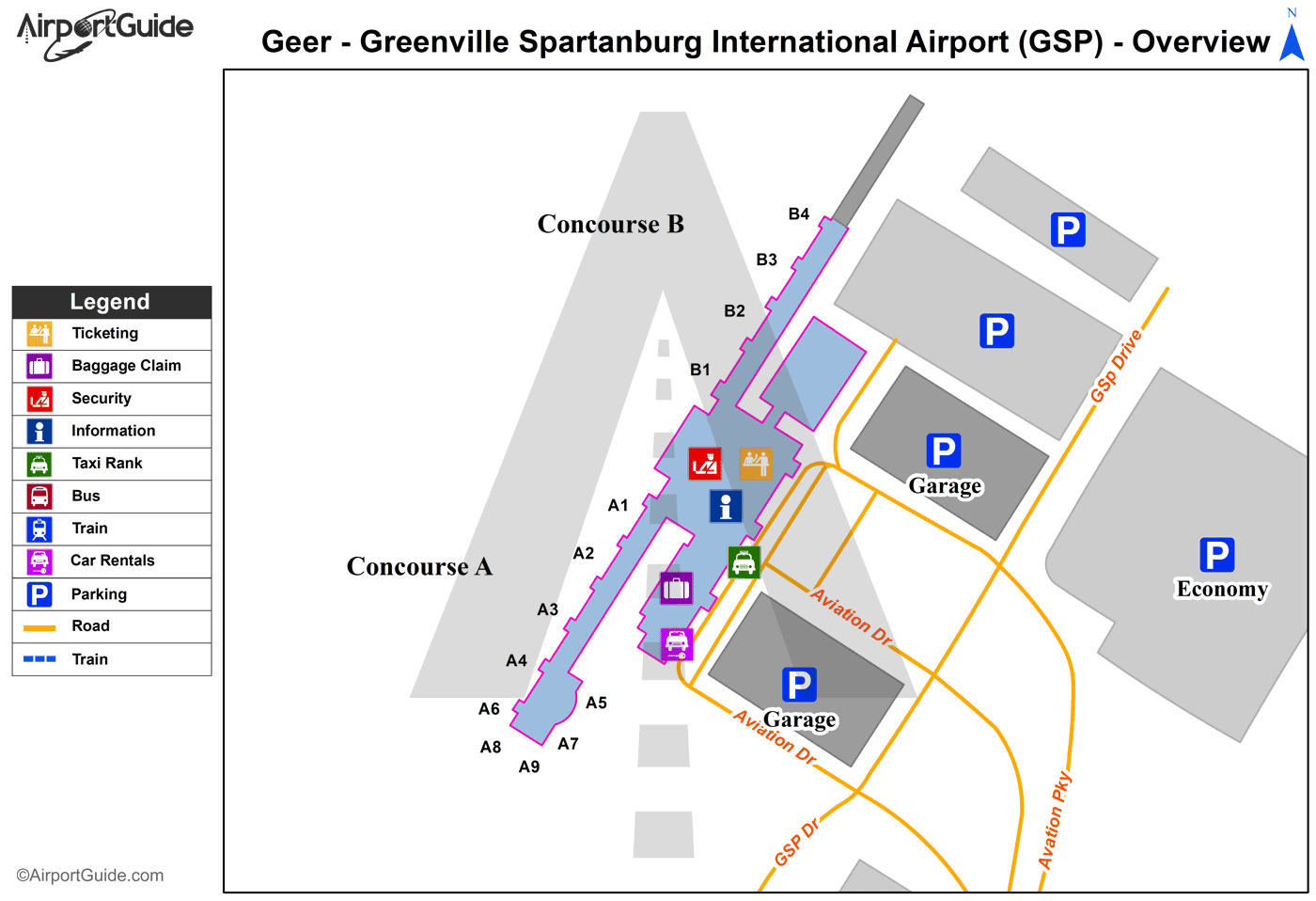
Maps & Diagrams
GSP Sectional
Flight Planning
at skyvector.com
at skyvector.com
