
Location
Latitude: |
44-02-43.2000N (44.045333) |
Longitude: |
103-03-26.5000W (-103.057361) |
Elevation: |
3203.5 feet MSL (976 m MSL) |
Magnetic Variation: |
6.9 E (as of April 2024 from WMM2020 model) |
Time Zone: |
UTC -7.0 (Standard Time) UTC -6.0 (Daylight Savings Time) |
From City: |
08 N.M. SE of Rapid City, South Dakota |
Found On: |
Cheyenne Chart |
FAA Region: |
AGL |
Contacts
Manager: |
Publicly owned: |
| PATRICK DAME 4550 TERMINAL RD - STE 102 RAPID CITY, SD 57703 605-394-4195 |
CITY OF RAPID CITY 4550 TERMINAL RD - STE 102 RAPID CITY, SD 57703 605-394-4195 |
Operations
Airport Status: |
Operational |
Facility Use: |
Public |
Type: |
Airport |
Activation Date: |
08/1950 |
Control tower: |
Yes |
Attendance (Months/Days/Hours): |
Months/Days/Hours ALL/ALL/ALL |
Boundary ARTCC: |
ZDV (Denver) |
Responsible ARTCC: |
ZDV (Denver) |
Lighting Schedule: |
SEE RMK |
Segmented Circle Indicator: |
Yes |
Traffic Pattern Altitude (MSL): |
4204 feet (1281 m) |
NOTAMs Facility: |
RAP |
NOTAM-D Service: |
Yes |
International Airport of Entry: |
No |
Customs Landing Rights: |
No |
Military Landing Rights: |
Yes |
Civil/Military Joint Use: |
No |
Aircraft Rescue and Firefighting: |
Class I ARFF Index: B Air Carrier Service: Scheduled Certification Date: 05/1973 |
Based Aircraft
| Single Engine: | 61 |
| Multi Engine: | 12 |
| Jet Engine: | 3 |
| GA Helicopters: | 2 |
Annual Operations (as of 12/31/2021)
| Total Operations: | 43805 | |
| Commercial: | 7754 | 17.7% |
| Air Taxi: | 6560 | 15.0% |
| GA Local: | 10992 | 25.1% |
| GA Itinerant: | 16491 | 37.6% |
| Military Aircraft: | 2008 | 4.6% |
Communications
| CTAF: | 125.850 |
| Unicom: | 122.950 |
| Tower: | RAPID CITY 125.85 257.8 Hrs: 0600-2200 |
| Ground: | 121.9 |
| Approach: | ELLSWORTH 119.5 119.5 119.5 DENVER ARTCC |
| Departure: | ELLSWORTH 119.5 119.5 119.5 DENVER ARTCC |
| ASOS: | 118.525 (605-393-2832) |
| EMERG: | 121.5 |
| NG OPS: | 123.05 |
| NG OPS: | 238.375FM |
| EMERG: | 243.0 |
| NG OPS: | 41.925FM |
- APCH/DEP CTL SVC PRVDD BY DENVER ARTCC (ZDV) ON FREQS 127.95/338.2 (RAPID CITY RCAG) WHEN ELLSWORTH APCH CTL (RCA) CLSD.
Fixed Based Operators (FBOs) & Fuel
(Click on a business for detail)
Please help us keep this information up to date. This is a FREE SERVICE just like everything else on Airport Guide! If you see that a business needs to be added, modified, or deleted please fill out our Update Form.
To add, modify, or delete a business click here.
Please help us keep this information up to date. This is a FREE SERVICE just like everything else on Airport Guide! If you see that a business needs to be added, modified, or deleted please fill out our Update Form.
Area Code: 605 |
| Business Name | Frequency | Phone | Fuel Grade |
|---|---|---|---|
| Air Support Services
Update FBO info |
Unicom 123.3 | 393-0335, 754-1220 | 100LL, Jet A |
| Westjet Air Center
Update FBO info |
Unicom 122.95 | 393-2500, 800-888-4270 | 100LL, Jet A |
Flight Service Stations
| Primary | Alternate | |
| FSS on Field: | N | |
| FSS Name (ID): | Huron(HON) | |
| Frequency: | ||
| Toll Free Phone: | 1-800-WX-BRIEF |
Instrument Procedures / Charts
FAA Terminal Procedures valid from 0901Z 03/21/24 to 0901Z 04/18/24.
There are various types of charts available for an airport. They are listed in the Page Type column. Here is a legend for those types:
APD - Airport Diagram
DP - Departure Procedure Charts
HOT - Hot Spots
IAP - Instrument Approach Procedure Charts
MIN - Minimums
STAR - Standard Terminal Arrival Charts
| Page Type | Page Name | Volume | Action Since Last Cycle |
|---|---|---|---|
| APD | AIRPORT DIAGRAM | NC-1 | Changed |
| IAP | ILS OR LOC RWY 32 | NC-1 | |
| IAP | RNAV (GPS) RWY 05 | NC-1 | |
| IAP | RNAV (GPS) RWY 14 | NC-1 | |
| IAP | RNAV (GPS) RWY 23 | NC-1 | |
| IAP | RNAV (GPS) RWY 32 | NC-1 | |
| IAP | VOR OR TACAN RWY 14 | NC-1 | |
| IAP | VOR OR TACAN RWY 32 | NC-1 | |
| MIN | ALTERNATE MINIMUMS | NC-1 | |
| MIN | DIVERSE VECTOR AREA | NC-1 | |
| MIN | TAKEOFF MINIMUMS | NC-1 |
Terminal Procedures are only available for airports in several countries with more being added all the time. If you are looking for a specific country's charts, please send an email to support(at)airportguide.com stating the country name. This will be used to prioritize the implementation.
Navigation Aids (Navaids) near RAP
| Dist (NM) | ID | Morse Code | Name | Type | Freq | True Hdg | Mag Hdg |
|---|---|---|---|---|---|---|---|
| 4.6 | RAP | . _ . . _ . _ _ . | Rapid City | VORTAC | 112.30 | 154 | 147 |
| 5.5 | RA | . _ . . _ | Ranch | NDB | 254 | 152 | 145 |
| 5.9 | RCA | . _ . _ . _ . . _ | Ellsworth | TACAN | 108.80 | 341 | 334 |
| 40.9 | SPF | . . . . _ _ . . . _ . | Black Hills | NDB | 300 | 310 | 303 |
| 54.9 | ECS | . _ . _ . . . . | Newcastle | VOR | 108.20 | 260 | 253 |
| 60.1 | PHP | . _ _ . . . . . . _ _ . | Philip | VOR-DME | 108.40 | 88 | 82 |
| 73.0 | HIN | . . . . . . _ . | Whitney | NDB | 275 | 181 | 174 |
| 77.6 | CD | _ . _ . _ . . | Dawes | NDB | 362 | 183 | 176 |
| 83.9 | GRN | _ _ . . _ . _ . | Gordon | NDB | 414 | 152 | 145 |
| 84.5 | DPR | _ . . . _ _ . . _ . | Dupree | VOR-DME | 116.80 | 42 | 35 |
| 89.9 | TST | _ . . . _ | Toadstool | VOR-DME | 113.40 | 187 | 180 |
| 92.0 | BUA | _ . . . . . _ . _ | Buffalo | DME | 109.4 | 349 | 342 |
Nearby Airports with Fuel
| Dist (NM) | Name (Airport IDs) | True Hdg | Mag Hdg | Fuel Grade |
|---|---|---|---|---|
| 26.3 | Sturgis Municipal Airport (49B) |
328 | 321 | 100LL, Jet A |
| 40.8 | Black Hills-Clyde Ice Field Airport (SPF KSPF SPF) |
310 | 303 | 100LL, Jet A |
| 43.1 | Hot Springs Municipal Airport (KHSR HSR) |
199 | 192 | 100LL |
| 53.8 | Belle Fourche Municipal Airport (KEFC EFC) |
320 | 313 | 100LL, Jet A |
| 55.1 | Mondell Field Airport (ECS KECS ECS) |
260 | 252 | 100LL, Jet A |
| 62.9 | Philip Airport (PHP KPHP PHP) |
89 | 83 | 100LL |
| 72.5 | Chadron Municipal Airport (CDR KCDR CDR) |
181 | 174 | 100LL, Jet A |
| 83.7 | Gordon Municipal Airport (GRN KGRN GRN) |
152 | 146 | 100LL |
| 91.9 | Bison Municipal Airport (6V5) |
15 | 8 | 100LL |
| 97.2 | Lusk Municipal Airport (LSK KLSK LSK) |
217 | 209 | 100LL |
Notices to Airmen (NOTAMS)
Remarks
| A110-1 | BIRDS ON & INVOF ARPT. |
| A110-10 | TWR HAS LIMITED VISIBILITY OF TWY T1 AND TWY T2 AND TWY B AT AER RWY 23 |
| A110-12 | USE OF ARMY NATIONAL GUARD (ANG) RAMP IS OFFICIAL BUSINESS ONLY; FOR PPR CALL ANG FLIGHT OPS AT (605) 737-6128. NORMAL ANG OPS ARE TUES-FRI 1400-0030Z++ EXCEPT HOLIDAYS. |
| A110-13 | OVERNIGHT PARKING ALLOWED IN DESIGNATED TIEDOWN AREAS ONLY. |
| A110-14 | CTC GROUND FOR FREE TIE-DOWN LOCATIONS, OR CALL ARPT OPNS AT 605-593-3419. |
| A110-15 | ALL CHARTER SERVICED ACFT OVER 12,500 LBS MUST CTC ARPT OPNS AT 605-593-3419 AT LEAST 48 HOURS PRIOR TO ARRIVAL. |
| A110-16 | DIVERTING NON-BASED AIR CARRIERS CTC ARPT OPS AT (605) 593-3419 PRIOR TO DIVERTING DUE TO LIMITED GATE SPACE. NO CUSTOMS SERVICE AVBL. |
| A110-17 | FOR CD CTC GND OR ATCT ON FREQ. IF UNA, CTC RAP ATCT AT 605-393-1161. WHEN ATCT CLSD, CTC ELLSWORTH APCH AT 605-385-6198. WHEN APCH CLSD CTC DENVER ARTCC AT 303-651-4257. |
| A110-18 | RWY 5/23 NOT AVBL TO ACFT OVER 12500 LBS TO TAXI. |
| A110-19 | HIGH VOL OF HELI TOURS INVOF MT RUSHMORE AND CRAZY HORSE MONUMENTS AT OR BLW 7500 FT; ALL OTR ACFT SHOULD RMN AT OR ABOVE 7700 FT AND MAINTAIN 1 NM HORIZONTAL SEPARATION FROM THE MONUMENTS; PILOTS ARE ADVISED TO MONITOR 122.85 FOR TFC ADVISORIES. |
| A110-2 | BE ALERT: EXTENSIVE MILITARY JET TFC INVOF & NNW OF ARPT. |
| A110-3 | LINE-OF-SIGHT IS RESTRICTED BETWEEN RY 14 & RY 23 PHYSICAL ENDS. |
| A110-6 | 152 FT AGL TWR 2.5 NM NNW OF ARPT. |
| A110-9 | BE ALERT DO NOT MISTAKE ELLSWORTH AFB, LOCATED 6.5 NM NNW FOR RAPID CITY RGNL. |
| A24 | LNDG FEES RQRD FOR AIRCRAFT 12,500 LBS OR GTR. |
| A26 | ARFF INDEX C AVBL UPON REQ. |
| A30-05/23 | RWY 5/23 NOT AVBL FOR SKEDD ACR OPNS WITH MORE THAN 9 PSGR SEATS OR UNSKED ACR AT LEAST 31 PSGR SEATS. |
| A70-FUEL-A | 100LL & JETA SELF SVC AVBL 24 HRS WITH CREDIT CARD ONLY NE SIDE OF GA RAMP. |
| A81-APT | WHEN ATCT CLSD ACTVT MALSR RWY 32; REIL RWY 14; HIRL RWY 14/32; MIRL RWY 05/23; TWY A & B LGTS - CTAF. PAPI RWYS 05, 14, 23, 32 OPR CONSLY. |
Runways
Runway Summary
| Runways: | 05/23 14/32 |
| Longest Runway: | 14/32 is 8701 ft (2652 m) long |
| Runways with an Instrument Approach: | 32 |
RAP Airport Runway Details
| Runway 05/23 | 3601 ft x 75 ft (1098 m x 23 m) | |
| Runway Length Source: | 3RD PARTY SURVEY as of 02/11/2015 | |
| Surface: | Asphalt - Good condition - No special surface treatment | |
| Runway Pavement Class: | 15 /F/C/X/T | |
| Runway Edge Lights: | Medium Intensity | |
Runway Weight Bearing Capacity (in thousands of pounds) |
||
| Single Wheel Landing Gear: | 12.5 | |
Runway 05 |
Runway 23 |
|
Elevation: |
3173.0 | 3203.5 |
Latitude: |
44-02-52.3227N | 44-03-09.1058N |
Longitude: |
103-03-49.7550W | 103-03-06.2973W |
|
Runway True Alignment: |
062 | 242 |
Glide Path Angle: |
3.0 degrees | 3.0 degrees |
Traffic Pattern: |
Right | Left |
Runway Markings Type: |
Nonprecision Instrument | Nonprecision Instrument |
Runway Markings Condition: |
Fair | Fair |
Object at End: |
ROAD | |
Object Height: |
15 | |
Distance from End: |
628 | |
Object Centerline Offset: |
0 ft. right of centerline | |
Visual Glide Slope Indicators: |
2-Light PAPI On Left Side Of Runway | 2-Light PAPI On Left Side Of Runway |
REIL: |
No | No |
Touchdown Lights: |
No | No |
Centerline Lights: |
No | No |
Threshold Crossing Height: |
34 | 38 |
Declared Distances |
||
Take Off Run Avbl. (TORA): |
3601 | 3601 |
Take Off Distance Avbl. (TODA): |
3601 | 3601 |
Actual Stop Dist. Avbl. (ASDA): |
3601 | 3601 |
Landing Dist. Avbl. (LDA): |
3601 | 3601 |
| Runway 14/32 | 8701 ft x 150 ft (2652 m x 46 m) | |
| Runway Length Source: | 3RD PARTY SURVEY as of 02/11/2015 | |
| Surface: | Asphalt - Good condition - Saw-cut or plastic grooved | |
| Runway Pavement Class: | 65 /R/C/W/T | |
| Runway Edge Lights: | High Intensity | |
Runway Weight Bearing Capacity (in thousands of pounds) |
||
| Single Wheel Landing Gear: | 140.0 | |
| Dual Wheel Landing Gear: | 190.0 | |
| Dual Tandem Wheel Landing Gear: | 300.0 | |
Runway 14 |
Runway 32 |
|
Elevation: |
3191.2 | 3142.8 |
Latitude: |
44-03-13.7835N | 44-01-58.0498N |
Longitude: |
103-03-54.0242W | 103-02-57.7996W |
|
Runway True Alignment: |
152 | 332 |
ILS Type: |
ILS/DME | |
Glide Path Angle: |
3.0 degrees | 3.0 degrees |
Traffic Pattern: |
Left | Left |
Runway Markings Type: |
Precision Instrument | Precision Instrument |
Runway Markings Condition: |
Good | Good |
Object at End: |
FENCE | |
Object Height: |
25 | |
Distance from End: |
1000 | |
Object Centerline Offset: |
0 ft. right of centerline | |
Visual Glide Slope Indicators: |
4-Light PAPI On Left Side Of Runway | 4-Light PAPI On Left Side Of Runway |
Runway Visual Range (RVR): |
Rollout | Touchdown |
Approach Light System: |
1,400 Foot Medium Intensity Approach Lighting System With Runway Alignment Indicator Lights | |
REIL: |
Yes | No |
Touchdown Lights: |
No | No |
Centerline Lights: |
No | No |
Threshold Crossing Height: |
50 | 54 |
Declared Distances |
||
Take Off Run Avbl. (TORA): |
8701 | 8701 |
Take Off Distance Avbl. (TODA): |
8701 | 8701 |
Actual Stop Dist. Avbl. (ASDA): |
8701 | 8701 |
Landing Dist. Avbl. (LDA): |
8701 | 8701 |
Services
Airframe Repair: |
None |
Powerplant Repair: |
None |
Bottled Oxygen: |
None |
Bulk Oxygen: |
None |
Fuel Available: |
100LL |
Landing Fees: |
No |
Parking: |
Tiedowns available |
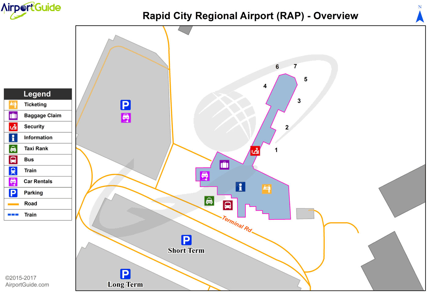
Maps & Diagrams
RAP Sectional
Flight Planning
at skyvector.com
at skyvector.com
