Location
Latitude: |
38-20-24.9000N (38.34025) |
Longitude: |
098-13-42.8000W (-98.228556) |
Elevation: |
1691.7 feet MSL (516 m MSL) |
Magnetic Variation: |
3.6 E (as of April 2024 from WMM2020 model) |
Time Zone: |
UTC -6.0 (Standard Time) UTC -5.0 (Daylight Savings Time) |
From City: |
01 N.M. W of Lyons, Kansas |
Found On: |
Wichita Chart |
FAA Region: |
ACE |
Contacts
Manager: |
Publicly owned: |
| THOMAS ROBL 718 WEST 5TH LYONS, KS 67554 620-257-2231 |
CITY OF LYONS AND RICE CO 1558 WEST MAIN LYONS, KS 67554 620-257-5002 |
Operations
Airport Status: |
Operational |
Facility Use: |
Public |
Type: |
Airport |
Activation Date: |
12/1944 |
Control tower: |
No |
Attendance (Months/Days/Hours): |
Months/Days/Hours ALL/MON-FRI/0800-1700 |
Boundary ARTCC: |
ZKC (Kansas City) |
Responsible ARTCC: |
ZKC (Kansas City) |
Lighting Schedule: |
SEE RMK |
Segmented Circle Indicator: |
No |
Traffic Pattern Altitude (MSL): |
2692 feet (821 m) |
NOTAMs Facility: |
ICT |
NOTAM-D Service: |
Yes |
International Airport of Entry: |
No |
Customs Landing Rights: |
No |
Military Landing Rights: |
Yes |
Civil/Military Joint Use: |
No |
Based Aircraft
| Single Engine: | 10 |
Annual Operations (as of 06/09/2020)
| Total Operations: | 8850 | |
| GA Local: | 3850 | 43.5% |
| GA Itinerant: | 5000 | 56.5% |
Communications
| CTAF: | 122.800 |
| Unicom: | 122.800 |
| AWOS-3P: | 119.925 (620-509-2357) |
- APCH/DEP CTL SVC PRVDD BY KANSAS CITY ARTCC (ZKC) ON FREQS 118.8/322.425 (HUTCHINSON RCAG).
Fixed Based Operators (FBOs) & Fuel
(Click on a business for detail)
Please help us keep this information up to date. This is a FREE SERVICE just like everything else on Airport Guide! If you see that a business needs to be added, modified, or deleted please fill out our Update Form.
To add, modify, or delete a business click here.
Please help us keep this information up to date. This is a FREE SERVICE just like everything else on Airport Guide! If you see that a business needs to be added, modified, or deleted please fill out our Update Form.
Area Code: 620 |
| Business Name | Frequency | Phone | Fuel Grade |
|---|---|---|---|
| Rice CO. Aviation
Update FBO info |
Unicom 122.8 | 257-5002 | 100LL, MOGAS |
Flight Service Stations
| Primary | Alternate | |
| FSS on Field: | N | |
| FSS Name (ID): | Wichita(ICT) | |
| Frequency: | ||
| Toll Free Phone: | 1-800-WX-BRIEF |
Instrument Procedures / Charts
FAA Terminal Procedures valid from 0901Z 03/21/24 to 0901Z 04/18/24.
There are various types of charts available for an airport. They are listed in the Page Type column. Here is a legend for those types:
APD - Airport Diagram
DP - Departure Procedure Charts
HOT - Hot Spots
IAP - Instrument Approach Procedure Charts
MIN - Minimums
STAR - Standard Terminal Arrival Charts
| Page Type | Page Name | Volume | Action Since Last Cycle |
|---|---|---|---|
| IAP | RNAV (GPS) RWY 17 | NC-2 | |
| IAP | RNAV (GPS) RWY 35 | NC-2 | |
| IAP | VOR-A | NC-2 | |
| MIN | ALTERNATE MINIMUMS | NC-2 | |
| MIN | TAKEOFF MINIMUMS | NC-2 |
Terminal Procedures are only available for airports in several countries with more being added all the time. If you are looking for a specific country's charts, please send an email to support(at)airportguide.com stating the country name. This will be used to prioritize the implementation.
Navigation Aids (Navaids) near LYO
| Dist (NM) | ID | Morse Code | Name | Type | Freq | True Hdg | Mag Hdg |
|---|---|---|---|---|---|---|---|
| 0.4 | LYO | . _ . . _ . _ _ _ _ _ | Lyons | NDB | 386 | 11 | 7 |
| 19.3 | HU | . . . . . . _ | Saltt | NDB | 404 | 132 | 129 |
| 24.8 | HUT | . . . . . . _ _ | Hutchinson | VOR-DME | 116.80 | 145 | 142 |
| 25.5 | MPR | _ _ . _ _ . . _ . | Mc Pherson | NDB | 227 | 88 | 85 |
| 30.0 | GB | _ _ . _ . . . | Babsy | NDB | 419 | 259 | 255 |
| 31.8 | HIL | . . . . . . . _ . . | Hilyn | NDB | 338 | 272 | 268 |
| 34.2 | SL | . . . . _ . . | Flory | NDB | 344 | 53 | 50 |
| 41.3 | LQR | . _ . . _ _ . _ . _ . | Larned | NDB | 296 | 258 | 254 |
| 44.2 | PTT | . _ _ . _ _ | Pratt | NDB | 356 | 213 | 209 |
| 45.2 | SLN | . . . . _ . . _ . | Salina | VORTAC | 117.10 | 38 | 35 |
| 46.4 | CA | _ . _ . . _ | Harvs | NDB | 395 | 104 | 101 |
| 46.9 | ICT | . . _ . _ . _ | Wichita | VORTAC | 113.80 | 139 | 136 |
| 48.0 | EWK | . . _ _ _ . _ | Newton | NDB | 281 | 109 | 106 |
| 54.5 | HY | . . . . _ . _ _ | Nette | NDB | 374 | 298 | 294 |
| 56.5 | ICT | . . _ . _ . _ | Wichita | VOT | 114.00 | 138 | 135 |
| 57.8 | HYS | . . . . _ . _ _ . . . | Hays | VORTAC | 110.40 | 302 | 298 |
| 58.5 | IC | . . _ . _ . | Piche | NDB | 332 | 141 | 138 |
| 62.6 | IAB | . . . _ _ . . . | Mc Connell | TACAN | 116.50 | 133 | 130 |
| 69.8 | HRU | . . . . . _ . . . _ | Herington | NDB | 407 | 71 | 68 |
| 70.9 | ANY | . _ _ . _ . _ _ | Anthony | TACAN | 112.90 | 177 | 173 |
Nearby Airports with Fuel
Notices to Airmen (NOTAMS)
Remarks
| A110-1 | FOR CD CTC KANSAS CITY ARTCC AT 913-254-8508. |
| A110-2 | COURTESY CAR AVBL. |
| A16 | MANAGERS CELL PHONE 785-577-1918 |
| A17 | FOR ATTENDANCE OTR TIMES ON REQ CALL 620-257-5002. |
| A70-FUEL-A | JET A ON REQUEST |
| A70-FUEL-10 | 0LL FUEL AVAILABLE DURING NORMAL ATTENDANCE SCHEDULE AFTER HOURS NUMBER 785-577-1918 |
| A81-APT | ACTVT REIL RWY 17 & 35; PAPI RWY 17 & 35; MIRL RWY 17/35 - CTAF. |
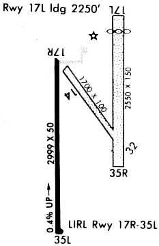
Runways
Runway Summary
| Runways: | 17/35 |
| Longest Runway: | 17/35 is 4400 ft (1341 m) long |
| Runways with an Instrument Approach: |
LYO Airport Runway Details
| Runway 17/35 | 4400 ft x 75 ft (1341 m x 23 m) | |
| Runway Length Source: | 3RD PARTY SURVEY as of 08/28/2018 | |
| Surface: | Concrete - Excellent condition - No special surface treatment | |
| Runway Pavement Class: | 12 /R/C/W/T | |
| Runway Edge Lights: | Medium Intensity | |
Runway Weight Bearing Capacity (in thousands of pounds) |
||
| Single Wheel Landing Gear: | 30.0 | |
Runway 17 |
Runway 35 |
|
Elevation: |
1691.6 | 1676.0 |
Latitude: |
38-20-46.6458N | 38-20-03.1560N |
Longitude: |
098-13-43.0650W | 098-13-42.5868W |
|
Runway True Alignment: |
180 | 360 |
Glide Path Angle: |
3.0 degrees | 3.0 degrees |
Traffic Pattern: |
Right | Left |
Runway Markings Type: |
Nonprecision Instrument | Nonprecision Instrument |
Runway Markings Condition: |
Good | Good |
Object at End: |
ROAD | ROAD |
Object Height: |
15 | 15 |
Distance from End: |
520 | 335 |
Object Centerline Offset: |
0 ft. left and right of centerline | 0 ft. left and right of centerline |
Visual Glide Slope Indicators: |
2-Light PAPI On Left Side Of Runway | 2-Light PAPI On Left Side Of Runway |
REIL: |
Yes | Yes |
Threshold Crossing Height: |
40 | 40 |
Services
Airframe Repair: |
Major |
Powerplant Repair: |
Major |
Bottled Oxygen: |
High Pressure / Low Pressure |
Bulk Oxygen: |
High Pressure / Low Pressure |
Fuel Available: |
100LL, Jet A |
Landing Fees: |
No |
Parking: |
Hangars and tiedowns available |
Maps & Diagrams
LYO Sectional
Flight Planning
at skyvector.com
at skyvector.com