Location
Latitude: |
43-10-24.7110N (43.173531) |
Longitude: |
078-16-28.6770W (-78.274633) |
Elevation: |
669.0 feet MSL (204 m MSL) |
Magnetic Variation: |
10.8 W (as of April 2024 from WMM2020 model) |
Time Zone: |
UTC -5.0 (Standard Time) UTC -4.0 (Daylight Savings Time) |
From City: |
05 N.M. SW of Albion, New York |
Found On: |
Detroit Chart |
FAA Region: |
AEA |
Contacts
Manager: |
Privately owned: |
| TIMOTHY ALLEN 4906 PINE HILL ROAD ALBION, NY 14411 716-597-7393 |
HAINES FAMILY FARM, LLC 4906 PINE HILL ROAD ALBION, NY 14411-9760 716-597-7393 |
Operations
Airport Status: |
Operational |
Facility Use: |
Public |
Type: |
Airport |
Activation Date: |
12/1963 |
Control tower: |
No |
Attendance (Months/Days/Hours): |
Months/Days/Hours Unattended |
Boundary ARTCC: |
ZOB (Cleveland) |
Responsible ARTCC: |
ZOB (Cleveland) |
Segmented Circle Indicator: |
No |
Traffic Pattern Altitude (MSL): |
1669 feet (509 m) |
NOTAMs Facility: |
BUF |
NOTAM-D Service: |
Yes |
Military Landing Rights: |
No |
Civil/Military Joint Use: |
No |
Based Aircraft
| Single Engine: | 10 |
| Ultralights: | 1 |
Annual Operations (as of 07/14/2023)
| Total Operations: | 11500 | |
| GA Local: | 7000 | 60.9% |
| GA Itinerant: | 4000 | 34.8% |
| Military Aircraft: | 500 | 4.3% |
Communications
| CTAF: | 123.000 |
| Unicom: | 123.000 |
| Approach: | BUFFALO 126.15 126.15 |
| Departure: | BUFFALO 126.15 126.15 |
Fixed Based Operators (FBOs) & Fuel
(Click on a business for detail)
Please help us keep this information up to date. This is a FREE SERVICE just like everything else on Airport Guide! If you see that a business needs to be added, modified, or deleted please fill out our Update Form.
To add, modify, or delete a business click here.
Please help us keep this information up to date. This is a FREE SERVICE just like everything else on Airport Guide! If you see that a business needs to be added, modified, or deleted please fill out our Update Form.
Area Code: 716 |
| Business Name | Frequency | Phone | Fuel Grade |
|---|---|---|---|
| Pine Hill Airport
Website Update FBO info |
Unicom 123.0 | 589-7758 | 100LL, Mogas |
Flight Service Stations
| Primary | Alternate | |
| FSS on Field: | N | |
| FSS Name (ID): | Buffalo(BUF) | |
| Frequency: | ||
| Toll Free Phone: | 1-800-WX-BRIEF |
Instrument Procedures / Charts
FAA Terminal Procedures valid from 0901Z 03/21/24 to 0901Z 04/18/24.
There are various types of charts available for an airport. They are listed in the Page Type column. Here is a legend for those types:
APD - Airport Diagram
DP - Departure Procedure Charts
HOT - Hot Spots
IAP - Instrument Approach Procedure Charts
MIN - Minimums
STAR - Standard Terminal Arrival Charts
| Page Type | Page Name | Volume | Action Since Last Cycle |
|---|---|---|---|
| APD | AIRPORT DIAGRAM | NE-2 | |
| IAP | RNAV (GPS)-B | NE-2 | |
| MIN | TAKEOFF MINIMUMS | NE-2 |
Terminal Procedures are only available for airports in several countries with more being added all the time. If you are looking for a specific country's charts, please send an email to support(at)airportguide.com stating the country name. This will be used to prioritize the implementation.
Navigation Aids (Navaids) near 9G6
| Dist (NM) | ID | Morse Code | Name | Type | Freq | True Hdg | Mag Hdg |
|---|---|---|---|---|---|---|---|
| 19.5 | BU | _ . . . . . _ | Klump | NDB | 231 | 237 | 248 |
| 21.9 | BUF | _ . . . . . _ . . _ . | Buffalo | DME | 116.4 | 228 | 239 |
| 24.2 | AVN | . _ . . . _ _ . | Avon | NDB | 344 | 113 | 124 |
| 24.6 | BUF | _ . . . . . _ . . _ . | Buffalo | VOT | 109.00 | 235 | 246 |
| 25.0 | IA | . . . _ | Kathi | NDB | 329 | 261 | 272 |
| 26.6 | ROC | . _ . _ _ _ _ . _ . | Rochester | VOR-DME | 110.00 | 97 | 108 |
| 29.8 | GB | _ _ . _ . . . | Plazz | NDB | 204 | 233 | 244 |
| 30.2 | IAG | . . . _ _ _ . | Niagara Falls | TACAN | 111.00 | 263 | 274 |
| 31.3 | GEE | _ _ . . . | Geneseo | VOR-DME | 108.20 | 130 | 141 |
| 42.9 | SN | St. Catharines | NDB | 408 | 268 | 279 | |
| 52.0 | IOO | Oshawa | DME | 111.35 | 329 | 340 | |
| 52.5 | OO | Oshawa | NDB | 391 | 328 | 339 | |
| 53.5 | LYS | . _ . . _ . _ _ . . . | Olean | NDB | 360 | 182 | 193 |
| 55.1 | TZ | Gibraltar Point | NDB | 257 | 298 | 309 | |
| 56.1 | ITZ | City Centre | DME | 110.15 | 299 | 310 | |
| 59.8 | ZZR | Severn | NDB | 317 | 27 | 38 | |
| 60.1 | DKK | _ . . _ . _ _ . _ | Dunkirk | DME | 116.2 | 227 | 237 |
| 61.6 | ZYZ | Queensway | NDB | 368 | 296 | 306 | |
| 62.3 | PYA | . _ _ . _ . _ _ . _ | Penn Yan | NDB | 260 | 120 | 131 |
| 62.6 | IKZ | Buttonville | DME | 111.10 | 311 | 322 |
Nearby Airports with Fuel
Notices to Airmen (NOTAMS)
Remarks
| A110*G | THIS AIRPORT HAS BEEN SURVEYED BY THE NATIONAL GEODETIC SURVEY. |
| A110-2 | 245 FT TWR 1500 FT SSE APCH END RY 28. |
| A110-6 | FOR CD CTC CLEVELAND ARTCC AT 440-774-0490. |
| A57-28 | APCH SLOPE 13:1 AT DTHR; OVR 38 FT TREE, 510 FT DSTC, 70 FT LEFT. |
| A58-28 | 8 FT SIGN; 185 FT DSTC, 64 FT RIGHT. |
Runways
Runway Summary
| Runways: | 10/28 |
| Longest Runway: | 10/28 is 2659 ft (810 m) long |
| Runways with an Instrument Approach: |
9G6 Airport Runway Details
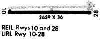
| Runway 10/28 | 2659 ft x 36 ft (810 m x 11 m) | |
| Surface: | Asphalt - Fair condition - No special surface treatment | |
Runway Weight Bearing Capacity (in thousands of pounds) |
||
| Single Wheel Landing Gear: | 12.0 | |
Runway 10 |
Runway 28 |
|
Elevation: |
653.0 | 669.0 |
Latitude: |
43-10-24.8680N | 43-10-24.5710N |
Longitude: |
078-16-46.6660W | 078-16-10.7830W |
|
Runway True Alignment: |
091 | 271 |
Glide Path Angle: |
0.0 degrees | 0.0 degrees |
Traffic Pattern: |
Left | Left |
Runway Markings Type: |
None | None |
Object at End: |
TREE | ROAD |
Object Height: |
76 | 16 |
Distance from End: |
1067 | 210 |
Object Centerline Offset: |
180 ft. right of centerline | 0 ft. left and right of centerline |
REIL: |
No | No |
Displaced Threshold: |
250 | |
Threshold Latitude: |
43-10-24.5991N | |
Threshold Longitude: |
078-16-14.1565W |
Services
Airframe Repair: |
Major |
Powerplant Repair: |
Major |
Bottled Oxygen: |
High Pressure / Low Pressure |
Bulk Oxygen: |
None |
Fuel Available: |
100LL, Jet A |
Landing Fees: |
No |
Parking: |
Hangars and tiedowns available |
Maps & Diagrams
9G6 Sectional
Flight Planning
at skyvector.com
at skyvector.com