Location
Latitude: |
44-23-16.5000N (44.387917) |
Longitude: |
075-03-58.8000W (-75.066333) |
Elevation: |
815.0 feet MSL (248 m MSL) |
Magnetic Variation: |
12.8 W (as of April 2024 from WMM2020 model) |
Time Zone: |
UTC -5.0 (Standard Time) UTC -4.0 (Daylight Savings Time) |
From City: |
03 N.M. N of Degrasse, New York |
Found On: |
Montreal Chart |
FAA Region: |
AEA |
Contacts
Manager: |
Privately owned: |
| ROBIN CELLECK 4482 CO. RT 27 CANTON, NY 13617 (315) 379-1907 |
KATHRYN MOORE 2522 CO. RT. 27 RUSSELL, NY 13684 (315) 848-2197 |
Operations
Airport Status: |
Operational |
Facility Use: |
Public |
Type: |
Airport |
Activation Date: |
08/1966 |
Control tower: |
No |
Attendance (Months/Days/Hours): |
Months/Days/Hours Unattended |
Boundary ARTCC: |
ZBW (Boston) |
Responsible ARTCC: |
ZBW (Boston) |
Segmented Circle Indicator: |
No |
Traffic Pattern Altitude (MSL): |
1815 feet (553 m) |
NOTAMs Facility: |
BTV |
NOTAM-D Service: |
Yes |
International Airport of Entry: |
No |
Customs Landing Rights: |
No |
Military Landing Rights: |
No |
Civil/Military Joint Use: |
No |
Based Aircraft
| Single Engine: | 3 |
| Ultralights: | 2 |
Annual Operations (as of 07/16/2020)
| Total Operations: | 1000 | |
| GA Local: | 1000 | 100.0% |
Communications
| CTAF: | 122.900 |
Fixed Based Operators (FBOs) & Fuel
(Click on a business for detail)
Please help us keep this information up to date. This is a FREE SERVICE just like everything else on Airport Guide! If you see that a business needs to be added, modified, or deleted please fill out our Update Form.
To add, modify, or delete a business click here.
Please help us keep this information up to date. This is a FREE SERVICE just like everything else on Airport Guide! If you see that a business needs to be added, modified, or deleted please fill out our Update Form.
Area Code: 315 |
| Business Name | Frequency | Phone | Fuel Grade |
|---|
Flight Service Stations
| Primary | Alternate | |
| FSS on Field: | N | |
| FSS Name (ID): | Burlington(BTV) | |
| Frequency: | ||
| Toll Free Phone: | 1-800-WX-BRIEF |
Instrument Procedures / Charts
Terminal Procedures are only available for airports in several countries with more being added all the time. If you are looking for a specific country's charts, please send an email to support(at)airportguide.com stating the country name. This will be used to prioritize the implementation.
Navigation Aids (Navaids) near 1E8
| Dist (NM) | ID | Morse Code | Name | Type | Freq | True Hdg | Mag Hdg |
|---|---|---|---|---|---|---|---|
| 21.6 | PTD | . _ _ . _ _ . . | Potsdam | NDB | 400 | 21 | 34 |
| 22.5 | OG | _ _ _ _ _ . | Ogive | NDB | 358 | 327 | 340 |
| 28.7 | MS | _ _ . . . | Misse | NDB | 278 | 12 | 25 |
| 34.6 | GTB | _ _ . _ _ . . . | Drum | NDB | 257 | 236 | 249 |
| 34.8 | MSS | _ _ . . . . . . | Massena | TACAN | 114.10 | 24 | 37 |
| 37.0 | SLK | . . . . _ . . _ . _ | Saranac Lake | DME | 109.2 | 90 | 103 |
| 40.7 | SLK | . . . . _ . . _ . _ | Briel | NDB | 395 | 82 | 95 |
| 40.7 | SL | . . . . _ . . | Briel | NDB | 395 | 82 | 95 |
| 50.3 | ART | . _ . _ . _ | Watertown | VORTAC | 109.80 | 239 | 252 |
| 57.1 | YRR | Greely | NDB | 377 | 337 | 350 | |
| 61.1 | IOW | Ottawa | DME | 109.50 | 335 | 348 | |
| 62.0 | OW | Ottawa | NDB | 236 | 340 | 353 | |
| 66.3 | YGK | Kingston | NDB | 263 | 265 | 277 | |
| 68.4 | PLB | . _ _ . . _ . . _ . . . | Plattsburgh | VORTAC | 116.90 | 74 | 87 |
| 72.4 | YOW | _ . _ _ _ _ _ . _ _ | Ottawa | VORTAC | 114.60 | 331 | 344 |
| 72.4 | YOW | Ottawa | VOR-DME | 114.60 | 331 | 344 | |
| 78.3 | BT | _ . . . _ | Herro | NDB | 382 | 83 | 96 |
| 80.8 | BTV | _ . . . _ . . . _ | Burlington | VOR-DME | 117.50 | 88 | 101 |
| 81.8 | UCA | . . _ _ . _ . . _ | Utica | TACAN | 111.20 | 183 | 196 |
| 82.0 | BJA | _ . . . . _ _ _ . _ | Burlington | TACAN | 112.40 | 85 | 98 |
Nearby Airports with Fuel
Notices to Airmen (NOTAMS)
Remarks
| A110-1 | DEER ON AND INVOF ARPT. |
| A110-2 | 2 FT DITCH IMT RT OF THLD MKD BY CONES. |
| A110-3 | RY 20, 58 FT TREES, 263 FT FM RY BEGINNING, ACROSS RY WIDTH & APPROXIMATELY 800 FT. ALONG BOTH SIDES. |
| A110-4 | DIRT ROAD TO HANGAR CROSSES APPROXIMATE MIDPOINT OF RY. |
| A110-5 | RWY 20 3 EARTHEN MOUNDS APPROX. 5 FT. HIGH OFF RIGHT SIDE OF RUNWAY 400 FT. FROM THRESHOLD. TREES/BRUSH NEXT TO RUNWAY THRESHOLD L/S. |
| A110-6 | RWY 02 TREES/BRUSH NEXT TO CORNER OF THRESHOLD L/S. |
| A110-7 | FOR CD CTC BOSTON ARTCC AT 603-879-6859. |
| A31-02/20 | RY 20 STARTS AT APPROX 250 FT FM TREES ON RY END. |
| E111 | AIRSPACE DETERMINATION PENDING. |
Runways
Runway Summary
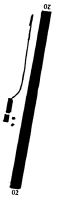
| Runways: | 02/20 |
| Longest Runway: | 02/20 is 2200 ft (671 m) long |
| Runways with an Instrument Approach: |
1E8 Airport Runway Details
| Runway 02/20 | 2200 ft x 55 ft (671 m x 17 m) | |
| Surface: | Turf - Good condition - No special surface treatment | |
Runway 02 |
Runway 20 |
|
Elevation: |
811.0 | 815.0 |
Latitude: |
44-23-05.7235N | 44-23-27.3614N |
Longitude: |
075-04-00.2128W | 075-03-57.4259W |
|
Runway True Alignment: |
005 | 185 |
Glide Path Angle: |
0.0 degrees | 0.0 degrees |
Traffic Pattern: |
Left | Left |
Object at End: |
TREES | TREES |
Object Height: |
30 | 65 |
Distance from End: |
49 | 312 |
Object Centerline Offset: |
47 ft. left of centerline | 77 ft. right of centerline |
Services
Fuel Available: |
100LL |
Landing Fees: |
No |
Parking: |
Tiedowns available |
Maps & Diagrams
1E8 Sectional
Flight Planning
at skyvector.com
at skyvector.com