Location
Latitude: |
43-31-36.4600N (43.526794) |
Longitude: |
121-56-52.4700W (-121.947908) |
Elevation: |
4750.0 feet MSL (1448 m MSL) |
Magnetic Variation: |
14.2 E (as of April 2024 from WMM2020 model) |
Time Zone: |
UTC -8.0 (Standard Time) UTC -7.0 (Daylight Savings Time) |
From City: |
03 N.M. N of Cresent Lake, Oregon |
Found On: |
Klamath Falls Chart |
FAA Region: |
ANM |
Contacts
Manager: |
Privately owned: |
| TIM CRAMBLIT, FIRE CHIEF PO BOX 1065, 20400 CRESCENT LAKE HWY CRESCENT LAKE, OR 97733-1065 541-433-2800 |
CENTRAL CASCADES FIRE & EMS PO BOX 1065, 20400 CRESCENT LAKE HWY CRESCENT LAKE, OR 97733-1065 541-433-2800 |
Operations
Airport Status: |
Operational |
Facility Use: |
Private |
Type: |
Heliport |
Activation Date: |
06/2000 |
Control tower: |
No |
Attendance (Months/Days/Hours): |
Months/Days/Hours Unattended |
Boundary ARTCC: |
ZSE (Seattle) |
Responsible ARTCC: |
ZSE (Seattle) |
Lighting Schedule: |
SS-SR |
Segmented Circle Indicator: |
Yes |
Traffic Pattern Altitude (MSL): |
5750 feet (1753 m) |
Based Aircraft
Annual Operations (as of )
Communications
Fixed Based Operators (FBOs) & Fuel
(Click on a business for detail)
Please help us keep this information up to date. This is a FREE SERVICE just like everything else on Airport Guide! If you see that a business needs to be added, modified, or deleted please fill out our Update Form.
To add, modify, or delete a business click here.
Please help us keep this information up to date. This is a FREE SERVICE just like everything else on Airport Guide! If you see that a business needs to be added, modified, or deleted please fill out our Update Form.
Area Code: 541 |
| Business Name | Frequency | Phone | Fuel Grade |
|---|
Flight Service Stations
| Primary | Alternate | |
| FSS on Field: | ||
| FSS Name (ID): | Mc Minnville(MMV) | |
| Frequency: | ||
| Toll Free Phone: | 1-800-WX-BRIEF |
Instrument Procedures / Charts
Terminal Procedures are only available for airports in several countries with more being added all the time. If you are looking for a specific country's charts, please send an email to support(at)airportguide.com stating the country name. This will be used to prioritize the implementation.
Navigation Aids (Navaids) near OR33
| Dist (NM) | ID | Morse Code | Name | Type | Freq | True Hdg | Mag Hdg |
|---|---|---|---|---|---|---|---|
| 51.7 | DSD | _ . . . . . _ . . | Deschutes | VORTAC | 117.60 | 32 | 18 |
| 61.7 | RD | . _ . _ . . | Bodey | NDB | 411 | 40 | 26 |
| 63.9 | RBG | . _ . _ . . . _ _ . | Roseburg | NDB | 400 | 254 | 240 |
| 64.7 | RBG | . _ . _ . . . _ _ . | Roseburg | VOR-DME | 108.20 | 251 | 237 |
| 65.7 | EUG | . . . _ _ _ . | Eugene | VORTAC | 112.90 | 303 | 289 |
| 68.7 | EU | . . . _ | Frakk | NDB | 260 | 307 | 293 |
| 75.8 | OED | _ _ _ . _ . . | Rogue Valley | VORTAC | 113.60 | 214 | 200 |
| 79.4 | MEF | _ _ . . . _ . | Medford | NDB | 356 | 211 | 197 |
| 80.9 | MFR | _ _ . . _ . . _ . | Medford | VOT | 117.20 | 210 | 196 |
| 82.3 | CVO | _ . _ . . . . _ _ _ _ | Corvallis | VOR-DME | 115.40 | 315 | 301 |
| 83.0 | LMT | . _ . . _ _ _ | Klamath Falls | VORTAC | 115.90 | 173 | 159 |
| 86.6 | LWG | . _ . . . _ _ _ _ . | Lewisburg | NDB | 225 | 319 | 305 |
| 88.6 | LKV | . _ . . _ . _ . . . _ | Lakeview | VORTAC | 112.00 | 133 | 119 |
| 90.2 | SL | . . . . _ . . | Turno | NDB | 266 | 331 | 317 |
| 96.9 | OTH | _ _ _ _ . . . . | North Bend | VOR-DME | 112.10 | 266 | 252 |
Nearby Airports with Fuel
Notices to Airmen (NOTAMS)
Remarks
| A110-1 | FOR CD CTC SEATTLE ARTCC AT 253-351-3694. |
| A14 | OTH CTC BRAD KAHLER 541-433-2800; BKAHLER@CCF-EMS.ORG |
| A18 | MEDICAL USE. |
| A52-H1 | 50 FT BLDG 150 W, 50 FT PLINES 250 FT S, AND 50 FT TREES 100 FT N, E, & S OF HELI. 70 FT LGTD TOWER 200 FT SW. |
Runways
Runway Summary
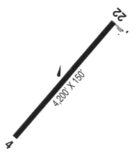
| Runways: | H1 |
| Longest Runway: | H1 is 100 ft (30 m) long |
| Runways with an Instrument Approach: |
OR33 Airport Runway Details
| Helipad H1 | 100 ft x 100 ft (30 m x 30 m) | |
| Surface: | Asphalt - No special surface treatment | |
| Runway Edge Lights: | Perimeter lights (for helipads) Intensity | |
Helipad H1 |
||
Elevation: |
4750.0 | |
Latitude: |
43-31-36.4600N | |
Longitude: |
121-56-52.4700W | |
Glide Path Angle: |
0.0 degrees | 0.0 degrees |
Services
Bottled Oxygen: |
None |
Bulk Oxygen: |
None |
Fuel Available: |
100LL, Jet A |
Landing Fees: |
No |
Parking: |
Tiedowns available |
Maps & Diagrams
OR33 Sectional
Flight Planning
at skyvector.com
at skyvector.com