Location
Latitude: |
39-32-59.5240N (39.549868) |
Longitude: |
097-39-07.3460W (-97.652041) |
Elevation: |
1488.1 feet MSL (454 m MSL) |
Magnetic Variation: |
3.3 E (as of April 2024 from WMM2020 model) |
Time Zone: |
UTC -6.0 (Standard Time) UTC -5.0 (Daylight Savings Time) |
From City: |
02 N.M. S of Concordia, Kansas |
Found On: |
Wichita Chart |
FAA Region: |
ACE |
Contacts
Manager: |
Publicly owned: |
| RON COPPLE 701 WASHINGTON CONCORDIA, KS 66901 785-243-2670 |
CITY OF CONCORDIA BOX 603 (CITY OFFICE) CONCORDIA, KS 66901 |
Operations
Airport Status: |
Operational |
Facility Use: |
Public |
Type: |
Airport |
Activation Date: |
01/1947 |
Control tower: |
No |
Attendance (Months/Days/Hours): |
Months/Days/Hours ALL/MON-FRI/0800-1600 |
Boundary ARTCC: |
ZKC (Kansas City) |
Responsible ARTCC: |
ZKC (Kansas City) |
Lighting Schedule: |
SEE RMK |
Segmented Circle Indicator: |
Yes |
Traffic Pattern Altitude (MSL): |
2488 feet (758 m) |
NOTAMs Facility: |
CNK |
NOTAM-D Service: |
Yes |
International Airport of Entry: |
No |
Customs Landing Rights: |
No |
Military Landing Rights: |
Yes |
Civil/Military Joint Use: |
No |
Based Aircraft
| Single Engine: | 12 |
| Multi Engine: | 1 |
Annual Operations (as of 09/29/2020)
| Total Operations: | 14550 | |
| GA Local: | 8000 | 55.0% |
| GA Itinerant: | 6150 | 42.3% |
| Military Aircraft: | 400 | 2.7% |
Communications
| CTAF: | 122.800 |
| Unicom: | 122.800 |
| ASOS: | 123.825 (785-243-3441) |
- APCH/DEP CTL SVC PRVDD BY KANSAS CITY ARTCC (ZKC) ON FREQS 134.9/363.2 (SALINA RCAG).
Fixed Based Operators (FBOs) & Fuel
(Click on a business for detail)
Please help us keep this information up to date. This is a FREE SERVICE just like everything else on Airport Guide! If you see that a business needs to be added, modified, or deleted please fill out our Update Form.
To add, modify, or delete a business click here.
Please help us keep this information up to date. This is a FREE SERVICE just like everything else on Airport Guide! If you see that a business needs to be added, modified, or deleted please fill out our Update Form.
Area Code: 785 |
| Business Name | Frequency | Phone | Fuel Grade |
|---|---|---|---|
| Hill Aviation
Update FBO info |
Unicom 122.8 | 243-2043 | 100LL, MOGAS |
Flight Service Stations
| Primary | Alternate | |
| FSS on Field: | N | |
| FSS Name (ID): | Wichita(ICT) | |
| Frequency: | ||
| Toll Free Phone: | 1-800-WX-BRIEF |
Instrument Procedures / Charts
FAA Terminal Procedures valid from 0901Z 03/21/24 to 0901Z 04/18/24.
There are various types of charts available for an airport. They are listed in the Page Type column. Here is a legend for those types:
APD - Airport Diagram
DP - Departure Procedure Charts
HOT - Hot Spots
IAP - Instrument Approach Procedure Charts
MIN - Minimums
STAR - Standard Terminal Arrival Charts
| Page Type | Page Name | Volume | Action Since Last Cycle |
|---|---|---|---|
| IAP | RNAV (GPS) RWY 18 | NC-2 | |
| IAP | RNAV (GPS) RWY 36 | NC-2 | |
| MIN | ALTERNATE MINIMUMS | NC-2 | |
| MIN | TAKEOFF MINIMUMS | NC-2 |
Terminal Procedures are only available for airports in several countries with more being added all the time. If you are looking for a specific country's charts, please send an email to support(at)airportguide.com stating the country name. This will be used to prioritize the implementation.
Navigation Aids (Navaids) near CNK
| Dist (NM) | ID | Morse Code | Name | Type | Freq | True Hdg | Mag Hdg |
|---|---|---|---|---|---|---|---|
| 0.2 | CNK | _ . _ . _ . _ . _ | Concordia | NDB | 335 | 10 | 7 |
| 15.8 | RPB | . _ . . _ _ . _ . . . | Republican | NDB | 414 | 359 | 356 |
| 24.9 | CYW | _ . _ . _ . _ _ . _ _ | Clay Center | NDB | 362 | 113 | 110 |
| 32.0 | TKO | _ _ . _ _ _ _ | Mankato | VORTAC | 109.80 | 298 | 295 |
| 36.2 | HJH | . . . . . _ _ _ . . . . | Hebron | NDB | 323 | 4 | 1 |
| 37.5 | SLN | . . . . _ . . _ . | Salina | VORTAC | 117.10 | 177 | 174 |
| 43.8 | FBY | . . _ . _ . . . _ . _ _ | Fairbury | NDB | 293 | 30 | 27 |
| 50.6 | FRI | . . _ . . _ . . . | Fort Riley | VOR | 109.40 | 133 | 130 |
| 50.7 | CVY | _ . _ . . . . _ _ . _ _ | Cavalry | NDB | 314 | 128 | 125 |
| 51.7 | MHK | _ _ . . . . _ . _ | Manhattan | VOR-DME | 110.20 | 117 | 114 |
| 52.1 | SL | . . . . _ . . | Flory | NDB | 344 | 179 | 176 |
| 61.1 | BIE | _ . . . . . . | Beatrice | VOR | 110.60 | 42 | 39 |
| 62.5 | FMZ | . . _ . _ _ _ _ . . | Beklof | NDB | 392 | 3 | 360 |
| 64.6 | HRU | . . . . . _ . . . _ | Herington | NDB | 407 | 142 | 139 |
| 72.1 | MPR | _ _ . _ _ . . _ . | Mc Pherson | NDB | 227 | 181 | 178 |
| 72.7 | HSI | . . . . . . . . . | Hastings | VOR-DME | 108.80 | 330 | 326 |
| 76.2 | PHG | . _ _ . . . . . _ _ . | Phillipsburg | NDB | 368 | 277 | 273 |
| 77.0 | LYO | . _ . . _ . _ _ _ _ _ | Lyons | NDB | 386 | 200 | 197 |
| 77.2 | PWE | . _ _ . . _ _ . | Pawnee City | DME | 112.4 | 59 | 56 |
| 78.0 | PSS | . _ _ . . . . . . . | Prosser | NDB | 338 | 331 | 327 |
Nearby Airports with Fuel
Notices to Airmen (NOTAMS)
Remarks
| A110-1 | |
| A110-2 | PHONE AVBL 24 HRS. |
| A110-3 | FOR CD CTC KANSAS CITY ARTCC AT 913-254-8508. |
| A35-18/36 | OBTAINED EARLIER FM DESIGN CRITERIA DURING NEW CONSTRUCTION. |
| A36-18/36 | OBTAINED EARLIER FM DESIGN CRITERIA DURING NEW CONSTRUCTION. |
| A43-18 | PAPI UNUSBL BYD 4 DEGS LEFT OF CNTRLN. |
| A43-36 | PAPI UNUSBL BYD 6 DEGS LEFT OF CNTRLN. |
| A70-FUEL-10 | 0LL FUEL AVBL 24 HRS BY CREDIT CARD. |
| A81-APT | ACTVT REIL RWYS 18 & 36; PAPI RWY 18 & 36 - CTAF. MIRL RWY 18/36 PRESET MED INTST DUSK-2200; AFT 2200 ACTVT - CTAF. |
Runways
Runway Summary
| Runways: | 12/30 18/36 |
| Longest Runway: | 18/36 is 4000 ft (1219 m) long |
| Runways with an Instrument Approach: |
CNK Airport Runway Details
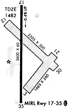
| Runway 12/30 | 2040 ft x 60 ft (622 m x 18 m) | |
| Runway Length Source: | 3RD PARTY SURVEY as of 09/03/2021 | |
| Surface: | Turf - Good condition - No special surface treatment | |
Runway 12 |
Runway 30 |
|
Elevation: |
1470.8 | 1456.3 |
Latitude: |
39-33-07.2824N | 39-32-53.6963N |
Longitude: |
097-39-16.3508W | 097-38-57.1074W |
|
Runway True Alignment: |
132 | 312 |
Glide Path Angle: |
0.0 degrees | 0.0 degrees |
Traffic Pattern: |
Left | Left |
Runway Markings Type: |
None | None |
Object at End: |
PLINE | |
Object Height: |
17 | |
Object Marked/Lighted?: |
Marked | |
Distance from End: |
534 | |
Object Centerline Offset: |
0 ft. left and right of centerline |
| Runway 18/36 | 4000 ft x 75 ft (1219 m x 23 m) | |
| Runway Length Source: | 3RD PARTY SURVEY as of 08/03/2019 | |
| Surface: | Turf - Good condition - No special surface treatment | |
| Runway Pavement Class: | 5 /F/C/Y/U | |
| Runway Edge Lights: | Medium Intensity | |
Runway Weight Bearing Capacity (in thousands of pounds) |
||
| Single Wheel Landing Gear: | 8.0 | |
| Dual Wheel Landing Gear: | 10.0 | |
Runway 18 |
Runway 36 |
|
Elevation: |
1475.6 | 1488.1 |
Latitude: |
39-33-18.7952N | 39-32-39.2669N |
Longitude: |
097-39-07.8194W | 097-39-07.5033W |
|
Runway True Alignment: |
180 | 360 |
Glide Path Angle: |
3.0 degrees | 3.0 degrees |
Traffic Pattern: |
Left | Left |
Runway Markings Type: |
Nonprecision Instrument | Nonprecision Instrument |
Runway Markings Condition: |
Good | Good |
Object at End: |
TREE | |
Object Height: |
69 | |
Distance from End: |
2010 | |
Object Centerline Offset: |
0 ft. left and right of centerline | |
Visual Glide Slope Indicators: |
4-Light PAPI On Left Side Of Runway | 4-Light PAPI On Left Side Of Runway |
REIL: |
Yes | Yes |
Threshold Crossing Height: |
35 | 40 |
Services
Airframe Repair: |
Major |
Powerplant Repair: |
Major |
Bottled Oxygen: |
None |
Bulk Oxygen: |
None |
Fuel Available: |
100LL, Jet A |
Landing Fees: |
No |
Parking: |
Hangars and tiedowns available |
Other Services: |
Parachute rental |
Maps & Diagrams
CNK Sectional
Flight Planning
at skyvector.com
at skyvector.com