Location
Latitude: |
34-20-49.2634N (34.347018) |
Longitude: |
119-03-41.8198W (-119.061616) |
Elevation: |
250.0 feet MSL (76 m MSL) |
Magnetic Variation: |
11.7 E (as of April 2024 from WMM2020 model) |
Time Zone: |
UTC -8.0 (Standard Time) UTC -7.0 (Daylight Savings Time) |
From City: |
01 N.M. SE of Santa Paula, California |
Found On: |
Los Angeles Chart |
FAA Region: |
AWP |
Contacts
Manager: |
Privately owned: |
| ROWENA MASON 28 WRIGHT TAXI SANTA PAULA, CA 93060 805-933-1155 |
SANTA PAULA ARPT ASSOCIATION 800 E SANTA MARIA STREET SANTA PAULA, CA 93060 805-933-1155 |
Operations
Airport Status: |
Operational |
Facility Use: |
Public |
Type: |
Airport |
Activation Date: |
04/1940 |
Control tower: |
No |
Attendance (Months/Days/Hours): |
Months/Days/Hours ALL/ALL/0800-1700 |
Boundary ARTCC: |
ZLA (Los Angeles) |
Responsible ARTCC: |
ZLA (Los Angeles) |
Segmented Circle Indicator: |
Yes |
Traffic Pattern Altitude (MSL): |
850 feet (259 m) |
NOTAMs Facility: |
HHR |
NOTAM-D Service: |
Yes |
International Airport of Entry: |
No |
Customs Landing Rights: |
No |
Military Landing Rights: |
No |
Civil/Military Joint Use: |
No |
Based Aircraft
| Single Engine: | 295 |
| Multi Engine: | 6 |
| GA Helicopters: | 4 |
| Gliders: | 2 |
| Ultralights: | 2 |
Annual Operations (as of 11/06/2023)
| Total Operations: | 97000 | |
| GA Local: | 72750 | 75.0% |
| GA Itinerant: | 24250 | 25.0% |
Communications
| CTAF: | 122.900 |
Fixed Based Operators (FBOs) & Fuel
(Click on a business for detail)
Please help us keep this information up to date. This is a FREE SERVICE just like everything else on Airport Guide! If you see that a business needs to be added, modified, or deleted please fill out our Update Form.
To add, modify, or delete a business click here.
Please help us keep this information up to date. This is a FREE SERVICE just like everything else on Airport Guide! If you see that a business needs to be added, modified, or deleted please fill out our Update Form.
Area Code: 805 |
| Business Name | Frequency | Phone | Fuel Grade |
|---|---|---|---|
| Aerobatic Safety Unlimited
Update FBO info |
525-0111 | ||
| Airport Management
Update FBO info |
933-1155 | 80, 100LL | |
| C P Aviation, Inc.
Update FBO info |
525-2138 | ||
| Day's Aircraft Supplies
Update FBO info |
525-6026 | ||
| Krybus Aviation
Update FBO info |
525-8764 | ||
| Marple Aviation
Update FBO info |
525-9711 | ||
| Mars Mobile Aircraft Repair Service
Update FBO info |
933-3994 | ||
| Ray's Aviation
Update FBO info |
525-4352 | ||
| Santa Paula Aircraft Painting
Update FBO info |
525-4521 | ||
| Santa Paula Flight Center
Update FBO info |
525-3561 | ||
| Santa Paula Sky Services
Update FBO info |
525-1810 | ||
| Screaming Eagle Aviation
Update FBO info |
525-7121 |
Flight Service Stations
| Primary | Alternate | |
| FSS on Field: | N | |
| FSS Name (ID): | Hawthorne(HHR) | |
| Frequency: | ||
| Toll Free Phone: | 1-800-WX-BRIEF |
Instrument Procedures / Charts
Terminal Procedures are only available for airports in several countries with more being added all the time. If you are looking for a specific country's charts, please send an email to support(at)airportguide.com stating the country name. This will be used to prioritize the implementation.
Navigation Aids (Navaids) near SZP
| Dist (NM) | ID | Morse Code | Name | Type | Freq | True Hdg | Mag Hdg |
|---|---|---|---|---|---|---|---|
| 8.2 | CMA | _ . _ . _ _ . _ | Camarillo | VOR-DME | 115.80 | 191 | 179 |
| 9.0 | FIM | . . _ . . . _ _ | Fillmore | VORTAC | 112.50 | 86 | 74 |
| 13.8 | NTD | _ . _ _ . . | Point Mugu | TACAN | 110.60 | 192 | 180 |
| 13.9 | VTU | . . . _ _ . . _ | Ventura | VOR-DME | 108.20 | 177 | 165 |
| 29.1 | GMN | _ _ . _ _ _ . | Gorman | VORTAC | 116.10 | 19 | 7 |
| 29.2 | VNY | . . . _ _ . _ . _ _ | Van Nuys | VOR-DME | 113.10 | 104 | 92 |
| 31.3 | LHS | . _ . . . . . . . . . | Lake Hughes | VORTAC | 114.35 | 49 | 37 |
| 32.6 | PAI | . _ _ . . _ . . | Pacoima | NDB | 370 | 99 | 87 |
| 35.1 | UR | . . _ . _ . | Vinee | NDB | 253 | 104 | 92 |
| 36.2 | SMO | . . . _ _ _ _ _ | Santa Monica | VOR-DME | 110.80 | 123 | 111 |
| 36.4 | RZS | . _ . _ _ . . . . . | San Marcus | VORTAC | 114.90 | 285 | 273 |
| 39.9 | LAX | . _ . . . _ _ . . _ | Los Angeles | VORTAC | 113.60 | 128 | 116 |
| 48.9 | CPM | _ . _ . . _ _ . _ _ | Compton | NDB | 378 | 123 | 111 |
| 51.0 | LAX | . _ . . . _ _ . . _ | San Pedro Hill | VOT | 113.90 | 134 | 122 |
| 52.1 | GVO | _ _ . . . . _ _ _ _ | Gaviota | VORTAC | 113.80 | 282 | 270 |
| 52.2 | PMD | . _ _ . _ _ _ . . | Palmdale | VORTAC | 114.50 | 70 | 58 |
| 53.4 | EMT | . _ _ _ | El Monte | NDB | 359 | 106 | 94 |
| 59.8 | FLW | . . _ . . _ . . . _ _ | Fellows | VOR-DME | 117.50 | 318 | 306 |
| 60.4 | SLI | . . . . _ . . . . | Seal Beach | VORTAC | 115.70 | 123 | 111 |
| 60.4 | LG | . _ . . _ _ . | Becca | NDB | 233 | 125 | 113 |
Nearby Airports with Fuel
Notices to Airmen (NOTAMS)
Remarks
| A110-10 | ULTRALIGHTS; BANNER TOWING; GLIDERS; RC MODELS OPER IN THE VICINITY. |
| A110-11 | DAILY AEROBATIC ACTIVITY 3-18 MILES EAST UP TO 5,255 FT AGL, MONITOR ON 122.775. |
| A110-12 | BE ALERT TO WIRES CROSSING OVER RIVER BED ADJACENT TO RY 04/22. LOCATIONS: 1.5 MILES & 3.5 MILES SW APCH END RY 04. ALSO, 1,500 FT AND 2.5 MILES NE APCH END RY 22. |
| A110-13 | HEL MUST USE DSGND HELI LCTD MID-FIELD ON THE SOUTH SIDE. ALL APCHS/DEPS ARE FROM THE SOUTH |
| A110-14 | TSNT HEL RSRTD TO THE HELI. HOVER TAXI NOT AUTH. |
| A110-15 | 2200 FT MT 1 NM S OF ARPT; FOR NOISE ABATEMENT MNTN 1500 FT UPWIND OVR CITY. |
| A110-16 | NO OHD APCHS; NO 45 DEG ENTRIES; NO CROSSWIND ENTRIES OVR RWY. |
| A110-17 | STAS NOT RCMDD. |
| A110-18 | ENTER PAT FM EXTDD DOWNWIND LEG OR ENTER FM A CROSSWIND LEG AT LEAST 1 MI BYD THE DEP END OF ACTIVE RWY. |
| A110-19 | FOR CD CTC LOS ANGELES ARTCC AT 661-575-2079. |
| A110-3 | NIGHT OPNS PROHIBITED. |
| A110-7 | +4 FT SIGN IN PRMARY SFC AT NE END OF ARPT. |
| A14 | SZPAIRPORT@GMAIL.COM |
| A57-22 | RWY 22 APCH RATIO 20:1 TO DSPLCD THLD TREES & WIRES; APCH RATIO TO DSPLCD THLD 14:1 OVER +16 FT BLDG 220 FT FROM DSPLCD THLD 135 FT RIGHT. |
| A70-FUEL-10 | 0LL 24 HR SELF-FUELING AVBL WITH ALL MAJOR CREDIT CARDS. |
| E111 | ESTBD BEFORE 5/15/59. |
Runways
Runway Summary
| Runways: | 04/22 H1 |
| Longest Runway: | 04/22 is 2665 ft (812 m) long |
| Runways with an Instrument Approach: |
SZP Airport Runway Details
| Runway 04/22 | 2665 ft x 60 ft (812 m x 18 m) | |
| Runway Length Source: | ARPTS CONTRACTOR as of 12/17/2018 | |
| Surface: | Asphalt - Good condition - No special surface treatment | |
Runway 04 |
Runway 22 |
|
Elevation: |
243.0 | 250.0 |
Latitude: |
34-20-42.1610N | 34-20-56.3640N |
Longitude: |
119-03-55.2118W | 119-03-28.4300W |
Glide Path Angle: |
0.0 degrees | 0.0 degrees |
Traffic Pattern: |
Right | Left |
Runway Markings Type: |
Basic | Basic |
Runway Markings Condition: |
Good | Good |
Object at End: |
BLDG | TREES |
Object Height: |
16 | 16 |
Distance from End: |
350 | 200 |
Object Centerline Offset: |
95 ft. left of centerline | 125 ft. right of centerline |
REIL: |
No | No |
Touchdown Lights: |
No | No |
Centerline Lights: |
No | No |
Threshold Elevation: |
243.4 | 249.4 |
Displaced Threshold: |
148 | 225 |
Threshold Latitude: |
34-20-42.9497N | 34-20-55.1678N |
Threshold Longitude: |
119-03-53.7248W | 119-03-30.6859W |
| Helipad H1 | 60 ft x 60 ft (18 m x 18 m) | |
| Surface: | Asphalt - Good condition - No special surface treatment | |
Helipad H1 |
||
Glide Path Angle: |
0.0 degrees | 0.0 degrees |
Runway Markings Type: |
Basic | |
Runway Markings Condition: |
Good | |
Object Centerline Offset: |
95 ft. left of centerline | 125 ft. right of centerline |
Services
Airframe Repair: |
Major |
Powerplant Repair: |
Major |
Fuel Available: |
100LL, Jet A |
Landing Fees: |
No |
Parking: |
Tiedowns available |
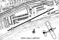
Maps & Diagrams
SZP Sectional
Flight Planning
at skyvector.com
at skyvector.com