
Location
Latitude: |
21-58-33.5400N (21.975983) |
Longitude: |
159-20-20.2480W (-159.338958) |
Elevation: |
152.4 feet MSL (46 m MSL) |
Magnetic Variation: |
9.5 E (as of April 2024 from WMM2020 model) |
Time Zone: |
UTC -10.0 (Standard Time) UTC -10.0 (Daylight Savings Time) |
From City: |
02 N.M. E of Lihue, Hawaii |
Found On: |
Hawaiian Islands Chart |
FAA Region: |
AWP |
Contacts
Manager: |
Publicly owned: |
| CRAIG H. DAVIS 3901 MOKULELE LP BOX 6 LIHUE, HI 96766 808-274-3800 |
HAWAII ST ARPTS DIV HONOLULU INTL ARPT HONOLULU, HI 96819 808-838-8600 |
Operations
Airport Status: |
Operational |
Facility Use: |
Public |
Type: |
Airport |
Activation Date: |
03/1950 |
Control tower: |
Yes |
Attendance (Months/Days/Hours): |
Months/Days/Hours ALL/ALL/0600-2200 |
Boundary ARTCC: |
ZHN (Honolulu Control Facility) |
Responsible ARTCC: |
ZHN (Honolulu Control Facility) |
Lighting Schedule: |
SEE RMK |
Segmented Circle Indicator: |
Yes |
Traffic Pattern Altitude (MSL): |
1152 feet (351 m) |
NOTAMs Facility: |
LIH |
NOTAM-D Service: |
Yes |
International Airport of Entry: |
No |
Customs Landing Rights: |
Yes |
Military Landing Rights: |
Yes |
Civil/Military Joint Use: |
No |
Aircraft Rescue and Firefighting: |
Class I ARFF Index: C Air Carrier Service: Scheduled Certification Date: 05/1973 |
Based Aircraft
| Single Engine: | 19 |
| Multi Engine: | 5 |
| GA Helicopters: | 22 |
Annual Operations (as of 09/05/2023)
| Total Operations: | 127071 | |
| Commercial: | 32625 | 25.7% |
| Air Taxi: | 74280 | 58.5% |
| GA Local: | 15101 | 11.9% |
| GA Itinerant: | 4086 | 3.2% |
| Military Aircraft: | 979 | 0.8% |
Communications
| CTAF: | 118.900 |
| Tower: | LIHUE 118.9 263.1 Hrs: 0600-2200 |
| Ground: | 121.9 |
| Approach: | HCF CENTER 134.0 ;CTC HCF WHEN LIH TWR CLSD AND UNABLE |
| Departure: | HCF CENTER 134.0 ;CTC HCF WHEN LIH TWR CLSD AND UNABLE |
| ATIS: | 127.2 Hrs: 24 |
| ASOS: | 127.2 (808-246-3707) |
| EMERG: | 121.5 |
| HEL OPS: | 128.4 |
| EMERG: | 243.0 |
- APCH/DEP CTL SVC/ CD PRVDD BY HONOLULU CONTROL FACILITY ON FREQS 126.5/269.4 (MOUNT KAALA RCAG) WHEN LIHUE TWR (LIH) CLOSED. IF UNABLE ON 126.5/269.4, THEN CTC HCF ON 134.0 (MOUNT KAALA RCAG). ALL OTHER TIMES HCF PROVIDES APCH/DEP CTL SVC ON 126.5/269.4.
Fixed Based Operators (FBOs) & Fuel
(Click on a business for detail)
Please help us keep this information up to date. This is a FREE SERVICE just like everything else on Airport Guide! If you see that a business needs to be added, modified, or deleted please fill out our Update Form.
To add, modify, or delete a business click here.
Please help us keep this information up to date. This is a FREE SERVICE just like everything else on Airport Guide! If you see that a business needs to be added, modified, or deleted please fill out our Update Form.
Area Code: 808 |
| Business Name | Frequency | Phone | Fuel Grade |
|---|---|---|---|
| Bradley Pacific Aviation
Update FBO info |
Arinc 130.8 | 839-2222, 877-500-0005 | Jet A |
| Century Aviation
Update FBO info |
Unicom 122.95 | 246-9074 | Jet A |
| Kumulani Aviation
Update FBO info |
246-9123 | 100 | |
| Signature Flight Support
Update FBO info |
Unicom: 130.8, Arinc: 130.8 | +1 808 245 7440 |
Flight Service Stations
| Primary | Alternate | |
| FSS on Field: | N | |
| FSS Name (ID): | Honolulu(HNL) | |
| Frequency: | ||
| Toll Free Phone: | 1-800-WX-BRIEF |
Instrument Procedures / Charts
FAA Terminal Procedures valid from 0901Z 03/21/24 to 0901Z 04/18/24.
There are various types of charts available for an airport. They are listed in the Page Type column. Here is a legend for those types:
APD - Airport Diagram
DP - Departure Procedure Charts
HOT - Hot Spots
IAP - Instrument Approach Procedure Charts
MIN - Minimums
STAR - Standard Terminal Arrival Charts
| Page Type | Page Name | Volume | Action Since Last Cycle |
|---|---|---|---|
| APD | AIRPORT DIAGRAM | PC-1 | |
| DP | LIHUE SIX | PC-1 | |
| DP | RICHE THREE | PC-1 | |
| IAP | ILS OR LOC RWY 35 | PC-1 | |
| IAP | RNAV (GPS) RWY 17 | PC-1 | |
| IAP | RNAV (GPS) Y RWY 21 | PC-1 | |
| IAP | RNAV (GPS) Y RWY 35 | PC-1 | |
| IAP | RNAV (RNP) Z RWY 21 | PC-1 | |
| IAP | RNAV (RNP) Z RWY 35 | PC-1 | |
| IAP | VOR OR TACAN RWY 21 | PC-1 | |
| IAP | VOR OR TACAN RWY 35 | PC-1 | |
| MIN | ALTERNATE MINIMUMS | PC-1 | |
| MIN | DIVERSE VECTOR AREA | PC-1 | |
| MIN | TAKEOFF MINIMUMS | PC-1 | |
| ODP | KAUAI ONE (OBSTACLE) | PC-1 | |
| ODP | KAUAI ONE (OBSTACLE)[DELIMITER] CONT.1 | PC-1 |
Terminal Procedures are only available for airports in several countries with more being added all the time. If you are looking for a specific country's charts, please send an email to support(at)airportguide.com stating the country name. This will be used to prioritize the implementation.
Navigation Aids (Navaids) near LIH
| Dist (NM) | ID | Morse Code | Name | Type | Freq | True Hdg | Mag Hdg |
|---|---|---|---|---|---|---|---|
| 0.6 | LIH | . _ . . . . . . . . | Lihue | VORTAC | 113.50 | 175 | 166 |
| 11.5 | SOK | . . . _ _ _ _ . _ | South Kauai | VORTAC | 115.40 | 246 | 237 |
| 25.1 | NBS | _ . _ . . . . . . | Barking Sands Pmrf | TACAN | 112.60 | 278 | 269 |
| 78.6 | HHI | . . . . . . . . . . | Wheeler | NDB | 373 | 112 | 103 |
| 81.9 | HN | . . . . _ . | Ewabe | NDB | 242 | 118 | 109 |
| 87.9 | HNL | . . . . _ . . _ . . | Honolulu | VOT | 111.00 | 116 | 107 |
| 88.2 | HNL | . . . . _ . . _ . . | Honolulu | VORTAC | 114.80 | 116 | 107 |
| 93.5 | NGF | _ . _ _ . . . _ . | Kaneohe Bay | TACAN | 114.60 | 109 | 100 |
Nearby Airports with Fuel
| Dist (NM) | Name (Airport IDs) | True Hdg | Mag Hdg | Fuel Grade |
|---|---|---|---|---|
| 67.9 | Kawaihapai Airfield Airport (HDH PHDH HDH) |
110 | 101 | 100, Jet A |
| 88.4 | Daniel K Inouye International Airport (HNL PHNL HNL) |
116 | 107 | 100, Jet A, Jet A-1+ |
Notices to Airmen (NOTAMS)
Remarks
| A10 | DIST. MGR; STATE OF HAWAII DEPT. OF TRANSPORTATION AIRPORTS DIV. |
| A110-1 | STADIUM FLOOD LIGHTS 125 FT AGL/282 FT MSL/ 2400 FT SW FROM RWY 03 THR. |
| A110-14 | RWY 17/35 WGT LMT DC10-10 340000 LBS; DC10-30 430000 LBS. |
| A110-17 | 405 FT OF RWY 17/35 500 FT SOUTH OF TWY D & RWY 17/35 INT NOT VSB FM ATCT. |
| A110-18 | HELICOPTER PADS 1-20 LCTD W OF CONTROL TOWER. |
| A110-20 | MISC 2 OF 3: ACFT NEEDING ENG RUNUPS FOR OTR THAN NML START-UP AND TAXI OUT ARE RQRD TO COORD THESE RUNUPS WITH OPS AT 808-651-6255. NML RUNUP AREA IS ON TWY ALPHA NORTH OF TWY B AND ALPHA INT. ACFT ORIENTATION IS DEPENDENT ON WIND AND TWR APVL. |
| A110-21 | MISC 3 OF 3: POWER SETTING WILL NOT CAUSE DAMAGE TO LIGHTS AND SIGNS, IF RUN MAY CAUSE DAMAGE AN ALTERNATE LOCATION WILL BE SELECTED. |
| A110-22 | MISC 1 OF 3: PPR FOR PARKING ALL TRANSIENT ACFT, CALL ARPT OPS CONTROL (808)651-6255; FAX (808) 241-3939 BTN 1700Z 0230Z, OTHER TIMES (808) 274-3814. MILITARY/CIVILIAN ACFT CARRYING MUNITIONS/HAZMAT MUST COORDINATE ITINERARY NLT 24 HRS PRIOR TO ARRIVAL. |
| A110-23 | EXTENSIVE LARGE AND SMALL BIRD ACTIVITY INVOF RYS INCLUDING THE NENE GOOSE. |
| A110-24 | FOR CD WHEN ATCT IS CLSD CTC HONOLULU CONTROL FACILITY AT 808-840-6262. |
| A110-5 | INTXN DEPS FM TWY D ON RY 17/35 NOT AUTHORIZED. |
| A110-6 | PPR FOR TRANSPORTATION OF DIV 1.1, 1.2, 1.3, 1.4 EXPLOSIVES AND HAZMAT IN AND OUT OF ARPT. CALL ARPT OPS AT 808-651-6255. |
| A110-7 | MILITARY ACFT MAKE FUEL ARRANGEMENTS BEFORE ARRIVAL. |
| A110-8 | DUE TO NONVISIBILITY ATCT UNABLE TO PROVIDE ATC SVC BTN ACFT AND/OR VEHICLES ON TWY B FM 220 FT TO 500 FT S OF TWY D. |
| A26 | |
| A31-17/35 | DIST RMNG SIGNS LEFT SIDE OF RWY 35. |
| A43-03 | UNUSBL BYD 1.5 NM AND 7 DEGS LEFT OF CNTRLN AND OFFSET 9.5 DEG E OF CNTRLN DUE TO RAPIDLY RISING TRRN. |
| A43-17 | UNUSBL BYD 5 DEGS RIGHT OF CNTRLN. |
| A70-FUEL-10 | 0 100 OCTANE FUEL AVBL 0900-1700. FOR JET A FUEL CALL 1-800-776-2138 OR 1-800-821-3122. |
| A72 | HELI MAJOR. |
| A81-APT | WHEN ATCT CLSD ACTVT MALSR RWY 35; REIL RWYS 03, 17, & 21; PAPI RWYS 03, 17, 21, & 35; MIRL RWY 03/21; HIRL RWY 17/35; TWY LGTS - CTAF. |
| E147 | TPA SINGLE ENGINE 1000 (851) MULTI ENGINE 1500 (1351). |
Runways
Runway Summary
| Runways: | 03/21 17/35 H1 H2 H3 |
| Longest Runway: | 03/21 is 6500 ft (1981 m) long |
| Runways with an Instrument Approach: | 35 |
LIH Airport Runway Details
| Runway 03/21 | 6500 ft x 150 ft (1981 m x 46 m) | |
| Runway Length Source: | 3RD PARTY SURVEY as of 08/16/2019 | |
| Surface: | Asphalt - Good condition - Saw-cut or plastic grooved | |
| Runway Pavement Class: | 75 /F/A/W/T | |
| Runway Edge Lights: | Medium Intensity | |
Runway Weight Bearing Capacity (in thousands of pounds) |
||
| Single Wheel Landing Gear: | 75.0 | |
| Dual Wheel Landing Gear: | 200.0 | |
| Dual Tandem Wheel Landing Gear: | 350.0 | |
| Dual Dual Tandem Wheel Landing Gear: | 730.0 | |
Runway 03 |
Runway 21 |
|
Elevation: |
152.3 | 80.2 |
Latitude: |
21-58-22.4563N | 21-59-07.9978N |
Longitude: |
159-20-55.7445W | 159-20-06.9063W |
|
Runway True Alignment: |
045 | 225 |
Glide Path Angle: |
3.0 degrees | 3.0 degrees |
Traffic Pattern: |
Right | Left |
Runway Markings Type: |
Nonprecision Instrument | Nonprecision Instrument |
Runway Markings Condition: |
Good | Good |
Object at End: |
TREE | |
Object Height: |
4 | |
Distance from End: |
200 | |
Object Centerline Offset: |
100 ft. right of centerline | |
Visual Glide Slope Indicators: |
4-Light PAPI On Left Side Of Runway | 4-Light PAPI On Left Side Of Runway |
REIL: |
Yes | Yes |
Touchdown Lights: |
No | No |
Centerline Lights: |
No | No |
Threshold Crossing Height: |
46 | 45 |
Threshold Elevation: |
83.1 | |
Displaced Threshold: |
205 | |
Threshold Latitude: |
21-59-06.5600N | |
Threshold Longitude: |
159-20-08.4472W | |
Declared Distances |
||
Take Off Run Avbl. (TORA): |
6500 | 6500 |
Take Off Distance Avbl. (TODA): |
6500 | 6500 |
Actual Stop Dist. Avbl. (ASDA): |
6500 | 6500 |
Landing Dist. Avbl. (LDA): |
6500 | 6295 |
| Runway 17/35 | 6500 ft x 150 ft (1981 m x 46 m) | |
| Runway Length Source: | 3RD PARTY SURVEY as of 08/16/2019 | |
| Surface: | Asphalt - Good condition - Saw-cut or plastic grooved | |
| Runway Pavement Class: | 75 /F/A/W/T | |
| Runway Edge Lights: | High Intensity | |
Runway Weight Bearing Capacity (in thousands of pounds) |
||
| Single Wheel Landing Gear: | 75.0 | |
| Dual Wheel Landing Gear: | 175.0 | |
| Dual Tandem Wheel Landing Gear: | 250.0 | |
| Dual Dual Tandem Wheel Landing Gear: | 630.0 | |
Runway 17 |
Runway 35 |
|
Elevation: |
91.2 | 91.3 |
Latitude: |
21-58-54.0604N | 21-57-49.6443N |
Longitude: |
159-20-09.1637W | 159-20-09.1770W |
|
Runway True Alignment: |
180 | 000 |
ILS Type: |
ILS/DME | |
Glide Path Angle: |
3.0 degrees | 3.0 degrees |
Traffic Pattern: |
Right | |
Runway Markings Type: |
Precision Instrument | Precision Instrument |
Runway Markings Condition: |
Good | Good |
Object Centerline Offset: |
100 ft. right of centerline | |
Visual Glide Slope Indicators: |
4-Light PAPI On Left Side Of Runway | 4-Light PAPI On Left Side Of Runway |
Approach Light System: |
1,400 Foot Medium Intensity Approach Lighting System With Runway Alignment Indicator Lights | |
REIL: |
Yes | |
Threshold Crossing Height: |
54 | 55 |
Declared Distances |
||
Take Off Run Avbl. (TORA): |
6500 | 6500 |
Take Off Distance Avbl. (TODA): |
6500 | 6500 |
Actual Stop Dist. Avbl. (ASDA): |
6500 | 6500 |
Landing Dist. Avbl. (LDA): |
6500 | 6500 |
| Helipad H1 | 40 ft x 40 ft (12 m x 12 m) | |
| Runway Length Source: | STATE as of 04/11/2014 | |
| Surface: | Asphalt - Good condition - No special surface treatment | |
Helipad H1 |
||
Elevation: |
144.1 | |
Latitude: |
21-58-56.0000N | |
Longitude: |
159-20-48.5000W | |
Glide Path Angle: |
0.0 degrees | 0.0 degrees |
Object Centerline Offset: |
100 ft. right of centerline | |
REIL: |
No | |
Touchdown Lights: |
No | |
Centerline Lights: |
No |
| Helipad H2 | 40 ft x 40 ft (12 m x 12 m) | |
| Runway Length Source: | STATE as of 04/11/2014 | |
| Surface: | Asphalt - Good condition - No special surface treatment | |
Helipad H2 |
||
Elevation: |
133.7 | |
Latitude: |
21-58-59.5000N | |
Longitude: |
159-20-44.9000W | |
Glide Path Angle: |
0.0 degrees | 0.0 degrees |
Object Centerline Offset: |
100 ft. right of centerline |
| Helipad H3 | 40 ft x 40 ft (12 m x 12 m) | |
| Runway Length Source: | STATE as of 04/11/2014 | |
| Surface: | Asphalt - Good condition - No special surface treatment | |
Helipad H3 |
||
Elevation: |
125.6 | |
Latitude: |
21-59-02.3000N | |
Longitude: |
159-20-41.8000W | |
Glide Path Angle: |
0.0 degrees | 0.0 degrees |
Object Centerline Offset: |
100 ft. right of centerline |
Services
Airframe Repair: |
Major |
Powerplant Repair: |
Major |
Bottled Oxygen: |
High Pressure / Low Pressure |
Bulk Oxygen: |
High Pressure / Low Pressure |
Fuel Available: |
100, Jet A, Jet A-1+ |
Landing Fees: |
No |
Parking: |
Tiedowns available |
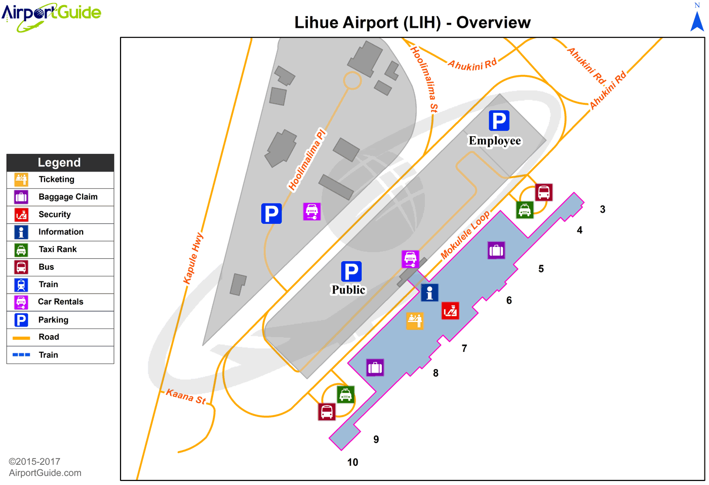
Maps & Diagrams
LIH Sectional
Flight Planning
at skyvector.com
at skyvector.com
 Diagram")