Location
Latitude: |
34-51-38.5160N (34.860699) |
Longitude: |
102-19-33.1797W (-102.325883) |
Elevation: |
3787.6 feet MSL (1154 m MSL) |
Magnetic Variation: |
5.9 E (as of April 2024 from WMM2020 model) |
Time Zone: |
UTC -6.0 (Standard Time) UTC -5.0 (Daylight Savings Time) |
From City: |
04 N.M. NE of Hereford, Texas |
Found On: |
Albuquerque Chart |
FAA Region: |
ASW |
Contacts
Manager: |
Publicly owned: |
| CAYDEN FINCH 4175 US HWY 60 HEREFORD, TX 79045 806-344-7710 |
CITY OF HEREFORD BOX 2277 HEREFORD, TX 79045 806-363-7100 |
Operations
Airport Status: |
Operational |
Facility Use: |
Public |
Type: |
Airport |
Activation Date: |
08/1958 |
Control tower: |
No |
Attendance (Months/Days/Hours): |
Months/Days/Hours ALL/ALL/0800-1700 |
Boundary ARTCC: |
ZAB (Albuquerque) |
Responsible ARTCC: |
ZAB (Albuquerque) |
Lighting Schedule: |
SEE RMK |
Segmented Circle Indicator: |
Yes |
Traffic Pattern Altitude (MSL): |
4788 feet (1459 m) |
NOTAMs Facility: |
FTW |
NOTAM-D Service: |
Yes |
International Airport of Entry: |
No |
Customs Landing Rights: |
No |
Military Landing Rights: |
Yes |
Civil/Military Joint Use: |
No |
Based Aircraft
| Single Engine: | 25 |
| Multi Engine: | 1 |
Annual Operations (as of 01/10/2018)
| Total Operations: | 7915 | |
| Air Taxi: | 15 | 0.2% |
| GA Local: | 5200 | 65.7% |
| GA Itinerant: | 2600 | 32.8% |
| Military Aircraft: | 100 | 1.3% |
Communications
| CTAF: | 122.800 |
| Unicom: | 122.800 |
| Approach: | AMARILLO 119.5 119.5 119.5 119.5 ALBUQUERQUE ARTCC |
| Departure: | AMARILLO 119.5 119.5 119.5 119.5 ALBUQUERQUE ARTCC |
| AWOS-3: | 118.05 (806-258-7283) |
- APCH/DEP SVC PRVDD BY ALBUQUERQUE ARTCC (ZAB) ON FREQS 127.85/285.475 (AMARILLO RCAG) WHEN AMARILLO APCH CTL (AMA) CLSD.
Fixed Based Operators (FBOs) & Fuel
(Click on a business for detail)
Please help us keep this information up to date. This is a FREE SERVICE just like everything else on Airport Guide! If you see that a business needs to be added, modified, or deleted please fill out our Update Form.
To add, modify, or delete a business click here.
Please help us keep this information up to date. This is a FREE SERVICE just like everything else on Airport Guide! If you see that a business needs to be added, modified, or deleted please fill out our Update Form.
Area Code: 806 |
| Business Name | Frequency | Phone | Fuel Grade |
|---|---|---|---|
| City of Hereford
Update FBO info |
122.8 | (806) 258-7289 | 100LL, Jet A |

|
Phillips | 100LL - 2.14 USD per gallon on 4/15/02 |
Pumps Requiring Line Service |
|
|
Phillips | Jet A - 2.10 USD per gallon on 4/15/02 |
Pumps Requiring Line Service |
| Hereford Aviation
Update FBO info |
Unicom 122.8 | 258-7281 | 100LL, Jet A |
Flight Service Stations
| Primary | Alternate | |
| FSS on Field: | N | |
| FSS Name (ID): | Fort Worth(FTW) | |
| Frequency: | ||
| Toll Free Phone: | 1-800-WX-BRIEF |
Instrument Procedures / Charts
FAA Terminal Procedures valid from 0901Z 03/21/24 to 0901Z 04/18/24.
There are various types of charts available for an airport. They are listed in the Page Type column. Here is a legend for those types:
APD - Airport Diagram
DP - Departure Procedure Charts
HOT - Hot Spots
IAP - Instrument Approach Procedure Charts
MIN - Minimums
STAR - Standard Terminal Arrival Charts
| Page Type | Page Name | Volume | Action Since Last Cycle |
|---|---|---|---|
| IAP | RNAV (GPS) RWY 02 | SC-2 | |
| IAP | RNAV (GPS) RWY 20 | SC-2 | |
| MIN | ALTERNATE MINIMUMS | SC-2 | |
| MIN | TAKEOFF MINIMUMS | SC-2 |
Terminal Procedures are only available for airports in several countries with more being added all the time. If you are looking for a specific country's charts, please send an email to support(at)airportguide.com stating the country name. This will be used to prioritize the implementation.
Navigation Aids (Navaids) near KHRX
| Dist (NM) | ID | Morse Code | Name | Type | Freq | True Hdg | Mag Hdg |
|---|---|---|---|---|---|---|---|
| 0.2 | HRX | . . . . . _ . _ . . _ | Hereford | NDB | 341 | 161 | 155 |
| 30.8 | AM | . _ _ _ | Pande | NDB | 251 | 56 | 50 |
| 33.5 | TXO | _ _ . . _ _ _ _ | Texico | VORTAC | 112.20 | 229 | 223 |
| 38.1 | PNH | . _ _ . _ . . . . . | Panhandle | VORTAC | 116.60 | 53 | 47 |
| 51.9 | CV | _ . _ . . . . _ | Hisan | NDB | 335 | 234 | 228 |
| 53.5 | PVW | . _ _ . . . . _ . _ _ | Plainview | VOR-DME | 112.90 | 150 | 144 |
| 56.6 | LIU | . _ . . . . . . _ | Littlefield | NDB | 212 | 183 | 177 |
| 57.0 | CVS | _ . _ . . . . _ . . . | Cannon | TACAN | 111.60 | 239 | 233 |
| 65.4 | TCC | _ _ . _ . _ . _ . | Tucumcari | VORTAC | 113.60 | 287 | 281 |
| 72.3 | LBB | . _ . . _ . . . _ . . . | Lubbock | VORTAC | 109.20 | 163 | 157 |
| 73.2 | BGD | _ . . . _ _ . _ . . | Borger | TACAN | 108.60 | 38 | 32 |
| 74.6 | DHT | _ . . . . . . _ | Dalhart | VORTAC | 112.00 | 351 | 345 |
| 77.8 | LD | . _ . . _ . . | Lubbi | NDB | 272 | 157 | 151 |
| 78.3 | LLN | . _ . . . _ . . _ . | Levelland | NDB | 266 | 181 | 175 |
| 79.4 | PPA | . _ _ . . _ _ . . _ | Pampa | NDB | 368 | 55 | 49 |
| 91.7 | CZX | _ . _ . _ _ . . _ . . _ | Crosbyton | NDB | 332 | 143 | 137 |
Nearby Airports with Fuel
Notices to Airmen (NOTAMS)
Remarks
| A110-1 | FOR CD CTC ALBUQUERQUE ARTCC AT 505-856-4861. |
| A33-14/32 | RWY SFC ROUGH. |
| A42-14 | 14/32 THRS MKD WITH CONCRETE MARKERS. |
| A70-FUEL-10 | 0LL 24 HRS SELF-SERVE. |
| A81-APT | MIRL RWY 02/20 PRESET LOW INTST SS-SR. TO ACTVT MIRL 02/20 OR INCR INTST - CTAF. PAPI RWY 02 & 20 OPR CONSLY. |
Runways
Runway Summary
| Runways: | 02/20 14/32 |
| Longest Runway: | 02/20 is 6100 ft (1859 m) long |
| Runways with an Instrument Approach: |
KHRX Airport Runway Details
| Runway 02/20 | 6100 ft x 100 ft (1859 m x 30 m) | |
| Runway Length Source: | 3RD PARTY SURVEY as of 06/02/2009 | |
| Surface: | Concrete - Excellent condition - Saw-cut or plastic grooved | |
| Runway Edge Lights: | Medium Intensity | |
Runway 02 |
Runway 20 |
|
Elevation: |
3786.2 | 3786.2 |
Latitude: |
34-51-19.4565N | 34-52-12.3012N |
Longitude: |
102-19-45.5134W | 102-19-10.1830W |
|
Runway True Alignment: |
029 | 209 |
Glide Path Angle: |
3.0 degrees | 3.0 degrees |
Runway Markings Type: |
Nonprecision Instrument | Nonprecision Instrument |
Runway Markings Condition: |
Good | Good |
Object at End: |
PLINE | |
Object Height: |
45 | |
Distance from End: |
2335 | |
Object Centerline Offset: |
596 ft. left of centerline | |
Visual Glide Slope Indicators: |
4-Light PAPI On Left Side Of Runway | 4-Light PAPI On Left Side Of Runway |
Threshold Crossing Height: |
52 | 48 |
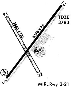
| Runway 14/32 | 3807 ft x 135 ft (1160 m x 41 m) | |
| Surface: | Concrete - Excellent condition - No special surface treatment | |
Runway 14 |
Runway 32 |
|
Elevation: |
3783.0 | 3783.0 |
Latitude: |
34-51-43.2180N | 34-51-10.2190N |
Longitude: |
102-19-52.7230W | 102-19-30.7220W |
|
Runway True Alignment: |
151 | 331 |
Glide Path Angle: |
0.0 degrees | 0.0 degrees |
Traffic Pattern: |
Left | Left |
Runway Markings Condition: |
Poor | Poor |
Object at End: |
PLINE | PLINE |
Object Height: |
50 | 50 |
Distance from End: |
1400 | 1200 |
Object Centerline Offset: |
596 ft. left of centerline |
Services
Bottled Oxygen: |
None |
Bulk Oxygen: |
None |
Fuel Available: |
100LL |
Landing Fees: |
No |
Parking: |
Tiedowns available |
Maps & Diagrams
KHRX Sectional
Flight Planning
at skyvector.com
at skyvector.com