Location
Latitude: |
30-26-27.9000N (30.441083) |
Longitude: |
093-28-25.0000W (-93.473611) |
Elevation: |
82.8 feet MSL (25 m MSL) |
Magnetic Variation: |
0.7 E (as of April 2024 from WMM2020 model) |
Time Zone: |
UTC -6.0 (Standard Time) UTC -5.0 (Daylight Savings Time) |
From City: |
02 N.M. SW of De Quincy, Louisiana |
Found On: |
Houston Chart |
FAA Region: |
ASW |
Contacts
Manager: |
Publicly owned: |
| KYLE RAINWATER PO BOX 968 DE QUINCY, LA 70633 337-660-3488 |
CITY OF DE QUINCY PO BOX 968 DE QUINCY, LA 70633 337-786-8211 |
Operations
Airport Status: |
Operational |
Facility Use: |
Public |
Type: |
Airport |
Control tower: |
No |
Attendance (Months/Days/Hours): |
Months/Days/Hours ALL/MON-THURS/0700-1600 |
Boundary ARTCC: |
ZHU (Houston) |
Responsible ARTCC: |
ZHU (Houston) |
Lighting Schedule: |
SEE RMK |
Segmented Circle Indicator: |
Yes |
Traffic Pattern Altitude (MSL): |
1083 feet (330 m) |
NOTAMs Facility: |
5R8 |
NOTAM-D Service: |
Yes |
International Airport of Entry: |
No |
Customs Landing Rights: |
No |
Military Landing Rights: |
Yes |
Civil/Military Joint Use: |
No |
Based Aircraft
| Single Engine: | 17 |
| Ultralights: | 1 |
Annual Operations (as of 08/16/2023)
| Total Operations: | 9600 | |
| GA Local: | 6000 | 62.5% |
| GA Itinerant: | 2600 | 27.1% |
| Military Aircraft: | 1000 | 10.4% |
Communications
| CTAF: | 122.800 |
| Unicom: | 122.800 |
| Approach: | LAKE CHARLES 119.35 119.35 HOUSTON ARTCC |
| Departure: | LAKE CHARLES 119.35 119.35 HOUSTON ARTCC |
| AWOS-3PT: | 121.2 (337-786-1518) |
- APCH/DEP SVC PRVDD BY HOUSTON ARTCC (ZHU) ON FREQS 124.7/317.4 (LAKE CHARLES RCAG) WHEN LAKE CHARLES APCH CTL (LCH) CLSD.
Fixed Based Operators (FBOs) & Fuel
(Click on a business for detail)
Please help us keep this information up to date. This is a FREE SERVICE just like everything else on Airport Guide! If you see that a business needs to be added, modified, or deleted please fill out our Update Form.
To add, modify, or delete a business click here.
Please help us keep this information up to date. This is a FREE SERVICE just like everything else on Airport Guide! If you see that a business needs to be added, modified, or deleted please fill out our Update Form.
Area Code: 318 |
| Business Name | Frequency | Phone | Fuel Grade |
|---|
Flight Service Stations
| Primary | Alternate | |
| FSS on Field: | N | |
| FSS Name (ID): | De Ridder(DRI) | |
| Frequency: | ||
| Toll Free Phone: | 1-800-WX-BRIEF |
Instrument Procedures / Charts
FAA Terminal Procedures valid from 0901Z 03/21/24 to 0901Z 04/18/24.
There are various types of charts available for an airport. They are listed in the Page Type column. Here is a legend for those types:
APD - Airport Diagram
DP - Departure Procedure Charts
HOT - Hot Spots
IAP - Instrument Approach Procedure Charts
MIN - Minimums
STAR - Standard Terminal Arrival Charts
| Page Type | Page Name | Volume | Action Since Last Cycle |
|---|---|---|---|
| IAP | RNAV (GPS) RWY 16 | SC-4 | |
| IAP | RNAV (GPS) RWY 34 | SC-4 | |
| MIN | TAKEOFF MINIMUMS | SC-4 |
Terminal Procedures are only available for airports in several countries with more being added all the time. If you are looking for a specific country's charts, please send an email to support(at)airportguide.com stating the country name. This will be used to prioritize the implementation.
Navigation Aids (Navaids) near 5R8
| Dist (NM) | ID | Morse Code | Name | Type | Freq | True Hdg | Mag Hdg |
|---|---|---|---|---|---|---|---|
| 0.5 | DQU | _ . . _ _ . _ . . _ | De Quincy | NDB | 410 | 135 | 134 |
| 14.8 | AUR | . _ . . _ . _ . | Sulphur | NDB | 278 | 169 | 168 |
| 16.5 | CW | _ . _ . . _ _ | Mossy | NDB | 418 | 119 | 118 |
| 20.0 | DXB | _ . . _ . . _ _ . . . | De Ridder | NDB | 385 | 20 | 19 |
| 26.2 | LCH | . _ . . _ . _ . . . . . | Lake Charles | VORTAC | 113.40 | 133 | 132 |
| 27.8 | ORG | _ _ _ . _ . _ _ . | Orange | NDB | 211 | 216 | 215 |
| 36.0 | POE | . _ _ . _ _ _ . | South | FAN MARKER | 26 | 25 | |
| 38.2 | GUV | _ _ . . . _ . . . _ | Gator | NDB | 359 | 22 | 21 |
| 40.3 | VED | . . . _ . _ . . | Leesville | NDB | 247 | 9 | 8 |
| 40.9 | BPT | _ . . . . _ _ . _ | Beaumont | VOR-DME | 114.50 | 223 | 222 |
| 41.2 | HRD | . . . . . _ . _ . . | Hardin County | NDB | 524 | 261 | 260 |
| 42.3 | POE1 | . _ _ . _ _ _ . | North | FAN MARKER | 17 | 16 | |
| 42.3 | LRR | . _ . . . _ . . _ . | Oakdale | NDB | 379 | 73 | 73 |
| 42.3 | FXU | . . _ . _ . . _ . . _ | Polk | VOR | 108.40 | 17 | 16 |
| 44.2 | GDE | _ _ . _ . . . | Goodhue | NDB | 368 | 239 | 238 |
| 53.5 | ECY | . _ . _ . _ . _ _ | Duralde | NDB | 263 | 82 | 82 |
| 53.9 | SBI | . . . _ . . . . . | Sabine Pass | VOR-DME | 115.40 | 213 | 212 |
| 62.5 | DAS | _ . . . _ . . . | Daisetta | VORTAC | 116.90 | 256 | 255 |
| 67.9 | MMY | _ _ _ _ _ . _ _ | Many | NDB | 272 | 357 | 356 |
| 68.9 | BWK | _ . . . . _ _ _ . _ | Bunkie | NDB | 397 | 67 | 67 |
Nearby Airports with Fuel
Notices to Airmen (NOTAMS)
Remarks
| A110-1 | FOR CD CTC LAKE CHARLES APCH AT 337-480-3103, WHEN APCH CLSD CTC HOUSTON ARTCC AT 281-230-5622. |
| A110-2 | COURTESY CAR AND PILOTS LOUNGE AVBL. |
| A70-FUEL-10 | 0LL SELF SERVICE FUEL WITH CREDIT CARD. |
| A71 | EMERG AIRFRAME RPR AVBL CALL ARPT MGR FOR DETAILS. |
| A72 | EMERG PWR PLANT RPR AVBL CALL ARPT MGR FOR DETAILS. |
| A75 | MUST PRVD ROPE AND CAULKS |
| A81-APT | MIRL RY 16/34, REIL RYS 16 & 34 PRESET LOW INTST DUSK-DAWN; TO INCR INTST ACTVT - CTAF. |
Runways
Runway Summary
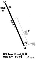
| Runways: | 16/34 |
| Longest Runway: | 16/34 is 4997 ft (1523 m) long |
| Runways with an Instrument Approach: |
5R8 Airport Runway Details
| Runway 16/34 | 4997 ft x 75 ft (1523 m x 23 m) | |
| Runway Length Source: | 3RD PARTY SURVEY as of 05/04/2010 | |
| Surface: | Asphalt - Good condition - No special surface treatment | |
| Runway Edge Lights: | Medium Intensity | |
Runway Weight Bearing Capacity (in thousands of pounds) |
||
| Single Wheel Landing Gear: | 18.0 | |
Runway 16 |
Runway 34 |
|
Elevation: |
72.7 | 80.7 |
Latitude: |
30-26-50.7021N | 30-26-05.0679N |
Longitude: |
093-28-36.0009W | 093-28-13.9795W |
|
Runway True Alignment: |
157 | 337 |
Glide Path Angle: |
3.0 degrees | 3.0 degrees |
Traffic Pattern: |
Left | Left |
Runway Markings Type: |
Nonprecision Instrument | Nonprecision Instrument |
Runway Markings Condition: |
Good | Good |
Object at End: |
TREE | TREES |
Object Height: |
59 | 43 |
Distance from End: |
1468 | 1573 |
Object Centerline Offset: |
0 ft. left and right of centerline | 280 ft. right of centerline |
Visual Glide Slope Indicators: |
2-Light PAPI On Left Side Of Runway | 2-Light PAPI On Left Side Of Runway |
REIL: |
Yes | Yes |
Threshold Crossing Height: |
50 | 50 |
Services
Airframe Repair: |
Major |
Powerplant Repair: |
Major |
Bottled Oxygen: |
None |
Bulk Oxygen: |
None |
Fuel Available: |
100LL, Jet A |
Landing Fees: |
No |
Parking: |
Hangars and tiedowns available |
Maps & Diagrams
5R8 Sectional
Flight Planning
at skyvector.com
at skyvector.com