
Location
Latitude: |
37-37-07.7000N (37.618806) |
Longitude: |
122-22-31.5000W (-122.375417) |
Elevation: |
13.1 feet MSL (4 m MSL) |
Magnetic Variation: |
13 E (as of April 2024 from WMM2020 model) |
Time Zone: |
UTC -8.0 (Standard Time) UTC -7.0 (Daylight Savings Time) |
From City: |
08 N.M. SE of San Francisco, California |
Found On: |
San Francisco Chart |
FAA Region: |
AWP |
Contacts
Manager: |
Publicly owned: |
| IVAR SATERO PO BOX 8097 SAN FRANCISCO, CA 94128 (650) 821-3355 |
CITY & COUNTY OF SAN FRANCISCO PO BOX 8097 SAN FRANCISCO, CA 94128 650-821-5000 |
Operations
Airport Status: |
Operational |
Facility Use: |
Public |
Type: |
Airport |
Activation Date: |
04/1940 |
Control tower: |
Yes |
Attendance (Months/Days/Hours): |
Months/Days/Hours ALL/ALL/ALL |
Boundary ARTCC: |
ZOA (Oakland) |
Responsible ARTCC: |
ZOA (Oakland) |
Segmented Circle Indicator: |
No |
Traffic Pattern Altitude (MSL): |
1013 feet (309 m) |
NOTAMs Facility: |
SFO |
NOTAM-D Service: |
Yes |
International Airport of Entry: |
No |
Customs Landing Rights: |
Yes |
Military Landing Rights: |
Yes |
Civil/Military Joint Use: |
No |
Aircraft Rescue and Firefighting: |
Class I ARFF Index: E Air Carrier Service: Scheduled Certification Date: 05/1973 |
Based Aircraft
| Jet Engine: | 7 |
| Military Aircraft: | 5 |
Annual Operations (as of 03/31/2022)
| Total Operations: | 299744 | |
| Commercial: | 240462 | 80.2% |
| Air Taxi: | 44917 | 15.0% |
| GA Itinerant: | 11740 | 3.9% |
| Military Aircraft: | 2625 | 0.9% |
Communications
| Unicom: | 122.950 |
| Tower: | SAN FRANCISCO 120.5 269.1 Hrs: 24 |
| Ground: | 121.8 |
| Approach: | NORCAL |
| Departure: | NORCAL |
| ATIS: | 113.7 115.8 118.85 Hrs: 24 |
| ASOS: | (650-827-8593) |
| EMERG: | 121.5 |
- DUE TO OBSTRUCTED VISION, SFO ATCT IS ABLE TO PROVIDE ONLY LIMITED AIRPORT TRAFFIC CONTROL SVC ON TWY A BETWEEN GATES 88 AND 89. ATCT PERSONNEL ARE UNABLE TO DETERMINE WHETHER THIS AREA IS CLEAR OF TRAFFIC OR OBSTRUCTIONS.
- DUE TO OBSTD VISION, THE TWR IS UNA TO DTRM IF ACFT PULLING INTO GATE F11 ARE AT THE HOOK-UP SPOT OR IN THE GATE.
Fixed Based Operators (FBOs) & Fuel
(Click on a business for detail)
Please help us keep this information up to date. This is a FREE SERVICE just like everything else on Airport Guide! If you see that a business needs to be added, modified, or deleted please fill out our Update Form.
To add, modify, or delete a business click here.
Please help us keep this information up to date. This is a FREE SERVICE just like everything else on Airport Guide! If you see that a business needs to be added, modified, or deleted please fill out our Update Form.
Area Code: 650 |
| Business Name | Frequency | Phone | Fuel Grade |
|---|---|---|---|
| Signature Flight Support
Website Update FBO info |
Unicom 122.95, Arinc 128.92 | +1 650 877 6800 | 100LL, Jet A |
Flight Service Stations
| Primary | Alternate | |
| FSS on Field: | N | |
| FSS Name (ID): | Oakland(OAK) | |
| Frequency: | ||
| Toll Free Phone: | 1-800-WX-BRIEF |
Instrument Procedures / Charts
FAA Terminal Procedures valid from 0901Z 03/21/24 to 0901Z 04/18/24.
There are various types of charts available for an airport. They are listed in the Page Type column. Here is a legend for those types:
APD - Airport Diagram
DP - Departure Procedure Charts
HOT - Hot Spots
IAP - Instrument Approach Procedure Charts
MIN - Minimums
STAR - Standard Terminal Arrival Charts
Terminal Procedures are only available for airports in several countries with more being added all the time. If you are looking for a specific country's charts, please send an email to support(at)airportguide.com stating the country name. This will be used to prioritize the implementation.
Navigation Aids (Navaids) near SFO
| Dist (NM) | ID | Morse Code | Name | Type | Freq | True Hdg | Mag Hdg |
|---|---|---|---|---|---|---|---|
| 0.1 | SFO | . . . . . _ . _ _ _ | San Francisco | VOR-DME | 115.80 | 59 | 46 |
| 0.5 | SFO | . . . . . _ . _ _ _ | San Francisco | VOT | 111.00 | 79 | 66 |
| 9.7 | OAK | _ _ _ . _ _ . _ | Oakland | VOR-DME | 116.80 | 48 | 35 |
| 14.3 | OSI | _ _ _ . . . . . | Woodside | VOR-DME | 113.90 | 161 | 148 |
| 15.8 | SAU | . . . . _ . . _ | Sausalito | VOR-DME | 116.20 | 333 | 320 |
| 18.8 | NUQ | _ . . . _ _ _ . _ | Moffett | TACAN | 117.60 | 126 | 113 |
| 25.2 | SJC | . . . . _ _ _ _ . _ . | San Jose | VOR-DME | 114.10 | 125 | 112 |
| 30.0 | CCR | _ . _ . _ . _ . . _ . | Concord | VOR-DME | 117.00 | 31 | 18 |
| 30.3 | CC | _ . _ . _ . _ . | Kanan | NDB | 335 | 32 | 19 |
| 33.1 | LV | . _ . . . . . _ | Reiga | NDB | 374 | 82 | 69 |
| 33.6 | SGD | . . . _ _ . _ . . | Scaggs Island | VORTAC | 112.10 | 0 | 347 |
| 36.2 | PYE | . _ _ . _ . _ _ . | Point Reyes | VOR-DME | 113.70 | 320 | 307 |
| 42.8 | SUU | . . . . . _ . . _ | Travis | TACAN | 116.60 | 28 | 15 |
| 44.4 | TCY | _ _ . _ . _ . _ _ | Tracy | NDB | 203 | 84 | 71 |
| 49.6 | WVI | . _ _ . . . _ . . | Watsonville | DME | 114.25 | 145 | 132 |
| 50.2 | PDG | . _ _ . _ . . _ _ . | Pajar | NDB | 327 | 147 | 134 |
| 51.1 | TZZ | _ _ _ . . _ _ . . | Travis | VOR | 116.40 | 31 | 18 |
| 57.2 | STS | . . . _ . . . | Santa Rosa | DME | 116.15 | 339 | 326 |
| 58.6 | ECA | . _ . _ . . _ | Manteca | VOR-DME | 116.00 | 76 | 63 |
| 63.0 | SAC | . . . . _ _ . _ . | Sacramento | VORTAC | 115.20 | 37 | 24 |
Nearby Airports with Fuel
Notices to Airmen (NOTAMS)
Remarks
| A11 | GLENN BROTMAN: AIRFIELD OPERATIONS PHONE 650-821-3349 AND FAX 650-821-4670. SHANNON WILSON: AIRFIELD OPERATIONS PHONE 650-821-3366. |
| A110-18 | RY 10 PREFERRED RY BTWN 0100-0600 WEATHER AND FLIGHT CONDITIONS PERMITTING. |
| A110-20 | AIRLINE PILOTS SHALL STRICTLY FOLLOW THE PAINTED NOSE GEAR LINES AND NO OVERSTEERING ADJUSTMENT IS PERMITTED. |
| A110-21 | PAEW APCH END RYS 28L, 28R, 19L INDEFLY. |
| A110-29 | ALL OUBD TWY ZULU 2 HVY ACFT WITH A WINGSPAN OF 171 FT OR GTR UNDER PWR PROHIBITED FROM ENTERING WB TWY ZULU. |
| A110-3 | FLOCKS OF BIRDS FEEDING ALONG SHORELINE ADJ TO ARPT; ON OCCASIONS FLY ACROSS VARIOUS PARTS OF THE ARPT. |
| A110-30 | SIMULTANEOUS OPERATIONS IN EFFECT ALL RYS. |
| A110-32 | ASSC IN USE. OPERATE TRANSPONDERS WITH ALTITUDE REPORTING MODE AND ADS-B (IF EQUIPPED) ENABLED ON ALL AIRPORT SURFACES. |
| A110-33 | RWY 1L CLSD TO DEPARTING TRIJET ACFT WITH WINGSPAN GREATER THAN 155 FT. |
| A110-34 | RWY STATUS LGTS IN OPN. |
| A110-35 | TWY S BTN TWY Z AND TWY S2 CLSD TO ACFT WITH WINGSPAN OVER 215 FT. |
| A110-4 | HIGH SPEED TWY (T) GRVD FULL WIDTH BTN RWY 28R AND 28L. |
| A110-6 | NOISE SENSITIVE ARPT; FOR NOISE ABATEMENT PROCEDURES CTC ARPT NOISE OFFICE MON-FRI 0800-1700 BY CALLING 650-821-5100. |
| A110-9 | SEVERAL RY HOLD POSITION SIGNS ARE ON THE RIGHT RATHER THAN THE LEFT SIDE OF THE TWYS. |
| A14 | NEIL WEINGARTEN: AIRSIDE OPNS DIR PHONE 650-821-3348. |
| A57-01R | APCH RATIO 28:1 TO DISPLACED THRESHOLD. |
| A58-01R | APCH BLOCKED BY A BLAST FENCE AND LOC ANT. |
| E60-01L | ENGINEERED MATERIAL ARRESTING SYSTEM (EMAS) 413 FT IN LENGTH BY 227 FT IN WIDTH LCTD AT THE DER 1L. |
| E60-01R | ENGINEERED MATERIALS ARRESTING SYSTEM (EMAS) 409 FT IN LENGTH BY 227 FT IN WIDTH LCTD AT THE DER 1R. |
| E60-19L | ENGINEERED MATERIALS ARRESTING SYSTEM (EMAS) 373 FT IN LENGTH BY 227 FT IN WIDTH LCTD AT THE DER 19L. |
| E60-19R | ENGINEERED MATERIALS ARRESTING SYSTEM (EMAS) 437 FT IN LENGTH BY 227 FT IN WIDTH LCTD AT THE DER 19R. |
Runways
Runway Summary
| Runways: | 01L/19R 01R/19L 10L/28R 10R/28L |
| Longest Runway: | 10L/28R is 11870 ft (3618 m) long |
| Runways with an Instrument Approach: | 19L, 28R, 28L |
SFO Airport Runway Details
| Runway 01L/19R | 7650 ft x 200 ft (2332 m x 61 m) | |
| Runway Length Source: | 3RD PARTY SURVEY as of 10/22/2014 | |
| Surface: | Asphalt - Good condition - Saw-cut or plastic grooved | |
| Runway Pavement Class: | 90 /F/B/X/T | |
| Runway Edge Lights: | High Intensity | |
Runway Weight Bearing Capacity (in thousands of pounds) |
||
| Single Wheel Landing Gear: | 75.0 | |
| Dual Wheel Landing Gear: | 200.0 | |
| Dual Tandem Wheel Landing Gear: | 400.0 | |
| Dual Dual Tandem Wheel Landing Gear: | 877.0 | |
Runway 01L |
Runway 19R |
|
Elevation: |
10.7 | 9.2 |
Latitude: |
37-36-28.4323N | 37-37-35.3329N |
Longitude: |
122-22-58.5426W | 122-22-14.1939W |
|
Runway True Alignment: |
028 | 208 |
Glide Path Angle: |
0.0 degrees | 3.1 degrees |
Traffic Pattern: |
Left | Left |
Runway Markings Type: |
Nonprecision Instrument | Nonprecision Instrument |
Runway Markings Condition: |
Good | Good |
Arresting Device: |
EMAS | EMAS |
Visual Glide Slope Indicators: |
4-Light PAPI On Left Side Of Runway | |
Runway Visual Range (RVR): |
Touchdown, Midfield, Rollout | Touchdown, Midfield, Rollout |
REIL: |
Yes | No |
Touchdown Lights: |
No | No |
Centerline Lights: |
Yes | Yes |
Threshold Crossing Height: |
58 | |
Threshold Elevation: |
10.4 | |
Displaced Threshold: |
640 | |
Threshold Latitude: |
37-36-34.0304N | |
Threshold Longitude: |
122-22-54.8330W | |
Declared Distances |
||
Take Off Run Avbl. (TORA): |
7650 | 7650 |
Take Off Distance Avbl. (TODA): |
7650 | 7650 |
Actual Stop Dist. Avbl. (ASDA): |
7650 | 7650 |
Landing Dist. Avbl. (LDA): |
7010 | 7650 |
| Runway 01R/19L | 8650 ft x 200 ft (2637 m x 61 m) | |
| Runway Length Source: | 3RD PARTY SURVEY as of 10/22/2014 | |
| Surface: | Asphalt - Good condition - Saw-cut or plastic grooved | |
| Runway Pavement Class: | 100/F/B/X/T | |
| Runway Edge Lights: | High Intensity | |
Runway Weight Bearing Capacity (in thousands of pounds) |
||
| Single Wheel Landing Gear: | 75.0 | |
| Dual Wheel Landing Gear: | 200.0 | |
| Dual Tandem Wheel Landing Gear: | 400.0 | |
| Dual Dual Tandem Wheel Landing Gear: | 877.0 | |
Runway 01R |
Runway 19L |
|
Elevation: |
11.4 | 10.5 |
Latitude: |
37-36-22.7876N | 37-37-38.4319N |
Longitude: |
122-22-51.7467W | 122-22-01.5990W |
|
Runway True Alignment: |
028 | 208 |
ILS Type: |
ILS/DME | |
Glide Path Angle: |
0.0 degrees | 3.0 degrees |
Traffic Pattern: |
Left | Left |
Runway Markings Type: |
Precision Instrument | Precision Instrument |
Runway Markings Condition: |
Good | Good |
Arresting Device: |
EMAS | EMAS |
Object at End: |
TREE | |
Object Height: |
177 | |
Distance from End: |
4000 | |
Visual Glide Slope Indicators: |
4-Light PAPI On Left Side Of Runway | |
Runway Visual Range (RVR): |
Touchdown, Midfield, Rollout | Touchdown, Midfield, Rollout |
Approach Light System: |
1,400 Foot Medium Intensity Approach Lighting System With Sequenced Flashers | |
REIL: |
Yes | No |
Touchdown Lights: |
No | Yes |
Centerline Lights: |
Yes | Yes |
Threshold Crossing Height: |
71 | |
Threshold Elevation: |
11.1 | |
Displaced Threshold: |
560 | |
Threshold Latitude: |
37-36-27.6857N | |
Threshold Longitude: |
122-22-48.5014W | |
Declared Distances |
||
Take Off Run Avbl. (TORA): |
8650 | 8650 |
Take Off Distance Avbl. (TODA): |
8650 | 8650 |
Actual Stop Dist. Avbl. (ASDA): |
8650 | 8650 |
Landing Dist. Avbl. (LDA): |
8090 | 8650 |
| Runway 10L/28R | 11870 ft x 200 ft (3618 m x 61 m) | |
| Runway Length Source: | 3RD PARTY SURVEY as of 10/22/2014 | |
| Surface: | Asphalt - Good condition - Saw-cut or plastic grooved | |
| Runway Pavement Class: | 80 /F/B/X/T | |
| Runway Edge Lights: | High Intensity | |
Runway Weight Bearing Capacity (in thousands of pounds) |
||
| Single Wheel Landing Gear: | 75.0 | |
| Dual Wheel Landing Gear: | 200.0 | |
| Dual Tandem Wheel Landing Gear: | 400.0 | |
| Dual Dual Tandem Wheel Landing Gear: | 877.0 | |
Runway 10L |
Runway 28R |
|
Elevation: |
5.5 | 13.0 |
Latitude: |
37-37-43.4594N | 37-36-48.7210N |
Longitude: |
122-23-36.2107W | 122-21-25.7080W |
|
Runway True Alignment: |
118 | 298 |
ILS Type: |
ILS/DME | |
Glide Path Angle: |
3.0 degrees | 3.0 degrees |
Traffic Pattern: |
Left | Right |
Runway Markings Type: |
Precision Instrument | Precision Instrument |
Runway Markings Condition: |
Good | Good |
Object at End: |
TOWER | |
Object Height: |
88 | |
Distance from End: |
3280 | |
Visual Glide Slope Indicators: |
4-Light PAPI On Left Side Of Runway | 4-Light PAPI On Left Side Of Runway |
Runway Visual Range (RVR): |
Touchdown, Midfield, Rollout | Touchdown, Midfield, Rollout |
Approach Light System: |
Standard 2,400 Foot High Intensity Approach Lighting System With Sequenced Flashers, Cat. II or III Config. | |
REIL: |
Yes | No |
Touchdown Lights: |
No | Yes |
Centerline Lights: |
Yes | Yes |
Threshold Crossing Height: |
80 | 68 |
Threshold Elevation: |
12.9 | |
Displaced Threshold: |
300 | |
Threshold Latitude: |
37-36-50.1053N | |
Threshold Longitude: |
122-21-29.0077W | |
Declared Distances |
||
Take Off Run Avbl. (TORA): |
11870 | 11870 |
Take Off Distance Avbl. (TODA): |
11870 | 11870 |
Actual Stop Dist. Avbl. (ASDA): |
11193 | 11870 |
Landing Dist. Avbl. (LDA): |
11193 | 11236 |
| Runway 10R/28L | 11381 ft x 200 ft (3469 m x 61 m) | |
| Runway Length Source: | 3RD PARTY SURVEY as of 10/22/2014 | |
| Surface: | Asphalt - Good condition - Saw-cut or plastic grooved | |
| Runway Pavement Class: | 80 /F/B/X/T | |
| Runway Edge Lights: | High Intensity | |
Runway Weight Bearing Capacity (in thousands of pounds) |
||
| Single Wheel Landing Gear: | 75.0 | |
| Dual Wheel Landing Gear: | 200.0 | |
| Dual Tandem Wheel Landing Gear: | 400.0 | |
| Dual Dual Tandem Wheel Landing Gear: | 877.0 | |
Runway 10R |
Runway 28L |
|
Elevation: |
7.1 | 12.6 |
Latitude: |
37-37-34.6480N | 37-36-42.1630N |
Longitude: |
122-23-35.1796W | 122-21-30.0570W |
|
Runway True Alignment: |
118 | 298 |
ILS Type: |
ILS/DME | |
Glide Path Angle: |
3.0 degrees | 2.9 degrees |
Traffic Pattern: |
Right | Left |
Runway Markings Type: |
Precision Instrument | Precision Instrument |
Runway Markings Condition: |
Good | Good |
Object at End: |
TOWER | |
Object Height: |
87 | |
Distance from End: |
3875 | |
Visual Glide Slope Indicators: |
4-Light PAPI On Left Side Of Runway | 4-Light PAPI On Left Side Of Runway |
Runway Visual Range (RVR): |
Touchdown, Midfield, Rollout | Touchdown, Midfield, Rollout |
Approach Light System: |
1,400 Foot Medium Intensity Approach Lighting System With Runway Alignment Indicator Lights | |
REIL: |
No | No |
Touchdown Lights: |
No | No |
Centerline Lights: |
Yes | Yes |
Threshold Crossing Height: |
68 | 67 |
Threshold Elevation: |
12.6 | |
Displaced Threshold: |
300 | |
Threshold Latitude: |
37-36-43.5474N | |
Threshold Longitude: |
122-21-33.3532W | |
Declared Distances |
||
Take Off Run Avbl. (TORA): |
11381 | 11381 |
Take Off Distance Avbl. (TODA): |
11381 | 11381 |
Actual Stop Dist. Avbl. (ASDA): |
10704 | 10981 |
Landing Dist. Avbl. (LDA): |
10704 | 10275 |
Services
Airframe Repair: |
Minor |
Powerplant Repair: |
Major |
Bottled Oxygen: |
Low Pressure |
Bulk Oxygen: |
None |
Fuel Available: |
100LL, Jet A, UL94 |
Landing Fees: |
No |
Parking: |
Tiedowns available |
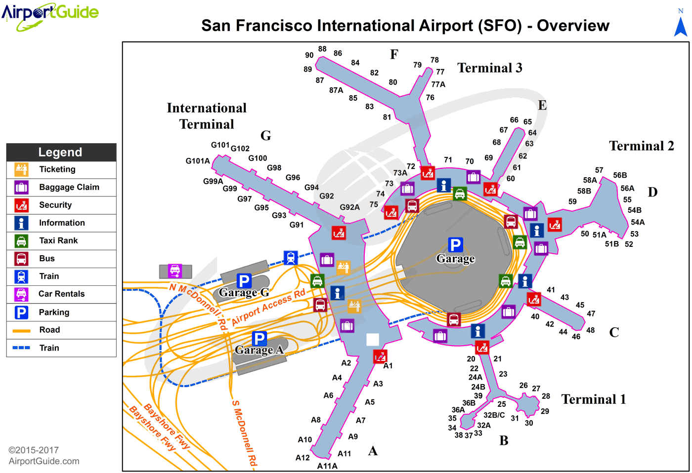
Maps & Diagrams
SFO Sectional
Flight Planning
at skyvector.com
at skyvector.com
 Diagram")