Location
Latitude: |
39-52-36.2000N (39.876722) |
Longitude: |
085-19-31.0000W (-85.325278) |
Elevation: |
1090.2 feet MSL (332 m MSL) |
Magnetic Variation: |
5.6 W (as of April 2024 from WMM2020 model) |
Time Zone: |
UTC -5.0 (Standard Time) UTC -4.0 (Daylight Savings Time) |
From City: |
04 N.M. SE of New Castle, Indiana |
Found On: |
St Louis Chart |
FAA Region: |
AGL |
Contacts
Manager: |
Publicly owned: |
| JOHN MARLATT 2912 E CO. RD 400 S NEW CASTLE, IN 47362 765-529-7903 |
NEW CASTLE/HENRY COUNTY 2912 E. CO. RD. 400 S. NEW CASTLE, IN 47362 765-529-7903 |
Operations
Airport Status: |
Operational |
Facility Use: |
Public |
Type: |
Airport |
Activation Date: |
09/1971 |
Control tower: |
No |
Attendance (Months/Days/Hours): |
Months/Days/Hours ALL/ALL/0800-1800 |
Boundary ARTCC: |
ZID (Indianapolis) |
Responsible ARTCC: |
ZID (Indianapolis) |
Lighting Schedule: |
SEE RMK |
Segmented Circle Indicator: |
No |
Traffic Pattern Altitude (MSL): |
2090 feet (637 m) |
NOTAMs Facility: |
HUF |
NOTAM-D Service: |
Yes |
International Airport of Entry: |
No |
Customs Landing Rights: |
No |
Military Landing Rights: |
No |
Civil/Military Joint Use: |
No |
Based Aircraft
| Single Engine: | 15 |
| GA Helicopters: | 1 |
Annual Operations (as of 12/31/2019)
| Total Operations: | 2261 | |
| Air Taxi: | 90 | 4.0% |
| GA Local: | 1809 | 80.0% |
| GA Itinerant: | 362 | 16.0% |
Communications
| CTAF: | 123.050 |
| Unicom: | 123.050 |
| Approach: | INDIANAPOLIS 135.45 135.45 |
| Departure: | INDIANAPOLIS 135.45 135.45 |
| AWOS-3: | 132.375 (765-422-5701) |
Fixed Based Operators (FBOs) & Fuel
(Click on a business for detail)
Please help us keep this information up to date. This is a FREE SERVICE just like everything else on Airport Guide! If you see that a business needs to be added, modified, or deleted please fill out our Update Form.
To add, modify, or delete a business click here.
Please help us keep this information up to date. This is a FREE SERVICE just like everything else on Airport Guide! If you see that a business needs to be added, modified, or deleted please fill out our Update Form.
Area Code: 765 |
| Business Name | Frequency | Phone | Fuel Grade |
|---|---|---|---|
| Sky Castle Aviation
Update FBO info |
Unicom 123.05 | 529-7903 | 100LL |
Flight Service Stations
| Primary | Alternate | |
| FSS on Field: | N | |
| FSS Name (ID): | Terre Haute(HUF) | |
| Frequency: | ||
| Toll Free Phone: | 1-800-WX-BRIEF |
Instrument Procedures / Charts
FAA Terminal Procedures valid from 0901Z 03/21/24 to 0901Z 04/18/24.
There are various types of charts available for an airport. They are listed in the Page Type column. Here is a legend for those types:
APD - Airport Diagram
DP - Departure Procedure Charts
HOT - Hot Spots
IAP - Instrument Approach Procedure Charts
MIN - Minimums
STAR - Standard Terminal Arrival Charts
| Page Type | Page Name | Volume | Action Since Last Cycle |
|---|---|---|---|
| IAP | NDB RWY 10 | EC-2 | Changed |
| IAP | RNAV (GPS) RWY 10 | EC-2 | Changed |
| IAP | RNAV (GPS) RWY 28 | EC-2 | Changed |
| MIN | ALTERNATE MINIMUMS | EC-2 | Added |
| MIN | TAKEOFF MINIMUMS | EC-2 |
Terminal Procedures are only available for airports in several countries with more being added all the time. If you are looking for a specific country's charts, please send an email to support(at)airportguide.com stating the country name. This will be used to prioritize the implementation.
Navigation Aids (Navaids) near KUWL
| Dist (NM) | ID | Morse Code | Name | Type | Freq | True Hdg | Mag Hdg |
|---|---|---|---|---|---|---|---|
| 0.4 | UWL | . . _ . _ _ . _ . . | New Castle | NDB | 385 | 56 | 62 |
| 10.8 | SQ | . . . _ _ . _ | Pnthr | NDB | 227 | 123 | 129 |
| 14.4 | AI | . _ . . | Video | NDB | 394 | 323 | 329 |
| 18.3 | JN | . _ _ _ _ . | Balll | NDB | 365 | 0 | 6 |
| 21.9 | MIE | _ _ . . . | Muncie | VOR-DME | 114.40 | 351 | 357 |
| 23.6 | RID | . _ . . . _ . . | Richmond | DME | 110.6 | 107 | 113 |
| 27.3 | SHB | . . . . . . . _ . . . | Shelbyville | VOR-DME | 116.15 | 237 | 242 |
| 32.0 | HLB | . . . . . _ . . _ . . . | Batesville | NDB | 254 | 174 | 180 |
| 33.5 | OXD | _ _ _ _ . . _ _ . . | Oxford | NDB | 282 | 131 | 137 |
| 33.6 | UMP | . . _ _ _ . _ _ . | Metropolitan | NDB | 338 | 276 | 281 |
| 38.2 | HFY | . . . . . . _ . _ . _ _ | Greenwood | NDB | 398 | 247 | 252 |
| 40.3 | BA | _ . . . . _ | Clifs | NDB | 410 | 214 | 219 |
| 40.4 | MZZ | _ _ _ _ . . _ _ . . | Marion | VOR-DME | 108.60 | 336 | 342 |
| 43.5 | DQN | _ . . _ _ . _ _ . | Dayton | VOR-DME | 114.50 | 78 | 84 |
| 45.6 | AT | . _ _ | Bruny | NDB | 315 | 91 | 97 |
| 46.1 | HAO | . . . . . _ _ _ _ | Hamilton | NDB | 260 | 130 | 136 |
| 46.1 | IND | . . _ . _ . . | Indianapolis Intl | VOT | 109.60 | 259 | 264 |
| 46.4 | HKF | . . . . _ . _ . . _ . | Hook Field | NDB | 239 | 118 | 124 |
| 48.2 | VHP | . . . _ . . . . . _ _ . | Brickyard | VORTAC | 116.30 | 265 | 270 |
| 49.6 | MW | _ _ . _ _ | Onida | NDB | 223 | 110 | 116 |
Nearby Airports with Fuel
Notices to Airmen (NOTAMS)
Remarks
| A110-2 | FOR CD CTC INDIANAPOLIS APCH AT 317-227-5743. |
| A16 | 765-529-7909. |
| A17 | FUEL AFT HR - 765-332-2969. |
| A81-APT | ACTVT REIL RWY 10 & 28; PAPI RWY 10 & 28; MIRL RWY 10/28 - CTAF. MIRL RWY 10/28 PRESET LOW INTST; INCR INTST - CTAF. |
| E111 | ESTAB PRIOR TO 1959. |
Runways
Runway Summary
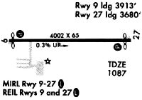
| Runways: | 10/28 |
| Longest Runway: | 10/28 is 4201 ft (1280 m) long |
| Runways with an Instrument Approach: |
KUWL Airport Runway Details
| Runway 10/28 | 4201 ft x 75 ft (1280 m x 23 m) | |
| Runway Length Source: | 3RD PARTY SURVEY as of 03/27/2018 | |
| Surface: | Asphalt - Good condition - No special surface treatment | |
| Runway Edge Lights: | Medium Intensity | |
Runway 10 |
Runway 28 |
|
Elevation: |
1080.1 | 1090.1 |
Latitude: |
39-52-36.3794N | 39-52-36.0879N |
Longitude: |
085-19-57.9748W | 085-19-04.0886W |
|
Runway True Alignment: |
090 | 270 |
Glide Path Angle: |
3.0 degrees | 3.0 degrees |
Runway Markings Type: |
Nonprecision Instrument | Nonprecision Instrument |
Runway Markings Condition: |
Good | Good |
Object at End: |
CROPS | CROPS |
Object Height: |
10 | 10 |
Distance from End: |
340 | 210 |
Object Centerline Offset: |
0 ft. left and right of centerline | 0 ft. left and right of centerline |
Visual Glide Slope Indicators: |
2-Light PAPI On Left Side Of Runway | 2-Light PAPI On Left Side Of Runway |
REIL: |
Yes | Yes |
Threshold Crossing Height: |
46 | 44 |
Services
Airframe Repair: |
Major |
Powerplant Repair: |
Major |
Bottled Oxygen: |
High Pressure |
Bulk Oxygen: |
High Pressure / Low Pressure |
Fuel Available: |
100LL, Jet A, Jet A+ |
Landing Fees: |
No |
Parking: |
Hangars and tiedowns available |
Maps & Diagrams
KUWL Sectional
Flight Planning
at skyvector.com
at skyvector.com