Location
Latitude: |
36-17-33.8000N (36.292722) |
Longitude: |
095-28-46.6000W (-95.479611) |
Elevation: |
733.0 feet MSL (223 m MSL) |
Magnetic Variation: |
1.9 E (as of April 2024 from WMM2020 model) |
Time Zone: |
UTC -6.0 (Standard Time) UTC -5.0 (Daylight Savings Time) |
From City: |
07 N.M. E of Claremore, Oklahoma |
Found On: |
Kansas City Chart |
FAA Region: |
ASW |
Contacts
Manager: |
Publicly owned: |
| MEGGIE FROMAN-KNIGHT 19502 E. ROGERS POST ROAD CLAREMORE, OK 74019 918-343-0931 |
CITY OF CLAREMORE PO BOX 249 CLAREMORE, OK 74018 918-341-2365 |
Operations
Airport Status: |
Operational |
Facility Use: |
Public |
Type: |
Airport |
Activation Date: |
08/1993 |
Control tower: |
No |
Attendance (Months/Days/Hours): |
Months/Days/Hours ALL/ALL/0800-1700 |
Boundary ARTCC: |
ZKC (Kansas City) |
Responsible ARTCC: |
ZKC (Kansas City) |
Lighting Schedule: |
SEE RMK |
Segmented Circle Indicator: |
Yes |
Traffic Pattern Altitude (MSL): |
1733 feet (528 m) |
NOTAMs Facility: |
GCM |
NOTAM-D Service: |
Yes |
Based Aircraft
| Single Engine: | 77 |
| Multi Engine: | 5 |
| Jet Engine: | 1 |
| GA Helicopters: | 3 |
Annual Operations (as of 02/16/2023)
| Total Operations: | 15000 | |
| GA Local: | 10500 | 70.0% |
| GA Itinerant: | 4500 | 30.0% |
Communications
| CTAF: | 122.700 |
| Unicom: | 122.700 |
| Approach: | TULSA 119.1 119.1 |
| Departure: | TULSA 119.1 119.1 |
| AWOS-3PT: | 119.925 (918-343-0184) |
Fixed Based Operators (FBOs) & Fuel
(Click on a business for detail)
Please help us keep this information up to date. This is a FREE SERVICE just like everything else on Airport Guide! If you see that a business needs to be added, modified, or deleted please fill out our Update Form.
To add, modify, or delete a business click here.
Please help us keep this information up to date. This is a FREE SERVICE just like everything else on Airport Guide! If you see that a business needs to be added, modified, or deleted please fill out our Update Form.
Area Code: 918 |
| Business Name | Frequency | Phone | Fuel Grade |
|---|---|---|---|
| Hawthorne Aviation Claremore
Update FBO info |
Unicom 122.9 | 343-0931 | 100LL, Jet A |
Flight Service Stations
| Primary | Alternate | |
| FSS on Field: | N | |
| FSS Name (ID): | Mc Alester(MLC) | |
| Frequency: | ||
| Toll Free Phone: | 1-800-WX-BRIEF |
Instrument Procedures / Charts
FAA Terminal Procedures valid from 0901Z 03/21/24 to 0901Z 04/18/24.
There are various types of charts available for an airport. They are listed in the Page Type column. Here is a legend for those types:
APD - Airport Diagram
DP - Departure Procedure Charts
HOT - Hot Spots
IAP - Instrument Approach Procedure Charts
MIN - Minimums
STAR - Standard Terminal Arrival Charts
| Page Type | Page Name | Volume | Action Since Last Cycle |
|---|---|---|---|
| IAP | RNAV (GPS) RWY 18 | SC-1 | |
| IAP | RNAV (GPS) RWY 36 | SC-1 | |
| IAP | VOR/DME-B | SC-1 | |
| MIN | TAKEOFF MINIMUMS | SC-1 |
Terminal Procedures are only available for airports in several countries with more being added all the time. If you are looking for a specific country's charts, please send an email to support(at)airportguide.com stating the country name. This will be used to prioritize the implementation.
Navigation Aids (Navaids) near KGCM
| Dist (NM) | ID | Morse Code | Name | Type | Freq | True Hdg | Mag Hdg |
|---|---|---|---|---|---|---|---|
| 16.0 | TUL | _ . . _ . _ . . | Tulsa | VORTAC | 114.40 | 248 | 246 |
| 20.3 | TUL | _ . . _ . _ . . | Tulsa Intl | VOT | 109.00 | 254 | 252 |
| 23.0 | TU | _ . . _ | Oillr | NDB | 338 | 239 | 237 |
| 31.7 | TQH | _ _ _ . _ . . . . | Tahlequah | NDB | 215 | 133 | 131 |
| 32.6 | GNP | _ _ . _ . . _ _ . | Glenpool | DME | 110.6 | 226 | 224 |
| 33.4 | OWP | _ _ _ . _ _ . _ _ . | William Pogue | NDB | 362 | 257 | 255 |
| 39.5 | OK | _ _ _ _ . _ | Preso | NDB | 388 | 215 | 213 |
| 40.6 | OKM | _ _ _ _ . _ _ _ | Okmulgee | VOR-DME | 114.90 | 207 | 205 |
| 41.6 | BVO | _ . . . . . . _ _ _ _ | Bartlesville | VOR-DME | 117.90 | 321 | 319 |
| 41.7 | BV | _ . . . . . . _ | Dewie | NDB | 201 | 322 | 320 |
| 48.2 | CFV | _ . _ . . . _ . . . . _ | Coffeyville | NDB | 212 | 354 | 352 |
| 48.4 | SLG | . . . . _ . . _ _ . | Siloam Springs | NDB | 284 | 97 | 95 |
| 53.6 | OSW | _ _ _ . . . . _ _ | Oswego | DME | 117.6 | 14 | 12 |
| 59.3 | HET | . . . . . _ | Henryetta | NDB | 267 | 206 | 204 |
| 60.2 | EOS | . _ _ _ . . . | Neosho | DME | 117.3 | 56 | 55 |
| 63.2 | IQS | . . _ _ . _ . . . | Sallisaw | NDB | 520 | 147 | 145 |
| 63.9 | DAK | _ . . . _ _ . _ | Drake | DME | 115.25 | 103 | 102 |
| 65.8 | RZC | . _ . _ _ . . _ . _ . | Razorback | VORTAC | 116.40 | 92 | 91 |
| 67.2 | CUH | _ . _ . . . _ . . . . | Cushing | NDB | 242 | 249 | 247 |
| 68.9 | RO | . _ . _ _ _ | Rogrs | NDB | 263 | 81 | 80 |
Nearby Airports with Fuel
Notices to Airmen (NOTAMS)
Remarks
| A110-1 | FOR CD CTC TULSA APCH AT 918-831-6714/6720. |
| A17 | UNATNDD FED HOLS. |
| A70-FUEL-10 | 0LL 24 HR AUTO FUEL SVC SYS FOR 100LL & JET A. |
| A81-APT | ACTVT ODALS RWY 18; REIL RWY 36 - CTAF. MIRL RWY 18/36 SS-SR. PAPI RWY 18 AND 36 ON CONSLY. |
Runways
Runway Summary
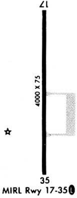
| Runways: | 18/36 |
| Longest Runway: | 18/36 is 5200 ft (1585 m) long |
| Runways with an Instrument Approach: |
KGCM Airport Runway Details
| Runway 18/36 | 5200 ft x 75 ft (1585 m x 23 m) | |
| Runway Length Source: | 3RD PARTY SURVEY as of 08/31/2007 | |
| Surface: | Asphalt - Good condition - No special surface treatment | |
| Runway Edge Lights: | Medium Intensity | |
Runway Weight Bearing Capacity (in thousands of pounds) |
||
| Single Wheel Landing Gear: | 30.0 | |
| Dual Wheel Landing Gear: | 58.5 | |
| Dual Tandem Wheel Landing Gear: | 119.5 | |
Runway 18 |
Runway 36 |
|
Elevation: |
697.0 | 733.0 |
Latitude: |
36-17-59.4661N | 36-17-08.0451N |
Longitude: |
095-28-46.5796W | 095-28-46.7042W |
|
Runway True Alignment: |
180 | 360 |
Glide Path Angle: |
3.0 degrees | 3.0 degrees |
Runway Markings Type: |
Nonprecision Instrument | Nonprecision Instrument |
Runway Markings Condition: |
Good | Good |
Object at End: |
TREES | TREES |
Object Height: |
19 | 15 |
Distance from End: |
615 | 633 |
Object Centerline Offset: |
151 ft. left of centerline | 0 ft. left and right of centerline |
Visual Glide Slope Indicators: |
4-Light PAPI On Left Side Of Runway | 4-Light PAPI On Left Side Of Runway |
Approach Light System: |
Omnidirectional Approach Lighting System | |
REIL: |
No | Yes |
Threshold Crossing Height: |
43 | 28 |
Services
Airframe Repair: |
None |
Powerplant Repair: |
None |
Bottled Oxygen: |
None |
Bulk Oxygen: |
None |
Fuel Available: |
100LL |
Landing Fees: |
No |
Parking: |
Hangars and tiedowns available |
Maps & Diagrams
KGCM Sectional
Flight Planning
at skyvector.com
at skyvector.com