Location
Latitude: |
42-44-30.4640N (42.741796) |
Longitude: |
092-30-25.9680W (-92.507213) |
Elevation: |
992.3 feet MSL (302 m MSL) |
Magnetic Variation: |
0.5 W (as of April 2024 from WMM2020 model) |
Time Zone: |
UTC -6.0 (Standard Time) UTC -5.0 (Daylight Savings Time) |
From City: |
02 N.M. NW of Waverly, Iowa |
Found On: |
Chicago Chart |
FAA Region: |
ACE |
Contacts
Manager: |
Publicly owned: |
| IRVIN SWIETER 1710 35TH ST NW WAVERLY, IA 50677 319-352-8862 |
CITY OF WAVERLY 200 2ST STREET NE WAVERLY, IA 50677 319-352-4252 |
Operations
Airport Status: |
Operational |
Facility Use: |
Public |
Type: |
Airport |
Activation Date: |
10/1966 |
Control tower: |
No |
Attendance (Months/Days/Hours): |
Months/Days/Hours ALL/MON-SAT/0800-1700 |
Boundary ARTCC: |
ZAU (Chicago) |
Responsible ARTCC: |
ZAU (Chicago) |
Lighting Schedule: |
SEE RMK |
Segmented Circle Indicator: |
No |
Traffic Pattern Altitude (MSL): |
1992 feet (607 m) |
NOTAMs Facility: |
FOD |
NOTAM-D Service: |
Yes |
International Airport of Entry: |
No |
Customs Landing Rights: |
No |
Military Landing Rights: |
Yes |
Civil/Military Joint Use: |
No |
Based Aircraft
| Single Engine: | 12 |
Annual Operations (as of 07/29/2021)
| Total Operations: | 4250 | |
| Air Taxi: | 94 | 2.2% |
| GA Local: | 1662 | 39.1% |
| GA Itinerant: | 2494 | 58.7% |
Communications
| CTAF: | 122.800 |
| Unicom: | 122.800 |
| Approach: | WATERLOO 118.9 118.9 CHICAGO ARTCC |
| Departure: | WATERLOO 118.9 118.9 CHICAGO ARTCC |
- APCH/DEP SVC PRVDD BY CHICAGO ARTCC ON FREQS 118.9 (REMOTED FROM WATERLOO) WHEN WATERLOO APCH CTL CLSD.
Fixed Based Operators (FBOs) & Fuel
(Click on a business for detail)
Please help us keep this information up to date. This is a FREE SERVICE just like everything else on Airport Guide! If you see that a business needs to be added, modified, or deleted please fill out our Update Form.
To add, modify, or delete a business click here.
Please help us keep this information up to date. This is a FREE SERVICE just like everything else on Airport Guide! If you see that a business needs to be added, modified, or deleted please fill out our Update Form.
Area Code: 319 |
| Business Name | Frequency | Phone | Fuel Grade |
|---|---|---|---|
| Nichols Aviation, Inc.
Update FBO info |
Unicom 122.8 | 352-4703 | 100LL |
Flight Service Stations
| Primary | Alternate | |
| FSS on Field: | N | |
| FSS Name (ID): | Fort Dodge(FOD) | |
| Frequency: | ||
| Toll Free Phone: | 1-800-WX-BRIEF |
Instrument Procedures / Charts
FAA Terminal Procedures valid from 0901Z 03/21/24 to 0901Z 04/18/24.
There are various types of charts available for an airport. They are listed in the Page Type column. Here is a legend for those types:
APD - Airport Diagram
DP - Departure Procedure Charts
HOT - Hot Spots
IAP - Instrument Approach Procedure Charts
MIN - Minimums
STAR - Standard Terminal Arrival Charts
| Page Type | Page Name | Volume | Action Since Last Cycle |
|---|---|---|---|
| IAP | RNAV (GPS) RWY 11 | NC-3 | |
| IAP | RNAV (GPS) RWY 29 | NC-3 | |
| MIN | TAKEOFF MINIMUMS | NC-3 |
Terminal Procedures are only available for airports in several countries with more being added all the time. If you are looking for a specific country's charts, please send an email to support(at)airportguide.com stating the country name. This will be used to prioritize the implementation.
Navigation Aids (Navaids) near C25
| Dist (NM) | ID | Morse Code | Name | Type | Freq | True Hdg | Mag Hdg |
|---|---|---|---|---|---|---|---|
| 12.1 | ALO | . _ . _ . . _ _ _ | Waterloo | VOR-DME | 112.20 | 156 | 157 |
| 20.1 | CCY | _ . _ . _ . _ . _ . _ _ | Charles City | NDB | 375 | 347 | 348 |
| 25.5 | IY | . . _ . _ _ | Chukk | NDB | 417 | 337 | 337 |
| 30.1 | IIB | . . . . _ . . . | Wapsie | NDB | 206 | 124 | 125 |
| 40.6 | MC | _ _ _ . _ . | Surff | NDB | 348 | 297 | 297 |
| 40.9 | CJJ | _ . _ . . _ _ _ . _ _ _ | Cresco | NDB | 293 | 23 | 24 |
| 41.8 | JWJ | . _ _ _ . _ _ . _ _ _ | Elmwood | DME | 109.4 | 205 | 205 |
| 41.9 | MCW | _ _ _ . _ . . _ _ | Mason City | VOR-DME | 114.90 | 300 | 300 |
| 53.2 | JAY | . _ _ _ . _ _ . _ _ | Austin | VOR-DME | 108.20 | 340 | 340 |
| 53.4 | UKN | . . _ _ . _ _ . | Waukon | DME | 116.6 | 52 | 53 |
| 55.2 | CAV | _ . _ . . _ . . . _ | Clarion | NDB | 387 | 270 | 270 |
| 57.2 | FXY | . . _ . _ . . _ _ . _ _ | Forest City | NDB | 359 | 301 | 301 |
| 60.4 | CID | _ . _ . . . _ . . | Cedar Rapids | VOR-DME | 114.10 | 147 | 148 |
| 62.6 | RST | . _ . . . . _ | Rochester | VOR-DME | 112.00 | 356 | 357 |
| 62.8 | EBS | . _ . . . . . . | Webster City | NDB | 323 | 253 | 253 |
| 63.4 | TNU | _ _ . . . _ | Newton | VOR-DME | 112.50 | 205 | 205 |
| 67.9 | AEL | . _ . . _ . . | Albert Lea | VOR-DME | 109.80 | 326 | 326 |
| 71.7 | EE | . . | Merle | NDB | 362 | 225 | 225 |
| 79.2 | FOD | . . _ . _ _ _ _ . . | Fort Dodge | TACAN | 113.50 | 264 | 264 |
| 80.2 | AXA | . _ _ . . _ . _ | Algona | NDB | 403 | 285 | 285 |
Nearby Airports with Fuel
Notices to Airmen (NOTAMS)
Remarks
| A11 | MIKE CHERRY - PUBLIC WORKS DEPT. |
| A110-2 | RY 11 PLINES L & R ON APCH. PLINE R ON APCH MKD WITH BALL MARKERS. |
| A110-3 | CLEARANCE DELIVERY PHONE: FOR CD CTC WATERLOO APCH 319-233-4835. WHEN WATERLOO APCH CLSD, FOR CD CTC CHICAGO ARTCC AT 630-906-8921. |
| A81-APT | ACTVT REIL RWY 11 AND 29; PAPI RWY 11 AND 29; MIRL RWY 11/29 - CTAF. |
Runways
Runway Summary
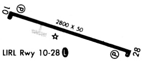
| Runways: | 11/29 |
| Longest Runway: | 11/29 is 3200 ft (975 m) long |
| Runways with an Instrument Approach: |
C25 Airport Runway Details
| Runway 11/29 | 3200 ft x 60 ft (975 m x 18 m) | |
| Runway Length Source: | 3RD PARTY SURVEY as of 09/02/2020 | |
| Surface: | Concrete - Good condition - No special surface treatment | |
| Runway Pavement Class: | 5 /R/D/W/U | |
| Runway Edge Lights: | Medium Intensity | |
Runway Weight Bearing Capacity (in thousands of pounds) |
||
| Single Wheel Landing Gear: | 15.0 | |
| Dual Wheel Landing Gear: | 30.0 | |
Runway 11 |
Runway 29 |
|
Elevation: |
992.3 | 980.0 |
Latitude: |
42-44-35.1228N | 42-44-25.8040N |
Longitude: |
092-30-46.4586W | 092-30-05.4783W |
|
Runway True Alignment: |
107 | 287 |
Glide Path Angle: |
3.0 degrees | 3.0 degrees |
Traffic Pattern: |
Left | Left |
Runway Markings Type: |
Nonprecision Instrument | Nonprecision Instrument |
Runway Markings Condition: |
Good | Good |
Visual Glide Slope Indicators: |
2-Light PAPI On Left Side Of Runway | 2-Light PAPI On Left Side Of Runway |
REIL: |
Yes | Yes |
Threshold Crossing Height: |
44 | 43 |
Services
Airframe Repair: |
Major |
Powerplant Repair: |
Major |
Bottled Oxygen: |
None |
Bulk Oxygen: |
None |
Fuel Available: |
100LL, Jet A |
Landing Fees: |
No |
Parking: |
Hangars and tiedowns available |
Maps & Diagrams
C25 Sectional
Flight Planning
at skyvector.com
at skyvector.com