Location
Latitude: |
60-54-10.4300N (60.902897) |
Longitude: |
161-13-50.1000W (-161.230583) |
Elevation: |
39.8 feet MSL (12 m MSL) |
Magnetic Variation: |
10.1 E (as of April 2024 from WMM2020 model) |
Time Zone: |
UTC -9.0 (Standard Time) UTC -8.0 (Daylight Savings Time) |
From City: |
00 N.M. SW of Akiak, Alaska |
Found On: |
Mc Grath Chart |
FAA Region: |
AAL |
Contacts
Manager: |
Publicly owned: |
| JOSEPH LARAUX P O BOX 505 BETHEL, AK 99559 (907) 543-2498 |
ALASKA DOT&PF CENTRAL REGION PO BOX 196900 ANCHORAGE, AK 99519-6900 907-269-0760 |
Operations
Airport Status: |
Operational |
Facility Use: |
Public |
Type: |
Airport |
Activation Date: |
07/1966 |
Control tower: |
No |
Attendance (Months/Days/Hours): |
Months/Days/Hours Unattended |
Boundary ARTCC: |
ZAN (Anchorage) |
Responsible ARTCC: |
ZAN (Anchorage) |
Lighting Schedule: |
SEE RMK |
Segmented Circle Indicator: |
Yes |
Traffic Pattern Altitude (MSL): |
1040 feet (317 m) |
NOTAMs Facility: |
ENA |
NOTAM-D Service: |
Yes |
International Airport of Entry: |
No |
Customs Landing Rights: |
No |
Military Landing Rights: |
Yes |
Civil/Military Joint Use: |
No |
Based Aircraft
Annual Operations (as of 12/31/2022)
| Total Operations: | 1000 | |
| Air Taxi: | 1000 | 100.0% |
Communications
| CTAF: | 122.900 |
- APCH/DEP SVC PRVDD BY ANCHORAGE ARTCC ON FREQS 125.2/372.0 (BETHEL RCAG).
Fixed Based Operators (FBOs) & Fuel
(Click on a business for detail)
Please help us keep this information up to date. This is a FREE SERVICE just like everything else on Airport Guide! If you see that a business needs to be added, modified, or deleted please fill out our Update Form.
To add, modify, or delete a business click here.
Please help us keep this information up to date. This is a FREE SERVICE just like everything else on Airport Guide! If you see that a business needs to be added, modified, or deleted please fill out our Update Form.
Area Code: 907 |
| Business Name | Frequency | Phone | Fuel Grade |
|---|
Flight Service Stations
| Primary | Alternate | |
| FSS on Field: | N | |
| FSS Name (ID): | Kenai(ENA) | |
| Frequency: | ||
| Toll Free Phone: | 1-866-864-1737 |
Instrument Procedures / Charts
FAA Terminal Procedures valid from 0901Z 03/21/24 to 0901Z 04/18/24.
There are various types of charts available for an airport. They are listed in the Page Type column. Here is a legend for those types:
APD - Airport Diagram
DP - Departure Procedure Charts
HOT - Hot Spots
IAP - Instrument Approach Procedure Charts
MIN - Minimums
STAR - Standard Terminal Arrival Charts
| Page Type | Page Name | Volume | Action Since Last Cycle |
|---|---|---|---|
| IAP | RNAV (GPS) RWY 03 | AK-1 | |
| IAP | RNAV (GPS) RWY 21 | AK-1 | |
| MIN | TAKEOFF MINIMUMS | AK-1 | |
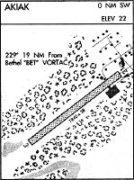
| ODP | AKIAK ONE (OBSTACLE) (RNAV) | AK-1 |
Terminal Procedures are only available for airports in several countries with more being added all the time. If you are looking for a specific country's charts, please send an email to support(at)airportguide.com stating the country name. This will be used to prioritize the implementation.
Navigation Aids (Navaids) near AKI
| Dist (NM) | ID | Morse Code | Name | Type | Freq | True Hdg | Mag Hdg |
|---|---|---|---|---|---|---|---|
| 18.7 | BET | _ . . . . _ | Bethel | VORTAC | 114.10 | 248 | 238 |
| 19.9 | OSE | _ _ _ . . . . | Oscarville | NDB | 251 | 250 | 240 |
| 62.6 | ANI | . _ _ . . . | Aniak | NDB | 359 | 48 | 38 |
| 90.9 | SMA | . . . _ _ . _ | St Marys | NDB | 230 | 320 | 310 |
Nearby Airports with Fuel
| Dist (NM) | Name (Airport IDs) | True Hdg | Mag Hdg | Fuel Grade |
|---|---|---|---|---|
| 19.2 | Bethel Airport (BET PABE BET) |
247 | 237 | 100, 100LL, Jet A, Jet A-1 |
| 63.4 | Aniak Airport (ANI PANI ANI) |
49 | 38 | 100LL, Jet A |
| 71.2 | Quinhagak Airport (KWN PAQH AQH) |
195 | 185 | 100LL |
Notices to Airmen (NOTAMS)
Remarks
| A110-2 | RY COND NOT MONITORED; RCMD VISUAL INSPECTION PRIOR TO USING. |
| A110-4 | WX CAMERA AVBL ON INTERNET AT HTTPS://WEATHERCAMS.FAA.GOV |
| A110-5 | NUMEROUS AIPORTS IN THE VICINITY, PILOTS ARE REQUESTED TO SELF-ANNOUNCE ON CTAF PRIOR TO TAXIING ON RWY FOR DEPARTURE: LEAVING THE RWY AND WITHIN 10 NM OF THE ARPT WHEN APPROACHING TO LAND. |
| A13 | 907-269-0760 |
| A42-03 | RYS 03 & 21 NSTD MKGS: RYS MKD WITH CONES & REFLECTIVE THLD MARKERS. |
| A81-APT | ACTVT MIRL RY 03/21 - CTAF. |
| A83 | WINDSOCK UNRELIABLE |
Runways
Runway Summary
| Runways: | 03/21 |
| Longest Runway: | 03/21 is 3200 ft (975 m) long |
| Runways with an Instrument Approach: |
AKI Airport Runway Details
| Runway 03/21 | 3200 ft x 76 ft (975 m x 23 m) | |
| Runway Length Source: | STATE as of 09/15/2014 | |
| Surface: | Gravel - Good condition - No special surface treatment | |
| Runway Edge Lights: | Medium Intensity | |
Runway 03 |
Runway 21 |
|
Elevation: |
39.8 | 39.8 |
Latitude: |
60-53-59.6830N | 60-54-21.1730N |
Longitude: |
161-14-13.7450W | 161-13-26.4590W |
|
Runway True Alignment: |
047 | 227 |
Glide Path Angle: |
0.0 degrees | 0.0 degrees |
Traffic Pattern: |
Left | Left |
Runway Markings Type: |
Nonstandard (other than numbers only) | Nonstandard (other than numbers only) |
Object at End: |
TREES | TREES |
Object Height: |
22 | 24 |
Distance from End: |
0 | 0 |
Object Centerline Offset: |
100 ft. left and right of centerline | 141 ft. left and right of centerline |
Services
Fuel Available: |
100LL |
Landing Fees: |
Yes |
Parking: |
Tiedowns available |
Maps & Diagrams
AKI Sectional
Flight Planning
at skyvector.com
at skyvector.com