Location
Latitude: |
29-43-12.9500N (29.720264) |
Longitude: |
082-39-54.7500W (-82.665208) |
Elevation: |
90.0 feet MSL (27 m MSL) |
Magnetic Variation: |
6.2 W (as of April 2024 from WMM2020 model) |
Time Zone: |
UTC -5.0 (Standard Time) UTC -4.0 (Daylight Savings Time) |
From City: |
07 N.M. SW of High Springs, Florida |
Found On: |
Jacksonville Chart |
FAA Region: |
ASO |
Contacts
Manager: |
Privately owned: |
| JULIE COLE 3603 NW 63RD PLACE GAINESVILLE, FL 32653 352-871-5354 |
OAK TREE LANDING LLC 300 SE 2ND ST FORT LAUDERDALE, FL 33301 954-627-9300 |
Operations
Airport Status: |
Operational |
Facility Use: |
Public |
Type: |
Airport |
Activation Date: |
12/1973 |
Control tower: |
No |
Attendance (Months/Days/Hours): |
Months/Days/Hours Unattended |
Boundary ARTCC: |
ZJX (Jacksonville) |
Responsible ARTCC: |
ZJX (Jacksonville) |
Segmented Circle Indicator: |
No |
Traffic Pattern Altitude (MSL): |
1090 feet (332 m) |
NOTAMs Facility: |
GNV |
NOTAM-D Service: |
Yes |
Civil/Military Joint Use: |
No |
Based Aircraft
Annual Operations (as of 04/05/2018)
| Total Operations: | 200 | |
| GA Local: | 100 | 50.0% |
| GA Itinerant: | 100 | 50.0% |
Communications
| CTAF: | 122.900 |
Fixed Based Operators (FBOs) & Fuel
(Click on a business for detail)
Please help us keep this information up to date. This is a FREE SERVICE just like everything else on Airport Guide! If you see that a business needs to be added, modified, or deleted please fill out our Update Form.
To add, modify, or delete a business click here.
Please help us keep this information up to date. This is a FREE SERVICE just like everything else on Airport Guide! If you see that a business needs to be added, modified, or deleted please fill out our Update Form.
Area Code: 904 |
| Business Name | Frequency | Phone | Fuel Grade |
|---|
Flight Service Stations
| Primary | Alternate | |
| FSS on Field: | N | |
| FSS Name (ID): | Gainesville(GNV) | |
| Frequency: | ||
| Toll Free Phone: | 1-800-WX-BRIEF |
Instrument Procedures / Charts
Terminal Procedures are only available for airports in several countries with more being added all the time. If you are looking for a specific country's charts, please send an email to support(at)airportguide.com stating the country name. This will be used to prioritize the implementation.
Navigation Aids (Navaids) near 6J8
| Dist (NM) | ID | Morse Code | Name | Type | Freq | True Hdg | Mag Hdg |
|---|---|---|---|---|---|---|---|
| 20.5 | GNV | _ _ . _ . . . . _ | Gators | VORTAC | 116.20 | 94 | 100 |
| 21.3 | CTY | _ . _ . _ _ . _ _ | Cross City | VORTAC | 112.00 | 250 | 256 |
| 25.9 | GN | _ _ . _ . | Wynds | NDB | 269 | 96 | 102 |
| 28.3 | LCQ | . _ . . _ . _ . _ _ . _ | Lake City | NDB | 204 | 9 | 15 |
| 39.8 | OCF | _ _ _ _ . _ . . . _ . | Ocala | VORTAC | 113.70 | 144 | 150 |
| 44.6 | IAK | . . . _ _ . _ | Palatka | NDB | 243 | 94 | 100 |
| 47.4 | TAY | _ . _ _ . _ _ | Taylor | VORTAC | 112.90 | 7 | 13 |
| 49.9 | VQQ | . . . _ _ _ . _ _ _ . _ | Cecil | VOR | 117.90 | 53 | 59 |
| 54.5 | RYD | . _ . _ . _ _ _ . . | Reynolds | NDB | 338 | 73 | 80 |
| 60.0 | NIP | _ . . . . _ _ . | Jacksonville | TACAN | 108.20 | 58 | 65 |
| 63.3 | JA | . _ _ _ . _ | Dinns | NDB | 344 | 44 | 51 |
| 68.6 | JAX | . _ _ _ . _ _ . . _ | Jacksonville Intl | VOT | 111.00 | 47 | 54 |
| 69.2 | EYA | . _ . _ _ . _ | Eastport | NDB | 357 | 52 | 59 |
| 70.3 | LEE | . _ . . . . | Leesburg | NDB | 335 | 140 | 146 |
| 70.6 | CRG | _ . _ . . _ . _ _ . | Craig | VORTAC | 114.50 | 57 | 64 |
| 70.9 | SGJ | . . . _ _ . . _ _ _ | St Augustine | VOR-DME | 109.40 | 78 | 85 |
| 71.1 | OTK | _ _ _ _ _ . _ | Valdosta | VOR-DME | 114.80 | 333 | 339 |
| 76.0 | NRB | _ . . _ . _ . . . | Mayport | TACAN | 111.40 | 57 | 64 |
| 76.5 | GEF | _ _ . . . . _ . | Greenville | VORTAC | 113.65 | 310 | 316 |
| 79.3 | VAD | . . . _ . _ _ . . | Moody | TACAN | 113.30 | 339 | 345 |
Nearby Airports with Fuel
Notices to Airmen (NOTAMS)
Remarks
| A11 | ARPT PHYS ADS: 1400 SE 80TH AVE, NEWBERRY, FL 32669. |
| A110-1 | 280 FT TWR 2 NM NW OF ARPT. |
| A110-2 | FOR CD CTC JACKSONVILLE APCH AT 904-741-0284. |
| A110-3 | MEN & EQPT WORKING INVOF THE RWY. |
| A110-4 | PRKG & LVE ARPT PROPERTY RQRS XNG PVT PROPERTY. FEE AND PAPERWORK RQRD TO INGREE/EGRESS PROPERTY. 7 DAY ADVND NOTIFICATION RQRD. CTC 352-871-5354 OR 352-316-3891. |
| A57-09 | RY 09 20:1 APCH SLOPE TO THE DSPLCD THLD. |
| E111 | VFR OPERATIONS. |
Runways
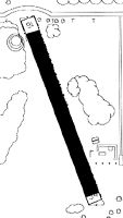
Runway Summary
| Runways: | 09/27 |
| Longest Runway: | 09/27 is 4630 ft (1411 m) long |
| Runways with an Instrument Approach: |
6J8 Airport Runway Details
| Runway 09/27 | 4630 ft x 75 ft (1411 m x 23 m) | |
| Runway Length Source: | ADO as of 07/08/2016 | |
| Surface: | Asphalt - Good condition - No special surface treatment | |
Runway 09 |
Runway 27 |
|
Elevation: |
90.0 | 90.0 |
Latitude: |
29-43-12.7000N | 29-43-13.2000N |
Longitude: |
082-40-21.0000W | 082-39-28.5000W |
Glide Path Angle: |
0.0 degrees | 0.0 degrees |
Runway Markings Type: |
Nonprecision Instrument | Nonprecision Instrument |
Runway Markings Condition: |
Fair | Fair |
Object at End: |
ROAD | TREES |
Object Height: |
22 | 55 |
Distance from End: |
343 | 1555 |
Object Centerline Offset: |
0 ft. left and right of centerline | 100 ft. right of centerline |
Threshold Elevation: |
90.0 | |
Displaced Threshold: |
100 | |
Threshold Latitude: |
29-43-12.6900N | |
Threshold Longitude: |
082-40-19.8700W |
Services
Airframe Repair: |
None |
Powerplant Repair: |
None |
Bottled Oxygen: |
None |
Bulk Oxygen: |
None |
Fuel Available: |
100, 100LL |
Landing Fees: |
No |
Parking: |
Tiedowns available |
Maps & Diagrams
6J8 Sectional
Flight Planning
at skyvector.com
at skyvector.com