Location
Latitude: |
42-27-24.8000N (42.456889) |
Longitude: |
091-56-51.6000W (-91.947667) |
Elevation: |
979.0 feet MSL (298 m MSL) |
Magnetic Variation: |
0.9 W (as of April 2024 from WMM2020 model) |
Time Zone: |
UTC -6.0 (Standard Time) UTC -5.0 (Daylight Savings Time) |
From City: |
03 N.M. SW of Independence, Iowa |
Found On: |
Chicago Chart |
FAA Region: |
ACE |
Contacts
Manager: |
Publicly owned: |
| BRETT SOUKUP 1684 - 230TH STREET, P.O. BOX 214 INDEPENDENCE, IA 50644-0506 (319) 332-0118 |
CITY OF INDEPENDENCE 331 1ST ST. EAST INDEPENDENCE, IA 50644 319-334-2780 |
Operations
Airport Status: |
Operational |
Facility Use: |
Public |
Type: |
Airport |
Activation Date: |
12/1967 |
Control tower: |
No |
Attendance (Months/Days/Hours): |
Months/Days/Hours ALL/ALL/0700-DUSK |
Boundary ARTCC: |
ZAU (Chicago) |
Responsible ARTCC: |
ZAU (Chicago) |
Lighting Schedule: |
SEE RMK |
Segmented Circle Indicator: |
Yes |
Traffic Pattern Altitude (MSL): |
1979 feet (603 m) |
NOTAMs Facility: |
IIB |
NOTAM-D Service: |
Yes |
International Airport of Entry: |
No |
Customs Landing Rights: |
No |
Military Landing Rights: |
Yes |
Civil/Military Joint Use: |
No |
Based Aircraft
| Single Engine: | 23 |
| Multi Engine: | 2 |
| GA Helicopters: | 2 |
Annual Operations (as of 07/06/2021)
| Total Operations: | 6500 | |
| Air Taxi: | 64 | 1.0% |
| GA Local: | 3784 | 58.2% |
| GA Itinerant: | 1884 | 29.0% |
| Military Aircraft: | 768 | 11.8% |
Communications
| CTAF: | 122.800 |
| Unicom: | 122.800 |
| Approach: | WATERLOO 118.9 118.9 CHICAGO ARTCC |
| Departure: | WATERLOO 118.9 118.9 CHICAGO ARTCC |
| AWOS-3: | 120.825 (319-334-3879) |
- APCH/DEP SVC PRVDD BY CHICAGO ARTCC ON FREQS 118.9 (REMOTED FROM WATERLOO) WHEN WATERLOO APCH CTL CLSD.
Fixed Based Operators (FBOs) & Fuel
(Click on a business for detail)
Please help us keep this information up to date. This is a FREE SERVICE just like everything else on Airport Guide! If you see that a business needs to be added, modified, or deleted please fill out our Update Form.
To add, modify, or delete a business click here.
Please help us keep this information up to date. This is a FREE SERVICE just like everything else on Airport Guide! If you see that a business needs to be added, modified, or deleted please fill out our Update Form.
Area Code: 319 |
| Business Name | Frequency | Phone | Fuel Grade |
|---|---|---|---|
| Connell Aviation II, Inc.
Update FBO info |
Unicom 122.8 | 334-4000 | 100LL, Jet A |
Flight Service Stations
| Primary | Alternate | |
| FSS on Field: | N | |
| FSS Name (ID): | Fort Dodge(FOD) | |
| Frequency: | ||
| Toll Free Phone: | 1-800-WX-BRIEF |
Instrument Procedures / Charts
FAA Terminal Procedures valid from 0901Z 03/21/24 to 0901Z 04/18/24.
There are various types of charts available for an airport. They are listed in the Page Type column. Here is a legend for those types:
APD - Airport Diagram
DP - Departure Procedure Charts
HOT - Hot Spots
IAP - Instrument Approach Procedure Charts
MIN - Minimums
STAR - Standard Terminal Arrival Charts
| Page Type | Page Name | Volume | Action Since Last Cycle |
|---|---|---|---|
| IAP | RNAV (GPS) RWY 18 | NC-3 | |
| IAP | RNAV (GPS) RWY 36 | NC-3 | |
| MIN | ALTERNATE MINIMUMS | NC-3 | |
| MIN | TAKEOFF MINIMUMS | NC-3 |
Terminal Procedures are only available for airports in several countries with more being added all the time. If you are looking for a specific country's charts, please send an email to support(at)airportguide.com stating the country name. This will be used to prioritize the implementation.
Navigation Aids (Navaids) near KIIB
| Dist (NM) | ID | Morse Code | Name | Type | Freq | True Hdg | Mag Hdg |
|---|---|---|---|---|---|---|---|
| 0.2 | IIB | . . . . _ . . . | Wapsie | NDB | 206 | 210 | 211 |
| 20.8 | ALO | . _ . _ . . _ _ _ | Waterloo | VOR-DME | 112.20 | 286 | 287 |
| 34.9 | CID | _ . _ . . . _ . . | Cedar Rapids | VOR-DME | 114.10 | 168 | 169 |
| 46.8 | CCY | _ . _ . _ . _ . _ . _ _ | Charles City | NDB | 375 | 321 | 322 |
| 47.4 | JWJ | . _ _ _ . _ _ . _ _ _ | Elmwood | DME | 109.4 | 244 | 245 |
| 52.6 | UKN | . . _ _ . _ _ . | Waukon | DME | 116.6 | 19 | 20 |
| 53.2 | IY | . . _ . _ _ | Chukk | NDB | 417 | 320 | 321 |
| 55.0 | DBQ | _ . . _ . . . _ _ . _ | Dubuque | VORTAC | 115.80 | 93 | 94 |
| 55.1 | CJJ | _ . _ . . _ _ _ . _ _ _ | Cresco | NDB | 293 | 351 | 352 |
| 58.2 | IOW | . . _ _ _ . _ _ | Iowa City | VOR-DME | 116.20 | 165 | 166 |
| 60.3 | DB | _ . . _ . . . | Zilom | NDB | 341 | 97 | 98 |
| 65.6 | TNU | _ _ . . . _ | Newton | VOR-DME | 112.50 | 232 | 232 |
| 70.5 | MC | _ _ _ . _ . | Surff | NDB | 348 | 300 | 300 |
| 71.7 | AWG | . _ . _ _ _ _ . | Washington | NDB | 219 | 170 | 171 |
| 71.9 | MCW | _ _ _ . _ . . _ _ | Mason City | VOR-DME | 114.90 | 302 | 302 |
| 74.5 | DDD | _ . . _ . . _ . . | Port City | DME | 116.5 | 151 | 152 |
| 77.2 | PEA | . _ _ . . . _ | Pella | NDB | 257 | 215 | 216 |
| 77.7 | OOA | _ _ _ _ _ _ . _ | Oskaloosa | NDB | 414 | 198 | 199 |
| 79.1 | DVN | _ . . . . . _ _ . | Davenport Municipal | VOT | 111.80 | 129 | 130 |
| 79.2 | CVA | _ . _ . . . . _ . _ | Davenport | VORTAC | 113.80 | 124 | 125 |
Nearby Airports with Fuel
Notices to Airmen (NOTAMS)
Remarks
| A11 | CITY CLERK SUSI LAMPE |
| A110-1 | PAEW PERFORMING SNOW REMOVAL OPS WILL MONITOR CTAF. |
| A110-2 | AG OPS DURG SUMMER MONTHS. |
| A110-3 | RY 36 IS CALM WIND RY. |
| A110-4 | CLEARANCE DELIVERY PHONE: FOR CD CTC WATERLOO APCH 319-233-4835. WHEN WATERLOO APCH CLSD, FOR CD CTC CHICAGO ARTCC AT 630-906-8921. |
| A81-APT | MIRL RY 18/36 PRESET LOW INTST; TO ACTVT HIGHER INTST & REILS & PAPI RYS 18 & 36 - CTAF. |
Runways
Runway Summary
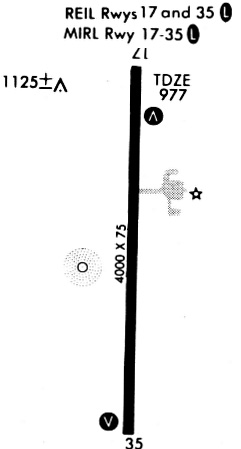
| Runways: | 18/36 |
| Longest Runway: | 18/36 is 5500 ft (1676 m) long |
| Runways with an Instrument Approach: |
KIIB Airport Runway Details
| Runway 18/36 | 5500 ft x 100 ft (1676 m x 30 m) | |
| Runway Length Source: | 3RD PARTY SURVEY as of 07/22/2013 | |
| Surface: | Concrete - Good condition - No special surface treatment | |
| Runway Pavement Class: | 15 /R/D/W/U | |
| Runway Edge Lights: | Medium Intensity | |
Runway Weight Bearing Capacity (in thousands of pounds) |
||
| Single Wheel Landing Gear: | 40.0 | |
| Dual Wheel Landing Gear: | 60.0 | |
Runway 18 |
Runway 36 |
|
Elevation: |
970.3 | 979.0 |
Latitude: |
42-27-51.9211N | 42-26-57.5982N |
Longitude: |
091-56-51.9576W | 091-56-51.2270W |
|
Runway True Alignment: |
179 | 359 |
Glide Path Angle: |
3.0 degrees | 3.0 degrees |
Traffic Pattern: |
Left | Left |
Runway Markings Type: |
Nonprecision Instrument | Nonprecision Instrument |
Runway Markings Condition: |
Good | Good |
Visual Glide Slope Indicators: |
2-Light PAPI On Left Side Of Runway | 2-Light PAPI On Left Side Of Runway |
REIL: |
Yes | Yes |
Touchdown Lights: |
No | |
Threshold Crossing Height: |
40 | 40 |
Services
Fuel Available: |
100LL |
Landing Fees: |
No |
Parking: |
Hangars available |
Maps & Diagrams
KIIB Sectional
Flight Planning
at skyvector.com
at skyvector.com