
Location
Latitude: |
48-15-27.5000N (48.257639) |
Longitude: |
101-16-40.9000W (-101.278028) |
Elevation: |
1715.7 feet MSL (523 m MSL) |
Magnetic Variation: |
6 E (as of April 2024 from WMM2020 model) |
Time Zone: |
UTC -6.0 (Standard Time) UTC -5.0 (Daylight Savings Time) |
From City: |
02 N.M. N of Minot, North Dakota |
Found On: |
Billings Chart |
FAA Region: |
AGL |
Contacts
Manager: |
Publicly owned: |
| JENNIFER ECKMAN 305 AIRPORT RD, SUITE 216 MINOT, ND 58703 701-857-4724 |
CITY OF MINOT 305 AIRPORT RD., SUITE 216 MINOT, ND 58703 701-857-4724 |
Operations
Airport Status: |
Operational |
Facility Use: |
Public |
Type: |
Airport |
Activation Date: |
03/1940 |
Control tower: |
Yes |
Attendance (Months/Days/Hours): |
Months/Days/Hours ALL/ALL/ALL |
Boundary ARTCC: |
ZMP (Minneapolis) |
Responsible ARTCC: |
ZMP (Minneapolis) |
Lighting Schedule: |
SEE RMK |
Segmented Circle Indicator: |
Yes |
Traffic Pattern Altitude (MSL): |
2716 feet (828 m) |
NOTAMs Facility: |
MOT |
NOTAM-D Service: |
Yes |
International Airport of Entry: |
Yes |
Customs Landing Rights: |
No |
Military Landing Rights: |
Yes |
Civil/Military Joint Use: |
No |
Aircraft Rescue and Firefighting: |
Class I ARFF Index: B Air Carrier Service: Scheduled Certification Date: 05/1973 |
Based Aircraft
| Single Engine: | 119 |
| Multi Engine: | 6 |
| Jet Engine: | 1 |
| GA Helicopters: | 2 |
Annual Operations (as of 03/31/2023)
| Total Operations: | 33020 | |
| Commercial: | 2020 | 6.1% |
| Air Taxi: | 4869 | 14.7% |
| GA Local: | 13697 | 41.5% |
| GA Itinerant: | 10494 | 31.8% |
| Military Aircraft: | 1940 | 5.9% |
Communications
| CTAF: | 118.200 |
| Unicom: | 122.950 |
| Tower: | MAGIC CITY 118.2 251.125 Hrs: 0700-2200 |
| Ground: | 121.9 |
| Approach: | MINOT 119.6 119.6 119.6 MINNEAPOLIS ARTCC |
| Departure: | MINOT 119.6 119.6 119.6 MINNEAPOLIS ARTCC |
| ASOS: | 118.725 (701-837-9379) |
- APCH/DEP SVC PRVDD BY MINNEAPOLIS ARTCC ON FREQS 127.6/279.6 (MINOT RCAG) WHEN MINOT APCH CTL CLSD.
Fixed Based Operators (FBOs) & Fuel
(Click on a business for detail)
Please help us keep this information up to date. This is a FREE SERVICE just like everything else on Airport Guide! If you see that a business needs to be added, modified, or deleted please fill out our Update Form.
To add, modify, or delete a business click here.
Please help us keep this information up to date. This is a FREE SERVICE just like everything else on Airport Guide! If you see that a business needs to be added, modified, or deleted please fill out our Update Form.
Area Code: 701 |
| Business Name | Frequency | Phone | Fuel Grade |
|---|---|---|---|
| Minot International Airport
Update FBO info |
Unicom 122.95 | 857-4738, 857-4724 | 100LL, Jet A |
Flight Service Stations
| Primary | Alternate | |
| FSS on Field: | N | |
| FSS Name (ID): | Grand Forks(GFK) | |
| Frequency: | ||
| Toll Free Phone: | 1-800-WX-BRIEF |
Instrument Procedures / Charts
FAA Terminal Procedures valid from 0901Z 03/21/24 to 0901Z 04/18/24.
There are various types of charts available for an airport. They are listed in the Page Type column. Here is a legend for those types:
APD - Airport Diagram
DP - Departure Procedure Charts
HOT - Hot Spots
IAP - Instrument Approach Procedure Charts
MIN - Minimums
STAR - Standard Terminal Arrival Charts
| Page Type | Page Name | Volume | Action Since Last Cycle |
|---|---|---|---|
| APD | AIRPORT DIAGRAM | NC-1 | |
| HOT | HOT SPOT | NC-1 | |
| IAP | ILS OR LOC RWY 31 | NC-1 | |
| IAP | LOC BC RWY 13 | NC-1 | |
| IAP | RNAV (GPS) RWY 08 | NC-1 | |
| IAP | RNAV (GPS) RWY 13 | NC-1 | |
| IAP | RNAV (GPS) RWY 26 | NC-1 | |
| IAP | RNAV (GPS) RWY 31 | NC-1 | |
| IAP | VOR RWY 08 | NC-1 | |
| IAP | VOR RWY 13 | NC-1 | |
| IAP | VOR RWY 26 | NC-1 | |
| IAP | VOR RWY 31 | NC-1 | |
| MIN | ALTERNATE MINIMUMS | NC-1 | |
| MIN | TAKEOFF MINIMUMS | NC-1 |
Terminal Procedures are only available for airports in several countries with more being added all the time. If you are looking for a specific country's charts, please send an email to support(at)airportguide.com stating the country name. This will be used to prioritize the implementation.
Navigation Aids (Navaids) near MOT
| Dist (NM) | ID | Morse Code | Name | Type | Freq | True Hdg | Mag Hdg |
|---|---|---|---|---|---|---|---|
| 0.4 | MOT | _ _ _ _ _ _ | Minot | VOR-DME | 117.10 | 293 | 287 |
| 10.1 | MIB | _ _ . . _ . . . | Deering | TACAN | 114.90 | 339 | 333 |
| 84.8 | L7 | Estevan | NDB | 395 | 312 | 305 | |
| 89.7 | SF | . . . . . _ . | Yuson | NDB | 275 | 265 | 258 |
| 92.2 | 8A | Carlyle | NDB | 310 | 334 | 328 | |
| 92.4 | ISN | . . . . . _ . | Williston | NDB | 275 | 266 | 259 |
| 93.1 | BIS | _ . . . . . . . . | Bismarck | VOR-DME | 115.65 | 164 | 158 |
| 95.0 | DVL | _ . . . . . _ . _ . . | Devils Lake | VOR-DME | 114.75 | 94 | 89 |
| 97.0 | BI | _ . . . . . | Jadan | NDB | 230 | 164 | 158 |
| 98.8 | ISN | . . . . . _ . | Williston | VOR-DME | 116.30 | 270 | 263 |
Nearby Airports with Fuel
Notices to Airmen (NOTAMS)
Remarks
| A110-1 | DEER & BIRDS INVOF ARPT. |
| A110-2 | TWYS E, B2, F, AND A ARE MKD WITH EDGE REFLECTORS. |
| A110-3 | CUSTOMS SVC AVBL 24 HRS; FOR CUSTOMS CALL 701-838-6704. |
| A110-7 | MINOT AFB (MIB) ASR OTS FOR PREVENTIVE MAINTENANCE FRIDAYS 0700-0900 & ALTN TUESDAYS 0630-0830. |
| A110-8 | RDO EQUIPD ACFT MUST ANNC ON CTAF - 118.2 WHEN TWR IS CLSD. |
| A110-9 | FOR CD IF UNA TO CTC ON FSS FREQ, CTC MINNEAPOLIS ARTCC AT 651-463-5588. |
| A24 | LDG FEE FOR ALL COML FREIGHT AND COMMUTER ACFT AND ALL ACFT OVR 12500 LB. |
| A57-08 | RWY 08 APCH RATIO 24:1 FM DSPLCD THLD. |
| A81-APT | WHEN ATCT IS CLSD, ACTVT MALSR RWY 31; REIL RWYS 08 & 26; HIRL RWYS 08/26 & 13/31 - CTAF. PAPI RWYS 08, 13, & 26 OPR CONSLY. |
Runways
Runway Summary
| Runways: | 08/26 13/31 |
| Longest Runway: | 13/31 is 7700 ft (2347 m) long |
| Runways with an Instrument Approach: | 31 |
MOT Airport Runway Details
| Runway 08/26 | 6348 ft x 100 ft (1935 m x 30 m) | |
| Runway Length Source: | 3RD PARTY SURVEY as of 01/25/2016 | |
| Surface: | Asphalt - Fair condition - Saw-cut or plastic grooved | |
| Runway Pavement Class: | 34 /F/D/W/T | |
| Runway Edge Lights: | High Intensity | |
Runway Weight Bearing Capacity (in thousands of pounds) |
||
| Single Wheel Landing Gear: | 120.0 | |
| Dual Wheel Landing Gear: | 150.0 | |
| Dual Tandem Wheel Landing Gear: | 240.0 | |
Runway 08 |
Runway 26 |
|
Elevation: |
1715.7 | 1658.2 |
Latitude: |
48-15-28.9553N | 48-15-28.6812N |
Longitude: |
101-17-26.8167W | 101-15-53.0194W |
|
Runway True Alignment: |
090 | 270 |
Glide Path Angle: |
3.0 degrees | 3.0 degrees |
Traffic Pattern: |
Left | Left |
Runway Markings Type: |
Nonprecision Instrument | Nonprecision Instrument |
Runway Markings Condition: |
Good | Good |
Object at End: |
TREES | |
Object Height: |
57 | |
Distance from End: |
1900 | |
Object Centerline Offset: |
160 ft. left of centerline | |
Visual Glide Slope Indicators: |
4-Light PAPI On Left Side Of Runway | 4-Light PAPI On Left Side Of Runway |
REIL: |
Yes | Yes |
Touchdown Lights: |
No | No |
Centerline Lights: |
No | No |
Threshold Crossing Height: |
45 | 49 |
Threshold Elevation: |
1711.8 | |
Displaced Threshold: |
393 | |
Threshold Latitude: |
48-15-28.9391N | |
Threshold Longitude: |
101-17-21.0524W | |
Declared Distances |
||
Take Off Run Avbl. (TORA): |
6348 | 5958 |
Take Off Distance Avbl. (TODA): |
6348 | 5958 |
Actual Stop Dist. Avbl. (ASDA): |
6348 | 6348 |
Landing Dist. Avbl. (LDA): |
5958 | 6348 |
| Runway 13/31 | 7700 ft x 150 ft (2347 m x 46 m) | |
| Runway Length Source: | 3RD PARTY SURVEY as of 01/25/2016 | |
| Surface: | Asphalt - Fair condition - Saw-cut or plastic grooved | |
| Runway Pavement Class: | 43 /R/C/W/T | |
| Runway Edge Lights: | High Intensity | |
Runway Weight Bearing Capacity (in thousands of pounds) |
||
| Single Wheel Landing Gear: | 120.0 | |
| Dual Wheel Landing Gear: | 150.0 | |
| Dual Tandem Wheel Landing Gear: | 240.0 | |
Runway 13 |
Runway 31 |
|
Elevation: |
1701.8 | 1657.1 |
Latitude: |
48-15-54.8994N | 48-14-58.0879N |
Longitude: |
101-17-19.4618W | 101-16-03.9067W |
|
Runway True Alignment: |
138 | 318 |
ILS Type: |
ILS/DME | |
Glide Path Angle: |
3.0 degrees | 0.0 degrees |
Traffic Pattern: |
Left | Left |
Runway Markings Type: |
Precision Instrument | Precision Instrument |
Runway Markings Condition: |
Good | Good |
Object Centerline Offset: |
160 ft. left of centerline | |
Visual Glide Slope Indicators: |
4-Light PAPI On Left Side Of Runway | |
Runway Visual Range (RVR): |
Rollout | Touchdown |
Approach Light System: |
1,400 Foot Medium Intensity Approach Lighting System With Runway Alignment Indicator Lights | |
REIL: |
Yes | No |
Touchdown Lights: |
No | No |
Centerline Lights: |
No | No |
Threshold Crossing Height: |
49 | |
Declared Distances |
||
Take Off Run Avbl. (TORA): |
7700 | 7700 |
Take Off Distance Avbl. (TODA): |
7700 | 7700 |
Actual Stop Dist. Avbl. (ASDA): |
7700 | 7700 |
Landing Dist. Avbl. (LDA): |
7700 | 7700 |
Services
Airframe Repair: |
Major |
Powerplant Repair: |
Major |
Bottled Oxygen: |
None |
Bulk Oxygen: |
None |
Fuel Available: |
100LL, Jet A |
Landing Fees: |
No |
Parking: |
Hangars and tiedowns available |
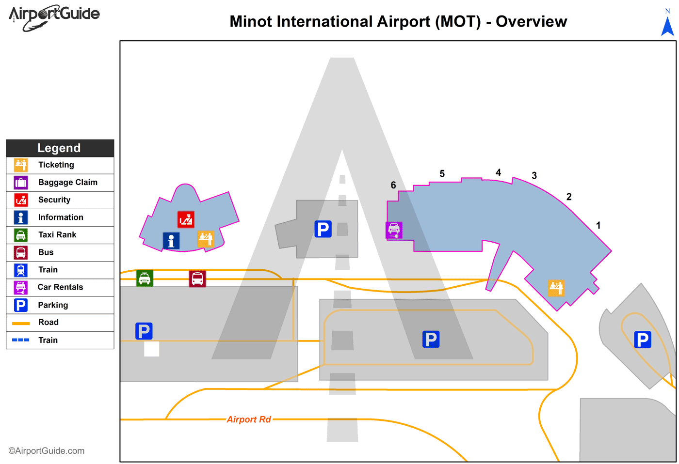
Maps & Diagrams
MOT Sectional
Flight Planning
at skyvector.com
at skyvector.com
 Diagram")