Location
Latitude: |
45-55-06.1699N (45.91838) |
Longitude: |
102-06-19.9312W (-102.105536) |
Elevation: |
2572.8 feet MSL (784 m MSL) |
Magnetic Variation: |
6.5 E (as of April 2024 from WMM2020 model) |
Time Zone: |
UTC -7.0 (Standard Time) UTC -6.0 (Daylight Savings Time) |
From City: |
03 N.M. SE of Lemmon, South Dakota |
Found On: |
Billings Chart |
FAA Region: |
AGL |
Contacts
Manager: |
Publicly owned: |
| MIKE GINTHER 10216 AIRPORT RD LEMMON, SD 57638 605-374-5281 |
CITY OF LEMMON 303 1ST AVE WEST LEMMON, SD 57638 605-374-5681 |
Operations
Airport Status: |
Operational |
Facility Use: |
Public |
Type: |
Airport |
Activation Date: |
02/1947 |
Control tower: |
No |
Attendance (Months/Days/Hours): |
Months/Days/Hours Unattended |
Boundary ARTCC: |
ZMP (Minneapolis) |
Responsible ARTCC: |
ZMP (Minneapolis) |
Lighting Schedule: |
SEE RMK |
Segmented Circle Indicator: |
No |
Traffic Pattern Altitude (MSL): |
3573 feet (1089 m) |
NOTAMs Facility: |
HON |
NOTAM-D Service: |
Yes |
International Airport of Entry: |
No |
Customs Landing Rights: |
No |
Military Landing Rights: |
Yes |
Civil/Military Joint Use: |
No |
Based Aircraft
| Single Engine: | 17 |
| GA Helicopters: | 1 |
Annual Operations (as of 08/01/2023)
| Total Operations: | 3920 | |
| Air Taxi: | 100 | 2.6% |
| GA Local: | 3500 | 89.3% |
| GA Itinerant: | 320 | 8.2% |
Communications
| CTAF: | 122.800 |
| Unicom: | 122.800 |
- APCH/DEP SVC PRVDD BY MINNEAPOLIS ARTCC ON FREQS 124.25/236.825 (DICKINSON RCAG).
Fixed Based Operators (FBOs) & Fuel
(Click on a business for detail)
Please help us keep this information up to date. This is a FREE SERVICE just like everything else on Airport Guide! If you see that a business needs to be added, modified, or deleted please fill out our Update Form.
To add, modify, or delete a business click here.
Please help us keep this information up to date. This is a FREE SERVICE just like everything else on Airport Guide! If you see that a business needs to be added, modified, or deleted please fill out our Update Form.
Area Code: 605 |
| Business Name | Frequency | Phone | Fuel Grade |
|---|
Flight Service Stations
| Primary | Alternate | |
| FSS on Field: | N | |
| FSS Name (ID): | Huron(HON) | |
| Frequency: | ||
| Toll Free Phone: | 1-800-WX-BRIEF |
Instrument Procedures / Charts
FAA Terminal Procedures valid from 0901Z 03/21/24 to 0901Z 04/18/24.
There are various types of charts available for an airport. They are listed in the Page Type column. Here is a legend for those types:
APD - Airport Diagram
DP - Departure Procedure Charts
HOT - Hot Spots
IAP - Instrument Approach Procedure Charts
MIN - Minimums
STAR - Standard Terminal Arrival Charts
| Page Type | Page Name | Volume | Action Since Last Cycle |
|---|---|---|---|
| IAP | RNAV (GPS) RWY 30 | NC-1 | |
| MIN | TAKEOFF MINIMUMS | NC-1 |
Terminal Procedures are only available for airports in several countries with more being added all the time. If you are looking for a specific country's charts, please send an email to support(at)airportguide.com stating the country name. This will be used to prioritize the implementation.
Navigation Aids (Navaids) near LEM
| Dist (NM) | ID | Morse Code | Name | Type | Freq | True Hdg | Mag Hdg |
|---|---|---|---|---|---|---|---|
| 0.1 | LEM | . _ . . . _ _ | Lemmon | VOR | 111.40 | 43 | 37 |
| 52.6 | DI | _ . . . . | Noson | NDB | 353 | 331 | 324 |
| 53.0 | DPR | _ . . . _ _ . . _ . | Dupree | VOR-DME | 116.80 | 161 | 155 |
| 57.4 | BOD | _ . . . _ _ _ _ . . | Bowman | NDB | 374 | 286 | 279 |
| 60.7 | BUA | _ . . . . . _ . _ | Buffalo | DME | 109.4 | 249 | 242 |
| 62.9 | DIK | _ . . . . _ . _ | Dickinson | VORTAC | 112.90 | 334 | 327 |
| 76.4 | BI | _ . . . . . | Jadan | NDB | 230 | 51 | 45 |
| 78.2 | BIS | _ . . . . . . . . | Bismarck | VOR-DME | 115.65 | 49 | 43 |
| 93.1 | BKU | _ . . . _ . _ . . _ | Timber | NDB | 344 | 286 | 279 |
Nearby Airports with Fuel
| Dist (NM) | Name (Airport IDs) | True Hdg | Mag Hdg | Fuel Grade |
|---|---|---|---|---|
| 23.7 | Hettinger/Jb Lindquist Regional Airport (KHEI HEI) |
284 | 277 | 100LL, Jet A |
| 28.4 | Bison Municipal Airport (6V5) |
212 | 205 | 100LL |
| 52.4 | Timber Lake Municipal Airport (D58) |
124 | 118 | 100LL |
| 60.3 | Dickinson/Theodore Roosevelt Regional Airport (DIK KDIK DIK) |
331 | 324 | 100LL, Jet A |
| 71.5 | Mandan Regional/Lawler Field Airport (Y19) |
44 | 38 | 100LL, Jet A |
| 74.6 | Mobridge Municipal Airport (MBG KMBG MBG) |
106 | 101 | 100LL, Jet A, MOGAS |
| 76.2 | Bismarck Municipal Airport (BIS KBIS BIS) |
47 | 41 | 100LL, Jet A |
| 85.1 | Mercer County Regional Airport (KHZE HZE) |
14 | 8 | 100LL, Jet A |
| 93.1 | Baker Municipal Airport (KBHK BHK) |
286 | 278 | 100LL, Jet A+ |
| 96.8 | Washburn Municipal Airport (5C8) |
26 | 20 | 100LL |
Notices to Airmen (NOTAMS)
Remarks
| A110-1 | WILDLIFE ON AND INVOF ARPT. |
| A110-2 | FOR CD CTC MINNEAPOLIS ARTCC AT 651-463-5588. |
| A42-06 | RWY 06/24 MKD WITH BLACK AND WHITE MKR CONES. |
| A70-FUEL-10 | 0LL FUEL AVIALABLE. |
| A70-FUEL-A | FUEL AVIALABLE. |
| A81-APT | ACTVT PAPI RWY 12 & 30; MIRL RWY 12/30 - CTAF. |
| A82 | AUTOMATED UNICOM. |
Runways
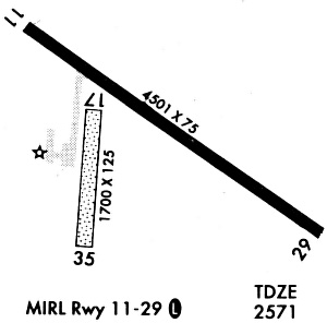
Runway Summary
| Runways: | 06/24 12/30 |
| Longest Runway: | 12/30 is 4499 ft (1371 m) long |
| Runways with an Instrument Approach: |
LEM Airport Runway Details
| Runway 06/24 | 3277 ft x 120 ft (999 m x 37 m) | |
| Runway Length Source: | 3RD PARTY SURVEY as of 08/11/2009 | |
| Surface: | Turf - Good condition - No special surface treatment | |
Runway 06 |
Runway 24 |
|
Elevation: |
2564.9 | 2570.0 |
Latitude: |
45-54-54.9246N | 45-55-10.0454N |
Longitude: |
102-06-42.8291W | 102-06-01.8547W |
|
Runway True Alignment: |
062 | 242 |
Glide Path Angle: |
0.0 degrees | 0.0 degrees |
| Runway 12/30 | 4499 ft x 75 ft (1371 m x 23 m) | |
| Runway Length Source: | 3RD PARTY SURVEY as of 08/11/2009 | |
| Surface: | Turf - Good condition - No special surface treatment | |
| Runway Edge Lights: | Medium Intensity | |
Runway Weight Bearing Capacity (in thousands of pounds) |
||
| Single Wheel Landing Gear: | 12.5 | |
Runway 12 |
Runway 30 |
|
Elevation: |
2567.9 | 2570.1 |
Latitude: |
45-55-21.8742N | 45-54-55.8337N |
Longitude: |
102-06-43.9427W | 102-05-52.4077W |
|
Runway True Alignment: |
126 | 306 |
Glide Path Angle: |
3.0 degrees | 3.0 degrees |
Traffic Pattern: |
Left | Left |
Runway Markings Type: |
Nonprecision Instrument | Nonprecision Instrument |
Runway Markings Condition: |
Good | Good |
Object at End: |
ROAD | |
Object Height: |
13 | |
Distance from End: |
600 | |
Visual Glide Slope Indicators: |
2-Light PAPI On Left Side Of Runway | 2-Light PAPI On Left Side Of Runway |
REIL: |
No | No |
Touchdown Lights: |
No | No |
Centerline Lights: |
No | No |
Threshold Crossing Height: |
28 | 27 |
Services
Airframe Repair: |
None |
Powerplant Repair: |
None |
Bottled Oxygen: |
None |
Bulk Oxygen: |
None |
Fuel Available: |
100LL |
Landing Fees: |
No |
Parking: |
Tiedowns available |
Maps & Diagrams
LEM Sectional
Flight Planning
at skyvector.com
at skyvector.com