Location
Latitude: |
38-27-05.2680N (38.451463) |
Longitude: |
101-45-00.2850W (-101.750079) |
Elevation: |
3609.9 feet MSL (1100 m MSL) |
Magnetic Variation: |
5.8 E (as of April 2024 from WMM2020 model) |
Time Zone: |
UTC -6.0 (Standard Time) UTC -5.0 (Daylight Savings Time) |
From City: |
01 N.M. S of Tribune, Kansas |
Found On: |
Wichita Chart |
FAA Region: |
ACE |
Contacts
Manager: |
Publicly owned: |
| GINA BOND 508 BROADWAY, PO BOX 577 TRIBUNE, KS 67879 620-376-4278 |
CITY AND COUNTY BOX 277 TRIBUNE, KS 67879 620-376-4256 |
Operations
Airport Status: |
Operational |
Facility Use: |
Public |
Type: |
Airport |
Activation Date: |
05/1950 |
Control tower: |
No |
Attendance (Months/Days/Hours): |
Months/Days/Hours Unattended |
Boundary ARTCC: |
ZDV (Denver) |
Responsible ARTCC: |
ZDV (Denver) |
Lighting Schedule: |
SEE RMK |
Segmented Circle Indicator: |
No |
Traffic Pattern Altitude (MSL): |
4610 feet (1405 m) |
NOTAMs Facility: |
ICT |
NOTAM-D Service: |
Yes |
Civil/Military Joint Use: |
No |
Based Aircraft
| Single Engine: | 17 |
Annual Operations (as of 09/24/2020)
| Total Operations: | 2650 | |
| GA Local: | 2400 | 90.6% |
| GA Itinerant: | 250 | 9.4% |
Communications
| CTAF: | 122.800 |
| Unicom: | 122.800 |
| AWOS-3PT: | 119.075 (620-376-2336) |
- APCH CTL SVC PRVDD BY DENVER ARTCC (ZDV) ON FREQS 133.4/377.175 (LA JUNTA RCAG).
Fixed Based Operators (FBOs) & Fuel
(Click on a business for detail)
Please help us keep this information up to date. This is a FREE SERVICE just like everything else on Airport Guide! If you see that a business needs to be added, modified, or deleted please fill out our Update Form.
To add, modify, or delete a business click here.
Please help us keep this information up to date. This is a FREE SERVICE just like everything else on Airport Guide! If you see that a business needs to be added, modified, or deleted please fill out our Update Form.
Area Code: 620 |
| Business Name | Frequency | Phone | Fuel Grade |
|---|
Flight Service Stations
| Primary | Alternate | |
| FSS on Field: | N | |
| FSS Name (ID): | Wichita(ICT) | |
| Frequency: | ||
| Toll Free Phone: | 1-800-WX-BRIEF |
Instrument Procedures / Charts
FAA Terminal Procedures valid from 0901Z 03/21/24 to 0901Z 04/18/24.
There are various types of charts available for an airport. They are listed in the Page Type column. Here is a legend for those types:
APD - Airport Diagram
DP - Departure Procedure Charts
HOT - Hot Spots
IAP - Instrument Approach Procedure Charts
MIN - Minimums
STAR - Standard Terminal Arrival Charts
| Page Type | Page Name | Volume | Action Since Last Cycle |
|---|---|---|---|
| IAP | RNAV (GPS) RWY 17 | NC-2 | |
| IAP | RNAV (GPS) RWY 35 | NC-2 | |
| MIN | TAKEOFF MINIMUMS | NC-2 |
Terminal Procedures are only available for airports in several countries with more being added all the time. If you are looking for a specific country's charts, please send an email to support(at)airportguide.com stating the country name. This will be used to prioritize the implementation.
Navigation Aids (Navaids) near 5K2
| Dist (NM) | ID | Morse Code | Name | Type | Freq | True Hdg | Mag Hdg |
|---|---|---|---|---|---|---|---|
| 40.5 | TQK | _ _ _ . _ _ . _ | Scott City | NDB | 256 | 87 | 81 |
| 46.7 | LAA | . _ . . . _ . _ | Lamar | VOR-DME | 116.90 | 251 | 245 |
| 49.0 | JHN | . _ _ _ . . . . _ . | Bear Creek | NDB | 341 | 179 | 173 |
| 51.0 | GL | _ _ . . _ . . | Shugr | NDB | 414 | 7 | 1 |
| 53.8 | ITR | . . _ . _ . | Kit Carson | NDB | 209 | 332 | 326 |
| 54.3 | ULS | . . _ . _ . . . . . | Ulysses | NDB | 395 | 160 | 154 |
| 56.3 | GLD | _ _ . . _ . . _ . . | Goodland | VORTAC | 115.10 | 2 | 356 |
| 57.9 | GCK | _ _ . _ . _ . _ . _ | Garden City | VORTAC | 113.30 | 123 | 118 |
| 59.0 | OEL | _ _ _ . . _ . . | Oakley | NDB | 380 | 47 | 41 |
| 61.2 | GC | _ _ . _ . _ . | Pieve | NDB | 347 | 127 | 122 |
| 71.5 | JDM | . _ _ _ _ . . _ _ | Wheatfield | NDB | 408 | 27 | 21 |
| 76.6 | SYF | . . . _ . _ _ . . _ . | St Francis | NDB | 386 | 359 | 353 |
| 79.3 | HQG | . . . . _ _ . _ _ _ . | Hugoton | NDB | 365 | 166 | 160 |
| 86.1 | HLC | . . . . . _ . . _ . _ . | Hill City | VORTAC | 113.70 | 55 | 50 |
| 87.3 | EHA | . . . . . . _ | Elkhart | NDB | 377 | 184 | 178 |
| 89.9 | DDC | _ . . _ . . _ . _ . | Dodge City | VORTAC | 108.20 | 113 | 108 |
| 90.4 | HGO | . . . . _ _ . _ _ _ | Hugo | VOR-DME | 112.10 | 284 | 278 |
| 92.2 | LBL | . _ . . _ . . . . _ . . | Liberal | TACAN | 112.30 | 156 | 150 |
| 96.8 | LB | . _ . . _ . . . | Panck | NDB | 383 | 156 | 151 |
Nearby Airports with Fuel
Notices to Airmen (NOTAMS)
Remarks
| A110-1 | PUB TELEPHONE AVBL 24 HRS 620-376-2285. |
| A110-2 | FOR CD CTC DENVER ARTCC AT 303-651-4257. |
| A110-3 | (CONTACT TITLE) ADDRESS QUESTIONS TO: PO BOX 577 508 BROADWAY TRIBUNE, KS 67879 CITYOFTRIBUNE@WBSNET.ORG |
| A16 | CELL# 620-376-8367 FOR REFUELING. |
| A58-17 | PVT ROAD AT THR. |
| A70-FUEL-10 | 0LL FOR FUEL CALL 620-376-4299. |
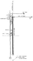
| A81-APT | ACTVT MIRLS RWY 17/35, & PAPI RWY 35 - CTAF |
| E111 | PRVDD APCH SLOPES ARE CLEARED & MAINT FOR A 20:1 GLIDE SLOPE. |
Runways
Runway Summary
| Runways: | 17/35 |
| Longest Runway: | 17/35 is 5007 ft (1526 m) long |
| Runways with an Instrument Approach: |
5K2 Airport Runway Details
| Runway 17/35 | 5007 ft x 60 ft (1526 m x 18 m) | |
| Runway Length Source: | 3RD PARTY SURVEY as of 12/15/2010 | |
| Surface: | Concrete - Excellent condition - No special surface treatment | |
| Runway Pavement Class: | 11 /R/C/X/U | |
| Runway Edge Lights: | Medium Intensity | |
Runway Weight Bearing Capacity (in thousands of pounds) |
||
| Single Wheel Landing Gear: | 30.0 | |
Runway 17 |
Runway 35 |
|
Elevation: |
3603.7 | 3609.9 |
Latitude: |
38-27-30.0100N | 38-26-40.5256N |
Longitude: |
101-45-00.3874W | 101-45-00.1831W |
|
Runway True Alignment: |
180 | 360 |
Glide Path Angle: |
0.0 degrees | 3.0 degrees |
Traffic Pattern: |
Left | Left |
Runway Markings Type: |
Nonprecision Instrument | Nonprecision Instrument |
Runway Markings Condition: |
Good | Good |
Object at End: |
ROAD | PLINE |
Object Height: |
15 | 55 |
Object Marked/Lighted?: |
Marked | |
Distance from End: |
529 | 2540 |
Object Centerline Offset: |
0 ft. left and right of centerline | 0 ft. left and right of centerline |
Visual Glide Slope Indicators: |
2-Light PAPI On Left Side Of Runway | |
REIL: |
No | No |
Threshold Crossing Height: |
43 |
Services
Airframe Repair: |
Minor |
Powerplant Repair: |
Minor |
Fuel Available: |
100LL |
Landing Fees: |
No |
Parking: |
Tiedowns available |
Maps & Diagrams
5K2 Sectional
Flight Planning
at skyvector.com
at skyvector.com