Location
Latitude: |
41-43-40.7618N (41.727989) |
Longitude: |
077-23-43.5751W (-77.395438) |
Elevation: |
1891.5 feet MSL (577 m MSL) |
Magnetic Variation: |
11 W (as of April 2024 from WMM2020 model) |
Time Zone: |
UTC -5.0 (Standard Time) UTC -4.0 (Daylight Savings Time) |
From City: |
04 N.M. SW of Wellsboro, Pennsylvania |
Found On: |
Detroit Chart |
FAA Region: |
AEA |
Contacts
Manager: |
Publicly owned: |
| SHAW SIGLIN 112 RUNWAY ROAD WELLSBORO, PA 16901 (570) 724-3746 |
GRAND CANYON ARPT AUTH 112 RUNWAY RD WELLSBORO, PA 16901 (570) 724-3746 |
Operations
Airport Status: |
Operational |
Facility Use: |
Public |
Type: |
Airport |
Activation Date: |
03/1947 |
Control tower: |
No |
Attendance (Months/Days/Hours): |
Months/Days/Hours ALL/MON-FRI/1000-1500 |
Boundary ARTCC: |
ZNY (New York) |
Responsible ARTCC: |
ZNY (New York) |
Lighting Schedule: |
SEE RMK |
Segmented Circle Indicator: |
No |
Traffic Pattern Altitude (MSL): |
2892 feet (881 m) |
NOTAMs Facility: |
IPT |
NOTAM-D Service: |
Yes |
International Airport of Entry: |
No |
Customs Landing Rights: |
No |
Military Landing Rights: |
No |
Civil/Military Joint Use: |
No |
Based Aircraft
| Single Engine: | 16 |
Annual Operations (as of 04/13/2023)
| Total Operations: | 5700 | |
| Air Taxi: | 200 | 3.5% |
| GA Local: | 3000 | 52.6% |
| GA Itinerant: | 2500 | 43.9% |
Communications
| CTAF: | 122.800 |
| Unicom: | 122.800 |
| Approach: | ELMIRA 128.425 128.425 NEW YORK ARTCC |
| Departure: | ELMIRA 128.425 128.425 NEW YORK ARTCC |
| AWOS-3PT: | 120.925 (570-723-0385) |
- APCH/DEP SVC PRVDD BY NEW YORK ARTCC ON FREQS 133.35/372.0 (SAYRE RCAG) WHEN ELMIRA APCH CTL CLSD.
Fixed Based Operators (FBOs) & Fuel
(Click on a business for detail)
Please help us keep this information up to date. This is a FREE SERVICE just like everything else on Airport Guide! If you see that a business needs to be added, modified, or deleted please fill out our Update Form.
To add, modify, or delete a business click here.
Please help us keep this information up to date. This is a FREE SERVICE just like everything else on Airport Guide! If you see that a business needs to be added, modified, or deleted please fill out our Update Form.
Area Code: 717 |
| Business Name | Frequency | Phone | Fuel Grade |
|---|---|---|---|
| Grand Canyon State Airport
Update FBO info |
Unicom 122.8 | 724-4851 | 80, 100LL |
Flight Service Stations
| Primary | Alternate | |
| FSS on Field: | N | |
| FSS Name (ID): | Williamsport(IPT) | |
| Frequency: | ||
| Toll Free Phone: | 1-800-WX-BRIEF |
Instrument Procedures / Charts
FAA Terminal Procedures valid from 0901Z 03/21/24 to 0901Z 04/18/24.
There are various types of charts available for an airport. They are listed in the Page Type column. Here is a legend for those types:
APD - Airport Diagram
DP - Departure Procedure Charts
HOT - Hot Spots
IAP - Instrument Approach Procedure Charts
MIN - Minimums
STAR - Standard Terminal Arrival Charts
| Page Type | Page Name | Volume | Action Since Last Cycle |
|---|---|---|---|
| IAP | RNAV (GPS) RWY 10 | NE-4 | |
| IAP | RNAV (GPS) RWY 28 | NE-4 | |
| MIN | ALTERNATE MINIMUMS | NE-4 | |
| MIN | TAKEOFF MINIMUMS | NE-4 |
Terminal Procedures are only available for airports in several countries with more being added all the time. If you are looking for a specific country's charts, please send an email to support(at)airportguide.com stating the country name. This will be used to prioritize the implementation.
Navigation Aids (Navaids) near N38
| Dist (NM) | ID | Morse Code | Name | Type | Freq | True Hdg | Mag Hdg |
|---|---|---|---|---|---|---|---|
| 2.2 | SFK | . . . . . _ . _ . _ | Stonyfork | VOR-DME | 108.60 | 209 | 220 |
| 27.5 | ULW | . . _ . _ . . . _ _ | Elmira | VOR-DME | 109.65 | 36 | 47 |
| 28.8 | SLT | . . . . _ . . _ | Slate Run | VORTAC | 113.90 | 243 | 254 |
| 34.6 | ELZ | . . _ . . _ _ . . | Wellsville | DME | 115.85 | 309 | 320 |
| 36.4 | FQM | . . _ . _ _ . _ _ _ | Williamsport | VOR-DME | 114.40 | 129 | 140 |
| 41.0 | PIX | . _ _ . . . _ . . _ | Picture Rocks | NDB | 344 | 131 | 142 |
| 41.6 | ALP | . _ . _ . . . _ _ . | Alpine | NDB | 245 | 42 | 53 |
| 45.6 | ETG | . _ _ _ . | Keating | VORTAC | 116.00 | 227 | 238 |
| 51.5 | UN | . . _ _ . | Penue | NDB | 388 | 197 | 208 |
| 53.5 | LYS | . _ . . _ . _ _ . . . | Olean | NDB | 360 | 308 | 319 |
| 53.6 | MIP | _ _ . . . _ _ . | Milton | VORTAC | 109.20 | 141 | 152 |
| 54.9 | BFD | _ . . . . . _ . _ . . | Bradford | DME | 116.6 | 274 | 285 |
| 55.6 | PSB | . _ _ . . . . _ . . . | Philipsburg | VORTAC | 115.50 | 209 | 220 |
| 57.0 | PYA | . _ _ . _ . _ _ . _ | Penn Yan | NDB | 260 | 15 | 26 |
| 60.8 | SEG | . . . . _ _ . | Selinsgrove | VOR-DME | 110.40 | 157 | 168 |
| 61.8 | CFB | _ . _ . . . _ . _ . . . | Binghamton | VOR-DME | 112.20 | 64 | 75 |
| 62.1 | ITH | . . _ . . . . | Ithaca | DME | 111.8 | 41 | 52 |
| 62.2 | IT | . . _ | Vrnah | NDB | 266 | 47 | 58 |
| 68.1 | GEE | _ _ . . . | Geneseo | VOR-DME | 108.20 | 347 | 358 |
| 70.9 | BG | _ . . . _ _ . | Smite | NDB | 332 | 70 | 81 |
Nearby Airports with Fuel
Notices to Airmen (NOTAMS)
Remarks
| A110-1 | TURF RWY 11/29 1600 FT X 100 FT DAY VFR ONLY; NON SIMULTANEOUS OPS; CLSD ANNUALLY DEC-APR. |
| A110-2 | FOR CD CTC NEW YORK ARTCC AT 631-468-1425. |
| A16 | (570) 439-8103 |
| A48-28 | REIL FOR RWY 28 IS ON A SOLAR SENSOR AND WILL NOT OPER DRG DALGT HRS. |
| A81-APT | ACTVT REIL RWY 28; MIRL 10/28 - CTAF. |
Runways
Runway Summary
| Runways: | 10/28 11/29 |
| Longest Runway: | 10/28 is 3597 ft (1096 m) long |
| Runways with an Instrument Approach: |
N38 Airport Runway Details
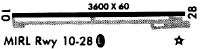
| Runway 10/28 | 3597 ft x 60 ft (1096 m x 18 m) | |
| Runway Length Source: | 3RD PARTY SURVEY as of 08/15/2016 | |
| Surface: | Asphalt - Fair condition - No special surface treatment | |
| Runway Edge Lights: | Medium Intensity | |
Runway 10 |
Runway 28 |
|
Elevation: |
1889.3 | 1881.1 |
Latitude: |
41-43-39.7074N | 41-43-41.0245N |
Longitude: |
077-24-11.1403W | 077-23-23.7441W |
|
Runway True Alignment: |
088 | 268 |
Glide Path Angle: |
3.0 degrees | 3.0 degrees |
Traffic Pattern: |
Left | Left |
Runway Markings Type: |
Nonprecision Instrument | Nonprecision Instrument |
Runway Markings Condition: |
Fair | Fair |
Object at End: |
TREES | TREES |
Object Height: |
41 | 21 |
Distance from End: |
585 | 330 |
Object Centerline Offset: |
298 ft. right of centerline | 0 ft. left and right of centerline |
Visual Glide Slope Indicators: |
2-Light PAPI On Left Side Of Runway | 2-Light PAPI On Left Side Of Runway |
REIL: |
No | Yes |
Threshold Crossing Height: |
40 | 40 |
| Runway 11/29 | 1576 ft x 80 ft (480 m x 24 m) | |
| Runway Length Source: | 3RD PARTY SURVEY as of 08/15/2016 | |
| Surface: | Asphalt - Fair condition - No special surface treatment | |
Runway 11 |
Runway 29 |
|
Elevation: |
1886.8 | 1877.9 |
Latitude: |
41-43-41.2658N | 41-43-41.9226N |
Longitude: |
077-23-45.1547W | 077-23-24.3919W |
|
Runway True Alignment: |
088 | 268 |
Glide Path Angle: |
0.0 degrees | 0.0 degrees |
Object Centerline Offset: |
298 ft. right of centerline | 0 ft. left and right of centerline |
Services
Airframe Repair: |
Major |
Powerplant Repair: |
Major |
Bottled Oxygen: |
None |
Bulk Oxygen: |
None |
Fuel Available: |
100LL |
Landing Fees: |
No |
Parking: |
Tiedowns available |
Maps & Diagrams
N38 Sectional
Flight Planning
at skyvector.com
at skyvector.com