Location
Latitude: |
39-10-01.1000N (39.166972) |
Longitude: |
082-55-42.0000W (-82.928333) |
Elevation: |
661.1 feet MSL (202 m MSL) |
Magnetic Variation: |
7.2 W (as of April 2024 from WMM2020 model) |
Time Zone: |
UTC -5.0 (Standard Time) UTC -4.0 (Daylight Savings Time) |
From City: |
03 N.M. NE of Waverly, Ohio |
Found On: |
Cincinnati Chart |
FAA Region: |
AGL |
Contacts
Manager: |
Publicly owned: |
| SARA JUNK 2577 ALMA OMEGA RD WAVERLY, OH 45690-9316 740-947-4952 |
PIKE COUNTY COMMISSIONERS 230 WAVERLY PLZ STE 100 WAVERLY, OH 45690-1288 740-947-4817 |
Operations
Airport Status: |
Operational |
Facility Use: |
Public |
Type: |
Airport |
Control tower: |
No |
Attendance (Months/Days/Hours): |
Months/Days/Hours ALL/MON-FRI/0830-1630 |
Boundary ARTCC: |
ZID (Indianapolis) |
Responsible ARTCC: |
ZID (Indianapolis) |
Lighting Schedule: |
SEE RMK |
Segmented Circle Indicator: |
No |
Traffic Pattern Altitude (MSL): |
1661 feet (506 m) |
NOTAMs Facility: |
DAY |
NOTAM-D Service: |
Yes |
International Airport of Entry: |
No |
Customs Landing Rights: |
No |
Military Landing Rights: |
No |
Civil/Military Joint Use: |
No |
Based Aircraft
| Single Engine: | 9 |
| Multi Engine: | 1 |
Annual Operations (as of 08/31/2023)
| Total Operations: | 2112 | |
| GA Local: | 800 | 37.9% |
| GA Itinerant: | 1300 | 61.6% |
| Military Aircraft: | 12 | 0.6% |
Communications
| CTAF: | 123.000 |
| Unicom: | 123.000 |
| AWOS-3PT: | 121.45 (740-947-0035) |
- APCH/DEP SVC PRVDD BY INDIANAPOLIS ARTCC ON FREQ 135.575/290.5 (PORTSMOUTH RCAG).
Fixed Based Operators (FBOs) & Fuel
(Click on a business for detail)
Please help us keep this information up to date. This is a FREE SERVICE just like everything else on Airport Guide! If you see that a business needs to be added, modified, or deleted please fill out our Update Form.
To add, modify, or delete a business click here.
Please help us keep this information up to date. This is a FREE SERVICE just like everything else on Airport Guide! If you see that a business needs to be added, modified, or deleted please fill out our Update Form.
Area Code: 740 |
| Business Name | Frequency | Phone | Fuel Grade |
|---|---|---|---|
| Pike County Airport
Update FBO info |
Unicom 122.8 | 437-9548 | 100LL, Jet A |
Flight Service Stations
| Primary | Alternate | |
| FSS on Field: | N | |
| FSS Name (ID): | Dayton(DAY) | |
| Frequency: | ||
| Toll Free Phone: | 1-800-WX-BRIEF |
Instrument Procedures / Charts
FAA Terminal Procedures valid from 0901Z 03/21/24 to 0901Z 04/18/24.
There are various types of charts available for an airport. They are listed in the Page Type column. Here is a legend for those types:
APD - Airport Diagram
DP - Departure Procedure Charts
HOT - Hot Spots
IAP - Instrument Approach Procedure Charts
MIN - Minimums
STAR - Standard Terminal Arrival Charts
| Page Type | Page Name | Volume | Action Since Last Cycle |
|---|---|---|---|
| IAP | RNAV (GPS) RWY 07 | EC-2 | |
| IAP | RNAV (GPS) RWY 25 | EC-2 | |
| MIN | TAKEOFF MINIMUMS | EC-2 |
Terminal Procedures are only available for airports in several countries with more being added all the time. If you are looking for a specific country's charts, please send an email to support(at)airportguide.com stating the country name. This will be used to prioritize the implementation.
Navigation Aids (Navaids) near EOP
| Dist (NM) | ID | Morse Code | Name | Type | Freq | True Hdg | Mag Hdg |
|---|---|---|---|---|---|---|---|
| 0.2 | EOP | . _ _ _ . _ _ . | Waverly | NDB | 385 | 275 | 282 |
| 16.9 | RZT | . _ . _ _ . . _ | Ross County | NDB | 236 | 344 | 351 |
| 21.7 | XUB | _ . . _ . . _ _ . . . | Yellow Bud | VOR | 112.50 | 353 | 360 |
| 23.7 | PZO | . _ _ . _ _ . . _ _ _ | Peebles | NDB | 329 | 231 | 238 |
| 28.6 | HOC | . . . . _ _ _ _ . _ . | Hillsboro | NDB | 278 | 272 | 279 |
| 31.5 | YRK | _ . _ _ . _ . _ . _ | York | VORTAC | 112.80 | 184 | 191 |
| 33.8 | CSS | _ . _ . . . . . . . | Court House | NDB | 414 | 320 | 327 |
| 34.2 | UNI | . . _ _ . . . | Athens | FAN MARKER | 83 | 90 | |
| 34.8 | DD | _ . . _ . . | Cobbs | NDB | 253 | 353 | 360 |
| 35.0 | AMT | . _ _ _ _ | West Union | NDB | 359 | 237 | 244 |
| 37.7 | UGS | . . _ _ _ . . . . | University | NDB | 250 | 81 | 88 |
| 38.5 | LCK | . _ . . _ . _ . _ . _ | Rickenbacker | TACAN | 69X | 359 | 366 |
| 41.2 | BU | _ . . . . . _ | Boutn | NDB | 230 | 341 | 348 |
| 42.4 | IL | . . . _ . . | Airbo | NDB | 407 | 297 | 304 |
| 43.1 | LC | . _ . . _ . _ . | Pickl | NDB | 376 | 5 | 12 |
| 43.5 | MXQ | _ _ _ . . _ _ _ . _ | Midwest | VOR-DME | 112.90 | 291 | 298 |
| 45.4 | HW | . . . . . _ _ | Cubla | NDB | 299 | 284 | 291 |
| 48.8 | HNN | . . . . _ . _ . | Henderson | DME | 115.9 | 120 | 127 |
| 48.9 | XW | _ . . _ . _ _ | Flmng | NDB | 400 | 223 | 230 |
| 49.7 | CMH | _ . _ . _ _ . . . . | Port Columbus | VOT | 111.00 | 2 | 9 |
Nearby Airports with Fuel
Notices to Airmen (NOTAMS)
Remarks
| A110-1 | BIRDS & OTR WILDLIFE ON & INVOF ARPT. |
| A110-2 | FOR CD CTC INDIANAPOLIS ARTCC AT 317-247-2411. |
| A14 | OR TIM DICKERSON 740-708-3941. |
| A16 | CELL 740-577-2644. |
| A17 | EXCLDG MAJOR HOLS. |
| A57-07 | CTLG OBSTN EXCEEDS A 45 DEG SLP. |
| A58-07 | +10 FT ROAD, 0-200 FT DIST, 205 FT L; +8 FT FENCE, 110-200 FT DIST, 180-190 FT L. |
| A70-FUEL-10 | 0LL FUEL AVBL H24 SELF SVC VIA CREDIT CARD. |
| A81-APT | ACTVT REIL RWY 07 & 25; MIRL RWY 07/25 - CTAF. PAPI RWY 07 & 25 OPR CONSLY. |
| E111 | VFR ONLY. |
Runways
Runway Summary
| Runways: | 07/25 |
| Longest Runway: | 07/25 is 4899 ft (1493 m) long |
| Runways with an Instrument Approach: |
EOP Airport Runway Details
| Runway 07/25 | 4899 ft x 75 ft (1493 m x 23 m) | |
| Runway Length Source: | 3RD PARTY SURVEY as of 07/03/2012 | |
| Surface: | Asphalt - Good condition - No special surface treatment | |
| Runway Edge Lights: | Medium Intensity | |
Runway Weight Bearing Capacity (in thousands of pounds) |
||
| Single Wheel Landing Gear: | 58.0 | |
Runway 07 |
Runway 25 |
|
Elevation: |
658.6 | 660.7 |
Latitude: |
39-09-49.7626N | 39-10-12.4201N |
Longitude: |
082-56-09.4659W | 082-55-14.4925W |
|
Runway True Alignment: |
062 | 242 |
Glide Path Angle: |
4.0 degrees | 3.0 degrees |
Traffic Pattern: |
Left | Left |
Runway Markings Type: |
Nonprecision Instrument | Nonprecision Instrument |
Runway Markings Condition: |
Fair | Fair |
Object at End: |
ROAD | TREE |
Object Height: |
10 | 46 |
Distance from End: |
201 | 664 |
Object Centerline Offset: |
205 ft. left of centerline | 315 ft. left of centerline |
Visual Glide Slope Indicators: |
4-Light PAPI On Left Side Of Runway | 4-Light PAPI On Left Side Of Runway |
REIL: |
Yes | Yes |
Touchdown Lights: |
No | No |
Centerline Lights: |
No | No |
Threshold Crossing Height: |
37 | 25 |
Services
Airframe Repair: |
Major |
Powerplant Repair: |
Major |
Bottled Oxygen: |
None |
Bulk Oxygen: |
High Pressure |
Fuel Available: |
100LL, Jet A+ |
Landing Fees: |
No |
Parking: |
Hangars and tiedowns available |
Other Services: |
Flight Test Support |
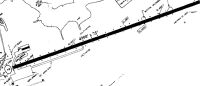
Maps & Diagrams
EOP Sectional
Flight Planning
at skyvector.com
at skyvector.com