
Location
Latitude: |
39-17-51.4000N (39.297611) |
Longitude: |
094-42-50.0000W (-94.713889) |
Elevation: |
1026.9 feet MSL (313 m MSL) |
Magnetic Variation: |
1.3 E (as of April 2024 from WMM2020 model) |
Time Zone: |
UTC -6.0 (Standard Time) UTC -5.0 (Daylight Savings Time) |
From City: |
15 N.M. NW of Kansas City, Missouri |
Found On: |
Kansas City Chart |
FAA Region: |
ACE |
Contacts
Manager: |
Publicly owned: |
| MR. LUKE MAWHIRTER P.O. BOX 20047 KANSAS CITY, MO 64195 816-243-5248 |
CITY OF KANSAS CITY 601 BRASILIA; PO BOX 20047 KANSAS CITY, MO 64141 816-243-3100 |
Operations
Airport Status: |
Operational |
Facility Use: |
Public |
Type: |
Airport |
Activation Date: |
05/1956 |
Control tower: |
Yes |
Attendance (Months/Days/Hours): |
Months/Days/Hours ALL/ALL/ALL |
Boundary ARTCC: |
ZKC (Kansas City) |
Responsible ARTCC: |
ZKC (Kansas City) |
Segmented Circle Indicator: |
No |
Traffic Pattern Altitude (MSL): |
2027 feet (618 m) |
NOTAMs Facility: |
MCI |
NOTAM-D Service: |
Yes |
International Airport of Entry: |
No |
Customs Landing Rights: |
Yes |
Military Landing Rights: |
Yes |
Civil/Military Joint Use: |
No |
Aircraft Rescue and Firefighting: |
Class I ARFF Index: C Air Carrier Service: Scheduled Certification Date: 05/1973 |
Based Aircraft
| Jet Engine: | 2 |
Annual Operations (as of 04/30/2023)
| Total Operations: | 107035 | |
| Commercial: | 98566 | 92.1% |
| Air Taxi: | 3524 | 3.3% |
| GA Local: | 261 | 0.2% |
| GA Itinerant: | 3436 | 3.2% |
| Military Aircraft: | 1248 | 1.2% |
Communications
| Unicom: | 122.950 |
| Tower: | INTERNATIONAL 128.2 254.25 125.75 Hrs: 24 |
| Clearance Del.: | 135.7 |
| Ground: | 121.8 |
| Approach: | KANSAS CITY 120.95 318.1 Hrs: 24 |
| Departure: | KANSAS CITY 120.95 318.1 Hrs: 24 |
| ATIS: | 128.375 Hrs: 24 |
| ASOS: | (816-329-2808) |
| CLASS B: | 118.4 ;EAST OF RWY 01/19 |
| TIFTO DP: | 124.7 |
| RACER DP: | 284.7 ;DOSOA TRANSITION |
| RACER DP: | 318.1 ;BUTLER/SPRINGFIELD TRANSITION |
| CLASS B: | 118.9 ;S OF A LINE FROM LWC ARPT TO 3GV ARPT |
| ROYAL DP: | 123.95 ;ARENZ/BODYN TRANSITION |
| WILDCAT DP: | 124.7 |
| ROYAL DP: | 284.7 ;TONCE TRANSITION |
| CLASS B: | 318.1 ;WEST OF RWY 01/19 |
| RACER DP: | 123.95 ;BUTLER/SPRINGFIELD TRANSITION |
| CHIEF DP: | 284.7 |
| BRAYMER STAR: | 120.95 |
| LAKES DP: | 123.95 |
| TIFTO DP: | 284.7 |
| BRAYMER STAR: | 318.1 |
| JHAWK STAR: | 120.95 |
| WILDCAT DP: | 284.7 |
| JHAWK STAR: | 318.1 |
| TYGER STAR: | 120.95 |
| RACER DP: | 124.7 ;DOSOA TRANSITION |
| CLASS B: | 294.7 ;EAST OF RWY 01-19 |
| LAKES DP: | 318.1 |
| EMERG: | 121.5 |
| ROYAL DP: | 124.7 ;TONCE TRANSITION |
| EMERG: | 243.0 |
| CLASS B: | 294.7 ;S OF A LINE FROM LWC ARPT TO 3GV ARPT |
| TYGER STAR: | 318.1 |
| CLASS B: | 124.7 ;WEST OF RWY 01/19 |
| CHIEF DP: | 124.7 |
| ROYAL DP: | 318.1 ;ARENZ/BODYN TRANSITION |
Fixed Based Operators (FBOs) & Fuel
(Click on a business for detail)
Please help us keep this information up to date. This is a FREE SERVICE just like everything else on Airport Guide! If you see that a business needs to be added, modified, or deleted please fill out our Update Form.
To add, modify, or delete a business click here.
Please help us keep this information up to date. This is a FREE SERVICE just like everything else on Airport Guide! If you see that a business needs to be added, modified, or deleted please fill out our Update Form.
Area Code: 816 |
| Business Name | Frequency | Phone | Fuel Grade |
|---|---|---|---|
| Executive Beechcraft, Inc.
Update FBO info |
Unicom 122.95, Arinc 129.57 | 243-6440 | 100LL, Jet A |
| Signature Flight Support
Update FBO info |
Unicom: 122.95, Arinc: 128.85 | +1 816 243 6440 |
Flight Service Stations
| Primary | Alternate | |
| FSS on Field: | N | |
| FSS Name (ID): | Columbia(COU) | |
| Frequency: | ||
| Toll Free Phone: | 1-800-WX-BRIEF |
Instrument Procedures / Charts
FAA Terminal Procedures valid from 0901Z 03/21/24 to 0901Z 04/18/24.
There are various types of charts available for an airport. They are listed in the Page Type column. Here is a legend for those types:
APD - Airport Diagram
DP - Departure Procedure Charts
HOT - Hot Spots
IAP - Instrument Approach Procedure Charts
MIN - Minimums
STAR - Standard Terminal Arrival Charts
Terminal Procedures are only available for airports in several countries with more being added all the time. If you are looking for a specific country's charts, please send an email to support(at)airportguide.com stating the country name. This will be used to prioritize the implementation.
Navigation Aids (Navaids) near MCI
| Dist (NM) | ID | Morse Code | Name | Type | Freq | True Hdg | Mag Hdg |
|---|---|---|---|---|---|---|---|
| 1.3 | MCI | _ _ _ . _ . . . | Kansas City | VORTAC | 113.25 | 235 | 234 |
| 4.9 | DO | _ . . _ _ _ | Dotte | NDB | 359 | 199 | 198 |
| 11.8 | MKC | _ _ _ . _ _ . _ . | Kansas City Downtown | VOT | 108.60 | 152 | 151 |
| 11.9 | RIS | . _ . . . . . . | Riverside | VOR-DME | 111.40 | 152 | 151 |
| 14.4 | GQ | _ _ . _ _ . _ | Norge | NDB | 517 | 169 | 168 |
| 24.4 | ST | . . . _ | Tario | NDB | 260 | 338 | 337 |
| 27.4 | OJC | _ _ _ . _ _ _ _ . _ . | Johnson County | VOR-DME | 113.00 | 182 | 181 |
| 29.8 | ANX | . _ _ . _ . . _ | Napoleon | VORTAC | 114.00 | 113 | 112 |
| 30.8 | JZ | . _ _ _ _ _ . . | Newbn | NDB | 338 | 221 | 220 |
| 32.7 | PK | . _ _ . _ . _ | Herbb | NDB | 420 | 181 | 180 |
| 36.3 | AZN | . _ _ _ . . _ . | Amazon | NDB | 233 | 345 | 344 |
| 40.0 | TOP | _ _ _ _ . _ _ . | Topeka | VORTAC | 117.80 | 256 | 254 |
| 41.0 | STJ | . . . _ . _ _ _ | St Joseph | VORTAC | 115.50 | 346 | 345 |
| 43.7 | BQS | _ . . . _ _ . _ . . . | Braymer | VOR-DME | 115.35 | 62 | 61 |
| 46.5 | TO | _ _ _ _ | Biloy | NDB | 521 | 257 | 255 |
| 46.7 | RBA | . _ . _ . . . . _ | Robinson | DME | 108.2 | 315 | 313 |
| 47.4 | FO | . . _ . _ _ _ | Riply | NDB | 326 | 238 | 236 |
| 48.8 | FOE | . . _ . _ _ _ . | Forbes | TACAN | 111.60 | 244 | 242 |
| 49.0 | FOE | . . _ . _ _ _ . | Forbes | VOT | 111.00 | 245 | 243 |
| 61.7 | FNB | . . _ . _ . _ . . . | Brenner | NDB | 404 | 319 | 317 |
Nearby Airports with Fuel
Notices to Airmen (NOTAMS)
Remarks
| A110-1 | WATERFOWL ON AND INVOF ARPT. |
| A110-11 | PPR TO PARK AT AIRLINE GATES CTC RESPECTIVE AIRLINE. |
| A110-14 | WHEN USING HIGH-SPEED EXITS C5 & C6 CONTINUE UNTIL FIRST PARALLEL TWY, THEN USE EXTREME CARE WHEN TURNING IN EXCESS OF 90 DEGREES. |
| A110-15 | NO ACFT PARKING ON POSTAL APRON. |
| A110-19 | DESIGN GROUP V AND VI ACFT RQR AN ARPT ESCORT ON TWY DELTA BTN TWYS JULIET AND LIMA. |
| A110-20 | ASSC IN USE. OPERATE TRANSPONDERS WITH ALTITUDE REPORTING MODE AND ADS-B (IF EQUIPPED) ENABLED ON ALL AIRPORT SURFACES. |
| A110-21 | TWY B1 BTN TWY B AND FEDEX APN COCKPIT OVER CNTRLN STEERING RQRD |
| A110-22 | TWY L BTN TWY L1 AND TWY D WINGSPAN RESTRICTION OF 118 FT. TWY C2 BTN TWY C3 AND TWY C1 WINGSPAN RESTRICTION OF 118 FT. |
| A110-23 | TXL W, N1, N3, M1, M3, S1, S3 WINGSPAN RESTRICTION OF 118 FT. |
| A110-24 | N RAMP CTL FREQ: 128.975 |
| A110-25 | S RAMP CTL FREQ: 130.825 |
| A110-3 | WINDSHEAR ALERT SYSTEM ON ARPT. |
| A110-4 | NOISE ABATEMENT PROCEDURES IN EFFECT 2200-0600 WITH LANDING ON RYS 01L & 19L; TAKEOFFS ON RYS 01R & 19R. |
| A110-6 | MIL ACFT MAY BE CHARGED RAMP/PARKING FEES. |
| A110-9 | FLIGHT NOTIFICATION SVC (ADCUS) AVBL AT GATE 90. |
| A39-01L/19R | PCR VALUE: 1106/R/D/W/T |
| A39-09/27 | PCR VALUE: 646/F/B/X/T |
Runways
Runway Summary
| Runways: | 01L/19R 01R/19L 09/27 |
| Longest Runway: | 01L/19R is 10801 ft (3292 m) long |
| Runways with an Instrument Approach: | 01L, 19R, 01R, 19L, 09, 27 |
MCI Airport Runway Details
| Runway 01L/19R | 10801 ft x 150 ft (3292 m x 46 m) | |
| Runway Length Source: | 3RD PARTY SURVEY as of 10/04/2012 | |
| Surface: | Asphalt - Fair condition - Saw-cut or plastic grooved | |
| Runway Edge Lights: | High Intensity | |
Runway Weight Bearing Capacity (in thousands of pounds) |
||
| Single Wheel Landing Gear: | 120.0 | |
| Dual Wheel Landing Gear: | 250.0 | |
| Dual Tandem Wheel Landing Gear: | 524.0 | |
| Dual Dual Tandem Wheel Landing Gear: | 450.0 | |
Runway 01L |
Runway 19R |
|
Elevation: |
1014.4 | 979.6 |
Latitude: |
39-17-36.0029N | 39-19-20.0396N |
Longitude: |
094-43-45.5433W | 094-43-14.7835W |
|
Runway True Alignment: |
013 | 193 |
ILS Type: |
ILS/DME | ILS/DME |
Glide Path Angle: |
3.0 degrees | 3.0 degrees |
Traffic Pattern: |
Left | Right |
Runway Markings Type: |
Precision Instrument | Precision Instrument |
Runway Markings Condition: |
Good | Good |
Visual Glide Slope Indicators: |
4-Light PAPI On Left Side Of Runway | 4-Light PAPI On Right Side Of Runway |
Runway Visual Range (RVR): |
Touchdown, Midfield, Rollout | Touchdown, Midfield, Rollout |
Approach Light System: |
1,400 Foot Medium Intensity Approach Lighting System With Runway Alignment Indicator Lights | Standard 2,400 Foot High Intensity Approach Lighting System With Sequenced Flashers, Cat. II or III Config. |
Touchdown Lights: |
Yes | Yes |
Centerline Lights: |
Yes | Yes |
Threshold Crossing Height: |
78 | 80 |
Declared Distances |
||
Take Off Run Avbl. (TORA): |
10801 | 10801 |
Take Off Distance Avbl. (TODA): |
10801 | 10801 |
Actual Stop Dist. Avbl. (ASDA): |
10801 | 10801 |
Landing Dist. Avbl. (LDA): |
10801 | 10801 |
| Runway 01R/19L | 9500 ft x 150 ft (2896 m x 46 m) | |
| Runway Length Source: | 3RD PARTY SURVEY as of 10/04/2012 | |
| Surface: | Asphalt - Fair condition - Saw-cut or plastic grooved | |
| Runway Pavement Class: | 71 /R/B/W/T | |
| Runway Edge Lights: | High Intensity | |
Runway Weight Bearing Capacity (in thousands of pounds) |
||
| Single Wheel Landing Gear: | 75.0 | |
| Dual Wheel Landing Gear: | 204.0 | |
| Dual Tandem Wheel Landing Gear: | 400.0 | |
| Dual Dual Tandem Wheel Landing Gear: | 450.0 | |
Runway 01R |
Runway 19L |
|
Elevation: |
1017.2 | 978.5 |
Latitude: |
39-16-53.2341N | 39-18-24.7369N |
Longitude: |
094-42-32.3935W | 094-42-05.3226W |
|
Runway True Alignment: |
013 | 193 |
ILS Type: |
ILS/DME | ILS/DME |
Glide Path Angle: |
3.0 degrees | 0.0 degrees |
Runway Markings Type: |
Precision Instrument | Precision Instrument |
Runway Markings Condition: |
Good | Good |
Visual Glide Slope Indicators: |
4-Light PAPI On Right Side Of Runway | |
Runway Visual Range (RVR): |
Touchdown, Midfield, Rollout | Touchdown, Midfield, Rollout |
Approach Light System: |
Standard 2,400 Foot High Intensity Approach Lighting System With Sequenced Flashers, Cat. II or III Config. | 1,400 Foot Medium Intensity Approach Lighting System With Runway Alignment Indicator Lights |
Touchdown Lights: |
Yes | Yes |
Centerline Lights: |
Yes | Yes |
Threshold Crossing Height: |
74 | |
Declared Distances |
||
Take Off Run Avbl. (TORA): |
9500 | 9500 |
Take Off Distance Avbl. (TODA): |
9500 | 9500 |
Actual Stop Dist. Avbl. (ASDA): |
9500 | 9500 |
Landing Dist. Avbl. (LDA): |
9500 | 9500 |
| Runway 09/27 | 9501 ft x 150 ft (2896 m x 46 m) | |
| Runway Length Source: | 3RD PARTY SURVEY as of 10/04/2012 | |
| Surface: | Asphalt - Fair condition - Saw-cut or plastic grooved | |
| Runway Edge Lights: | High Intensity | |
Runway Weight Bearing Capacity (in thousands of pounds) |
||
| Single Wheel Landing Gear: | 120.0 | |
| Dual Wheel Landing Gear: | 250.0 | |
| Dual Tandem Wheel Landing Gear: | 465.0 | |
| Dual Dual Tandem Wheel Landing Gear: | 260.0 | |
Runway 09 |
Runway 27 |
|
Elevation: |
1015.3 | 1026.9 |
Latitude: |
39-17-27.0990N | 39-17-17.0716N |
Longitude: |
094-43-35.7371W | 094-41-35.5978W |
|
Runway True Alignment: |
096 | 276 |
ILS Type: |
ILS/DME | ILS/DME |
Glide Path Angle: |
0.0 degrees | 3.0 degrees |
Traffic Pattern: |
Left | Right |
Runway Markings Type: |
Precision Instrument | Precision Instrument |
Runway Markings Condition: |
Good | Good |
Visual Glide Slope Indicators: |
4-Light PAPI On Left Side Of Runway | |
Runway Visual Range (RVR): |
Touchdown, Rollout | Touchdown, Rollout |
Approach Light System: |
1,400 Foot Medium Intensity Approach Lighting System With Runway Alignment Indicator Lights | 1,400 Foot Medium Intensity Approach Lighting System With Runway Alignment Indicator Lights |
REIL: |
No | |
Touchdown Lights: |
No | |
Centerline Lights: |
No | No |
Threshold Crossing Height: |
72 | |
Declared Distances |
||
Take Off Run Avbl. (TORA): |
9501 | 9501 |
Take Off Distance Avbl. (TODA): |
9501 | 9501 |
Actual Stop Dist. Avbl. (ASDA): |
9501 | 9501 |
Landing Dist. Avbl. (LDA): |
9501 | 9501 |
Services
Airframe Repair: |
Major |
Powerplant Repair: |
Major |
Bottled Oxygen: |
None |
Bulk Oxygen: |
None |
Fuel Available: |
100LL, Jet A |
Landing Fees: |
No |
Parking: |
Hangars and tiedowns available |
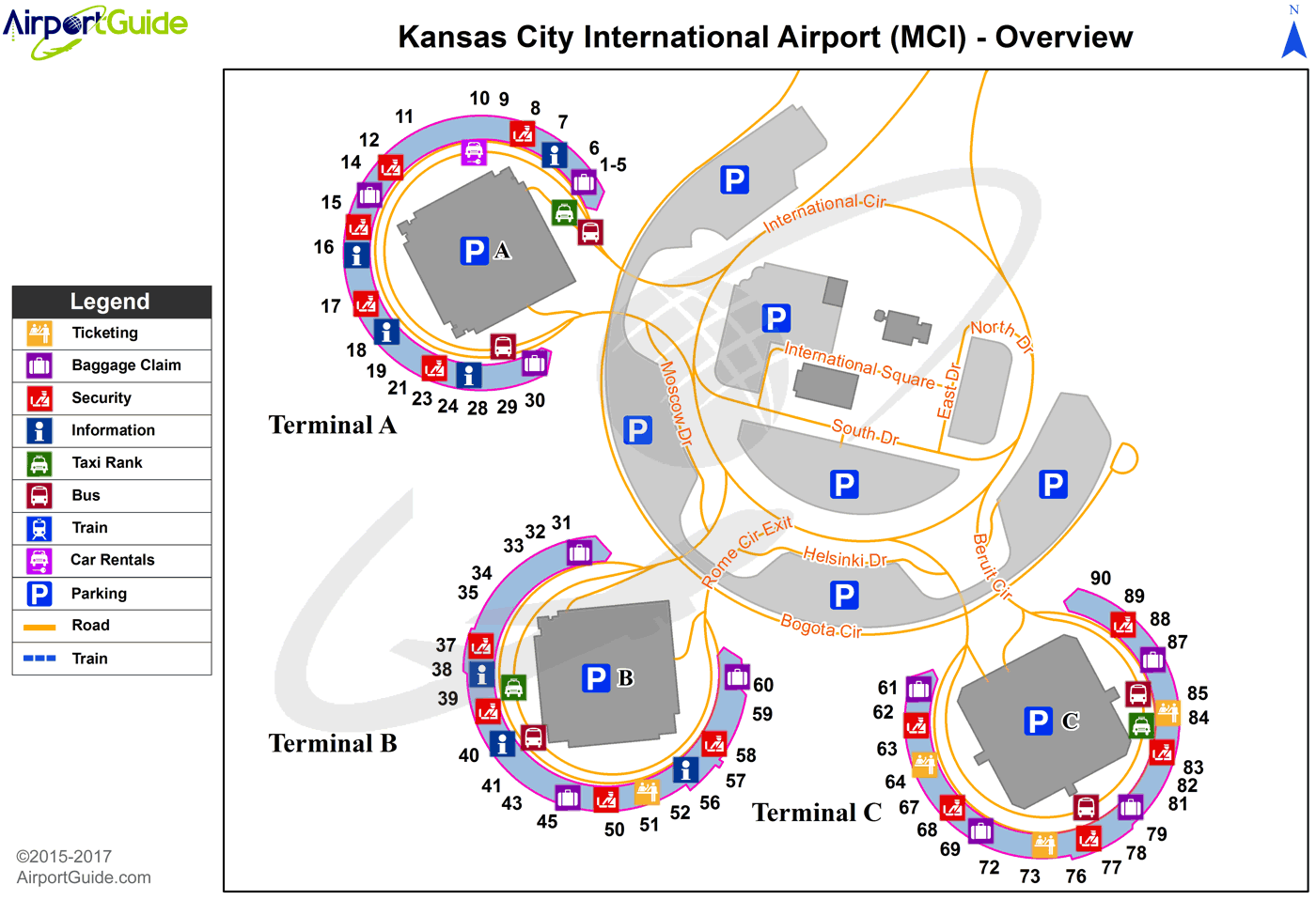
Maps & Diagrams
MCI Sectional
Flight Planning
at skyvector.com
at skyvector.com
 Diagram")