Location
Latitude: |
34-34-35.3710N (34.576492) |
Longitude: |
090-40-33.2020W (-90.675889) |
Elevation: |
241.7 feet MSL (74 m MSL) |
Magnetic Variation: |
1.3 W (as of April 2024 from WMM2020 model) |
Time Zone: |
UTC -6.0 (Standard Time) UTC -5.0 (Daylight Savings Time) |
From City: |
05 N.M. NW of Helena/West Helena, Arkansas |
Found On: |
Memphis Chart |
FAA Region: |
ASW |
Contacts
Manager: |
Publicly owned: |
| BILL BROTHERS PO BOX 2948 WEST HELENA, AR 72390 870-714-1844 |
HELENA WEST HELENA CITY OF HELENA / WEST HELENA, 226 PERRY STR HELENA, AR 72342 (870) 817-7400 |
Operations
Airport Status: |
Operational |
Facility Use: |
Public |
Type: |
Airport |
Activation Date: |
09/1942 |
Control tower: |
No |
Attendance (Months/Days/Hours): |
Months/Days/Hours ALL/MON-FRI/DALGT |
Boundary ARTCC: |
ZME (Memphis) |
Responsible ARTCC: |
ZME (Memphis) |
Lighting Schedule: |
SEE RMK |
Segmented Circle Indicator: |
Yes |
Traffic Pattern Altitude (MSL): |
1242 feet (379 m) |
NOTAMs Facility: |
JBR |
NOTAM-D Service: |
Yes |
International Airport of Entry: |
No |
Customs Landing Rights: |
No |
Military Landing Rights: |
Yes |
Civil/Military Joint Use: |
No |
Based Aircraft
| Single Engine: | 14 |
| Multi Engine: | 1 |
Annual Operations (as of 08/31/2021)
| Total Operations: | 35000 | |
| Air Taxi: | 500 | 1.4% |
| GA Local: | 30500 | 87.1% |
| GA Itinerant: | 3500 | 10.0% |
| Military Aircraft: | 500 | 1.4% |
Communications
| CTAF: | 122.800 |
| Unicom: | 122.800 |
- APCH/DEP SVC PRVDD BY MEMPHIS ARTCC ON FREQS 135.3/335.8(BRINKLEY RCAG).
Fixed Based Operators (FBOs) & Fuel
(Click on a business for detail)
Please help us keep this information up to date. This is a FREE SERVICE just like everything else on Airport Guide! If you see that a business needs to be added, modified, or deleted please fill out our Update Form.
To add, modify, or delete a business click here.
Please help us keep this information up to date. This is a FREE SERVICE just like everything else on Airport Guide! If you see that a business needs to be added, modified, or deleted please fill out our Update Form.
| Business Name | Frequency | Phone | Fuel Grade |
|---|---|---|---|
| South Delta Aviation, Inc.
Update FBO info |
Unicom 122.8 | 870-572-9011 | 100LL, Jet A |

|
Phillips | 100LL - 4.75 USD per gallon on 7/30/2018 |
Pumps requiring line service |
|
|
Phillips | Jet A - 3.99 USD per gallon on 7/30/2018 |
Pumps requiring line service |
Flight Service Stations
| Primary | Alternate | |
| FSS on Field: | N | |
| FSS Name (ID): | Jonesboro(JBR) | |
| Frequency: | ||
| Toll Free Phone: | 1-800-WX-BRIEF |
Instrument Procedures / Charts
FAA Terminal Procedures valid from 0901Z 03/21/24 to 0901Z 04/18/24.
There are various types of charts available for an airport. They are listed in the Page Type column. Here is a legend for those types:
APD - Airport Diagram
DP - Departure Procedure Charts
HOT - Hot Spots
IAP - Instrument Approach Procedure Charts
MIN - Minimums
STAR - Standard Terminal Arrival Charts
| Page Type | Page Name | Volume | Action Since Last Cycle |
|---|---|---|---|
| IAP | RNAV (GPS) RWY 18 | SC-1 | |
| IAP | RNAV (GPS) RWY 36 | SC-1 | |
| IAP | VOR RWY 36 | SC-1 | |
| MIN | TAKEOFF MINIMUMS | SC-1 |
Terminal Procedures are only available for airports in several countries with more being added all the time. If you are looking for a specific country's charts, please send an email to support(at)airportguide.com stating the country name. This will be used to prioritize the implementation.
Navigation Aids (Navaids) near HEE
| Dist (NM) | ID | Morse Code | Name | Type | Freq | True Hdg | Mag Hdg |
|---|---|---|---|---|---|---|---|
| 0.1 | UJM | . . _ . _ _ _ _ _ | Marvell | VOR-DME | 109.60 | 140 | 141 |
| 41.6 | ME | _ _ . | Elvis | NDB | 287 | 45 | 47 |
| 43.1 | MEM | _ _ . _ _ | Memphis | VORTAC | 117.50 | 52 | 54 |
| 44.5 | MEM | _ _ . _ _ | Memphis Metropolitn | VOT | 111.00 | 50 | 52 |
| 45.0 | TT | _ _ | Stutt | NDB | 338 | 264 | 265 |
| 45.5 | SGT | . . . _ _ . _ | Stuttgart | NDB | 269 | 276 | 277 |
| 47.2 | GQE | _ _ . _ _ . _ . | Gilmore | VOR-DME | 113.00 | 11 | 12 |
| 48.5 | SPQ | . . . . _ _ . _ _ . _ | Spain | NDB | 414 | 39 | 41 |
| 53.2 | UV | . . _ . . . _ | Tunng | NDB | 426 | 102 | 104 |
| 55.9 | MIG | _ _ . . _ _ . | Millington | NDB | 232 | 40 | 42 |
| 57.2 | SBQ | . . . _ . . . _ _ . _ | Scobey | NDB | 245 | 135 | 137 |
| 59.3 | HLI | . . . . . _ . . . . | Holly Springs | VORTAC | 112.40 | 78 | 80 |
| 62.7 | DS | _ . . . . . | Cercy | NDB | 375 | 301 | 302 |
| 65.0 | PBF | . _ _ . _ . . . . . _ . | Pine Bluff | VOR-DME | 116.00 | 252 | 253 |
| 65.0 | GLH | _ _ . . _ . . . . . . | Greenville | VOR-DME | 114.25 | 193 | 194 |
| 66.0 | GW | _ _ . . _ _ | Teock | NDB | 349 | 153 | 155 |
| 69.6 | SQS | . . . _ _ . _ . . . | Sidon | VORTAC | 114.70 | 163 | 164 |
| 70.0 | TYV | _ _ . _ _ . . . _ | Toneyville | NDB | 290 | 289 | 290 |
| 70.7 | MTQ | _ _ _ _ _ . _ | Metcalf | NDB | 359 | 192 | 193 |
| 73.6 | FYE | . . _ . _ . _ _ . | Somerville | NDB | 255 | 58 | 60 |
Nearby Airports with Fuel
Notices to Airmen (NOTAMS)
Remarks
| A110-2 | (E81) TWY EXIT & GUIDANCE SIGNS. |
| A110-3 | NUMEROUS AGRICULTURE OPS FEB THRU OCT. |
| A110-4 | FOR CD CTC MEMPHIS ARTCC AT 901-368-8453/8449. |
| A81-APT | ACTVT MIRL RWY 09/27 & 18/36 - CTAF. PAPI RWY 18 & 36 ON CONSLY. |
Runways
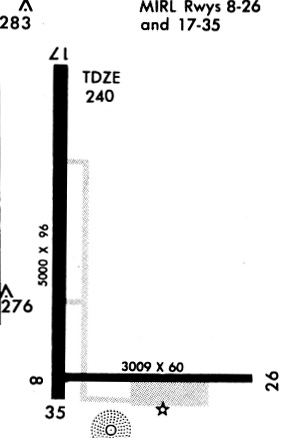
Runway Summary
| Runways: | 09/27 18/36 |
| Longest Runway: | 18/36 is 5001 ft (1524 m) long |
| Runways with an Instrument Approach: |
HEE Airport Runway Details
| Runway 09/27 | 3011 ft x 60 ft (918 m x 18 m) | |
| Runway Length Source: | 3RD PARTY SURVEY as of 03/29/2021 | |
| Surface: | Asphalt - Fair condition - No special surface treatment | |
| Runway Edge Lights: | Medium Intensity | |
Runway Weight Bearing Capacity (in thousands of pounds) |
||
| Single Wheel Landing Gear: | 16.0 | |
Runway 09 |
Runway 27 |
|
Elevation: |
237.1 | 241.7 |
Latitude: |
34-34-20.2703N | 34-34-20.2306N |
Longitude: |
090-40-40.4869W | 090-40-04.4835W |
|
Runway True Alignment: |
090 | 270 |
Glide Path Angle: |
0.0 degrees | 0.0 degrees |
Traffic Pattern: |
Left | Left |
Runway Markings Type: |
Basic | Basic |
Runway Markings Condition: |
Good | Good |
Object at End: |
TREE | |
Object Height: |
20 | |
Distance from End: |
725 | |
Object Centerline Offset: |
115 ft. right of centerline |
| Runway 18/36 | 5001 ft x 100 ft (1524 m x 30 m) | |
| Runway Length Source: | 3RD PARTY SURVEY as of 10/23/2019 | |
| Surface: | Asphalt - Fair condition - Saw-cut or plastic grooved | |
| Runway Edge Lights: | Medium Intensity | |
Runway Weight Bearing Capacity (in thousands of pounds) |
||
| Single Wheel Landing Gear: | 15.0 | |
Runway 18 |
Runway 36 |
|
Elevation: |
241.0 | 237.6 |
Latitude: |
34-35-09.2044N | 34-34-19.7445N |
Longitude: |
090-40-39.4147W | 090-40-39.8949W |
|
Runway True Alignment: |
180 | 000 |
Glide Path Angle: |
3.0 degrees | 3.0 degrees |
Traffic Pattern: |
Left | Left |
Runway Markings Type: |
Nonprecision Instrument | Nonprecision Instrument |
Runway Markings Condition: |
Good | Good |
Object Centerline Offset: |
115 ft. right of centerline | |
Visual Glide Slope Indicators: |
4-Light PAPI On Left Side Of Runway | 4-Light PAPI On Left Side Of Runway |
REIL: |
Yes | Yes |
Threshold Crossing Height: |
48 | 48 |
Services
Airframe Repair: |
Major |
Powerplant Repair: |
Major |
Bottled Oxygen: |
None |
Bulk Oxygen: |
None |
Fuel Available: |
100LL |
Landing Fees: |
No |
Parking: |
Tiedowns available |
Maps & Diagrams
HEE Sectional
Flight Planning
at skyvector.com
at skyvector.com